Search
Satellite Imaging and Daily Earth Insights to Take Action
As the leading provider of daily data and insights about Earth, Planet helps organizations harness change for action with a multidimensional view of our changing planet.

Harness the power of multidimensional Earth insights to look broader with daily monitoring, closer with high resolution tasking, and deeper with derived data.
Look broader.

Hood Canal, WA • 3m PlanetScope
Look closer.

Port of Seattle, WA • 50cm SkySat
Look deeper.

Eastern Washington • Soil Water Content
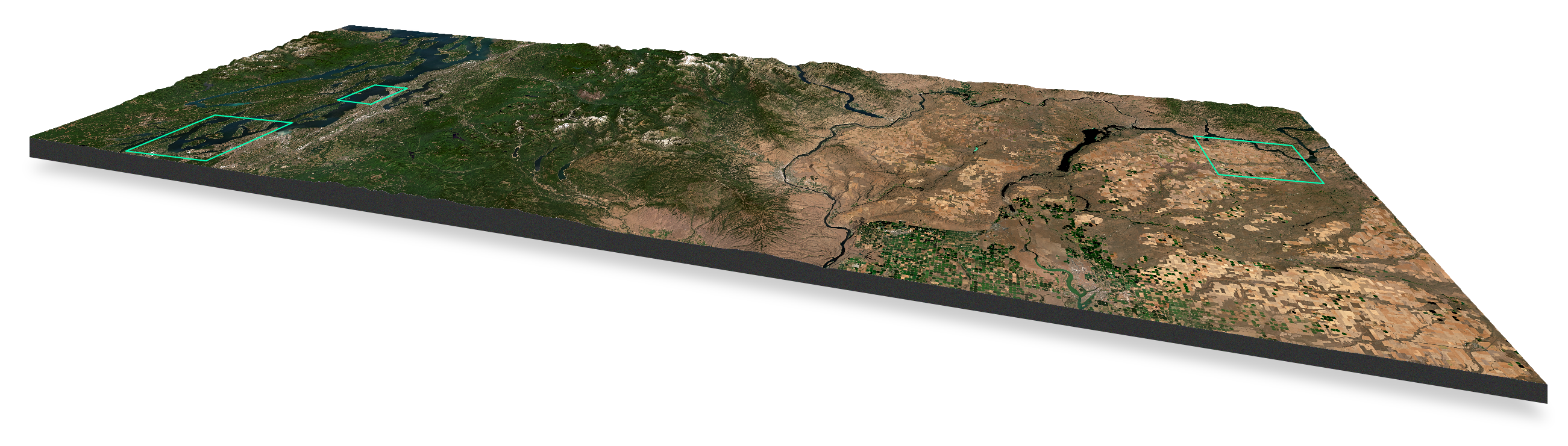
Broad Area Management over the state of Washington, USA, using Planet monthly Basemap
Areas indicated are not to scale and are for illustrative purposes only. Elevation data: SRTM data accessed via USGS.
Don't just capture change.
Act on it.
Planet revolutionized the Earth observation industry with the highest frequency satellite imagery data commercially available, transforming the way governments and companies deliver insights at the daily pace of change.
Our high-resolution daily Earth data, archive, and analytics give customers an unprecedented view, allowing them to cast further and wider in time, space, and frequency. So they can make decisions and take confident action, fast.
Hear from our customers
Organizations across industries and geographies work with Planet to gain a global, dynamic perspective about their most pressing operational challenges.
See. Decide. Act.
When the scope of your challenges are global and change is frequent, the potential for blindspots increases.
Planet combines powerful capabilities into a single platform, providing our clients with multidimensional insights to make decisions reliably and with confidence.
Look
Broader
Expand your vantage point by monitoring geographically dispersed locations, from cities to continents.
Look
Backward
Go back in time to understand unforeseen events or establish baselines of activity.
Look
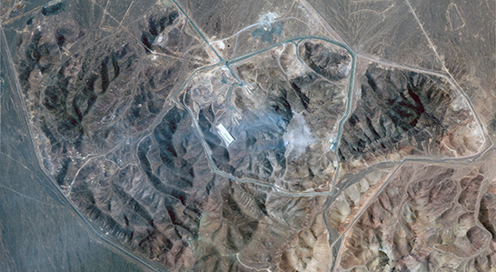
Closer
Inspect events and activities in greater detail, characterizing change or attributes.
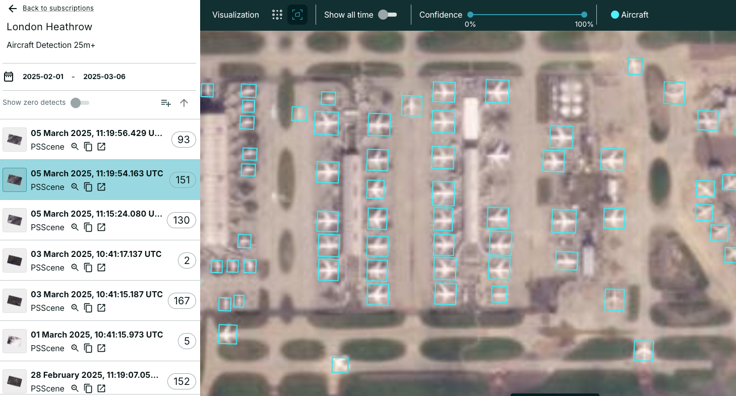
Look
Deeper
Measure changing phenomena over time, even when it is indiscernible to the naked eye.
See. Decide. Act.
Planet Insights Platform is the central place where daily Earth data, analytics, and powerful tools are combined to create insights.
© 2025 Planet Labs PBC. All rights reserved.
| Privacy Policy | California Privacy Notice |California Do Not Sell
Your Privacy Choices | Cookie Notice | Terms of Use | Sitemap
