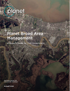
Broad Area Management FOR CIVIL GOVERNMENT
Detect Environmental and Land Use Changes Across Vast and Remote Areas
Detect Environmental and Land Use Changes Across Vast and Remote Areas
Identify change in disaster-prone regions and active response areas with Planet high-frequency monitoring, high-resolution imagery, and analysis-ready data.
Identify change in disaster-prone regions and active response areas with Planet high-frequency monitoring, high-resolution imagery, and analysis-ready data.
Learn How We Can Help
1
Expectation 1 - dolor sit amet, consectetur adipiscing elit
2
Expectation 2 - dolor sit amet, consectetur adipiscing elit
3
Expectation 3 - dolor sit amet, consectetur adipiscing elit
Step 1/3
See Broad Area in Action
Enhance situational awareness and reduce intelligence gaps across borders, remote geographies, and coastal waters.
Deforestation Monitoring
Identify early indicators of illegal activity with real-time actionable data and change detection
Identify early indicators of illegal activity with real-time actionable data and change detection
Quantify trends like clearing size and log landings
Measure changes like aboveground carbon density

Agricultural Compliance
Accurately verify parcel-level compliance at scale with daily monitoring, derived data, and analytics.
Quantify change within field boundaries
Identify events like mowing and plowing
Measure soil water content and crop biomass
Download our Buyer’s Guide for Civil Government
Learn more about the products that support Planet Broad Area Management
Forest Health Monitoring
Rapidly identify threats like vegetative fuel loads with high-frequency, hi-res data, and scientific measurements
Detect damage to forest inventory
Monitor pests, disease, and land degradation
Measure land surface temperature and forest cover
Not sure yet?
See More Applications
Planet Customers Unlock Critical Insights with Broad Area Management
Planet Customers Unlock Critical Insights with Broad Area Management
How ‘Institution’ used BAM to solve this issue
Steve Brumby,
CEO at Impact Observatory
How ‘Institution’ used BAM to solve this issue
Steve Brumby,
CEO at Impact Observatory
How ‘Institution’ used BAM to solve this issue
Steve Brumby,
CEO at Impact Observatory
See More Applications
Planet’s approach to Broad Area Management combines daily satellite monitoring with high-resolution imagery, data, and analytics to help identify known and unknown changes at any scale.


CAPABILITIES
Augment existing capabilities with data and tools that easily integrate into workflows
Augment existing capabilities with data and tools that easily integrate into workflows

Look broader
Monitors Vast Areas
Monitor vast landscapes with daily satellite imagery

Look BACK
Access Historical Data
Identify change with a living archive AI-powered alerts

Look CLOSER
Rapid Revisit Tasking
Gain a more detailed view with high-resolution, rapid revisit tasking

Look DEEPER
Analysis-Ready Data
Measure conditions beyond the visible spectrum with analysis-ready data
Seamless ArcGIS integration
Seamless ArcGIS integration
With flexible integration options, Planet makes it easy to unlock the value of daily satellite imagery in your GIS.
FEATURES
Tile Services
ArcGIS Pro Add-In
API-First Platform
Learn How We Can Help
1
Expectation 1 - dolor sit amet, consectetur adipiscing elit
2
Expectation 2 - dolor sit amet, consectetur adipiscing elit
3
Expectation 3 - dolor sit amet, consectetur adipiscing elit
Step 1/3
Get Answers to Some of the Most Common Questions About Planet Broad Area Management
- 1.
What are common applications of broad area management?
This is a question
- 2.
What industries use broad area management solutions?
This is a question
- 3.
How does AI support broad area management in satellite imagery?
This is a question
- 4.
Can Planet’s broad area management solutions be customized to specific needs?
This is a question
- 5.
How does broad area management help in disaster response and recovery?
This is a question
- 6.
Pricing related question placeholder?
Yes, if you do not need every image with …… llentesque ornare sem lacinia quam venenatis vestibulum. Lorem ipsum dolor sit amet, consectetur adipiscing elit. Maecenas faucibus mollis interdum. Sed posuere consectetur est at lobortis. Check our pricing plans.
© 2025 Planet Labs PBC. All rights reserved.
California Do Not Sell
Your Privacy Choices