Frontier Oil Exploration in Libya

Libya has the largest proven oil reserves in Africa, and has been a key supplier of crude oil to Europe. Last year, the country hit 1 million bpd of oil for the first time in five years and tripled oil revenues. But continued instability and armed conflict has hampered production.

Despite this, oil exploration in remote regions outside well-known reserves continues. In 2014, with oil prices plunging and markets shaky, Planet spotted a small encampment forming in the middle of the desert.

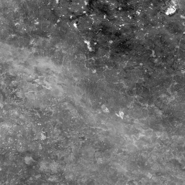
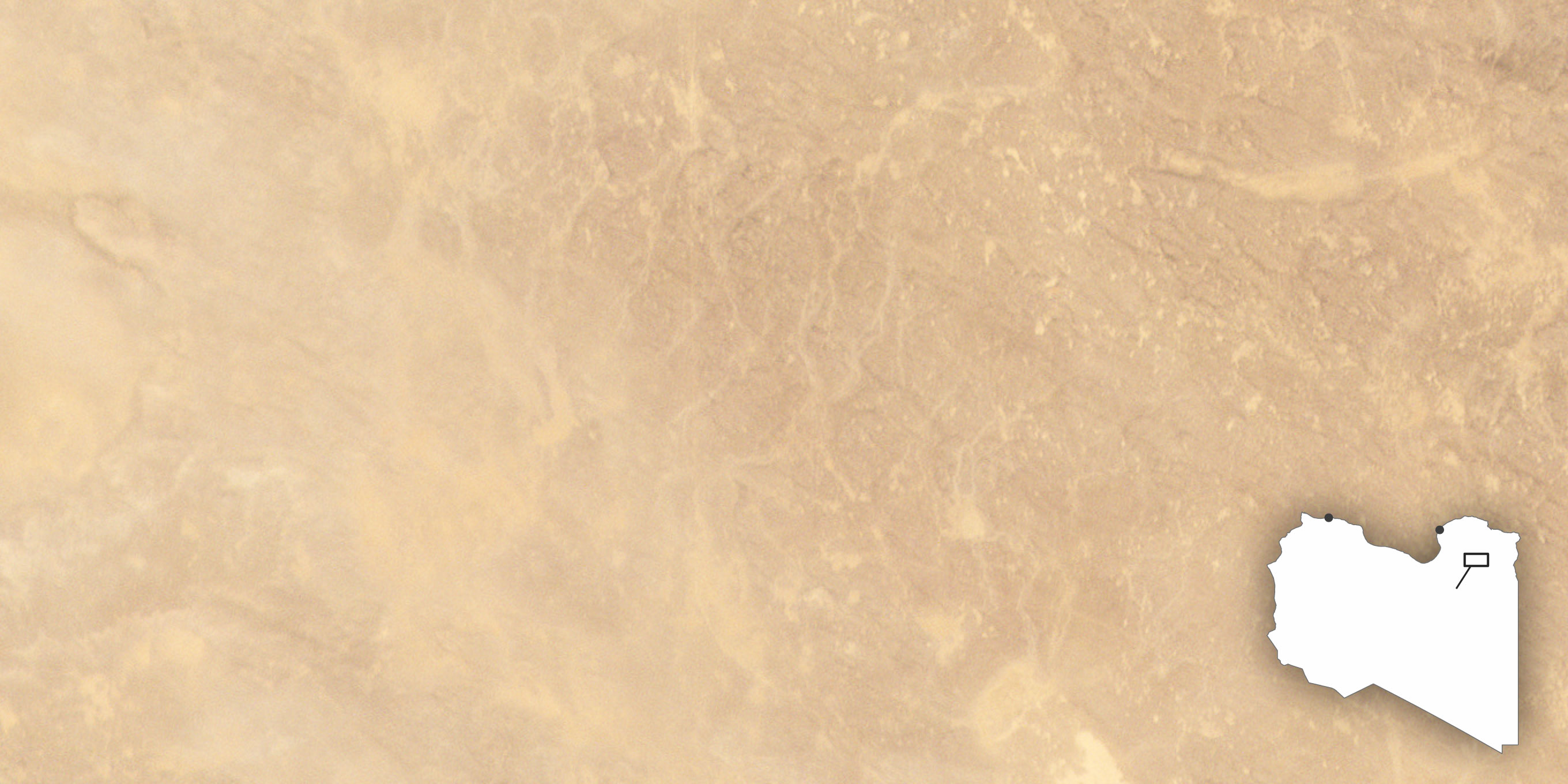
A Curious Observation
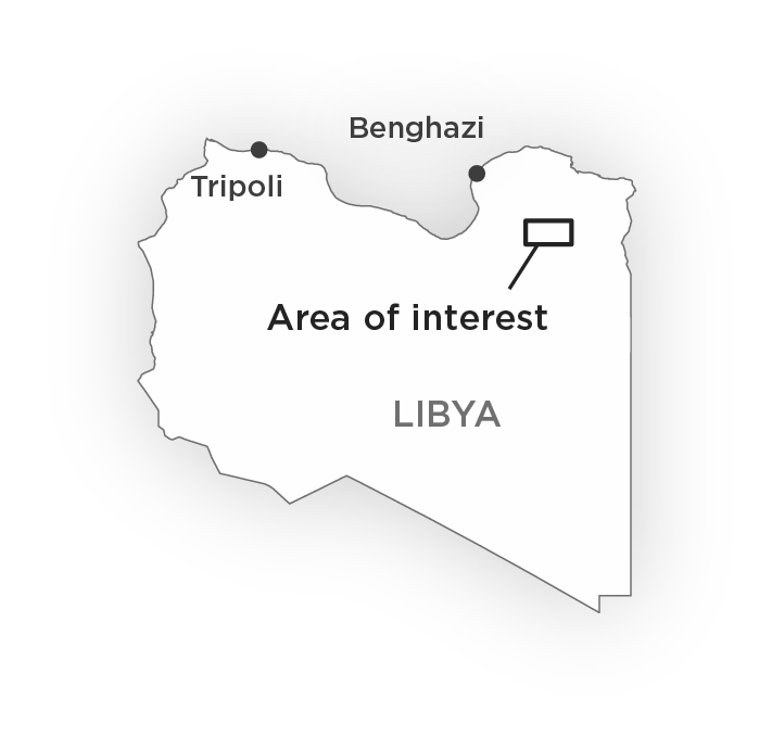
Benghazi

Tripoli

Area of interest

LIBYA

December 2, 2013

The Libyan Desert is one the harshest environments in the world, filled with rocky plateaus and sandy plains that remain largely untouched by humans.
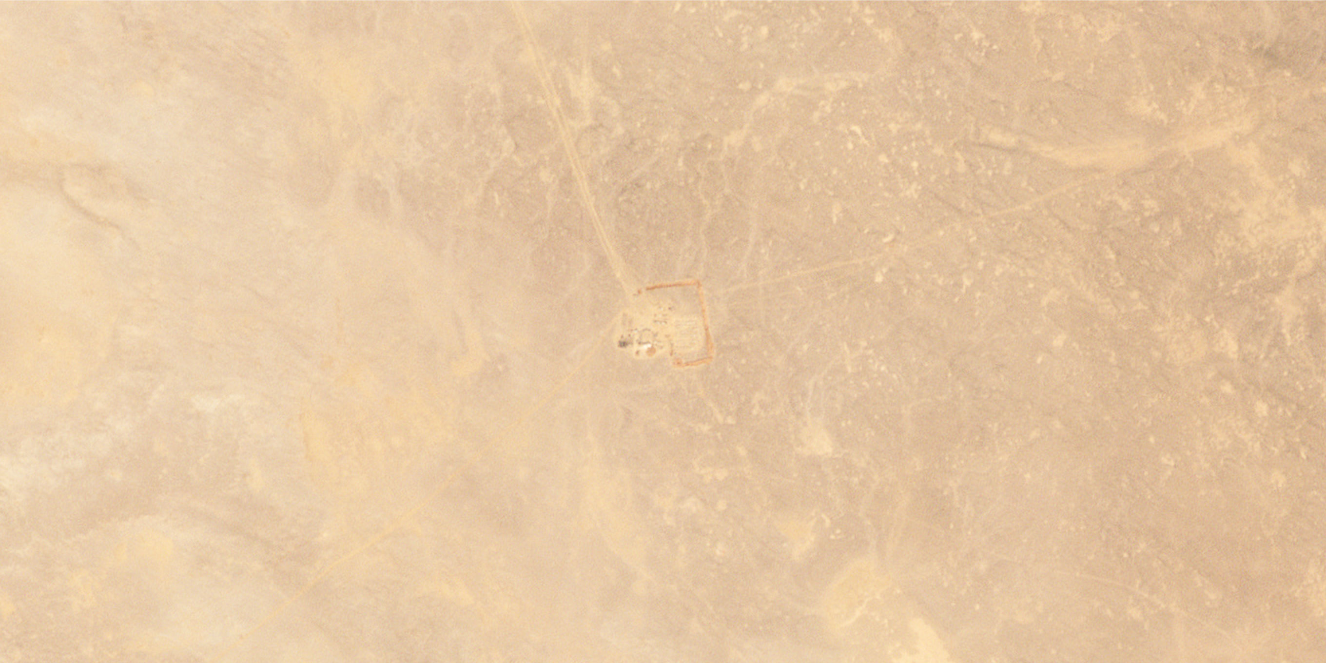
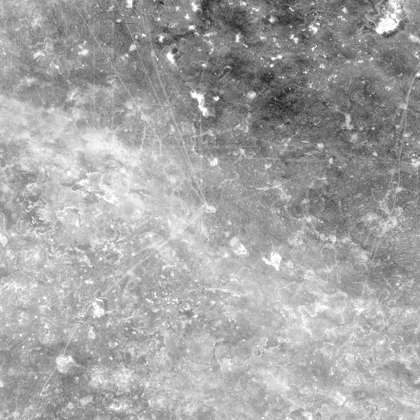
Unknown Encampment

January 16, 2014

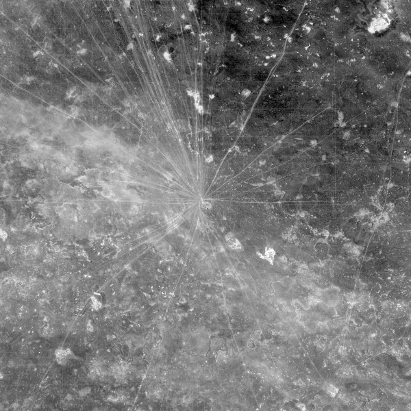
In January 2014, Planet identified traces of human activity appearing in the northeastern region of the Libyan Desert. Two large dirt tracks lead to an unknown encampment, which also has a bermed border under construction.
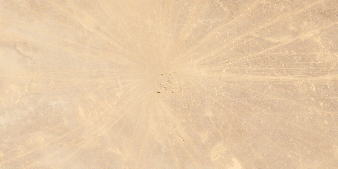
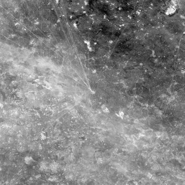
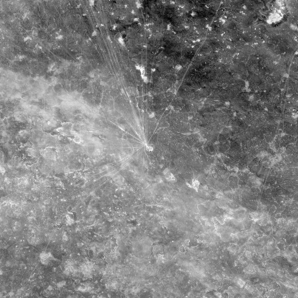
December 19, 2014

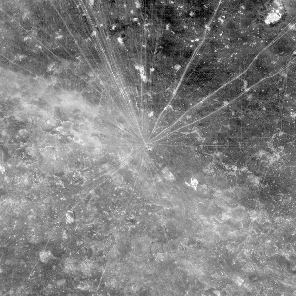
By the end of the year, the small encampment has grown, with dirt tracks creating a network-like system around it. You can also begin to discern faint lines that intersect these tracks in areas east of the site.

Another Perspective

With a revisit rate of every 16 days, Landsat 8 panchromatic band (15 meters per pixel) helped illuminate the increased development of tracks and traffic to the site over the year.

January 4, 2014

February 5

March 25

April 26

June 13

July 15

August 16

October 3

USGS/NASA

May 5, 2017


Fast forward three years later, and the tracks and grid lines have grown. At this stage, it becomes apparent that the grids are evenly spaced at around 300 meters apart. However, it was still unclear what the site was used for. Bermed encampments can suggest the presence of military, which often organize in remote areas.

A clue was found in the evenly spaced grid lines around the encampment, which often indicate seismic surveys. Energy companies in particular use seismic surveying to understand below-surface oil and gas reservoirs.

May 21, 2017


To take a closer look at what was happening on the ground, we tasked SkySat satellites. This high-resolution data (0.8 meters per pixel resolution) revealed in greater detail the presence of a grid, with lines intersecting at regular intervals, and confirmed our hypothesis that seismic surveying was likely happening.

The SkySat imagery also showed how the encampment infrastructure had grown up through May 2017. In this image, you can see two possible refineries, the bivouac site, and possible thumper trucks.

Activity at the camp in 2018 suggests that exploration is ongoing. What is unusual about the site is its location outside of known reserves in the Benghazi Governorate. The Sirte Basin is home to the majority of the country’s oil reserves, while this site is around 100 miles northeast of the Sirte Basin’s Messla Oil Field.

Frequent high-resolution monitoring can illuminate how places that appear as static and remote as the desert are brimming with change.


Sources: USGS/NASA

Writing and Editing: Jenna Mukuno

Data Visualization: Robert Simmon, Daniel Wolfe

Development: Daniel Wolfe

Monitor What Matters

High-cadence, high-resolution satellite data can help you understand global change in a new dimension. For more on energy and infrastructure monitoring or to learn how to leverage Planet imagery for daily global insights, get started today.