
Analyzing Urban Populations from Space with Planet Basemaps
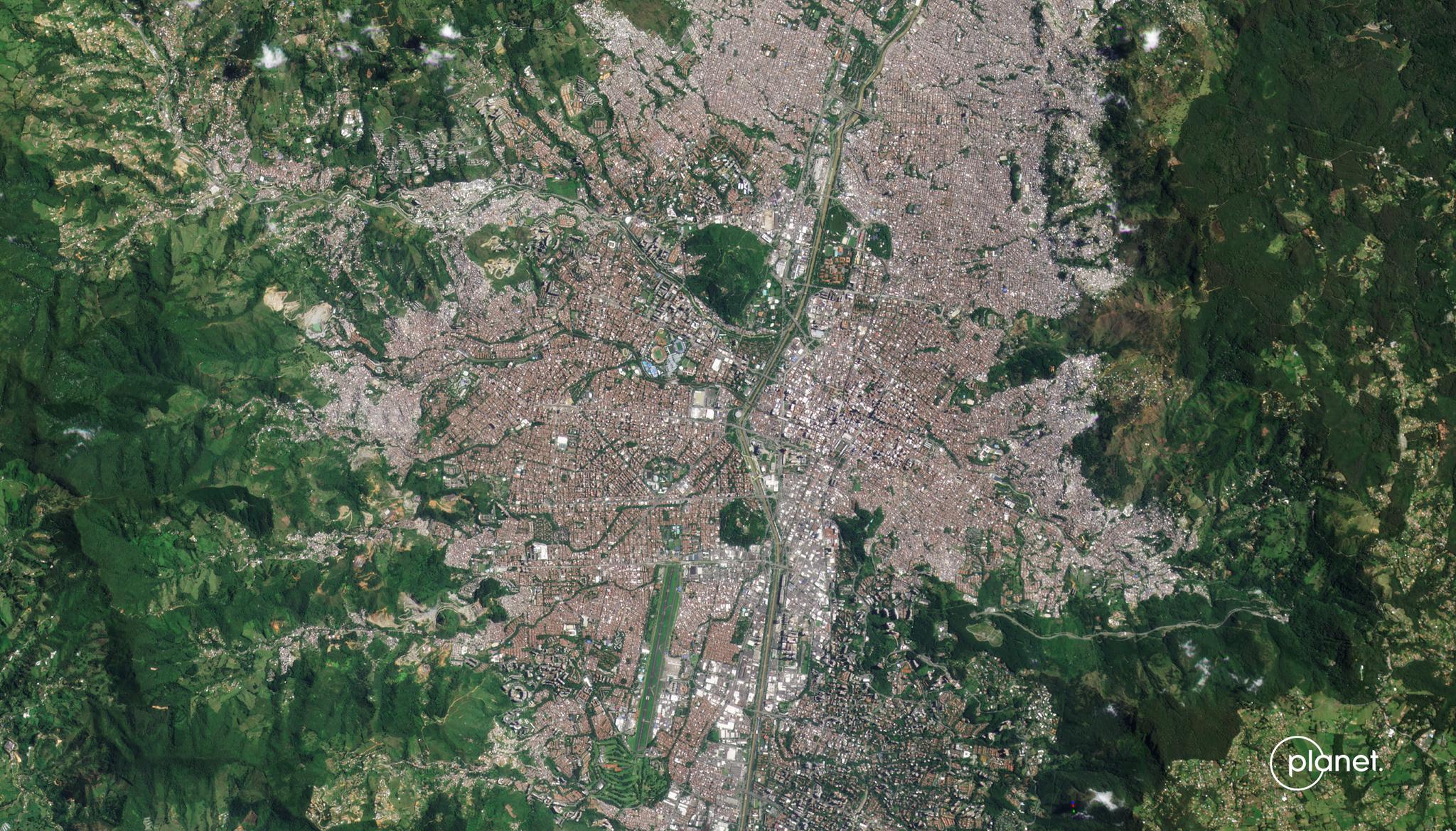
Image above: PlanetScope image of Medellin, Columbia taken August 8, 2022. © 2022, Planet Labs PBC. All Rights Reserved. The human population on Earth has been growing at unprecedented rates, and alongside this growth, we have witnessed mass migrations to urban locations. Tracking population changes in these urban environments is critical for implementing crisis management programs, ensuring effective urban planning, protecting vulnerable populations, and adapting to climate change. Traditionally, collecting regional urban population numbers and demographics has been done through census or field surveys. However, these methods have low temporal frequency or are inconsistent in their collection processes across the globe. But in the era of digital revolution, remotely sensed data has contributed greatly to the collection of disaggregated urban population data. For example, researchers from the German Aerospace Center (Deutsches Zentrum für Luft- und Raumfahrt or DLR) and Universidad EAFIT in Colombia have relied on a PlanetScope Basemap image mosaic for the year of 2019 to generate an urban mask for population analysis. With this data, the researchers performed a land cover classification to disaggregate urban area data between water, forests, and urban living centers. Their research demonstrated which methods of image analysis were best suited given data availability. In scenarios where the researchers have access to the remotely sensed data as well as topography and road network data, they recommended a combination of using demographic data collected in statistical formats and dasymetric methods (a mapping technique that parses land areas into discrete sections). However, they recommended that if researchers had access to building footprints in addition to the remotely sensed data, they should solely use the dasymetric method as building footprints offered a strong indicator of population and helped distinguish non-residential urban land-cover (like transport systems) in the satellite data. The full study can be found in PLOS One.
Ready to Get Started
Connect with a member of our Sales team. We'll help you find the right products and pricing for your needs.