
Charting Karst Topography in the Black Hills Region of South Dakota and Wyoming
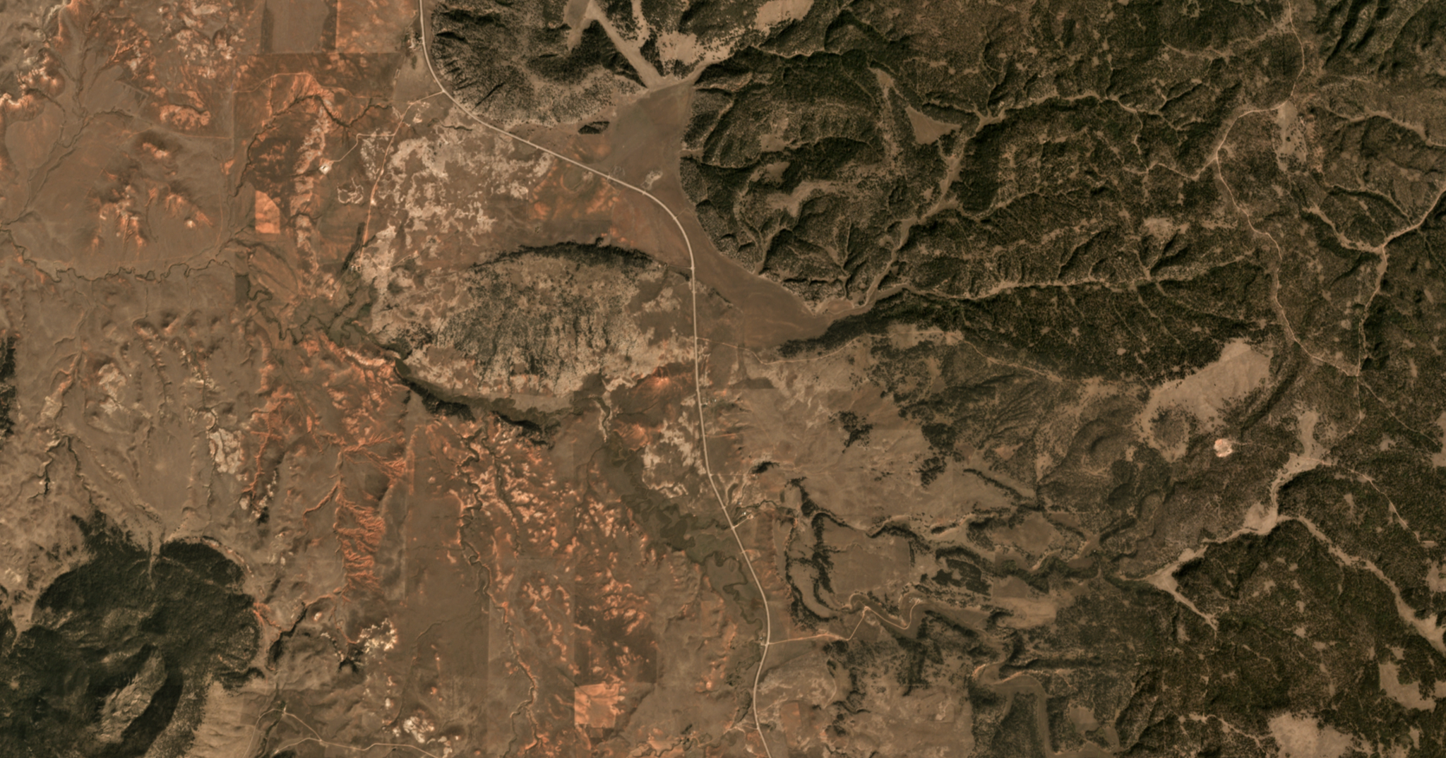
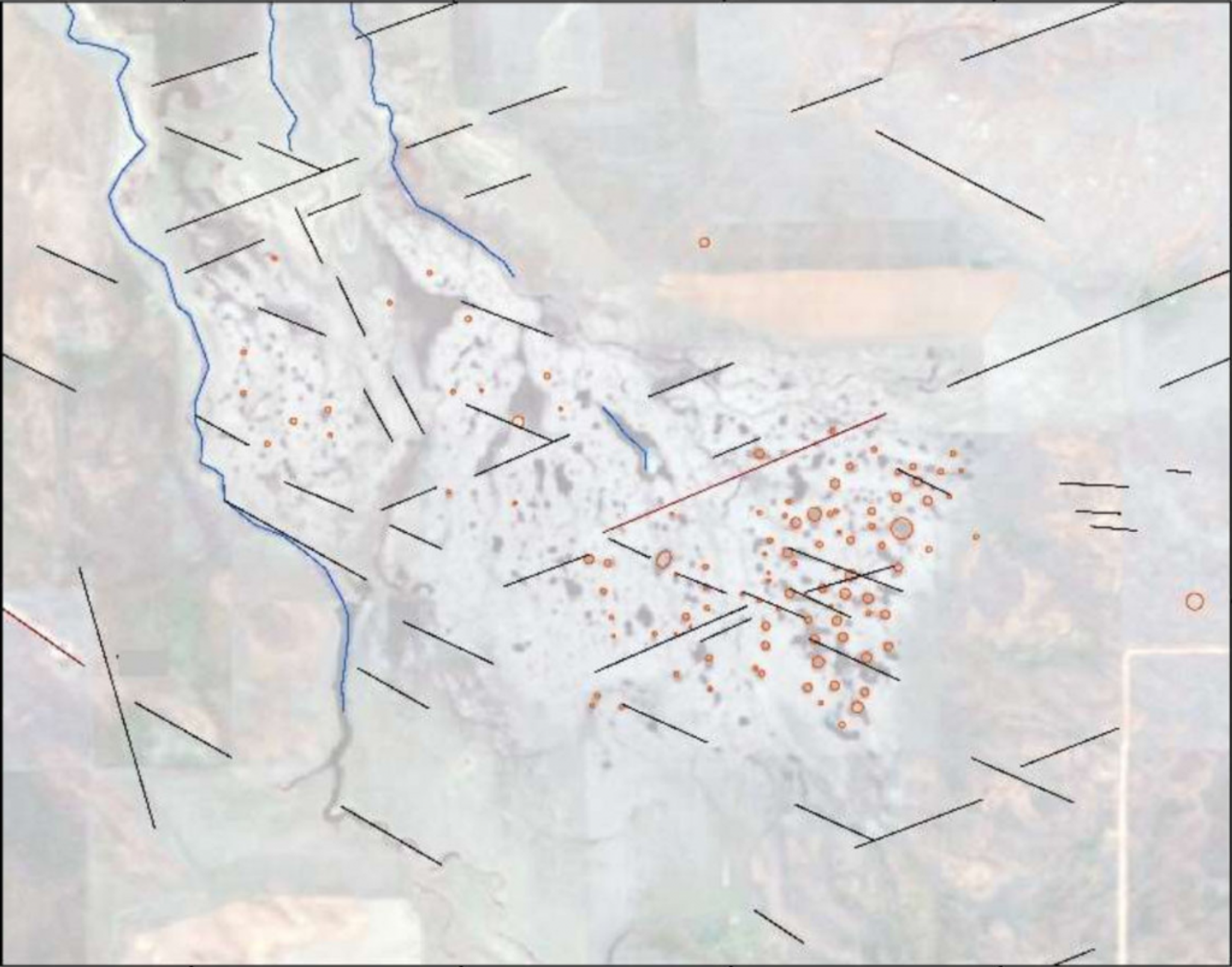
Straddling the South Dakota-Wyoming border, the Black Hills region is characterized by karst features—caves, sinkholes and other landforms created as water erodes dolomite and limestone deposits. Given the importance of water in creating karst formations, climate change has the potential to alter karst intensity. Barbara Theilen-Willige, Professor at Technical University Berlin, used a variety of remote sensing assets, including PlanetScope and RapidEye imagery, to characterize karst features throughout the Black Hills. Sentinel-1, ALOS, SRTM and other active sensors were also utilized to understand the three-dimensional nature of the karst landscapes. Theilen-Willige found that Planet images were particularly useful for providing multiple, high resolution images of the same target features over the course of seasonal changes in vegetation and snow cover. Read the full paper, which is available by open access in the journal Geosciences, here. [caption id="attachment_142482" align="aligncenter" width="1024"]
Ready to Get Started
Connect with a member of our Sales team. We'll help you find the right products and pricing for your needs