
Daily, High-resolution Leaf Area Index from Sensor Fusion with Planet, Landsat and MODIS
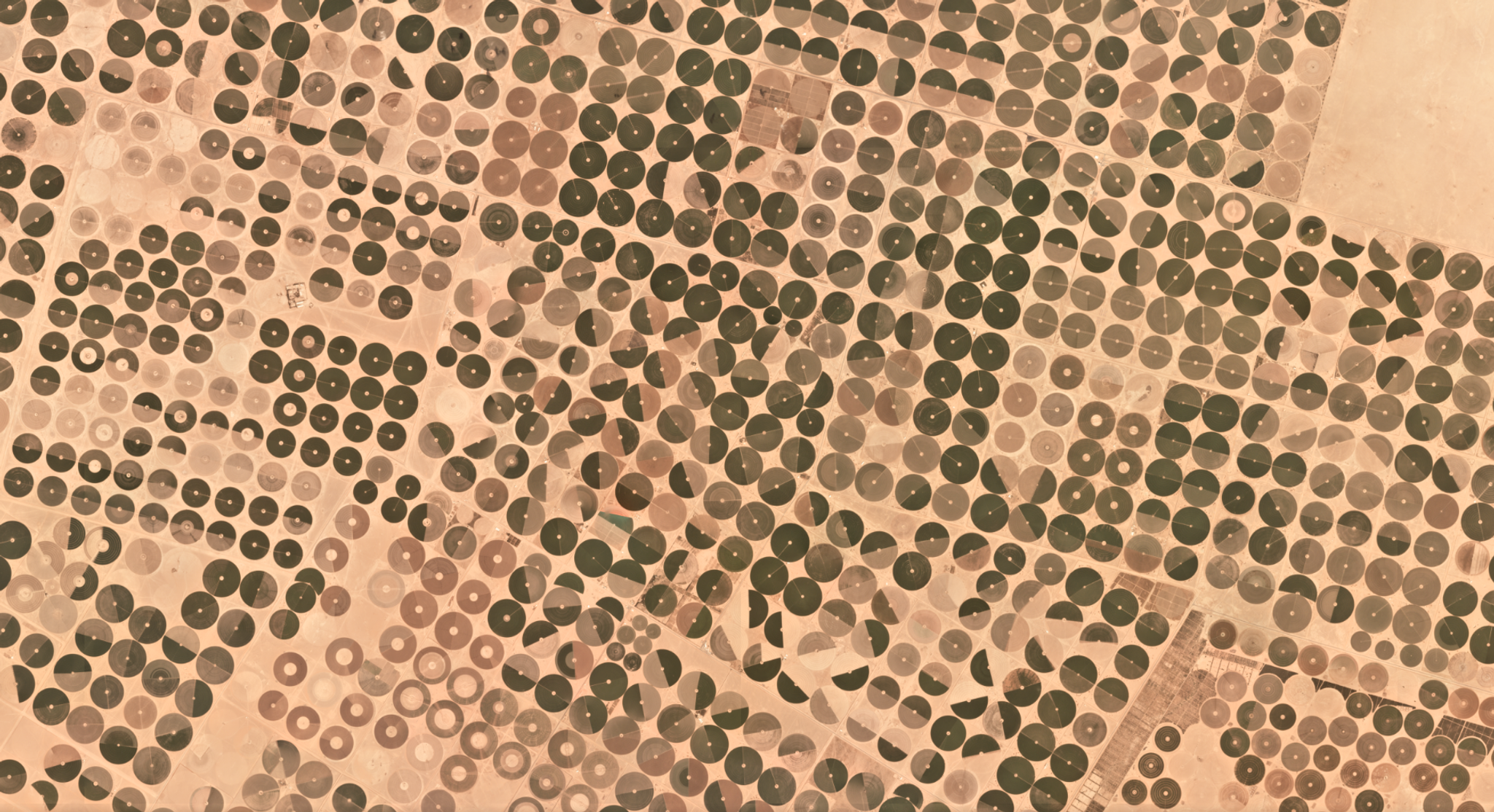
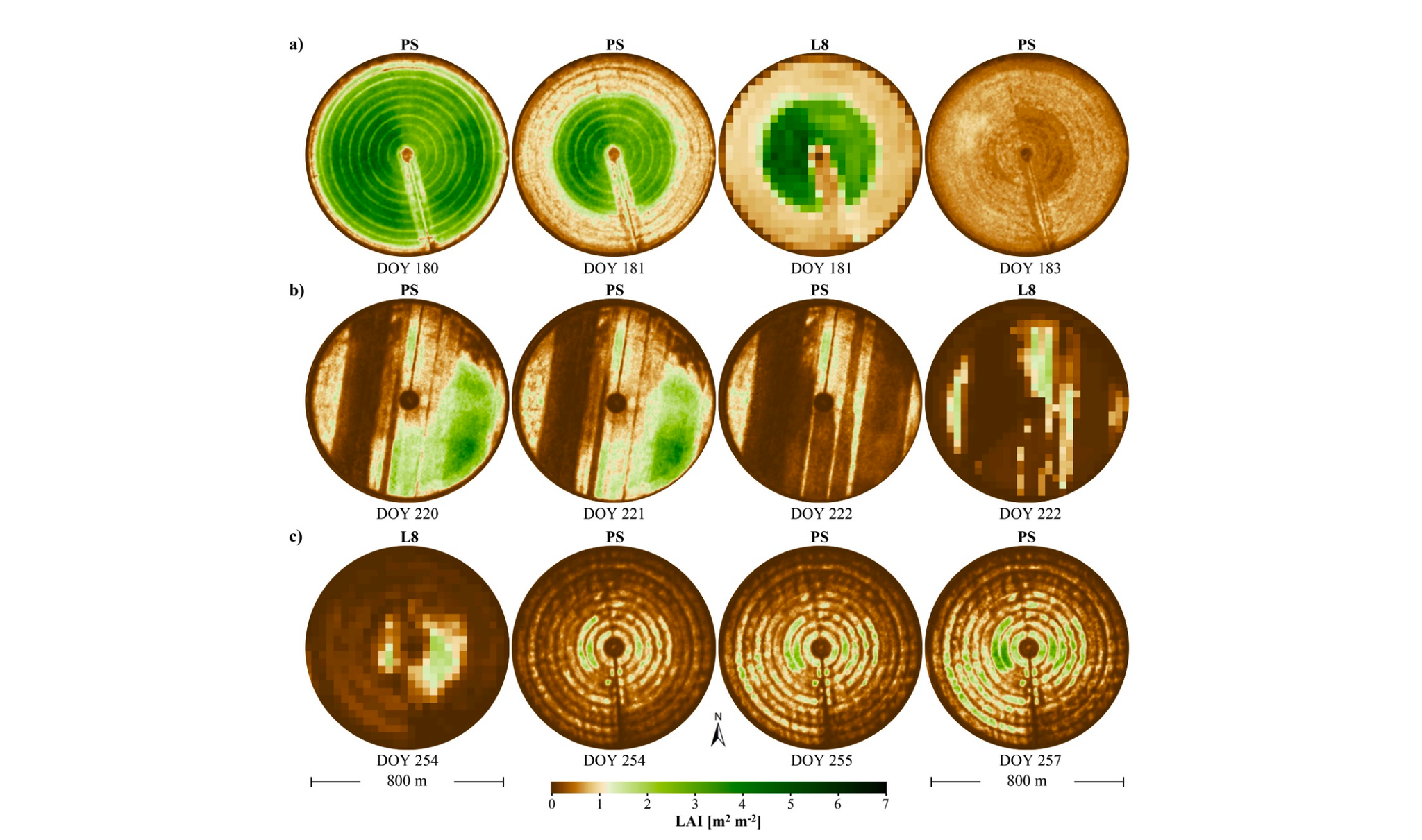
Classic remote sensing for agricultural relies heavily on indices like NDVI (Normalized Differential Vegetation Index), which uses information from the red and near-infrared portions of the spectrum to provide an indicator of vegetation greenness and vitality. However, other indices, often implicating other parts of the spectrum, may provided added and actionable information for agricultural management. One of these is Leaf Area Index (LAI), a measure of the surface area of vegetation divided by the surface area of the ground. For production alfalfa in the region of Saudi Arabia considered here, LAI can reach 5 to 6 square meters of vegetation per square meter of ground. LAI has previously been shown to be related to remote sensing observations from Landsat 8 (L8), including through the short-wave infrared (SWIR) portion of the spectrum (see, e.g. Houborg and McCabe 2018). While Planet's Dove satellites do not image in the SWIR, the method employed here by Rasmus Houborg and Matt McCabe still reproduces LAI from L8 with high accuracy: "The adopted RF [RandomForest] machine-learning approach was shown to reproduce the L8 reference LAI with high accuracy... based on a relatively limited suite of spectral variables.... This was despite the fact that a more spectrally enhanced dataset, including critical bands in the shortwave infrared domain, was needed for the Landsat-based LAI retrieval in order to reproduce observed multiday features with sufficient accuracy." The work builds upon a series of efforts undertaken by Houborg and McCabe (e.g., here). They conclude: "Daily sequences of CubeSat-based LAI highlighted the spatial resolution advantage and provided critical temporal insights into within-field variations in vegetation health and condition, the rate of vegetation green-up, and the timing and progress of harvesting events, features that were largely uncaptured by the 8–16-day Landsat imagery." Read the full paper, which was published in the journal Remote Sensing, here. [caption id="attachment_142525" align="alignnone" width="2214"]
Ready to Get Started
Connect with a member of our Sales team. We'll help you find the right products and pricing for your needs.