
Dove Imagery Used for Bathymetric Mapping
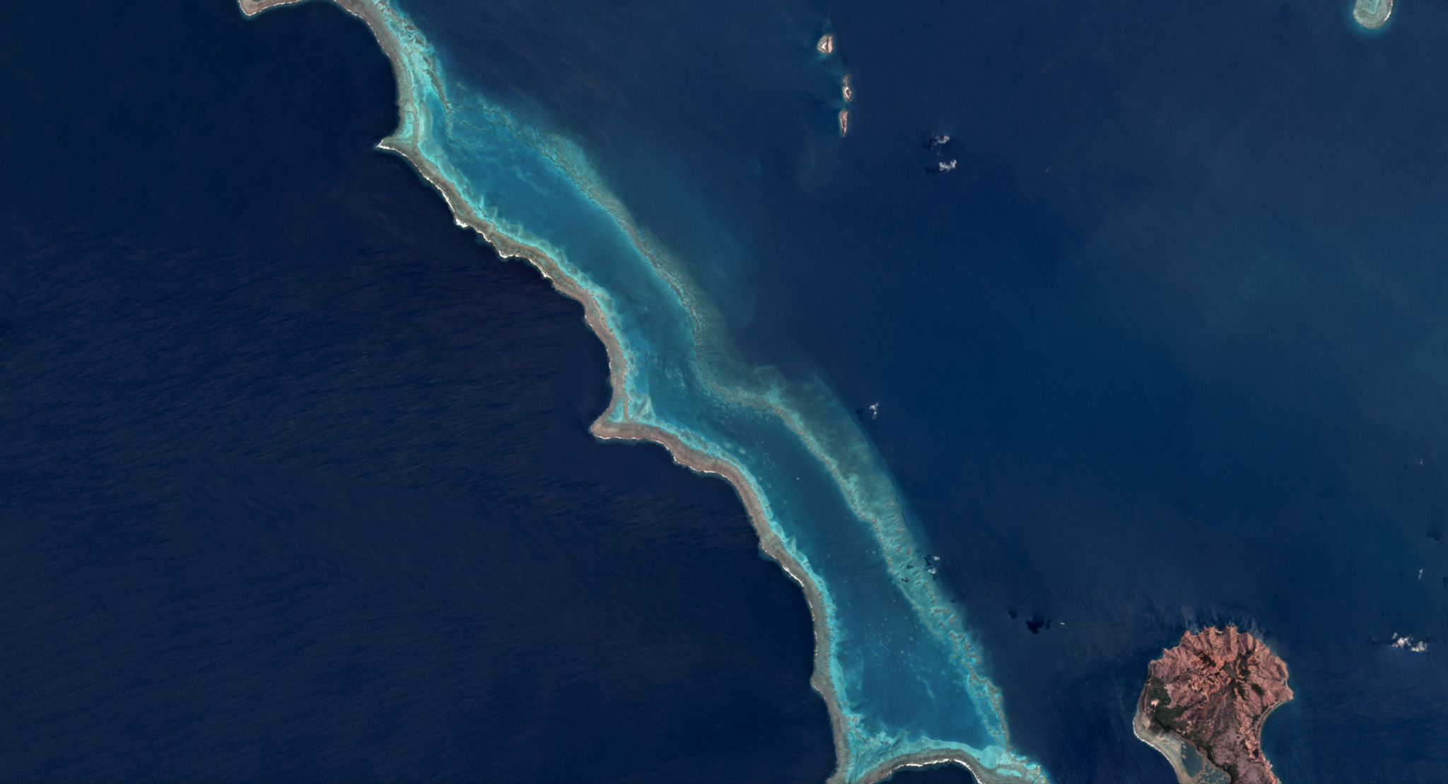
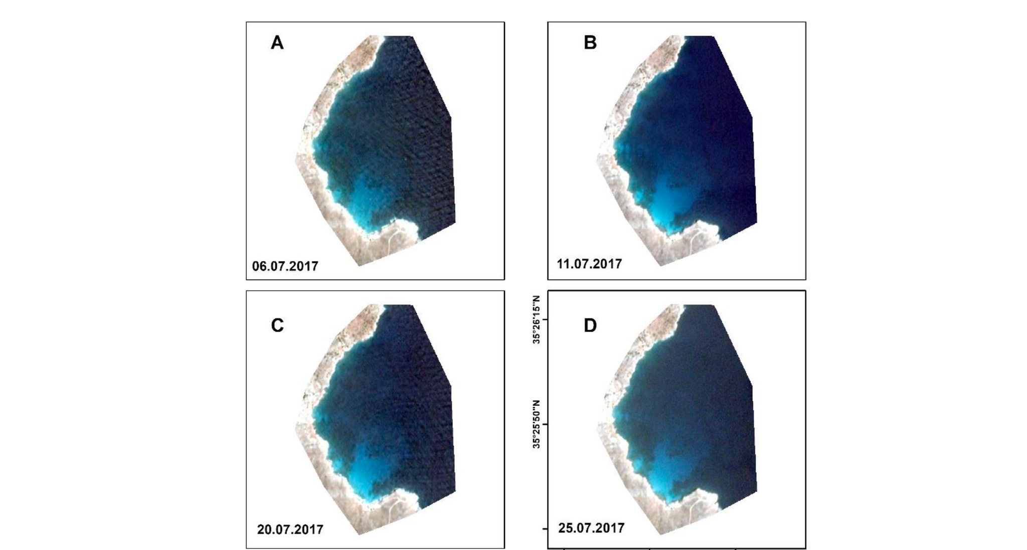
Satellite-derived bathymetry has numerous applications, including enhanced mapping and classification of bathymetric features such as coral reefs and seagrass meadows, as well as use in maritime navigation and coastline infrastructure. Dimitris Poursanidis from the Foundation for Research and Technology in Hellas, with colleagues from the German Aerospace Centre, used Planet’s Dove images to estimate water depth within a cove on the Island of Crete in Greece. While working only in this local area, Poursanidis and team were able to predict depth from Dove imagery with an R2 of 0.88 and RMSE of 0.32m to a depth of 10m. The recovered additional predictive power, although at lower precision, to depths of 25m. Poursanidis and team also found that Dove imagery was suitable for navigation, noting the results are compliant with the International Hydrographic Organization requirements: “The results from the applied empirical method with the intermediate preprocessing steps are promising and show that it has great potential for coastal bathymetry estimation, especially in the shallow waters.” The authors suggest that the results “can be eventually exploited to carry out scientific and operational mapping and monitoring of the coastal aquatic environment at a fraction of the cost of ‘traditional’ satellite platforms.” Read the full paper, which was published open access, in the journal Remote Sensing. [caption id="attachment_143526" align="aligncenter" width="2738"]
Ready to Get Started
Connect with a member of our Sales team. We'll help you find the right products and pricing for your needs