
Fusing PlanetScope & Sentinel-2 for Daily, High-resolution Leaf Area
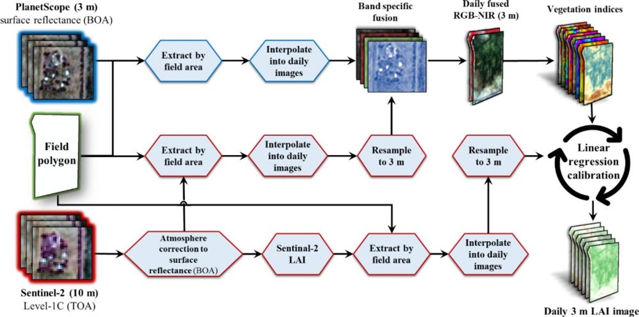
Improving crop yields, vigor and health, can be facilitated by better monitoring of the cross-sectional area of vegetation—i.e., Leaf Area Index or LAI. However, measuring LAI on the ground is time consuming and expensive. Sentinel-2, operated by the European Space Agency, publishes a global LAI product; but at 10m resolution and a revisit of 5 days, Sentinel-based LAI estimates are limited in both spatial and temporal resolution. Yuval Sadeh and colleagues at Monash University in Australia fused PlanetScope data with Sentinel-2 to generate daily, ~3m resolution LAI estimates. The results explained 94% of ground-measured LAI for validation sites in Israel and Australia. Sadeh and colleagues report that "These high spatio-temporal resolution time-series are valuable for monitoring crop growth and health, and can improve the effectiveness of farming practices and enhance yield forecasts at the field and sub-field scales." The study by Sadeh and team joins several recent efforts to fuse PlanetScope data with other passive optical sensors, combining the spectral fidelity of public assets such as Landsat and Sentinel, with Planet’s unique, daily high-resolution capabilities. As newer Planet spacecraft with improved radiometric sensitivity are increasingly deployed, even greater accuracy may be achieved. The study is open access, and can be found at the International Journal of Applied Earth Observation and Geoinformation. [caption id="attachment_146084" align="aligncenter" width="1000"]
Ready to Get Started
Connect with a member of our Sales team. We'll help you find the right products and pricing for your needs.