
Mapping Landslide Susceptibility in Dove Imagery after the 2018 Tomakomai Earthquake
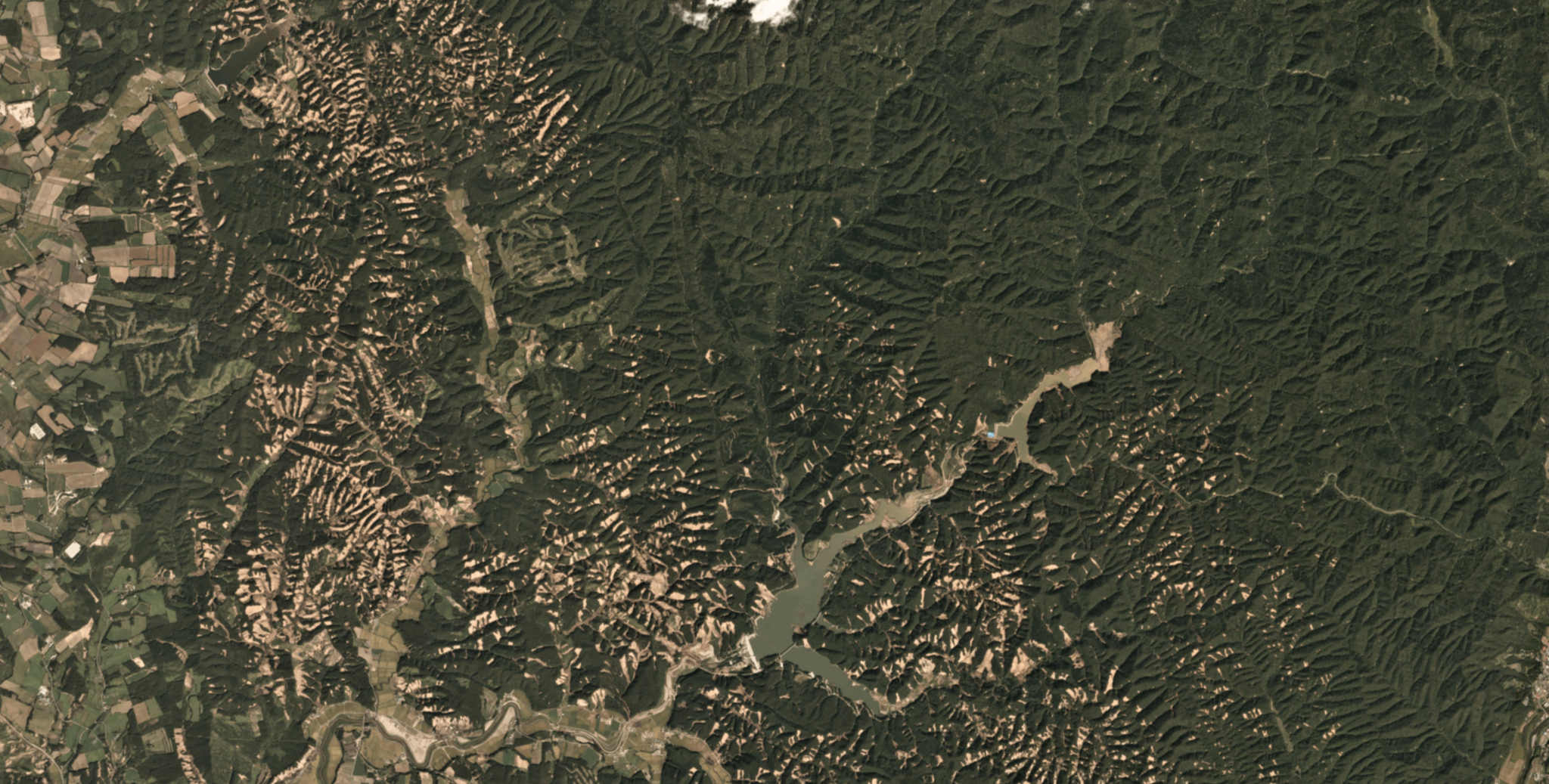
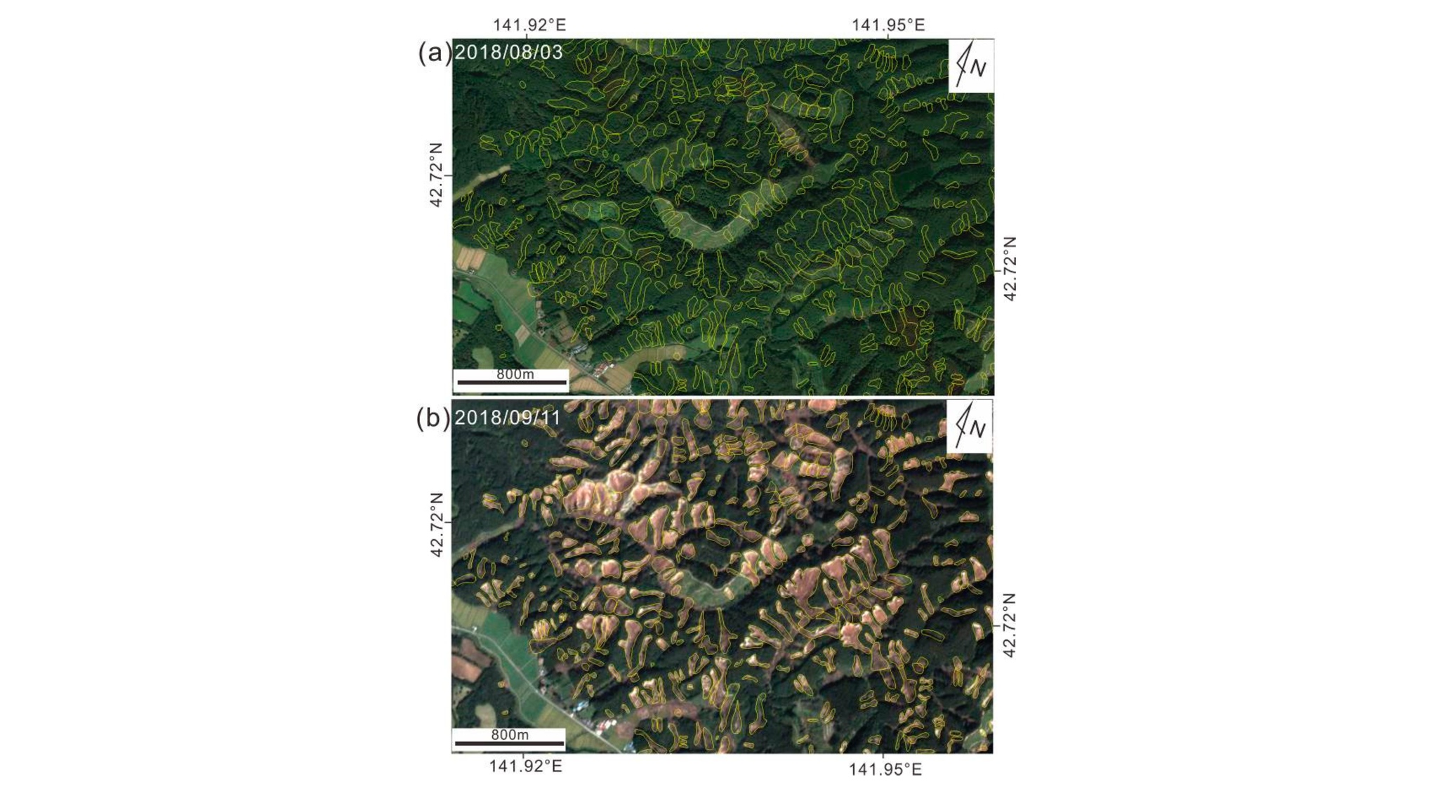
Globally, landslides kill ~5,000 people per year. If landslides—including rock falls, mudslides and other surface failures—can be better predicted, these deaths could be avoided. Landslides are highly heterogeneous, both spatially and temporally. They are more common in the steep, mountainous regions of the Earth, but also more frequent during particular seasons due to changes in soil moisture. Xiaoyi Shao and a team of researchers from the China Earthquake Administration and several Chinese universities used Planet imagery to explore the factors controlling the distribution of landslides after the 2018 magnitude 6.6 Tomakomai earthquake in Japan. They used logistic regression and support vector machines (SVM) to determine which controlling variables, including elevation, slope, distance to the fault and others, had outsize influence on landslide occurrence. Shao and team found the Planet imagery to be excellent for landslide assessment, greatly accelerating the post-disaster analysis by providing complete, cloud-free coverage of the affected area within days. “In the past, it was impossible to obtain images covering the entire earthquake zone in one month or even [a] few months after the earthquake (such as the Wenchuan, Nepal, and Lushan earthquakes), which brought great difficulties to the construction of the seismic-landslide database.... The Planet satellite changed this status, and the images can be acquired within a few days after the earthquake, which greatly increases the acquisition speed of landslides.” The authors note that the faster speed of analysis will assist in recovery efforts: “We completed the landslide inventory within 1 month after the earthquake, so that the assessment results can be applied to the medium-term resettlement and reconstruction, and are helpful to earthquake landslide prevention and mitigation.” Read the full paper, which was published as open access, in the journal Remote Sensing. [caption id="attachment_143494" align="aligncenter" width="3280"]
Ready to Get Started
Connect with a member of our Sales team. We'll help you find the right products and pricing for your needs