
Military Base-building Destroys Coral Reefs in the South China Sea
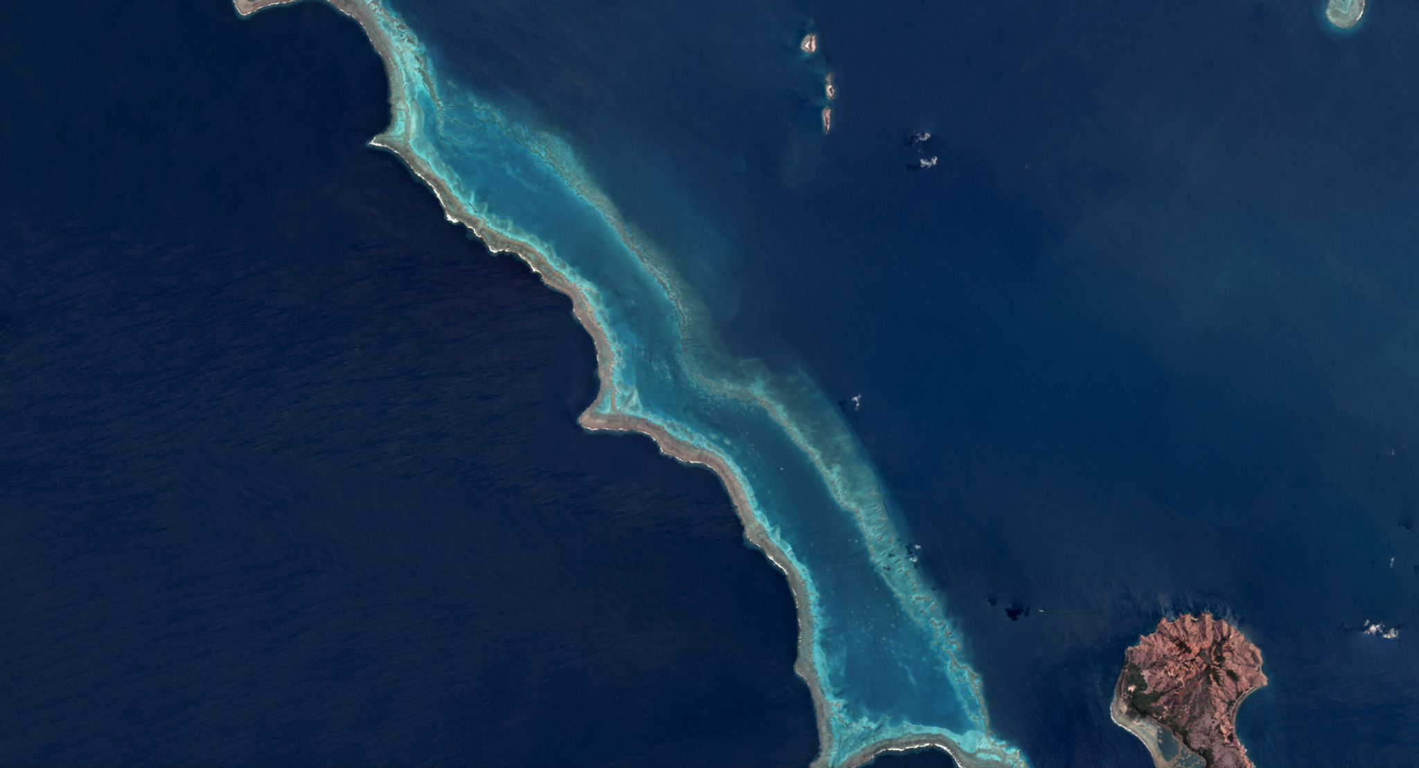
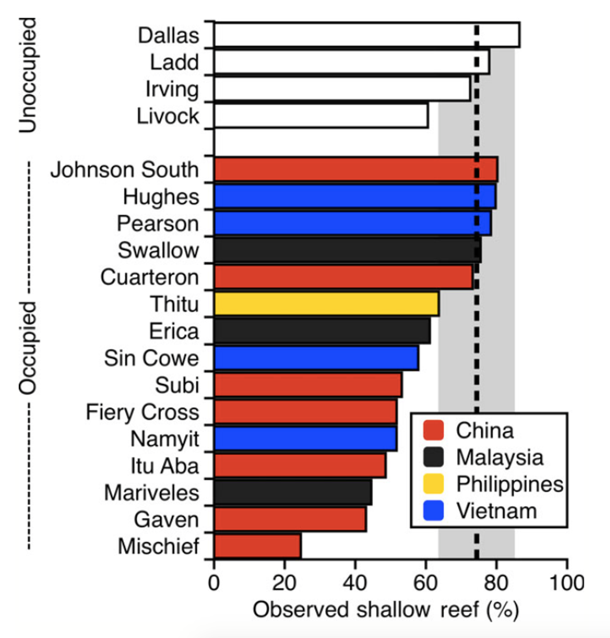
In late 2016, Greg Asner, of the Carnegie Institution for Science, led a field survey of the spectacularly diverse Spratly Islands archipelago. The mission combined in-water diving and photography with Planet's Dove data in order to map coral reefs and assess the damage they face from military base expansion. Greg described the campaign to Mongabay: "The region has also become a hotbed for modern naval activity, owing to critical commercial shipping through its waters, and the oil that underlies its seabed. The U.S. routinely navigates the South China Sea as a demonstration of its naval power, said to ensure right-of-passage, and which China openly views as a threat. And as a result, military base and outpost building continues at a feverish and ecologically destructive pace. Whole coral reef atolls have been dredged to form hard land for military complexes and aircraft runways. "As a global ecologist and conservation scientist, I have long been interested in the Spratlys as a biodiversity hotspot. With its purported 600 coral and 6000 fish species, I had wondered what this ecoregion looks like underwater, and more recently, what the frenzied building of military bases might mean for its sea life. I wondered too if coral reefs of the Spratlys had been impacted by recent hot water events that cause coral bleaching, like that which has devastated the Great Barrier Reef." "My initial visit to Swallow Reef yielded thousands of photographs and video. It also sparked the idea to combine rapid underwater surveys with a new class of satellite imaging that might give us a fast-track way to assess coral reefs on more atolls than we could possibly visit in the water. To do this, I turned to my colleagues at Planet.com, formerly known as Planet Labs. They operate the world’s largest constellation of small orbiting satellites that can image Earth on a daily basis at about 3 to 5 meter spatial resolution. As one of Planet’s science Ambassadors, I collaborate with the company to apply their satellite data to new environmental challenges, so the Spratlys were a perfect fit." [caption id="attachment_138913" align="alignnone" width="722"]
Ready to Get Started
Connect with a member of our Sales team. We'll help you find the right products and pricing for your needs.