
PlanetScope and Blue Wavelengths Help Map Snow Melt
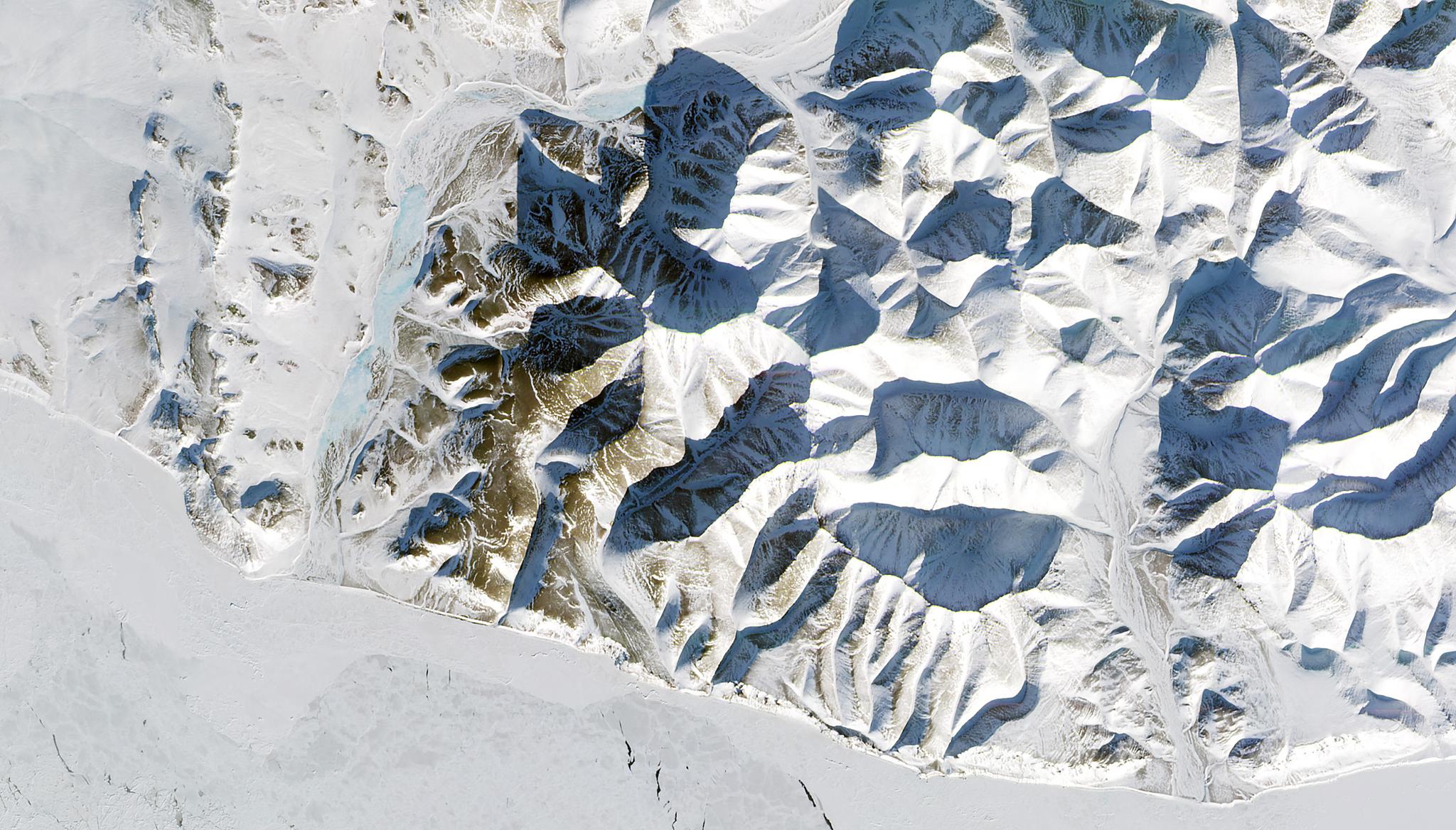
Image above: Snow cover on the Seward Peninsula in Alaska taken February 27, 2020. © 2020, Planet Labs PBC. All Rights Reserved. Seasonal snowfall is very important to maintaining important ecological systems. For example, mountainous snowmelt replenishes rivers and watersheds with the arrival of spring and summer. Snow cover also acts as an insulator for soil, trapping temperatures and keeping the ground protected from atmospheric influences, such as sun and wind. But snowy ecosystems are changing dramatically due to climate change and impacting these ecological systems. Scientists know it is imperative that we gain an understanding of this shifting snow cover, and so researchers from the Earth and Environmental Sciences Division of Los Alamos National Laboratory are exploring the use of remote sensing tools to map and monitor global snow cover. Scientists typically estimate snow-cover area with a normalized difference snow index (NDSI) which provides data based on spectral measurements in the shortwave-infrared wavelengths. However, given the lack of high temporal and high resolution satellite data that can be analyzed with NDSI, this research group aimed to find an alternative analytical method to monitor snow melt at a fine scale. In their study, this group mapped snow-covered areas with a thresholding method using blue wavelengths which they aptly named the Blue Snow Threshold algorithm. Their team refined the algorithm and applied it to PlanetScope imagery to assess fine scale snow cover areas. This method “offers a reliable and easy-to-apply tool for examining fine-scale snow-related processes,” according to the authors. The full study can be found in Remote Sensing of Environment.
Ready to Get Started
Connect with a member of our Sales team. We'll help you find the right products and pricing for your needs.