
PlanetScope Enables Detailed Mapping of Lava and Ash Deposits of Indonesian Volcanoes
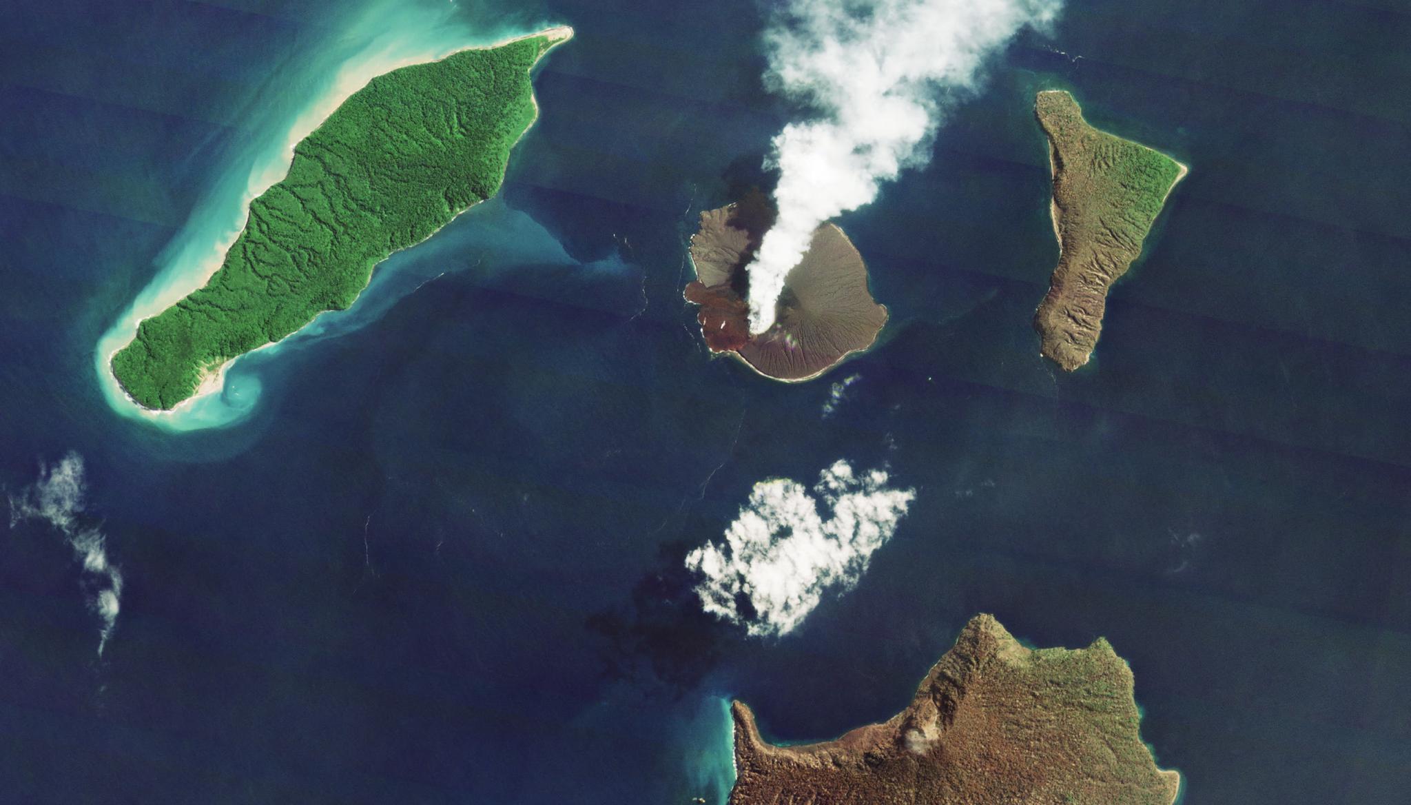
Above image: Planet image of the eruption of the Krakatau volcano in Indonesia taken May 2, 2022. © 2022, Planet Labs PBC. All Rights Reserved. Monitoring active volcanoes from the ground can present a lot of challenges - especially when they are erupting. From lava flows, earthquakes, tsunamis, and ash plumes, active eruptions provide a myriad of hazards for researchers, not to mention entire communities of people. But now, researchers can use satellite imagery to monitor volcanic activity and see large-scale views of the areas impacted by the volcanoes. Scientists Moritz Rösch from the University of Wuerzburg and Simon Plank from the German Aerospace Center, have created a detailed mapping approach using Planet's satellite imagery to understand how lava flows from eruptions are impacting both vegetative and non-vegetative regions surrounding volcanoes. The scientists noted that visualizing lava flows in areas without vegetation has been challenging with optical satellites due to the similarities of spectral information from each. However, by leveraging PlanetScope data with analyses of texture and brightness changes and thermal anomalies from Sentinel-2 and Landsat-8, they were able to create a novel object-oriented classification approach for mapping eruptive phases of three Indonesian volcanoes. This work highlighted how this process could support near real-time monitoring of eruptions and could be used for effective hazard response. "The PlanetScope data turned out to be highly useful in the analysis of volcanic hazards. Due to the high geometric resolution, even small-scale change processes can be detected. In addition, the high temporal resolution allows for the monitoring of highly dynamic processes in volcanic environments with high eruptive activity," said the authors. The full study can be found in Remote Sensing.
Ready to Get Started
Connect with a member of our Sales team. We'll help you find the right products and pricing for your needs