
Using PlanetScope to Map Snowmelt In Alpine Ecosystems
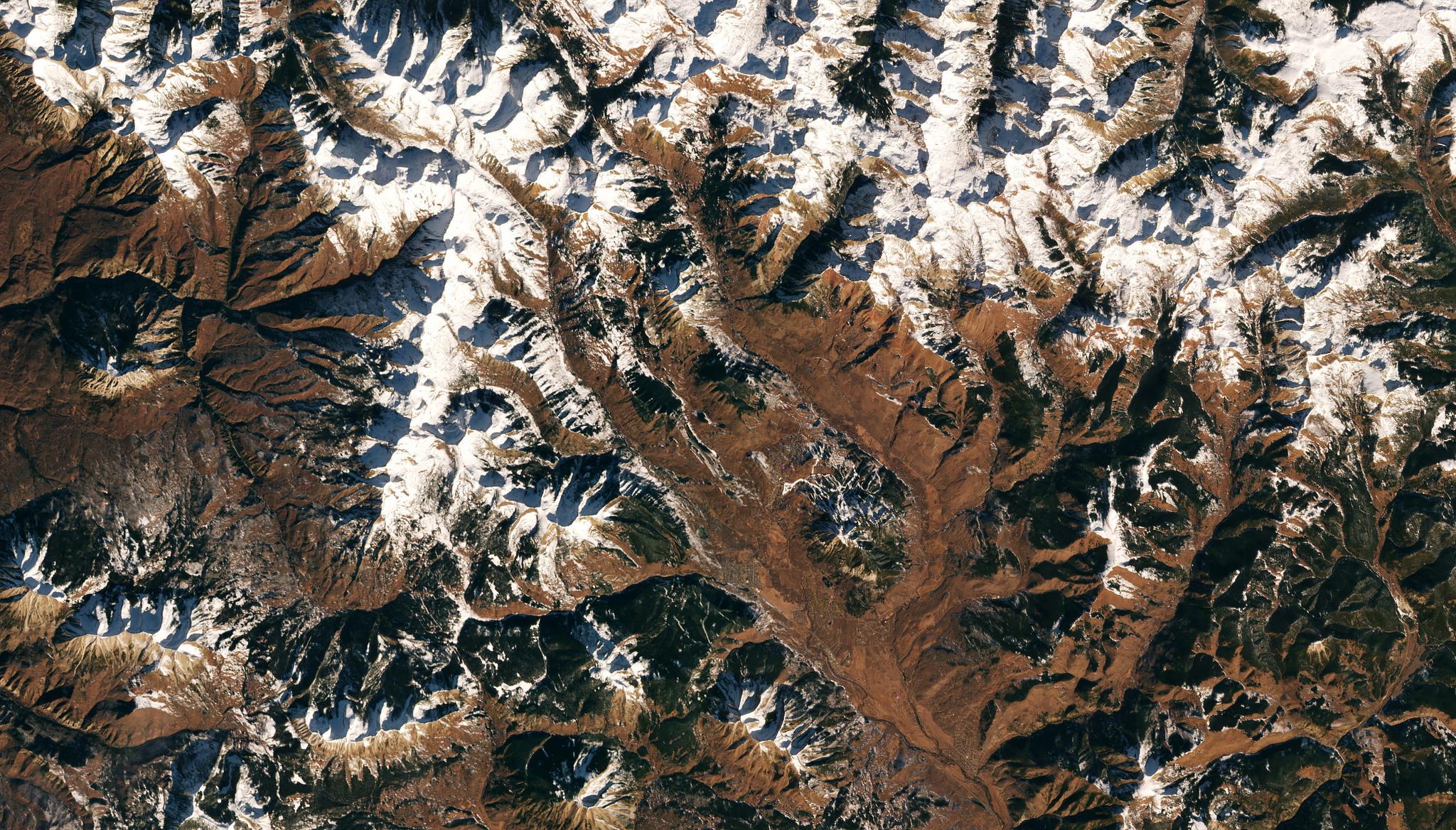
Image above: PlanetScope image of snowcapped Upper Gunnison Mountains, Colorado taken December 4, 2021. © 2021, Planet Labs PBC. All Rights Reserved. Alpine regions are some of the most sensitive systems to climate change. In the mountainous ecosystems of the western United States, for example, even small changes in temperature cause significant shifts. As snow melts earlier and earlier each year, there are cascading effects on these complex systems which are full of interconnected species. For example, the change in snowmelt can impact the phenological advancement of species. Previously, in the western United States, wildflower season would begin just following the snow disappearance, but now, wildflower emergence is shifting earlier; and this change can cause pollinating insects and flora to suddenly be on asynchronous timelines. This snowmelt can also cause a myriad of environmental changes from springtime flooding to uncharacteristically drier summers. Due to these complexities, it’s important for researchers to be able to map and monitor this snowmelt to better understand the full extent of impacts that climate change can have on these species and water systems. With this in mind, researchers from University of Washington and ETH Zürich used PlanetScope data to map these snow-covered areas with high temporal frequency. Their study demonstrated how PlanetScope reflectance products and a machine learning approach based on convolutional neural networks could be used to accurately map snow cover and vegetation metrics in snowy forested regions. Their research team worked to improve their model’s performance by focusing on two geographies, Gunnison, Colorado and Engadin, Switzerland; and they added additional input data including NDVI and DEM metrics including elevation, slope, and aspect to enhance their outputs. While it is still a challenge to detect snow melt under tree canopies, their model also used the NDVI and NIR bands together to elevate the performance of their data outputs in forested regions. “The improved high-resolution snow maps in forested environments can support studies involving climate change effects on mountain ecosystems and evaluations of hydrological impacts in snow-dominated river basins,” said the authors. The full study can be found in Remote Sensing.
Ready to Get Started
Connect with a member of our Sales team. We'll help you find the right products and pricing for your needs