
PlanetScope, Sentinel-2, and Sentinel-1 Data Integration for Object-Based Land Cover Classification of Tropical Forests in Google Earth Engine
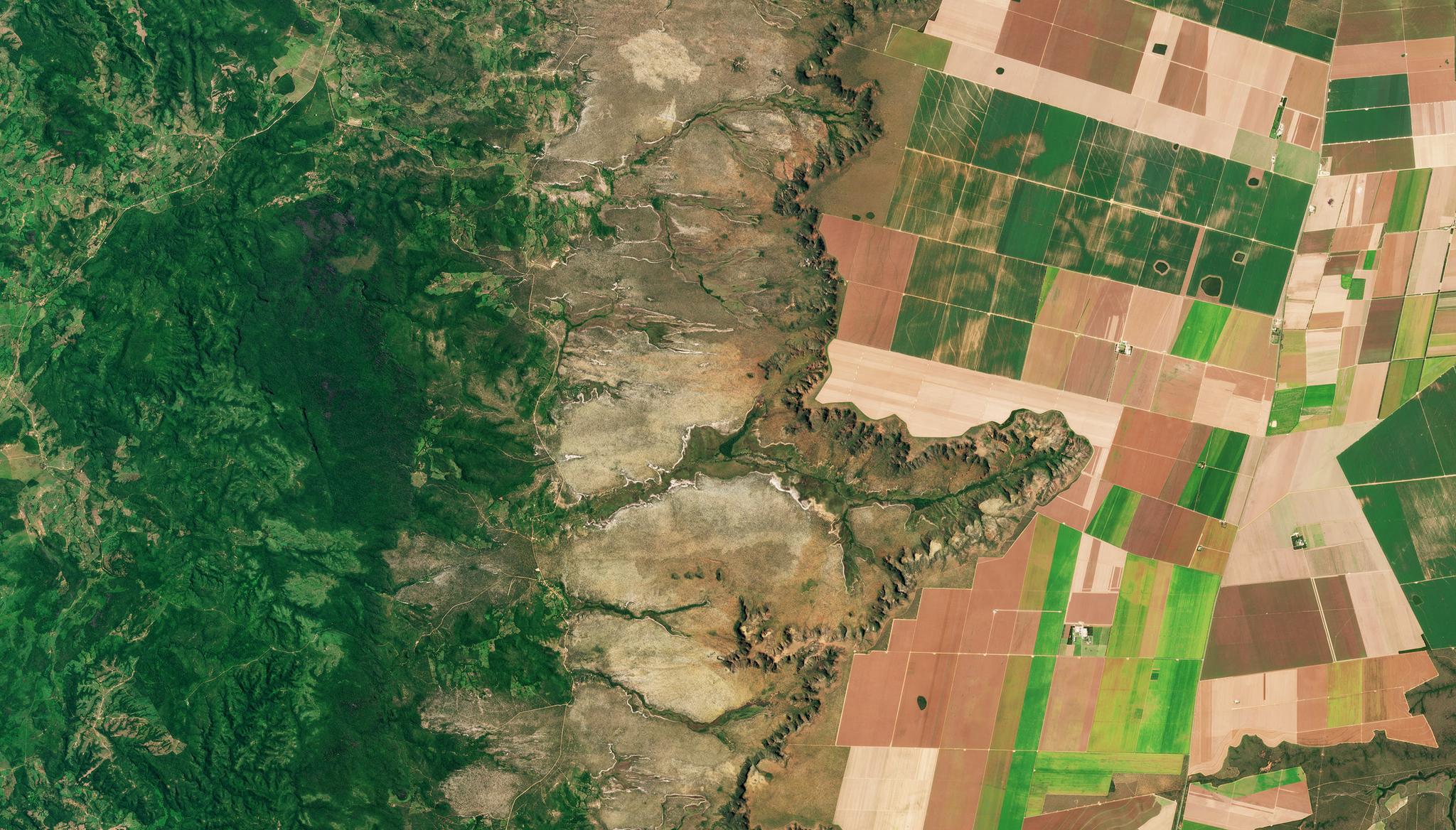
Above image: Planet image of study site in central Brazil taken March 26, 2022. © 2022, Planet Labs PBC. All Rights Reserved. Through last year's partnership between Norway’s International Climate and Forest Initiative (NICFI) and Google, Planetscope Basemaps of global tropical forests are now accessible to Google Earth Engine users. With this data, users can use Object-based image classification to assess land use and land cover in tropical areas. Deforestation, agricultural practices, and drought can all cause devastating impacts to the biodiversity and ecosystems in these regions, and researchers are working on critical projects to create and analyze land use and land cover maps to better understand how humans are utilizing land in these vulnerable areas. Researcher Marco Vizzari from the University of Perugia in Italy is utilizing Google Earth Engine-accessible Planet data to evaluate Object-based approaches to the creation of a land use and land cover map of an area 69,272 km2 wide in central Brazil. His study demonstrated that by adopting an Object-based approach over a Pixel-based approach, while using Planet data, researchers can gain higher overall detection accuracy results (67% accurate versus 82% accurate respectively). The study further determined that integrating Planet data with Sentinel-2 and Sentinel-1 datasets in Google Earth Engine yielded improved Object-based outputs, moving the 82% accuracy to 91% accuracy. “This research demonstrated the Object-based approaches’ applicability in Google Earth Engine, even in vast study areas and using high-resolution imagery. Although additional applications are necessary, the proposed methodology appears to be very promising for properly exploiting the potential of Planet Labs data in Google Earth Engine,” wrote Vizzari. The full study can be found in Remote Sensing.
Ready to Get Started
Connect with a member of our Sales team. We'll help you find the right products and pricing for your needs.