
PlanetScope Used to Monitor Illegal Trash Burning
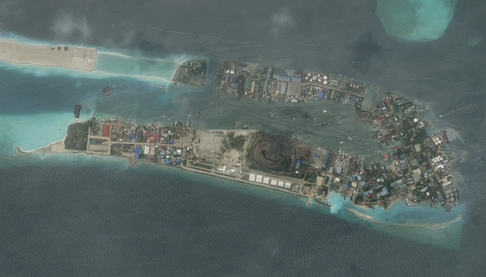
Image above: Planet satellite image of Thilafushi landfill in the Maldives, one of the research study site locations, taken May 5, 2023. © 2023, Planet Labs PBC. All Rights Reserved. Across the world, countries are faced with the challenge of increasing trash. Waste generation in many developing countries is far outpacing municipal resources that manage trash. As a result, many have turned to waste burning in landfills and designated public locations, but this practice can release hazardous pollutants. As a result, some governments have recently placed bans on open trash burning at municipal facilities, however, evaluating if this ban is effectively helping to decrease air pollution is difficult due to the lack of air pollution monitoring systems. To address this challenge, researchers from the Department of Civil and Environmental Engineering at Duke University have demonstrated how the combination of Planet satellite data and machine learning could be an effective method for identifying waste burning plumes. Focusing their research in the Maldives, the team of researchers leveraged PlanetScope imagery of the region and an image classification and semantic segmentation model to identify and locate plumes of smoke from trash burning. “Our results demonstrate the potential of machine learning models in detecting plumes from sources where measurements are not available, including wildfires, coal-fired power plants, and industrial plumes, as well as in tracking the progress of mitigation strategies,” said the authors. The full study can be found in Environmental Science & Technology Letters.
Ready to Get Started
Connect with a member of our Sales team. We'll help you find the right products and pricing for your needs