
River Morphology Dynamics Revealed with Dove Imagery
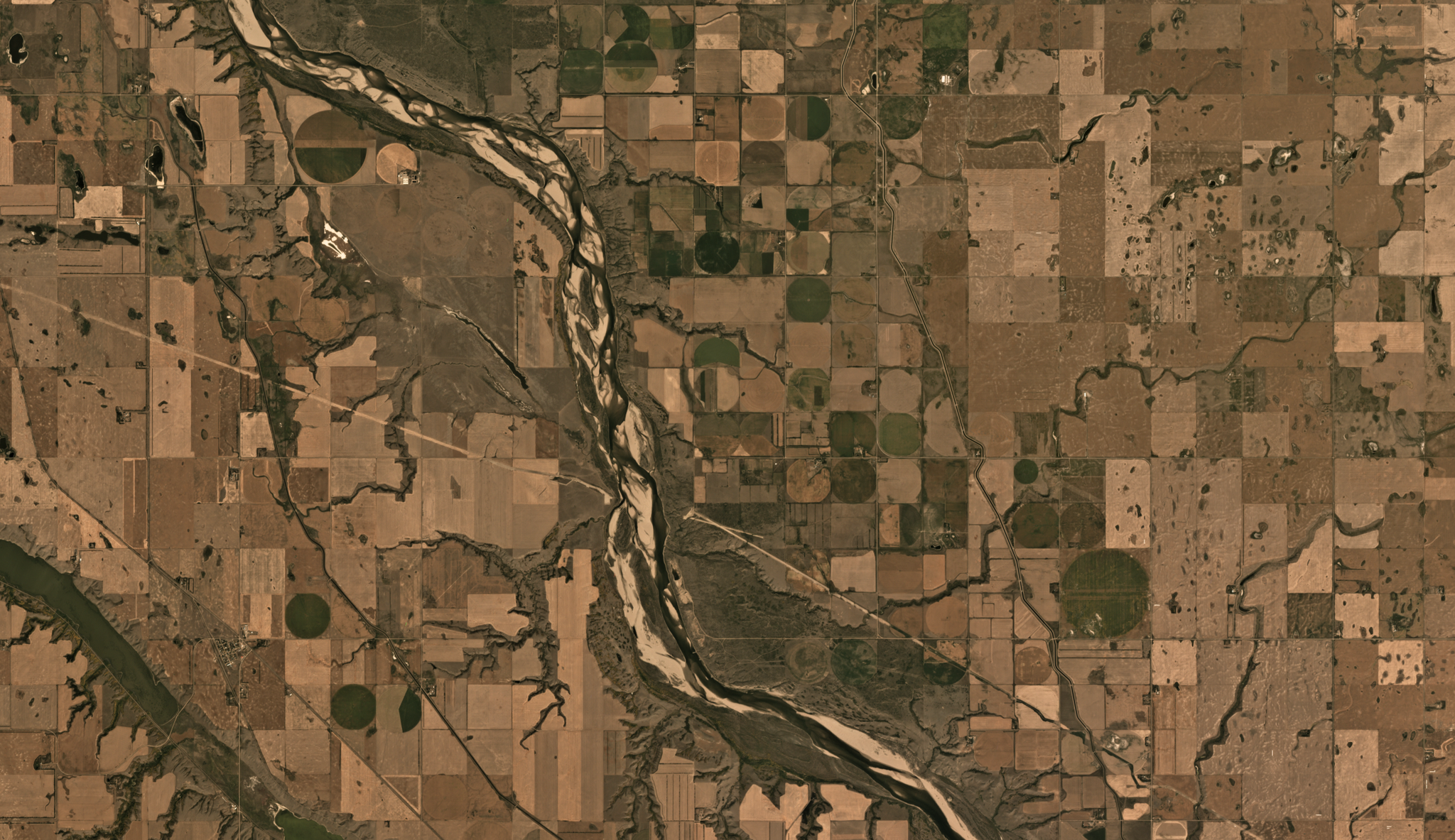
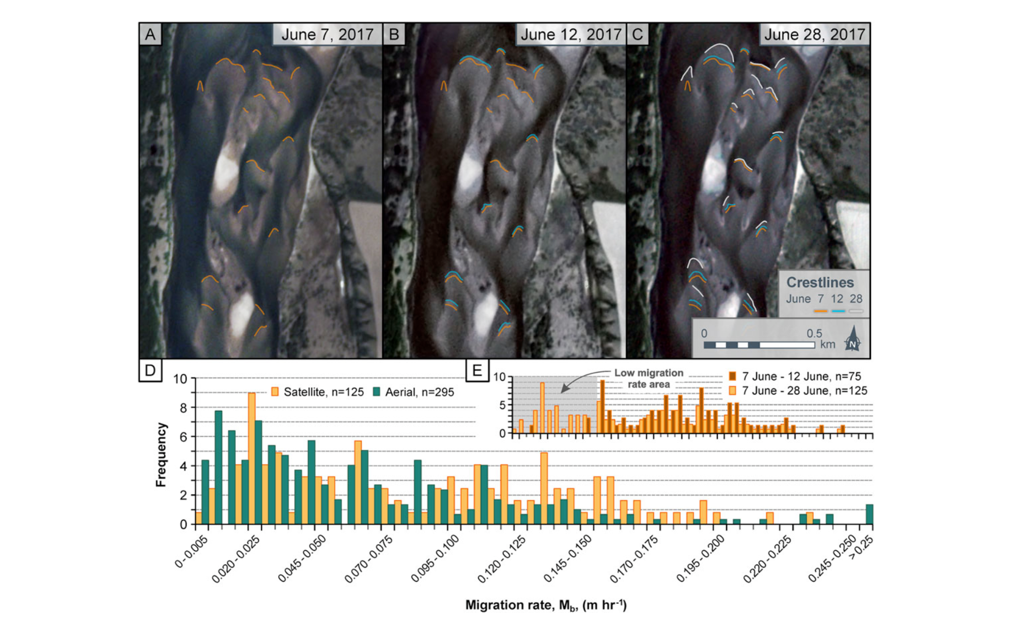
The movement of river sediment influences many aspects of land management, including water quality and the life cycle of dams and other impoundments. Hydrologists will benefit from improved methodologies to track river sediment flow and geomorphological evolution of the river channel. Robert Strick, from the University of Brighton, and colleagues used a combination of airborne imagery and Planet’s Dove images to track river evolution in the South Saskatchewan River. Strick and team first a combination of crewed aircraft and uncrewed drone imaging to generate a series of digital surface models of the river bed. They subsequently identified 125 river bars (bathymetric features) in Planet’s Dove imagery, and tracked their motion relative to the more accurate drone data. Strick and team concluded that “reasonable estimates of bedload sediment transport may be possible from just unit bar migration as measured from 2D imagery, including from satellite imagery, and assumptions regarding average bar shape and height.” This finding opens the possibility that Planet time series may allow more comprehensive estimates of river sediment transport in the future. Read the complete paper in the journal Earth Surface Processes and Landforms. [caption id="attachment_143447" align="aligncenter" width="1919"]
Ready to Get Started
Connect with a member of our Sales team. We'll help you find the right products and pricing for your needs