
Satellite Data and Computer Vision Used to Monitor Manure from Factory Farms
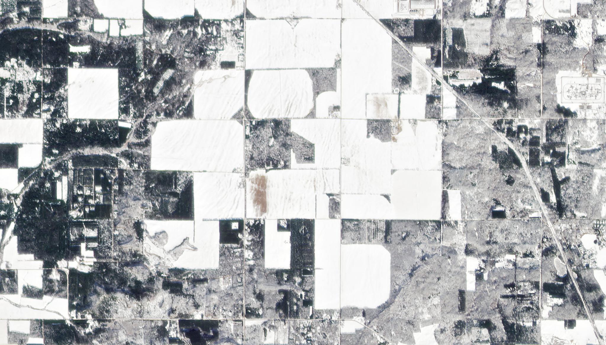
Image above: PlanetScope image of manure spread over snow in Easton, Wisconsin taken February 7, 2022. © 2022, Planet Labs PBC. All Rights Reserved. Concentrated Animal Feeding Operations (CAFOs), also known as industrial-scale factory farms, raise large amounts of livestock in small confined spaces. As a consequence, these environments also generate a significant amount of manure. For instance, a large cattle farm can produce more than 2 million tons of manure in one year. When not disposed of properly, this manure can wash into streams, rivers, and lakes, contaminating local water supplies. This is particularly a risk in the winter months of the United States, and dumping manure in this time of the year violates the Clean Water Act and other environmental laws in a number of states. Currently, farms self-report their dumping practices to share that they are compliant with laws, however, it is not always easy to verify these claims. Satellite data offers promising datasets to monitor these areas. This year, researchers from Stanford University, UC Berkeley, and the California Institute of Technology have integrated PlanetScope imagery surrounding CAFOs into computer vision models to better understand where and when dumping is happening. Their study demonstrated how Planet’s 3 meter resolution imagery combined with machine learning algorithms can help automatically detect unsustainable levels of manure applied to the land. Notably, using the state of Wisconsin as a test case, their research also showed that a number of CAFOs had more land applications than they self-reported. “Overall, our application demonstrates the potential for AI-based computer vision systems to solve major problems in environmental compliance with near-daily imagery,” said the authors. The full study can be found in arXiv published from the 2022 Conference on Information & Knowledge Management.
Ready to Get Started
Connect with a member of our Sales team. We'll help you find the right products and pricing for your needs.