
Understanding Landslide Risk with Planet Imagery
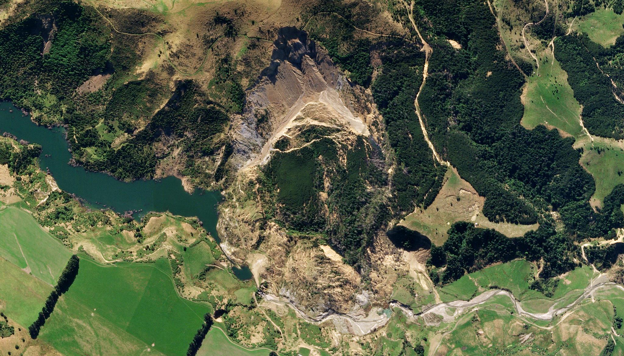
Image above: Planet image of a landslide in the Hurunui district of Canterbury in the South Island of New Zealand taken March 22, 2019. © 2019, Planet Labs PBC. All Rights Reserved. In mountainous regions around the world, landslides cause significant harm to lives and economies. Between 1990 and 2017, these disasters led to approximately $4.5 billion in economic losses globally. These events typically occur following significant tectonic or meteorological events, such as earthquakes or heavy rainstorms, but they can still come as a surprise. To help prepare and protect communities, scientists are looking to better understand these risk factors, catch early warning signs, and create landslide susceptibility maps. To advance this understanding, researchers from the University of Padova in Italy and University of Twente in The Netherlands leveraged archived PlanetScope imagery between 2009 and 2021 to generate a model that can help detect landslide risk through polygon inventories. By collecting past geographic data of landslides before and after they occurred, the team was able to use deep learning strategies to gain critical details about historic landslides, including spatial locations, timing, area, and volume of the landslide matter itself. Polygon-based inventories generated through satellite imagery showed greater situational, geographic, and geomorphic details than simple event record inventories, and this enabled the team to train supervised models for image classification. Overall, this work helped advance the understanding of landslide causes and risks. The full study can be found in Scientific Reports.
Ready to Get Started
Connect with a member of our Sales team. We'll help you find the right products and pricing for your needs