Planet Imagery Aids Flood Response in New South Wales, Australia
)
At the end of September, New South Wales, Australia experienced its worst flooding in over twenty years – with over one hundred buildings inundated and one thousand people evacuated.
The disaster took a particular toll on farming communities in the area, as the harvest was due to take place in November but crops were severely flooded. Thousands of cattle had to be evacuated to safer areas while water levels recede.

Farmland flooding in New South Wales, Australia. Images ©2016 Planet Labs, Inc. cc-by-sa 4.0.
More information and coverage of the event is available here and here.
In accordance with the International Charter for Space and Major Disasters and the DLR/ZKI (a division of the German Government), Planet provided data that allowed for the very rapid production of the flood map below.
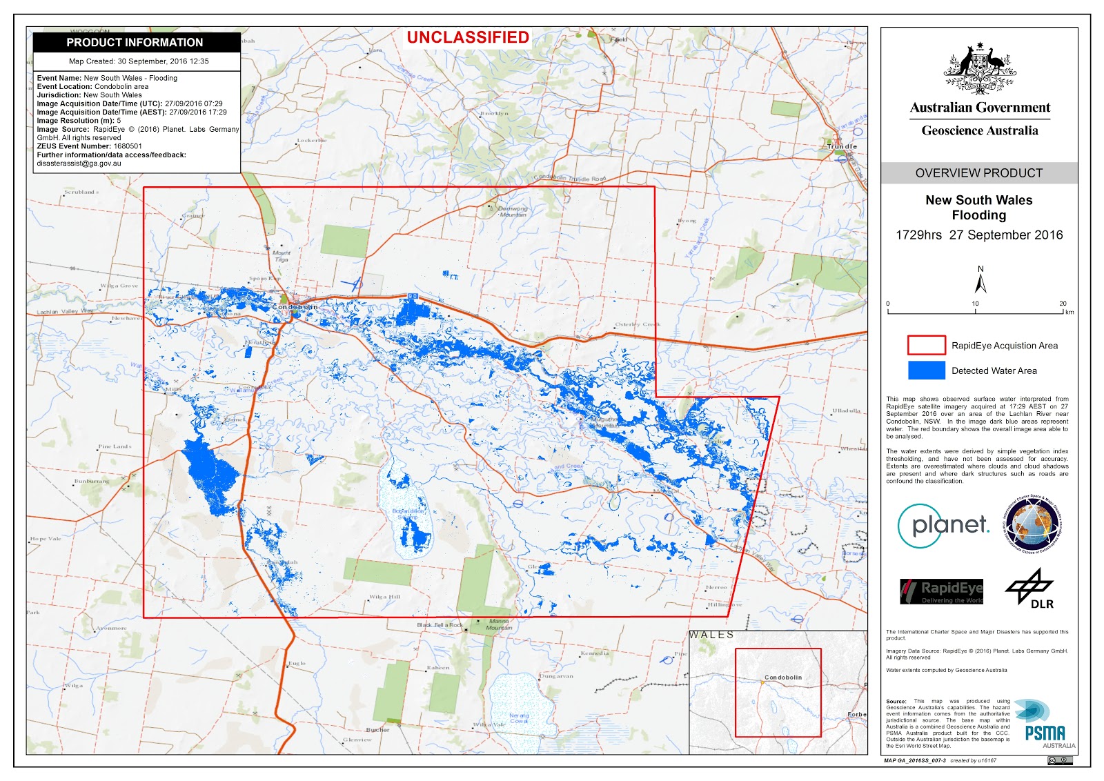
Observed surface water interpreted from RapidEye satellite imagery, which was delivered to authorities within 18 hours from the request for data.
Timeliness matters in a disaster, and Planet provided data from the RapidEye constellation of 5 Earth observation satellites within 18 hours after the acquisition request from the International Charter. The Charter Project Manager, Norman Mueller of Geoscience Australia, said that Planet’s response and the RapidEye data set have been very useful to the disaster response and management in Australia, noting that our data “has been a big help as few other datasets have been available so quickly.”
For more information on satellites imagery and disaster response visit planet.com/impact.