
Multi-sensor Fusion to Assess Building Damage After Sulawesi Earthquake and Tsunami
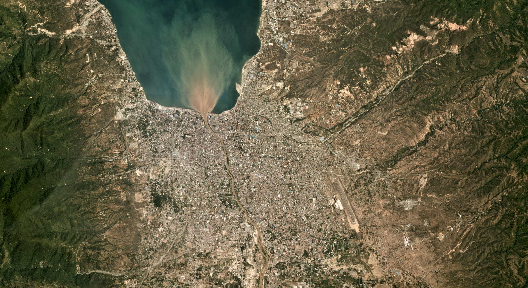
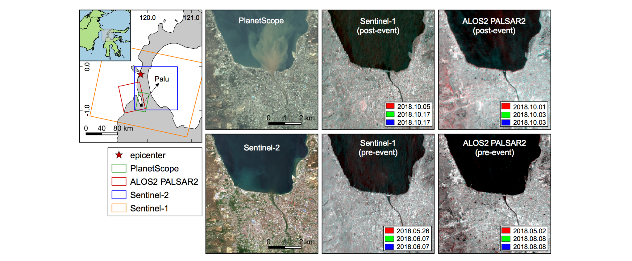
When disaster strikes, accurate information about the scale and scope of impact becomes critical. The first 24 hours are often the most important, and any accurate data may prove life saving. Leveraging data from Planet’s Disaster Program, Bruno Adriano and his team used a variety of data sources and machine learning to estimate building damage resulting from the catastrophic 2018 Sulawesi earthquake and tsunami in the area of Palu, Indonesia. Adriano and team ingested images from Planet’s Dove sensors, SAR data from Sentinel-1, ALOS-2 and PALSAR-2, as well as additional optical data from Sentinel-2. They evaluated a range of different damage classification methods, finding that a canonical correlation forest classifier performed best. Four levels of building damage were successfully classified with an overall accuracy of > 90%. While SAR datasets proved to be most important, time series optical data improved the analyses in this sensor fusion approach. The authors note that their analysis could be completed in ~ 3 hours, meaning that in future disasters it can be performed as soon as post-event imagery becomes available, potentially contributing to post-event assistance. Read the entire study, which is published open access, in the journal Remote Sensing. [caption id="attachment_143451" align="aligncenter" width="2039"]
Ready to Get Started
Connect with a member of our Sales team. We'll help you find the right products and pricing for your needs.