
Potential for PlanetScope Data to Aid Oil Response Monitoring
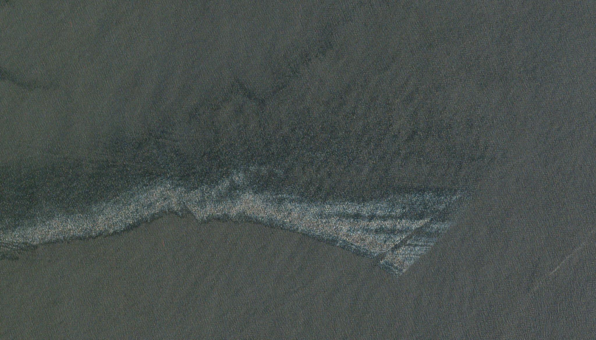
Image above: Site of the Taylor oil spill in the Gulf of Mexico taken April 25, 2018. © 2018, Planet Labs PBC. All Rights Reserved. Oil spills around the world have caused some of the worst environmental damage to marine environments, and these coastal ecosystems are hard to monitor due to their off-shore locations. Scientists have leveraged satellites to view these spills from space, however, the data is frequently limited by spatial or temporal resolution, making it hard to assess ecosystem damage overtime. Planet’s Dove satellites, on the other hand, offer the unique ability for researchers to see changes in these spill sites on a near daily basis and at 3 meter resolution. This PlanetScope data offers ways to complement other monitoring resources and fill in data gaps. Researchers from the Environmental Protection Agency accessed the Dove’s PlanetScope near daily data from the NASA Commercial Smallsat Data Acquisition program. With these datasets, they demonstrated the potential of the data to investigate oil spills by leveraging sun glint caused by the nadir viewing angle to maximize their view of the oil in the water. In their assessment, certain locations and times of year were identified as ideal for such research efforts, including the summer solstice and lower latitudes which offered high glint opportunities. “When combined with other high-resolution active and passive satellites, PlanetScope coverage added an average of 86.3 days each year from January 2018 through December 2020,” stated the authors, sharing how Planet’s images could further support oil spill monitoring surrounding the United States. The full study can be found in Marine Pollution Bulletin.
Ready to Get Started
Connect with a member of our Sales team. We'll help you find the right products and pricing for your needs