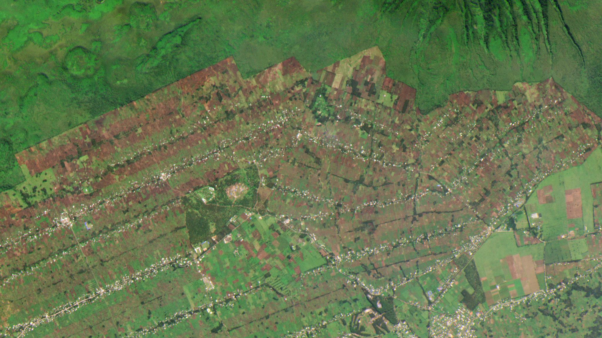
Dense agriculture lies along the border of Rwanda’s Volcanoes National Park © 2019, Planet Labs Inc. All Rights Reserved.
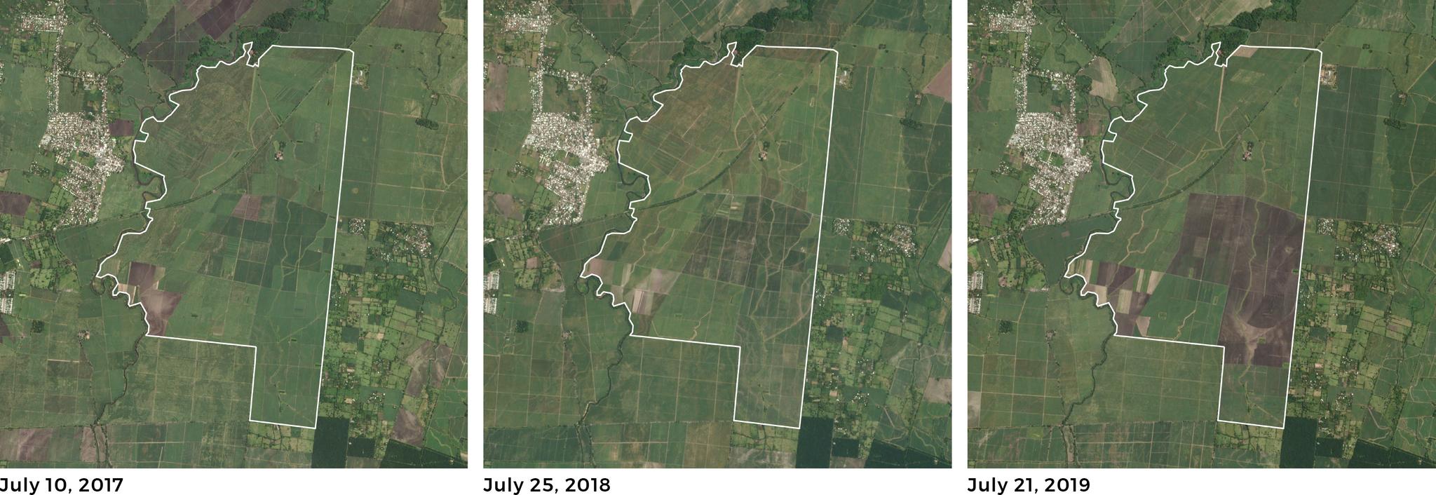
AUTHOR PROFILE Zara Khan
Curious Planeteer working to make the Earth's changes visible, accessible and actionable.

Agtech Startups Continue to Scale Globally with Planet Imagery

Tech

The key to a startup’s success is growth. To achieve that, you need a foundation that is scalable. Planet’s constellation of Earth-observation satellites is imaging the entire Earth every day, unlocking unlimited potential and providing the needed foundation for agricultural technology (agtech) startups.

The agtech sector is showing continued momentum in 2019, paving the way for another “record-breaking year.” Planet is witnessing this growth firsthand as it continues to expand its agricultural customer base while supporting customers’ expansion to new markets through dependable, consistent, “always-on” daily imagery.

“To reach our growth targets, we need a global dataset. We know we can rely on Planet’s high frequency imagery to rapidly prototype, pilot, and launch products in new markets like Central America and Southeast Asia,” says Ben Worley, CEO of Agrisource Data. “These equatorial regions are also extremely cloudy, so there isn’t really an alternative to high frequency satellite imagery. Planet is the most economical option for getting enough cloud-free images during the growing season.”

Planet’s long-term archive of frequent data allows comparison across growing seasons. These images show a cluster of fields in La Gomera, Guatemala in July 2017, 2018, and 2019. © 2019, Planet Labs Inc. All Rights Reserved.

Customers are also adopting Planet data because they want an economical option for accessing higher resolution imagery than what is publicly available.

“We are working with smallholder coffee farmers in Rwanda, so we have to manage our costs and ensure we develop an affordable product,” says David Mills, CEO of WeatherSafe. “But in order to deliver actionable insights, we need a high enough resolution to detect in-field variability for plots that average less than one hectare in size.”

For startups that often have to adjust their strategies and pivot, Planet offers flexible solutions to meet their changing needs.

“We are in such an early growth phase that I can’t accurately predict which exact direction our business will grow within the next year,” says Fernando Luege, CEO of ActiveTerra. “But the ‘always-on’ PlanetScope imagery ensures that there will be coverage where I need it.”

Planet imagery includes the near-infrared spectral band, which allows for crop classification based on detecting different spectral crop signatures throughout specific periods of the growing season. Such information is being used to gain an edge. However, these models are still being tested and improved.

Planet’s dataset includes a near-infrared band, which allows the measurement of subtle changes in vegetation that are invisible in visible wavelengths. These images show central pivot irrigation in Turkey’s Southern Anatolia Project in red, green, blue (left) and near infrared, red, green light (right). © 2019, Planet Labs Inc. All Rights Reserved.

“Only a very small fraction of the value of longitudinal, high resolution and multi-spectral planetary imaging data has been realized,” says Ben Brown, deputy director of Environmental Genomics and Systems Biology at Berkeley Lawrence National Lab. “Eventually, as both spatial and spectral resolution improve, these datasets will enable us to learn causal models for crop yields. These will take into account weather and climate, soil conditions and chemistry, and farm management practices—both remotely and over tens or hundreds of millions of cultivated and grazed acres.”

Planet’s value for agriculture is further validated by the number of renewal customers including AgSpace (now part of Origin Enterprises), FarmShots (now part of Syngenta), Doktar, KisanHub, SatAgro, and many others.