
COP30 - Rivers Shrink, Cities Expand: Satellites Reveal a Transforming Brazil
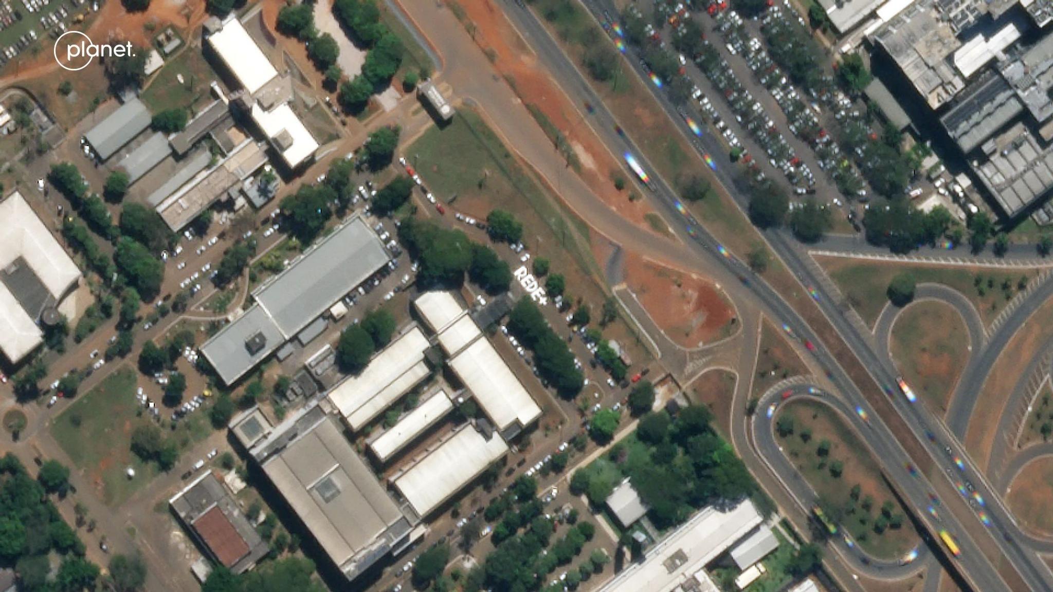
PlanetScope image of Brasilia Federal District, Brazil, captured June 14, 2023. © 2023 Planet Labs PBC. All Rights Reserved.
StoriesNote: This article is also available in Portuguese.
In recent years, Brazil has undergone profound transformations across its territory, marked by shrinking rivers, rapid urban expansion, and shifts in vegetation. These changes directly affect water security, infrastructure, agriculture, and urban life — challenging governments, companies, and communities to grasp the speed and scale of these transformations.
As Brazil prepares for COP-30, to be held in Belém November 10, satellite data has become an increasingly strategic resource, offering transparency and traceability for public policies, corporate commitments, and restoration projects. From space, it’s possible to verify whether rivers and reservoirs are recovering, if vegetation is being preserved, and how urban expansion interacts with ecosystems and water resources.
Today, the biggest challenge isn’t just collecting images — it’s turning data into decisions. The integration of satellites, artificial intelligence, and socio-environmental information is creating a new frontier for monitoring, enabling preventive and strategic action in the face of rapid change.
Satellites now allow us to observe these transformations with near-daily precision and on a national scale. Constellations such as PlanetScope® capture images and transform Earth observation into a practical tool to measure, analyze, and act on environmental changes. This capability not only expands spatial coverage but also provides continuous time series — essential for identifying seasonal patterns, anomalies, and long-term trends.
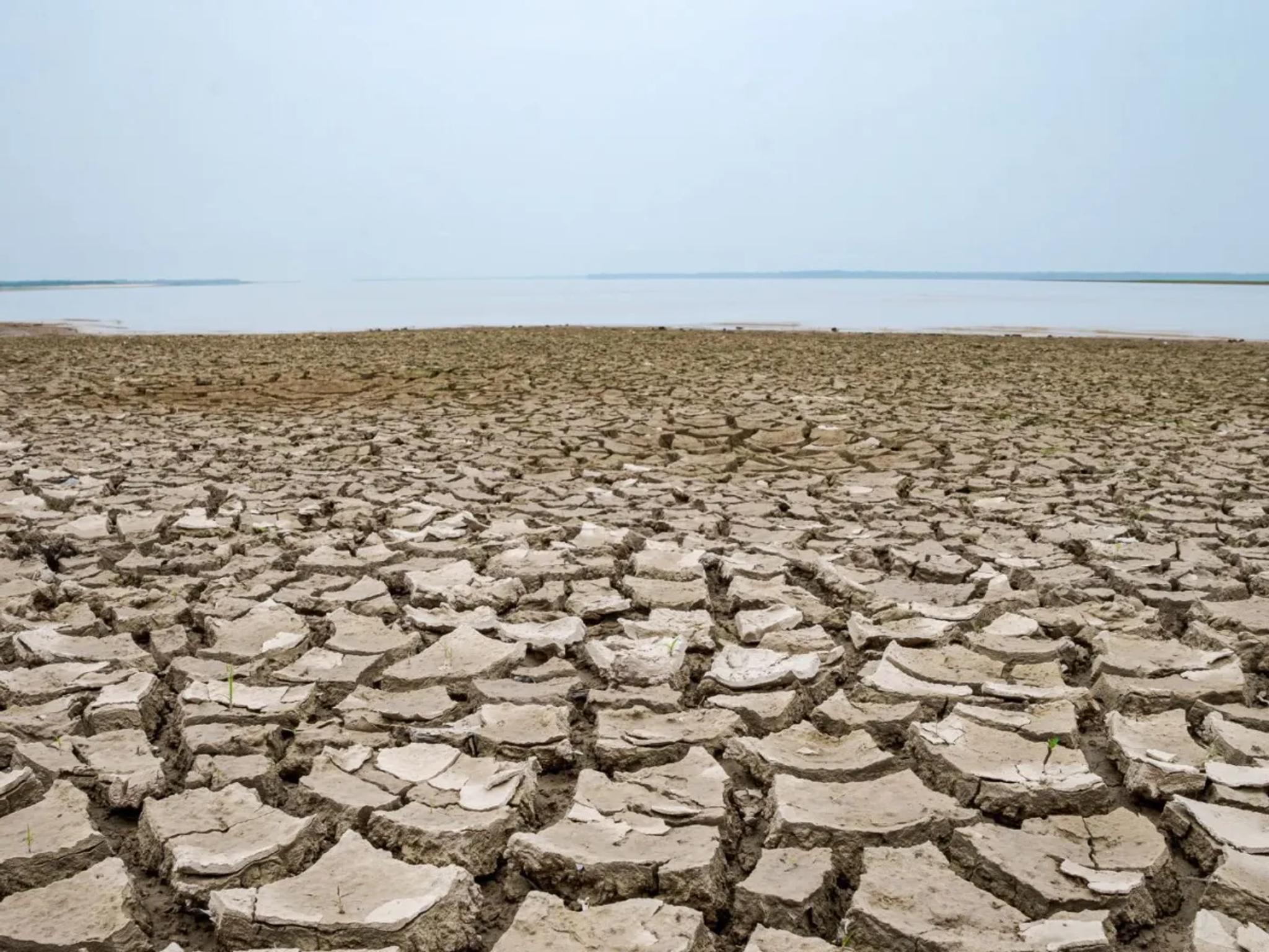
Shrinking Rivers and Water Scarcity: How Can Satellites Help?
Source: CNN Brasil
Satellite monitoring makes it possible to track rivers, lakes, and reservoirs, detecting variations in water levels, sedimentation, and changes in hydrological regimes. Indices like NDWI (Normalized Difference Water Index) help map alterations in water coverage, revealing sections that dry up or retreat even before scarcity becomes visible on the ground.
This information is critical for urban and agricultural planning. It enables authorities to issue public alerts about water levels, helps hydroelectric operators manage reservoirs more efficiently, and allows farmers to adapt crop management practices — just to name a few examples. Moreover, by combining high-frequency imagery with evapotranspiration models — a parameter that represents all the water lost to the atmosphere that neither remains in the soil nor is absorbed by plants — and historical land use data, it’s possible to estimate water availability more accurately and identify regions most vulnerable to prolonged droughts.
Satellite data also enables integrated analysis of entire watersheds, taking into account both water supply and urban or agricultural demand. This allows decision-makers to make more informed choices about consumption, distribution, and conservation — anticipating impacts that could affect millions of people.
Urban Expansion: Cities Through the Eyes of Space
The growth of Brazilian cities can now be observed almost in real time from space. Near-daily imagery reveals new built-up areas and land use changes, providing access to strategic data for urban planning. Continual monitoring helps detect trends, compare with historical patterns, and support sustainable development policies.
Satellite data also allows analysis of connectivity between urban areas and natural ecosystems, revealing pressures on green zones, urban rivers, and critical habitats. This helps inform decisions that integrate urban growth with conservation strategies — reducing conflicts between development and environmental preservation.
Vegetation and Natural Areas: From Impacts to Opportunities
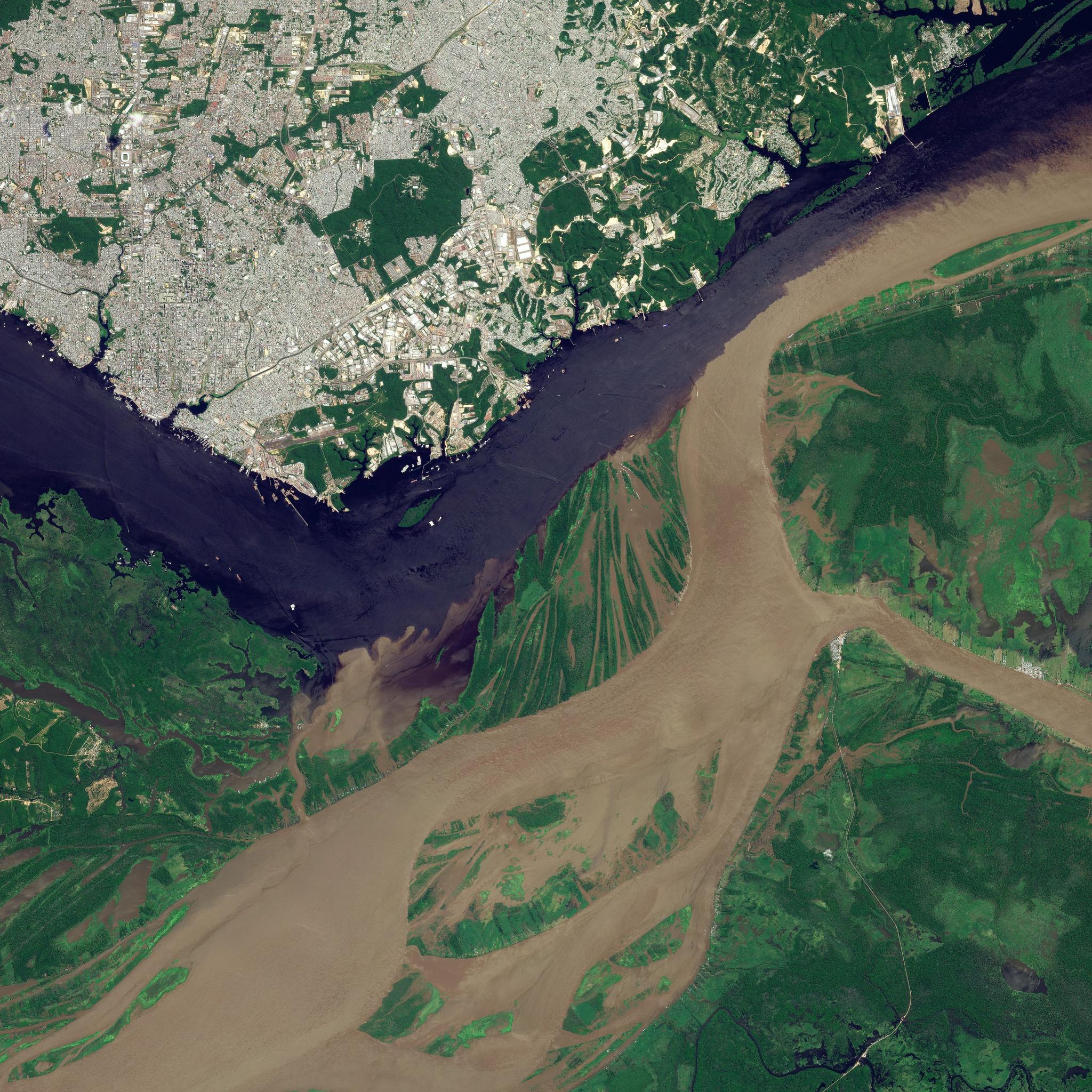
Source: PlanetScope image of Manaus, Brazil, captured on June 14, 2023. ©Planet Labs PBC. All rights reserved.
Combining optical data with vegetation indices such as NDVI enables mapping of degraded areas, regenerating forests, and pressures on sensitive ecosystems. This analysis plays a crucial role in preservation efforts, environmental restoration, and monitoring of carbon emissions linked to land use — helping turn climate commitments into tangible action.
Temporal analysis also makes it possible to monitor ecosystem regeneration and measure the impacts of human interventions, such as reforestation, riparian forest restoration, and sustainable agricultural management. With these insights, governments, businesses, and NGOs can design evidence-based actions — prioritizing areas and strategies with the greatest potential for positive impact.
Transparency and Data for Strategic Decision-Making
By integrating different layers of information — such as water coverage, vegetation, and land use — it becomes possible to identify complex correlations, including the relationships between urban expansion, water consumption, and ecosystem pressure. This integrated view provides a more complete understanding of Brazil’s territory, allowing stakeholders not only to react to changes but to anticipate and mitigate them through effective planning.
The future of Brazil — where rivers shrink and cities expand — can be seen from space, making the invisible visible and enabling more informed, assertive action.
Interested in learning more? Explore these resources about COP30 that illustrate how Planet data and solutions are driving progress toward a more sustainable future.
Ready to Get Started
Connect with a member of our Sales team. We'll help you find the right products and pricing for your needs.