
From Data to Action: Colombia's High-Tech Approach to Conservation
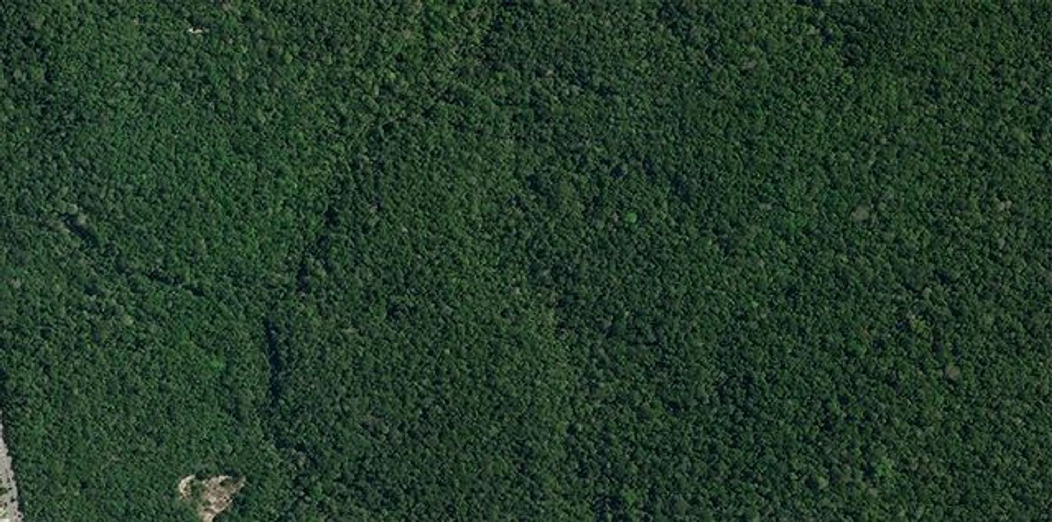
SkySat image of the Adolfo Ducke Forest Reserve next to Manaus, Brazil captured June 26, 2022. © 2023 Planet Labs PBC. All Rights Reserved.
StoriesThis article is also available in the following languages: Spanish, Portuguese
For COP30 this year, all eyes were on Belém, Brazil, an Amazonian city surrounded by lush tropical forests that secure freshwater, store carbon, and house an incredible array of animals and plants. The need for scalable, evidence-based solutions to protect tropical forests has never been more urgent.
While satellite data has expanded our ability to track change on Earth, AI and biodiversity data are unlocking new insights and transforming our ability to safeguard one of the planet's most vital ecosystems.
How AI Supports Scientists and Removes Barriers
Artificial intelligence is not replacing human effort in science, it’s amplifying it. At last year’s Planet On The Road event in Bogotá, Guillermo Ocampo, Microsoft’s National Digital Transformation Officer, explained AI serves as a “copilot,” operating alongside researchers to enhance the speed and scale of their work.

Planet On The Road LATAM Event© June 2024, Planet Labs PBC. All Rights Reserved.
AI tools remove barriers to analyzing data. Because generative AI understands everyday language, in multiple dialects, processing a dataset can be as simple as asking a question. These tools allow governments and organizations to process vast datasets, such as Planet's near-daily satellite imagery and tropical forest mosaics, with minimal effort, speeding up insights that can inform policy for conservation efforts and disaster response.
In addition, with AI handling large-scale data analysis, scientists have more time to focus on what they do best: forming hypotheses and interpreting results. This combination of computer efficiency and human rights helps maximize the value of rapidly changing climate and biodiversity data.
Project Guacamaya: AI-Powered Conservation in the Colombian Amazon
At our On the Road event, Ocampo shared a powerful example of AI and satellite data in action: Project Guacamaya. This initiative combines Microsoft’s powerful AI capabilities with Planet satellite data and local partners to protect Colombia’s forest biodiversity.
Loading Video...
Project Guacamaya is fighting deforestation by monitoring the Amazon rainforest with Microsoft AI.
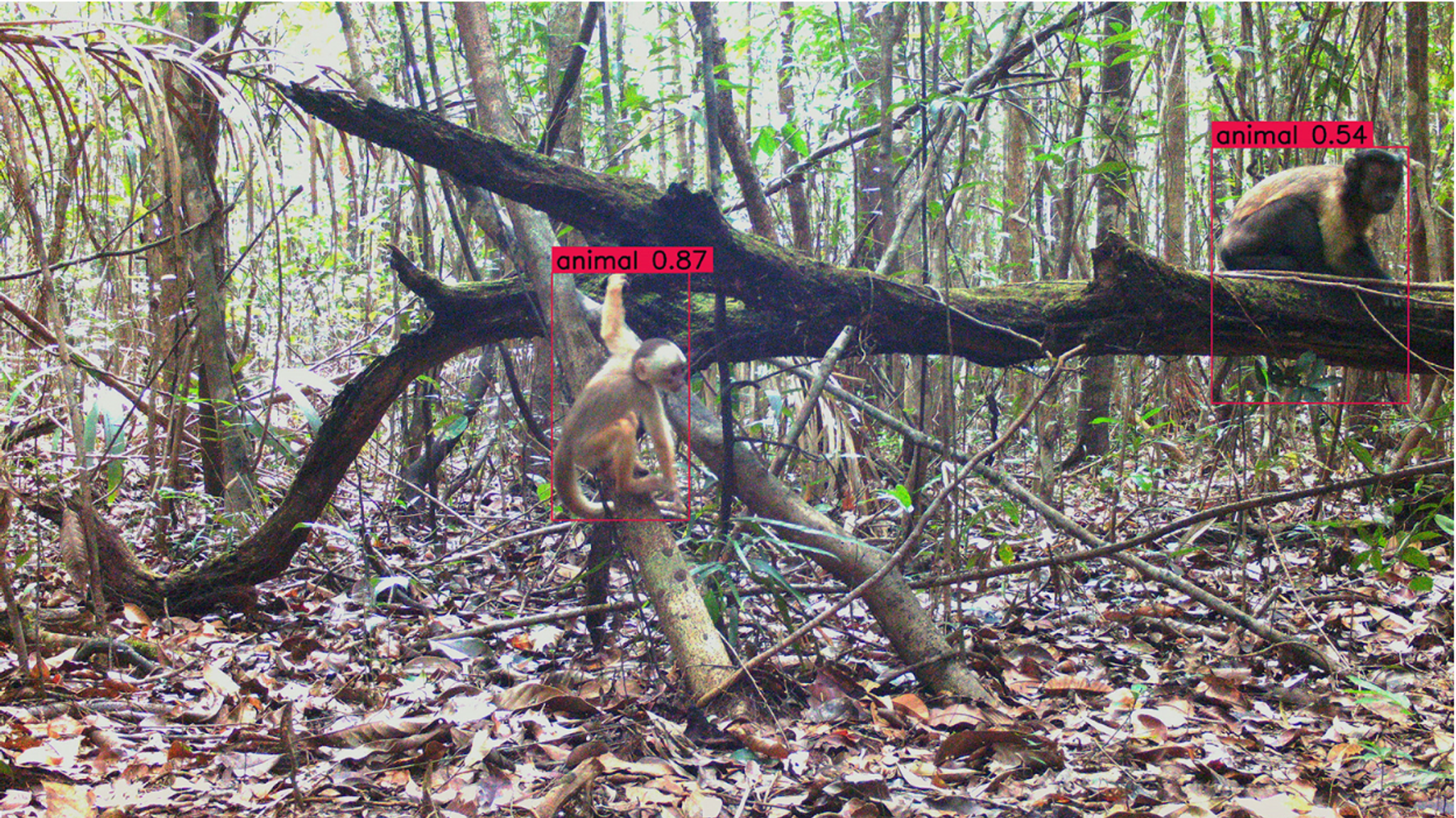
The project team monitors deforestation by analyzing vast amounts of satellite data as it comes in, enabling faster responses to threats like illegal mining and logging. Alongside Planet satellite images, researchers also track animal populations with camera traps and bioacoustic sensors embedded in the forest — and then Microsoft’s open-source AI biodiversity models identify species from sight and sound.
Project Guacamaya's success is scaling. What began in Colombia has since expanded to other Amazon basin countries. In Peru, the project aims to incorporate drivers of deforestation such as agricultural expansion, illegal logging, and mining to better understand risks to tropical forests and their biodiversity. Results can strengthen Amazon forest monitoring and enhance environmental management, thanks to satellite imagery and AI.
Proof of Concept for the Power of Partnerships
Project Guacamaya thrives on strong alliances. Ocampo emphasized that the project is about more than just technology. It unites local governments, research institutes — like Sinchi Amazon Institute for Scientific Research and the Humboldt Institute — universities such as Los Andes, and local and Indigenous communities. These partners contribute critical on-the-ground data, help refine AI models for precision and accuracy, and incorporate results into action.
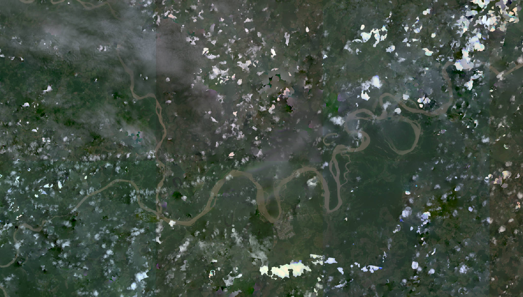
This collage of Planet Labs satellite images from Project Guacamaya shows a composite of the Rio Guayabero in Colombia, the daily imagery helps researchers monitor critical areas for early signs of deforestation.
As Ocampo explained, many researchers and communities were initially cautious and reluctant to share their data. But by showing how the technology could support their work — not replace it — the project earned their trust. “We explained how it’s a win-win,” Ocampo said. “They can focus on what they love while making a real impact.” This collaborative approach places AI tools in the hands of those who know the land best, creating technology that's faster, smarter, and more effective by respecting local knowledge.
Looking Ahead: AI’s Expanding Role in Conservation
As AI evolves, so will its role in tackling the world’s most pressing environmental challenges and opportunities to restore vibrant nature and biosphere health. AI’s ability to process massive amounts of data and deliver real-time insights unlocks possibilities previously unimaginable for biodiversity conservation.
Project Guacamaya uses daily satellite images, Amazon-specific AI models in battle against deforestation. Microsoft. September 25, 2024.
Project Guacamaya is a testament to how high-frequency, high-resolution data, when paired with accessible AI and human insight, can empower governments, organizations, and local communities to make a tangible difference. This is the future of environmental stewardship that Planet is committed to building — one where technology enables us to understand and respond to changes faster and more effectively. At COP30, Planet was on hand to share Project Guacamaya, alongside many other products and partnerships that advance tropical forest conservation, from Project Centinela to the Tropical Forest Observatory and Amazon.ia.
Interested in learning more? Explore these resources about COP30 that illustrate how Planet data and solutions are driving progress toward a more sustainable future.
Ready to Get Started
Connect with a member of our Sales team. We'll help you find the right products and pricing for your needs.