Landsat 8 Data is Available on Amazon Web Services! How This Helps Us…
)
Landsat is history’s longest-running Earth imaging project. Its enormous data set cements it as an industry standard. We’ve used Landsat data in comparison with our imagery to demonstrate the pace of change on the Earth’s surface. It also informs our image rectification process, helping us create accurate and timely mosaics.
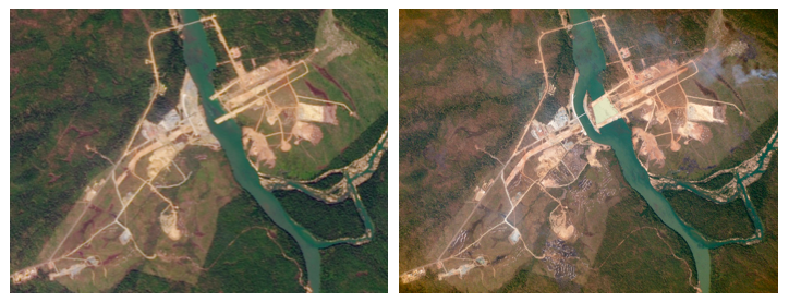
Left: a Landsat image of the lower Se San dam taken on December 22, 2014. Right: A Planet Labs image of the dam taken less than a month later on January 14, 2015
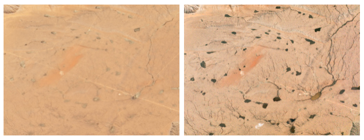
Standing water is visible on the mesa in a Planet Labs image collected on September 9, 2014, (right) compared to a USGS/NASA Landsat image from August 22, 2014 (left)
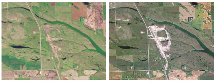
These satellite images in Saskatchewan, Canada show progress on the construction of the Northgate Hub between September 10, 2013 (Landsat 8, NASA/USGS), and August 28, 2014 (Planet Labs).
We’re thrilled that all new Landsat 8 data is now available on Amazon Web Services. AWS’ streamlined access lets us process more images quicker and helps us deliver fresh insights about our changing planet to customers like Geoplex, Woolpert and Wilbur-Ellis. It’s now much easier for our team to search the Landsat archive and acquire images that help us build seamless, geospatially accurate mosaics.
It has been exciting to contribute to this effort by providing the processing resources and scripts to populate this new public data resource.
We’re ready to see new, meaningful applications of Landsat’s unique data set. Collaborators are welcome to contribute to the data ingest code at https://github.com/landsat-pds/landsat_ingestor. To learn more about the process, join the Landsat-pds mailing list at https://lists.osgeo.org/cgi-bin/mailman/listinfo/landsat-pds.