
PlanetScope and Advance Machine Learning Techniques Enable Seagrass Mapping in New Zealand
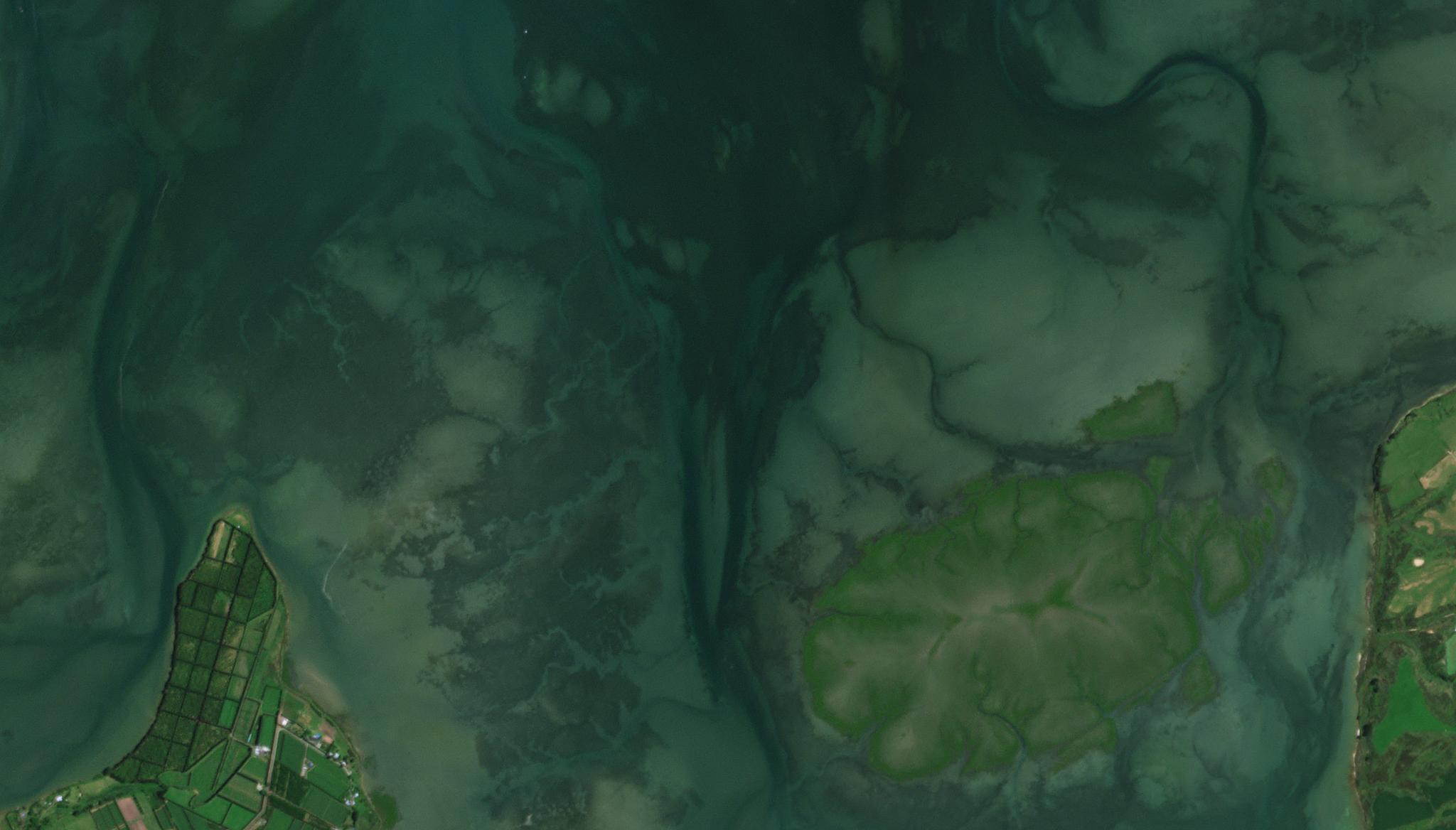
Image above: PlanetScope image of seagrass habitats in Tauranga Harbour, New Zealand taken December 26, 2022. © 2022, Planet Labs PBC. All Rights Reserved. We often associate meadows with rolling country hills and charming picnics, but meadows also exist in the shallow waters along our global coastlines. And while these seagrass meadows may not serve as idyllic picnicking locations for mermaids, they do provide valuable ecosystem services, including habitat for a myriad of marine species, and they act as a vital carbon sink, sequestering CO2 from the atmosphere. But overtime, these important ecosystems have been degraded around the globe, and to support large-scale conservation efforts, managers, governments, and scientists need detailed seagrass meadow maps. To enable accurate monitoring, report, and verification (MRV) programs, high accuracy extent maps are necessary to analyze the health of both dense and sparse seagrass environments. Previously, collecting accurate remote sensing data on sparse communities has been difficult, but a research group from Hue University in Vietnam, Van Lang University in Vietnam, Macquarie University in Australia, and the University of Waikato in New Zealand have leveraged our PlanetScope data and advanced machine learning techniques to generate an approach to mapping small regions of these habitats. Their novel approach, tested on Tauranga Harbour in New Zealand, demonstrated high accuracy and an improved ability to classify sparse seagrass meadows. They suggest that this technique for quantifying the spatial distribution and area of seagrass could be leveraged on ecosystems worldwide. The full study can be found in Environmental Earth Sciences.
Ready to Get Started
Connect with a member of our Sales team. We'll help you find the right products and pricing for your needs.