

What Are Satellite Mosaics and How Do They Keep Maps Up to Date?

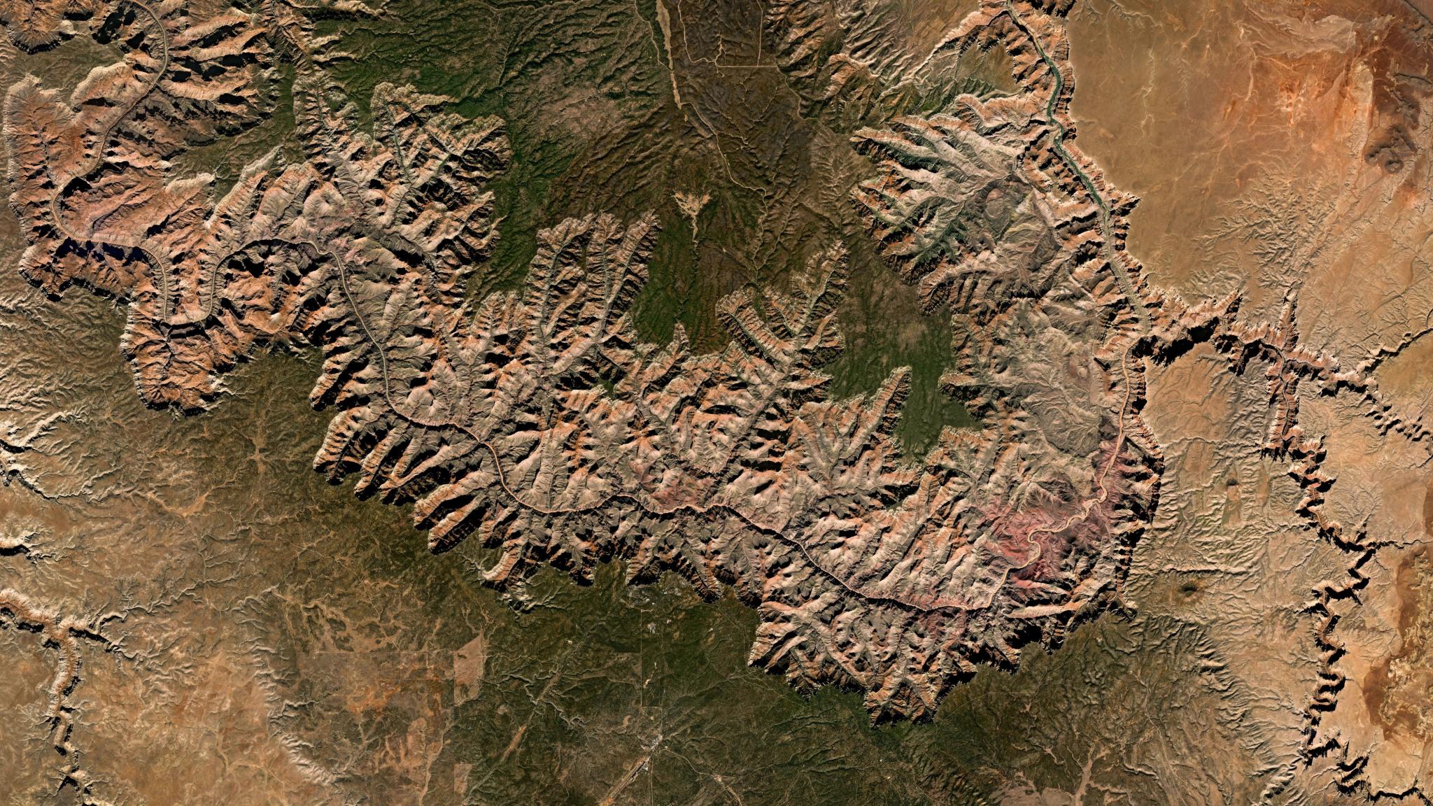
October 2025 Planet Mosaic of the Grand Canyon. © 2025 Planet Labs PBC. All Rights Reserved.
EducationIf satellite mosaics had a tagline, it could easily be “better, together.” Afterall, in every mosaic there are numerous images, that have been stitched together to cover a large geographic area seamlessly.
By drawing on a number of images, mosaics eliminate the visual gaps and atmospheric interference often found in single images, providing a clear, cloud-free view of the Earth at a regional or global scale.
Planet Mosaics leverage near-daily PlanetScope® imagery to provide a uniform visual and spectral foundation for both human viewing and quantitative analysis workflows (like automated AI and machine learning). This continuous coverage can be used to maintain accurate maps and track large-scale environmental changes over time.
What Is a Satellite Imagery Mosaic?
A satellite imagery mosaic is a composite, large-scale image created by stitching together numerous smaller, overlapping satellite images of the Earth. Unlike a single image that may only capture a small town or forest, a mosaic can represent an entire country or continent without any visible seams.
In addition, mosaics are often processed to ensure that color and brightness are consistent across the entire image, regardless of when each individual part was photographed. This creates a standardized map layer that serves as a foundational tool for geographic information systems. It allows users to view broad landscapes as a single, cohesive picture of the ground.
And not only are Planet Mosaics useful to understand change across broad areas, they are beautiful! Here are a few of our favorites:
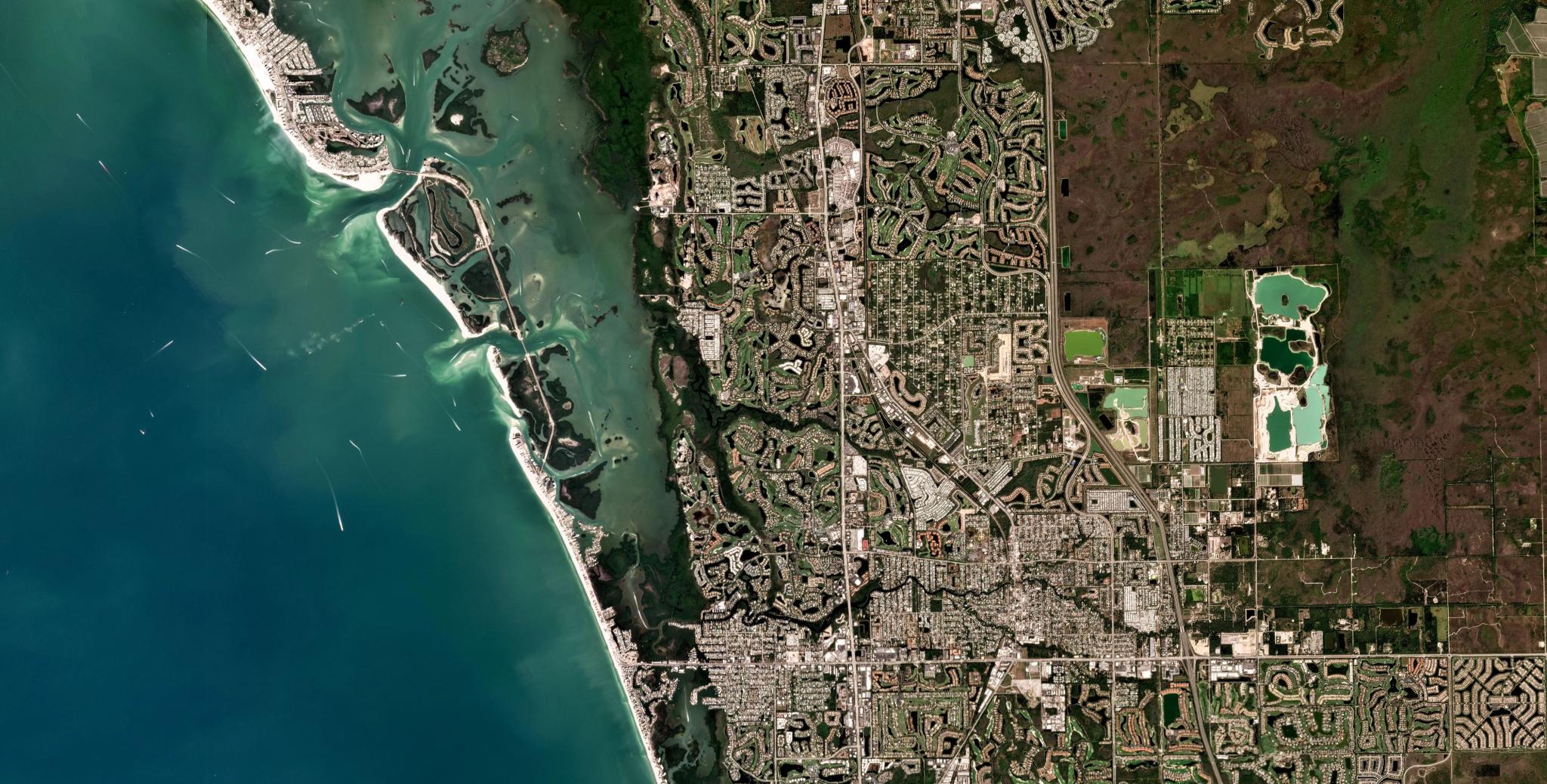
February 2025 Planet Mosaic of Bonita Springs, Florida.
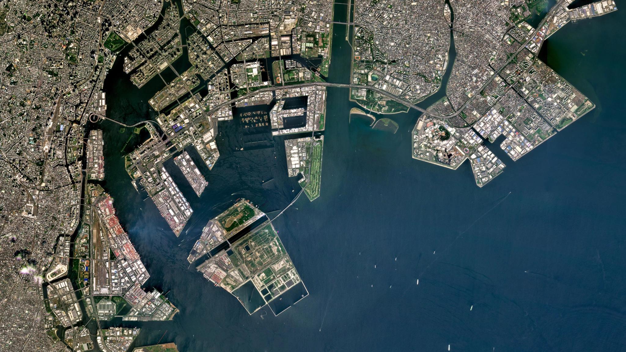
2025 Quarterly Planet Mosaic of Tokyo, Japan.
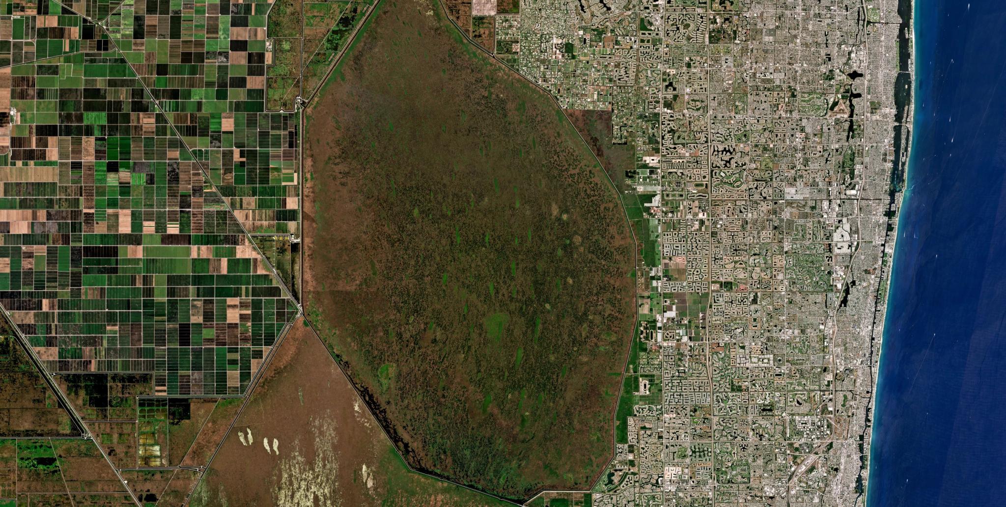
March 2025 Planet Mosaic of Boca Raton, Florida.
Planet Mosaics are Current and Complete
Mosaics keep maps current by integrating the most recent cloud-free captures available into the image. With near-daily data from Planet, a mosaic can be updated on a weekly or monthly basis to reflect new construction, agricultural growth, or environmental changes.
This regular refresh cycle helps the mosaics remain reflections of current ground conditions. Users can make faster, higher-confidence decisions in monitoring, change detection, and analytics at scale across entire regions. .
Planet Mosiacs can be downloaded or streamed through multiple methods, including Planet Insights Platform, QGIS/ArcGIS Pro plugins, APIs, or tile services.
Different Types of Planet Mosaics
Planet Mosaics delivers the best PlanetScope imagery to support visual and automated analysis. There are four types of Planet Mosaics:
- Planet Visual Mosaics provides color-corrected imagery with minimal cloud cover, haze, and topographical variations; and are ideal for human view and computer vision analytics.
- Planet SuperRes Mosaics uses custom tailored generative AI algorithms to enhance near-daily PlanetScope imagery into sharp 2 m imagery designed specifically for human perception.
- Planet Normalized Surface Reflectance Mosaics provides four or eight spectral bands for spectral, quantitative, and time-series analysis.
- The Planet Global Mosaic enhances maps and applications with our most comprehensive and seamless mosaic of the Earth’s landmass.
- Build Custom Mosaics to your own standards by defining band combinations, image processing, map projection, and more.
Learn More
To explore different types of global and regional composites, visit the Planet Mosaics page on the Planet website. You can also find documentation on how to integrate these seamless data layers into your own GIS software or web applications.
Questions You Might Have
Mosaics are built by geometrically correcting individual scenes and using algorithms to select the best pixels for a seamless, uniform appearance.The creation of a mosaic involves a technical process that includes orthorectification and color balancing to ensure all individual scenes align perfectly.
Software tools first correct the geometric distortions caused by the satellite’s angle and the Earth’s terrain to make sure every pixel is in its exact geographic location. Next, algorithms identify overlapping areas and choose the clearest, most cloud-free pixels from available scenes to fill the frame. Finally, the system adjusts the exposure and color levels of each image to remove visible borders between the different photos. This complex data processing results in a smooth transition from one image to the next across the entire dataset.
Key takeaway: Mosaics are built from several individual scenes, using algorithms to select the best pixels for a seamless, uniform appearance.
Mosaics are often used for broad area analysis and monitoring when a single pass of a satellite may make it difficult to analyze large infrastructure projects or entire ecosystems that span hundreds of miles.
By using a mosaic, analysts can also access a "best of" composite that provides a clean and unobstructed view of the land that minimizes clouds, shadows, and atmospheric haze that can obscure important features on the ground. This format also simplifies data management by providing one large file or stream rather than thousands of smaller, disconnected images. It provides a more practical and visually clear starting point for large scale mapping and monitoring.
Key Takeaway: Mosaics provide a cleaner and more manageable view than single images by filtering out clouds and combining multiple small scenes into one large area.
In GIS and mapping applications, mosaics serve as the primary base map layer upon which other data points, such as property lines or utility networks, are placed. Professionals use these seamless backgrounds to provide geographic context for their vector data and to identify features that may not be present on traditional street maps. Because the imagery is already aligned to a global coordinate system, users can easily measure distances and areas directly on the mosaic.
These composites are also used for visual verification during the digitization of new roads or building footprints. This provides a high-fidelity visual foundation for any professional mapping project.
Key Takeaway: Mosaics act as the accurate, high-fidelity base layer in GIS that provides the necessary geographic context for all other data layers.
Regularly updated mosaics save time and provide a consistent stream of fresh data for tracking development and managing natural resources. Organizations can detect and respond to physical changes as they happen over large areas.
Organizations can track the steady progress of urban development or the seasonal health of forests without having to manually order and process individual images. This automated stream of fresh data saves significant time and reduces the technical burden on internal GIS teams. Additionally, updated mosaics provide a reliable historical record that allows users to look back at previous versions to understand how an area has evolved. This consistency supports better long-term planning and more effective environmental management.
Key Takeaway: Regularly updated mosaics save time and provide a consistent stream of fresh data for tracking development and managing natural resources.

Ready to Get Started
Connect with a member of our Sales team. We'll help you find the right products and pricing for your needs.