
Agile EO Webinar: Updates to Planetary Variables for Agriculture
The future of agriculture is here, and it's powered by cloud-free, near-real time, analysis-ready satellite data. In our recent webinar, Updates to Planetary Variables for Agriculture, the Planet team shared exciting advancements and upcoming releases to Crop Biomass, Soil Water Content, Land Surface Temperature, and Field Boundaries that transform how agricultural professionals monitor crops, manage soil, and understand field conditions.
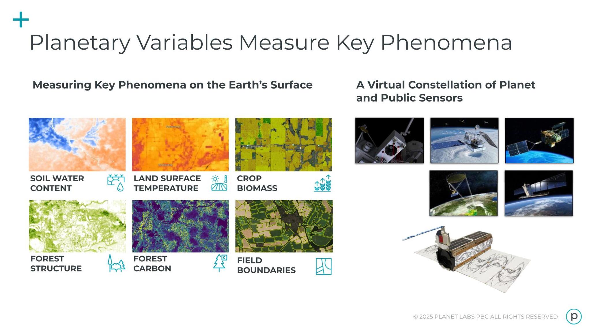
What Are Planetary Variables?
Planetary Variables draw on observations from Planet and public satellites to measure the changing conditions on Earth’s surface. We discussed four Planetary Variable datasets in this webinar:
- Crop Biomass: Provides daily crop monitoring capabilities.
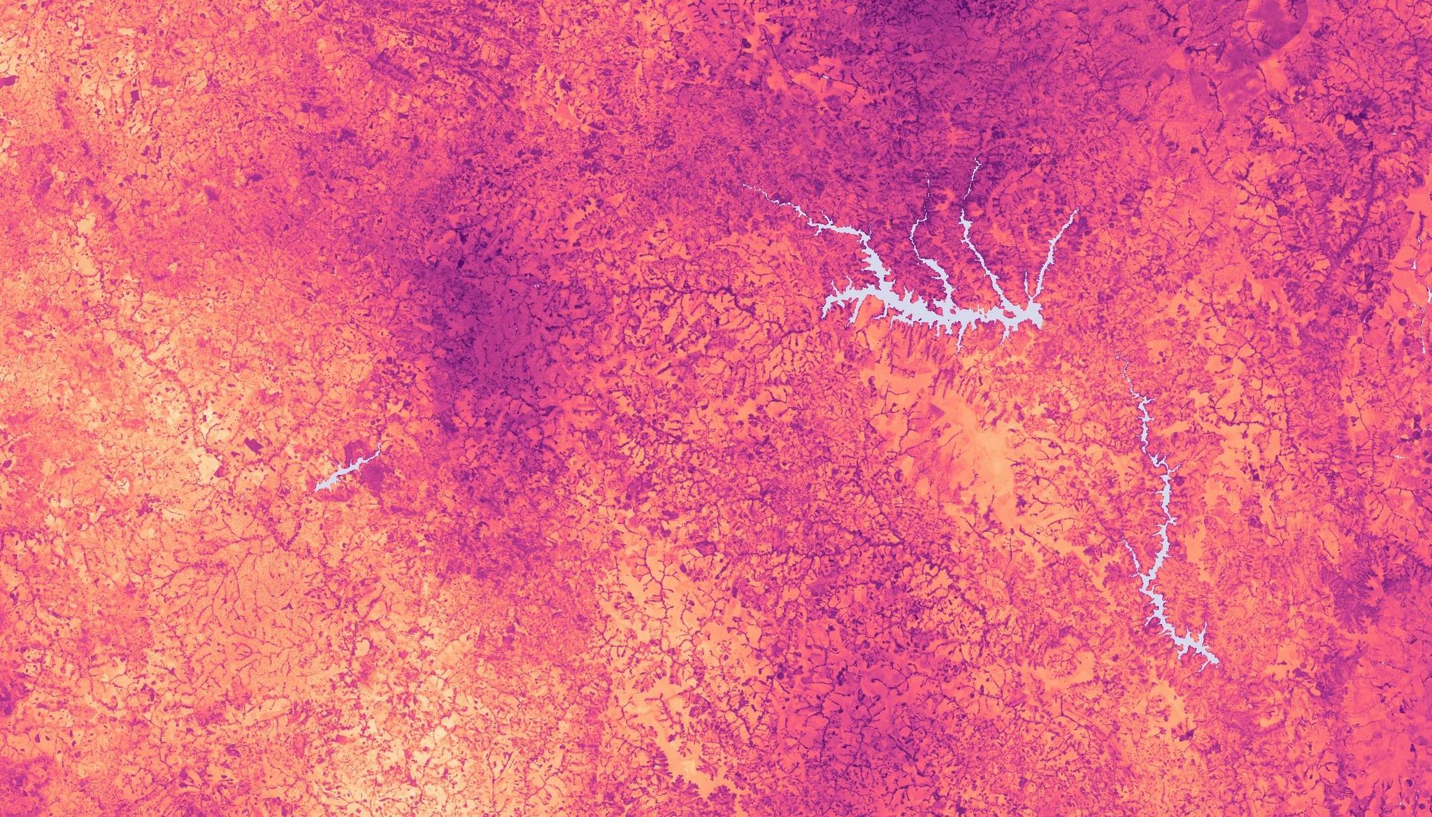
- Soil Water Content: Helps monitor and measure water levels to estimate water demand.
- Land Surface Temperature: A twice-daily measurement of the Earth’s skin temperature at a global level.
- Field Boundaries: Provides regional crop monitoring and yield estimation through parcel and field identification.
These are analysis-ready data products, which means that remote sensing expertise isn’t required. They're designed for immediate use, offering:
- Cloud-free coverage: By combining passive and active microwave data, Planetary Variables deliver data even during cloudy days – a critical advantage in regions with persistent cloud cover.
- Global coverage: Available worldwide, delivering data in near real-time.
- Ease of use: Clean, single-band rasters ready for your applications.
How Planetary Variable Datasets Enhance Agricultural Outcomes
All four of these Planetary Variables have recent or planned improvements.
- Released June 1, 2025: Soil Water Content and Land Surface Temperature Improvements
The release of these new versions bring significant improvements in resolution: from 100 meters to 20 meters. This update also includes 30-60% more observations for Soil Water Content by combining L, C, and X bands from different sources to provide more frequent, consistent coverage. These improvements, combined with enhanced downscaling techniques, will help you achieve a much more precise understanding of soil moisture conditions and thermal variations across your fields.
In addition, the webinar also covered how to leverage Land Surface Temperature data for Growing Degree Days (GDD), which is crucial for tracking crop phenology and modeling pest/disease cycles. You can also review our Land Surface Temperature Product Validation white paper for more information on this product. - Expected August 1, 2025: Crop Biomass Version 5
The latest version of Crop Biomass will include an upgrade from 10 meter to an unprecedented 3 meter resolution. This highly-detailed daily, cloud-free data will be ideal for tracking crop development, identifying stress, and optimizing interventions. In addition, we are adding new field-level metadata tags, like NDVI and a bare soil probability index. For more information, read about our validation work on Crop Biomass. - Up Next: Field Boundaries Updates
The webinar shared upcoming enhancements to PlanetScope® data that will improve the accuracy in detecting smaller fields, especially in regions where Sentinel-2 data alone might not capture intricate shapes. This will result in sharper corners and more refined delineations to use in your analysis.
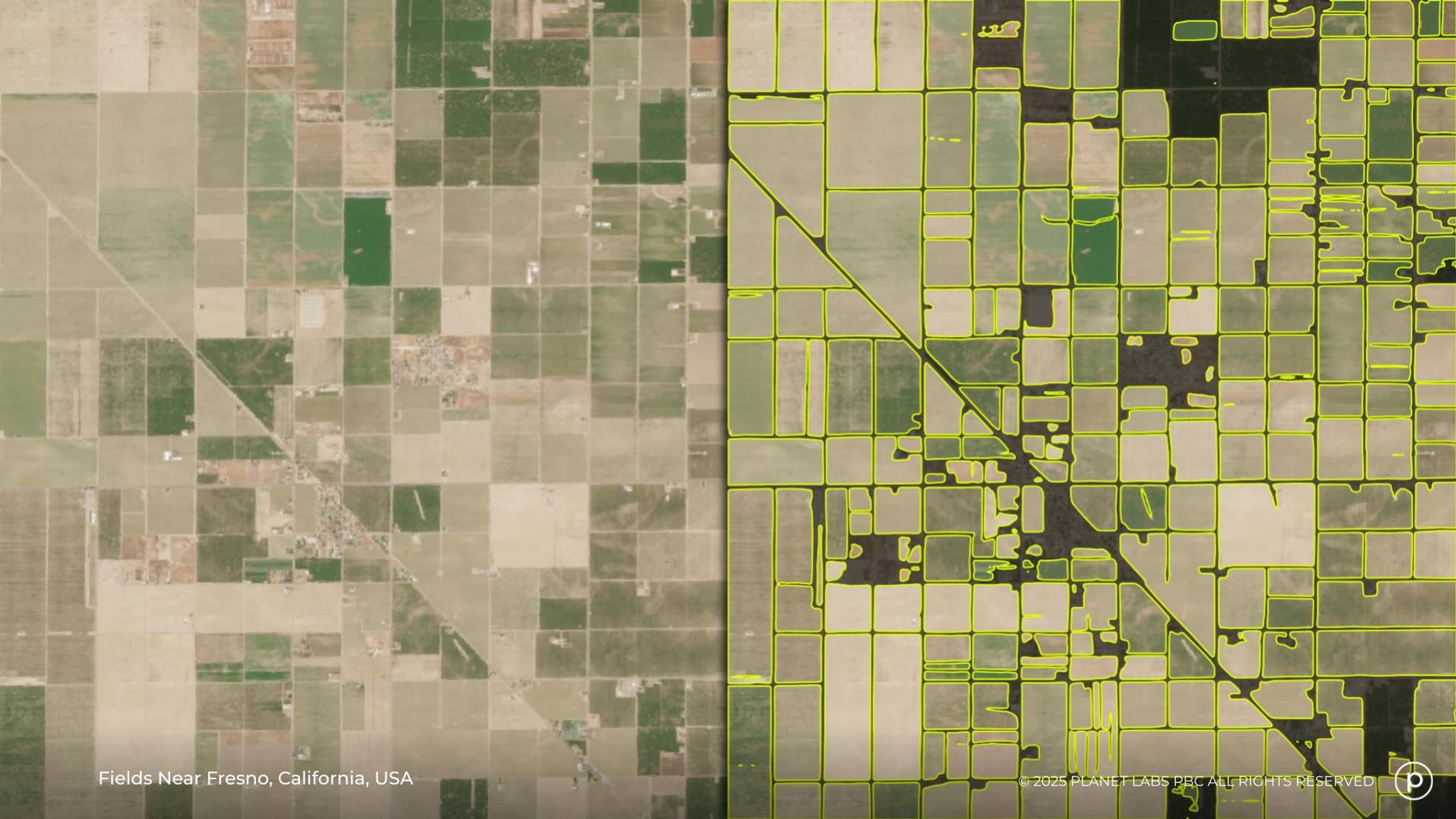
On the right, you can see boundaries identified via the Field Boundaries dataset in the Central Valley of California.
Get Started Today
Updates to Soil Water Content and Land Surface Temperature have already been implemented — reach out today to get started.
If you’re excited to test out the upcoming improvements to Crop Biomass and Field Boundaries, you can reach out to Senior Product Manager for Agriculture, Ariel Zajband, at a.zajdband at planet.com to request access ahead of their scheduled release dates.
Watch the Full Webinar
Interested in learning more? The full webinar provides detailed explanations, visual examples, and a Q&A session that addresses common questions about data accuracy, global availability, and specific use cases (a Q&A summary is also available in Planet Community).
Discover the full potential of analysis-ready satellite data and explore opportunities to test these powerful new products for your operations. Watch the complete Updates to Planetary Variables for Agriculture webinar now!
Ready to Get Started
Connect with a member of our Sales team. We'll help you find the right products and pricing for your needs.