How Can I Access, Integrate, and Use Satellite Imagery in My Workflows?

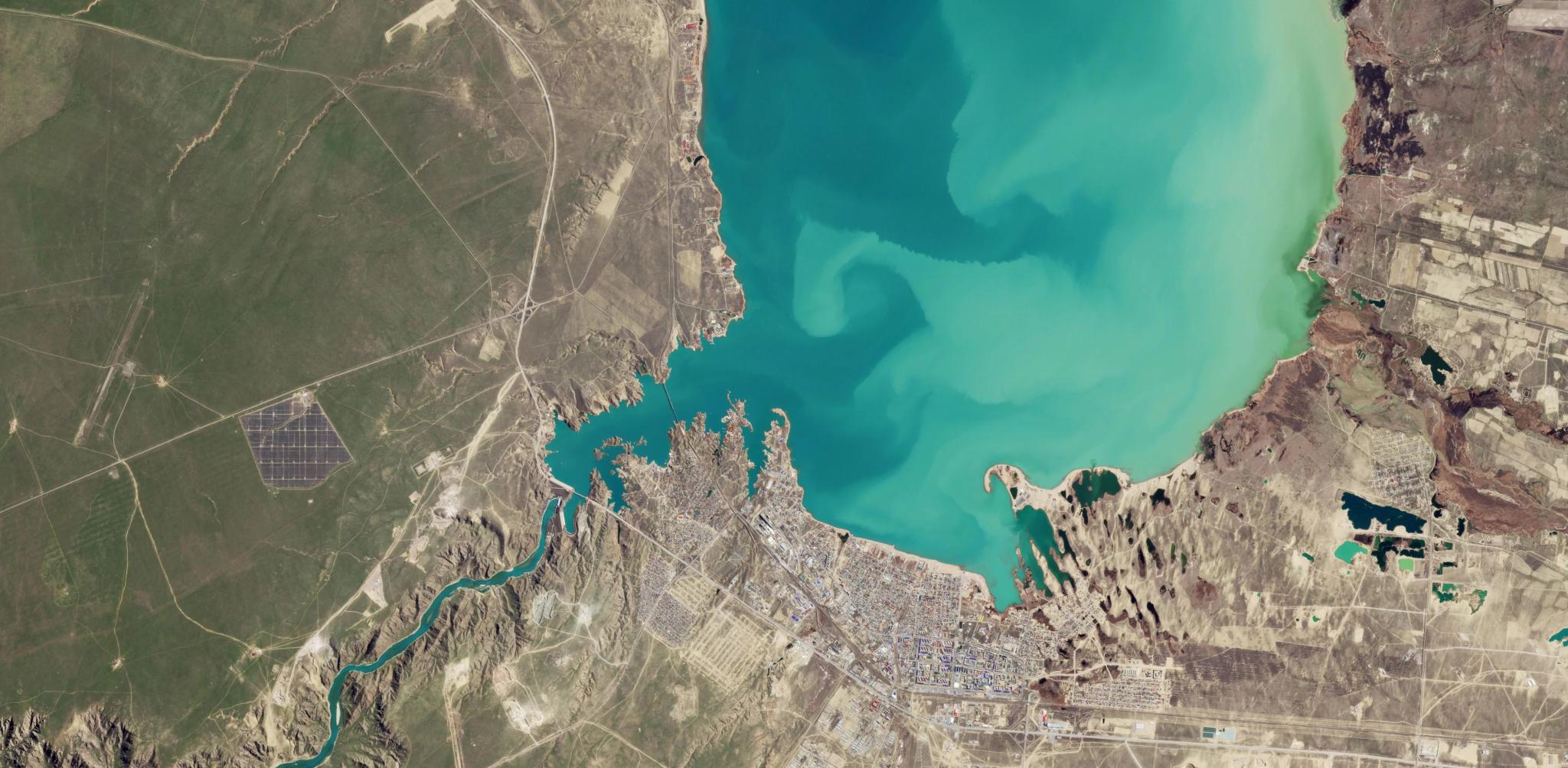
PlanetScope image of the the Kapshagay Reservoir in Kazakhstan captured March 28, 2026. © 2026 Planet Labs PBC. All Rights Reserved.
EducationEarth observation has traditionally been a specialized discipline that involves using a suite of technical platforms and tools to manage and analyze data.
Fortunately, there are many ways to approach this challenge. How satellite imagery is accessed and integrated into workflows varies depending on your technical needs and preferred tools. Let’s take a look at some of these options and how they apply to Planet imagery and data products.
Accessing Satellite Imagery and Data Products
While there are many ways to access satellite data, they fall into three buckets: web applications, APIs, and integrated software plugins.
- Web applications are browser based software platforms for accessing and analyzing data. There are several web applications for accessing Planet data:
- Planet Insights Platform: A cloud-based platform for visualization, hosting imagery, and performing analysis without downloading data.
- Planet Browser: A browser-based tool to search, preview, filter, and download imagery.
- Visual Analysis Application: visualization, hosting imagery, and performing analysis without downloading data.
- Additional web tools on insights.planet.com: Used for various tasks like Quota management, Area of Interest (AOI) creation and quota reservation, subscription management and more.
- APIs, or application programming interfaces, define a way of communicating between software applications, and are ideal for automated or large-scale workflows. Planet offers several APIs, each with a distinct purpose:
- Data API: Search and filter Planet's imagery catalog.
- Orders API: Request specific imagery for one-time download or cloud delivery.
- Subscriptions API: Set up automated, continuous delivery of imagery matching your criteria.
- Basemaps API: Access and download mosaic products programmatically.
- And more, Including the Statistical API, Features API, and Tasking API.
- GIS integrations or plugins allow you to stream or download imagery directly within your existing GIS tools. With Planet data, this includes:
- ArcGIS Pro Plugin: Search, access, and download imagery within ArcGIS Pro.
- QGIS Plugin: Search imagery, stream basemaps, inspect metadata, and task satellites from within QGIS.
- Google Earth Engine: Deliver Planet data to Google Earth Engine image collections.
- OGC Streaming (WMS/WMTS): Provide access to functionality through interfaces that conform to the Open Geospatial Consortium (OGC) standards: WMS, WCS, WFS, and WMTS.
Deciding which method is best for you depends on your system configuration and workflow needs.
Integrating Satellite Imagery Into Existing Software or Workflows
The tools mentioned above for accessing satellite data also allow you to integrate it into your existing workflows. Plugins for popular GIS systems like ArcGIS and QGIS allow you to search and pull imagery directly into your map projects without leaving the application.
You can also build custom integrations using APIs and software development kits (SDKs) to automate data retrieval and processing within your own code. This allows for the creation of internal dashboards that update automatically as new imagery becomes available.
By using these integration tools, organizations can build streamlined workflows that treat satellite data like any other live data feed in their tech stack.
How Satellite Data Is Delivered to Users
Satellite data is commonly delivered to users through direct cloud transfers, API downloads, or standardized geospatial streaming services.
- Cloud delivery allows for large volumes of data to be sent directly to your own AWS or Google Cloud environment to facilitate large-scale processing.
- Downloading individual image files in standard formats like GeoTIFF or JPEG through the platform’s interface, is a good option for smaller tasks.
- OGC-compliant streaming, such as WMS or WMTS, allows you to view imagery instantly without hosting the files locally.
These delivery methods ensure that the data is compatible with both custom software and commercial mapping applications.
Learn More
If you are interested in learning more about accessing and integrating satellite data, you can read the questions and answers below, or visit Planet Documentation for step-by-step guides on getting started with system integrations and using the Planet APIs and SDKs.
Questions You Might Have
A variety of platforms are used to analyze satellite data, ranging from traditional desktop GIS software to cloud-native analytical engines. Cloud platforms allow users to run complex calculations on vast datasets without the need for powerful local hardware. These tools often include built-in algorithms for detecting objects, measuring plant health, or identifying changes in land cover over time. Open-source libraries in languages like Python also play a major role in custom data analysis and machine learning workflows.
By using these specialized tools, analysts can extract structured information and statistical trends from the raw pixels of a satellite image.
Key Takeaway: Analysis is performed using desktop GIS software, cloud-native processing engines, and open-source libraries to extract structured trends from raw imagery.
The speed of delivery after capture depends on the level of processing required and the specific satellite constellation being used. Standard imagery products are often available within several hours of being recorded by the satellite sensors. Some high-cadence systems can provide data even faster to support emergency response or real-time monitoring of critical events.
However, the final, most accurately calibrated versions of the data may take slightly longer as they undergo rigorous geometric and radiometric corrections. This tiered delivery system allows users to prioritize either low-latency speed for immediate awareness or high-fidelity accuracy for scientific measurement.
Key Takeaway: Satellite imagery is typically available within hours of capture, with tiered delivery options to balance immediate speed and technical precision.
The process for requesting new satellite imagery of a specific area of interest (AOI), often called tasking, involves using a dedicated dashboard to submit specific geographic coordinates and time windows.
You begin by choosing the type of imagery required and defining the area of interest on a digital map. The system then evaluates the request and provides an imaging window during which a high-resolution satellite will pass over the location. Once the order is submitted, the satellite is programmed to capture the area according to your specific technical requirements, such as the camera angle or stereo imaging mode. You can then monitor the progress of your order and the subsequent delivery of the assets through the same dashboard.
Key Takeaway: Tasking involves submitting coordinates and timing via a dashboard to schedule a specific satellite capture of your area of interest.