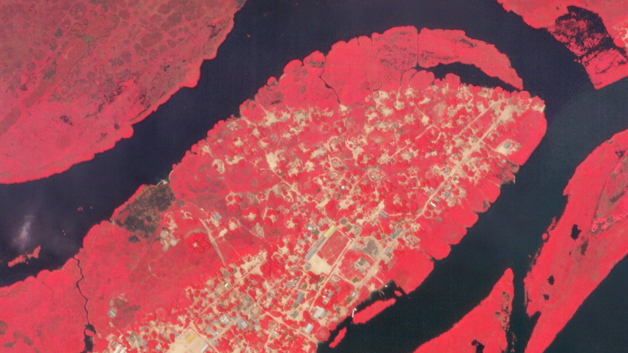
High-resolution false-color (near infrared, red, green) Planet SkySat view of the Makotipoko camp on June 15, 2019 © 2019, Planet Labs Inc. All Rights Reserved.
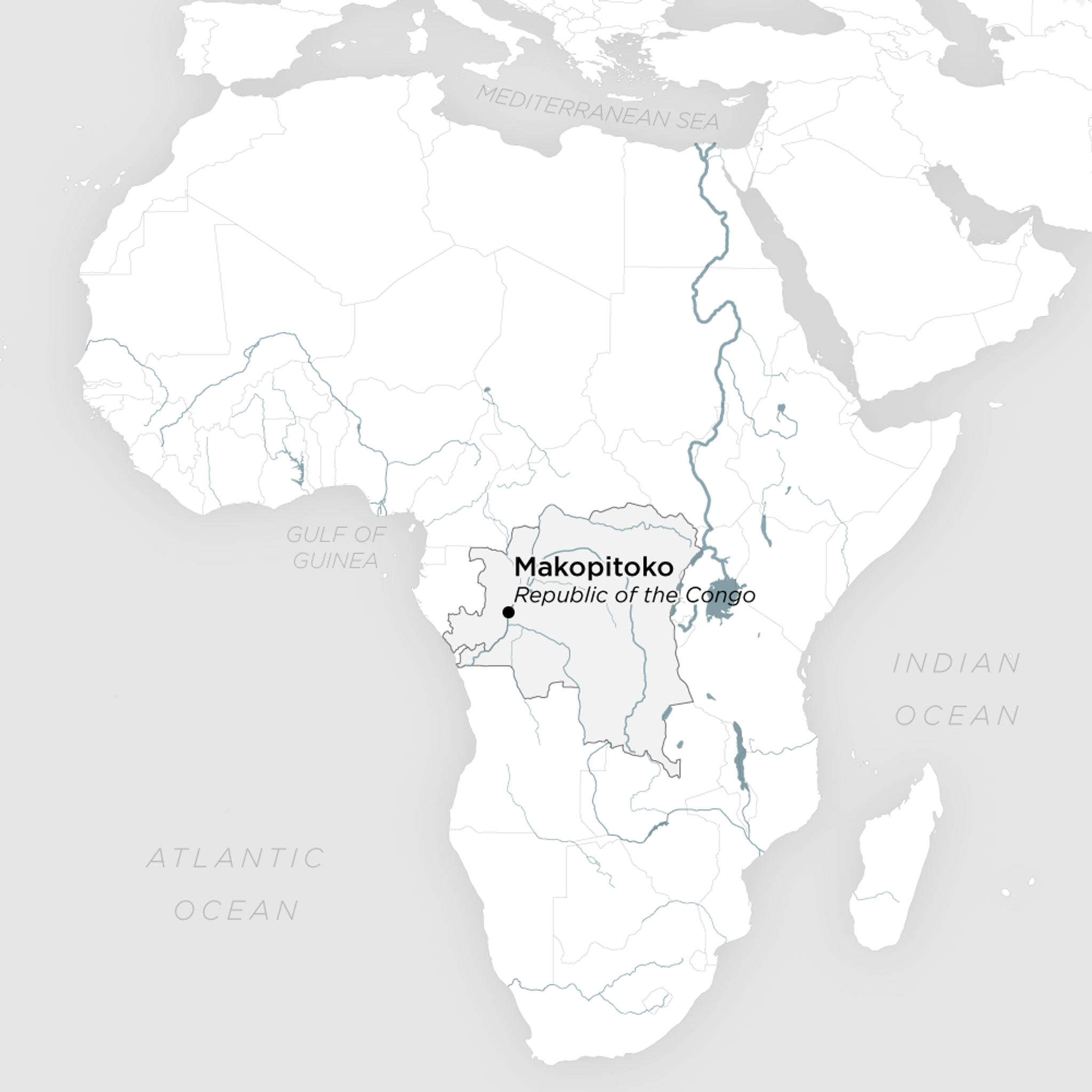
AUTHOR PROFILE Brittany Zajic
Curious Planeteer working to make the Earth's changes visible, accessible and actionable.

How Flood Mapping from Space Protects the Vulnerable and Can Save Lives

News

In late 2017, in the town of Impfondo in the Republic of the Congo (RoC), five thousand people were victims of a major flood. Tragically, as is often the case in the world’s under-resourced communities, the Congolese government lacked sufficient resources to detect and monitor such an event, and a full three weeks would pass before a disaster was formally declared. Aid groups such as the United Nations World Food Programme (WFP) were unaware and therefore unable to provide needed relief.

As in all things, the speed of information limits the speed of action.

A year later, WFP and the RoC government leveraged Cloud to Street, a pioneering flood mapping and response organization that uses troves of high-cadence, high-resolution satellite imagery—including Planet’s—to build country-wide flood monitoring and dynamic analytics systems for the most vulnerable on Earth. These systems can detect, measure, and monitor flood and their impact in days, not weeks—enabling faster, more effective and more humane response.

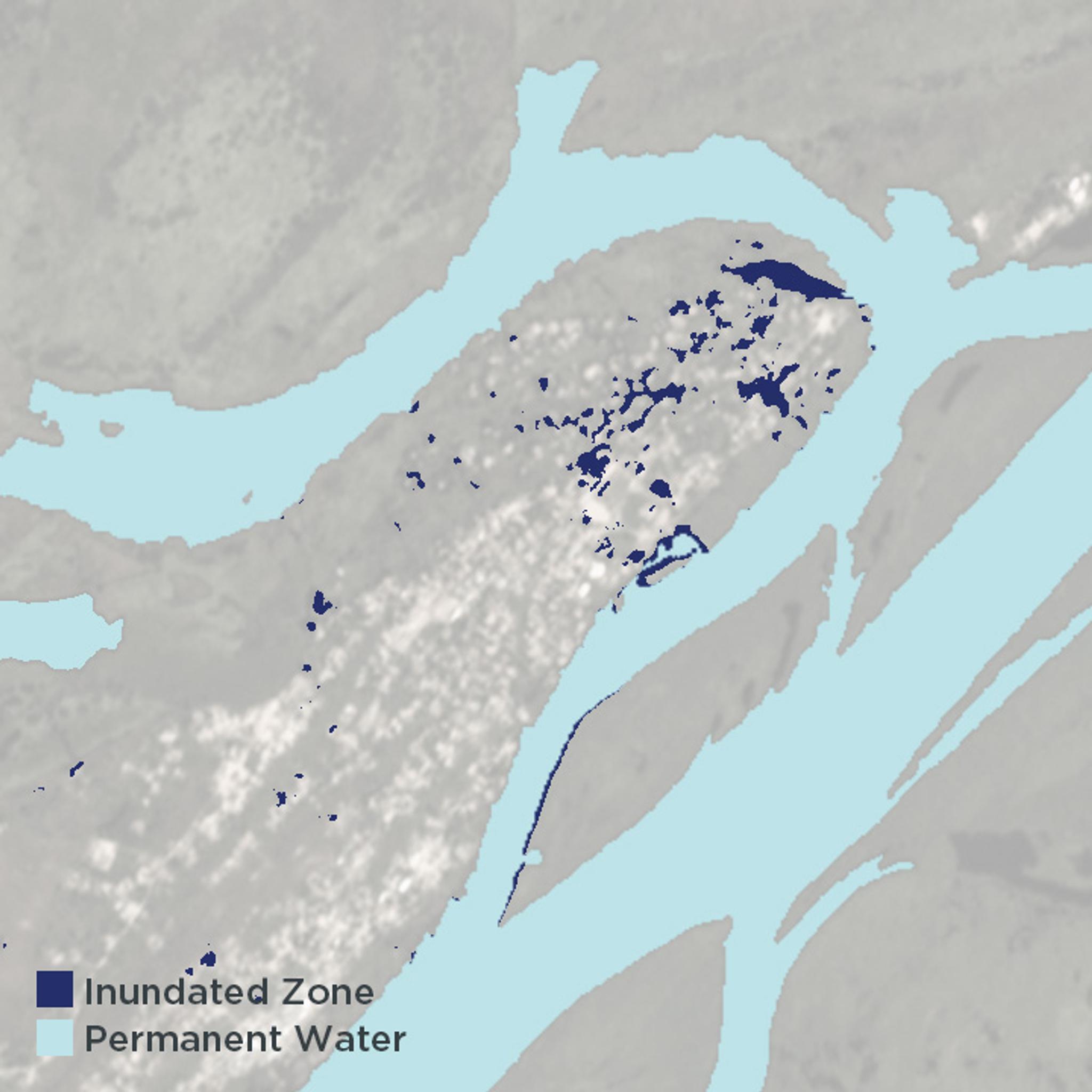
Cloud to Street’s tools proved invaluable in December of 2018, when the company received a message from WFP that 16,000 refugees from the neighboring Democratic Republic of the Congo (DRC) had fled into the Republic of the Congo and were settling in low-lying, flood-prone areas. Cloud to Street rapidly analyzed the history of flooding for each of these refugee camps and determined that the largest camp, Makotipoko, was at high risk; using Planet’s satellite imagery, the team confirmed it was already starting to flood. Armed with this data, Cloud to Street recommended relocating 7,000 refugees in Makotipoko to safer sites, possibly saving countless lives.

The Makotipoko Camp is located in the Republic of the Congo, along the Congo River. © 2019, Planet Labs Inc. All Rights Reserved.

The Republic of the Congo is not alone. Today, 11 flood vulnerable countries have used or are using Cloud to Street’s flood monitoring and remote analytics systems to achieve similar results. The system helps countries identify critical assets at risk, realize their flood forecasts are wrong, design insurance products for new customers, protect wetlands, access new catastrophe insurance, and devise other ways to prepare for and respond to catastrophic flooding and climate change.

“We aim to enable all countries at risk to access the information they need to prepare and respond to disasters, and to build a safety net,” says Bessie Schwarz, co-founder and CEO of Cloud to Street. “High quality flood information by the traditional methods can be cost-prohibitive for the places we work because it usually requires ample and expensive field equipment.”

These models also tend to require a sophisticated knowledge of hydrology, and as such are not always accessible to local communities. With Cloud to Street’s easy-to-use flood-monitoring dashboard, the barrier to entry for the tools are much lower, and local governments can operate and run them independently while getting advice and direct help from Cloud to Street’s experts. The system enables locally optimized flood frequency maps, high flood risk alerts, near real-time flood impact analytics and other tools that are designed for specific end users’ decisions through a dedicated user-centered process.

Cloud to Street’s analysis of Planet imagery from January 4, 2019 showed floodwater (dark blue) throughout the Makotipoko Camp.

“Cloud to Street is at the vanguard of a new wave of innovators who combine a deep understanding of a critical domain—like floods—with Planet’s global, daily imagery, to create low-cost, hyper-scalable solutions. And these protect vulnerable people and ecosystems,” says Andrew Zolli, vice president of Global Impact Initiatives at Planet. “Now no community is too far to reach or too far to protect.”

“What’s exciting is that if you continually measure risk for a community, you can use these measurements as the basis for new risk-reduction interventions and new insurance strategies—which speed recovery, protect property and reduce suffering,” added Schwarz. “In an age when climate change is accelerating those risks by the day, enabling this local flood resilience couldn’t feel more important.”