NewsNewsPlanet’s Startup Program Unlocks Innovation & Improves Satellite Data AccessibilityBrittany Zajic |May 19, 2023|3 min readRead more
StoriesStoriesHow Flood Mapping From Space Protects the Vulnerable and Can Save LivesBrittany Zajic |June 17, 2019|4 min readRead more
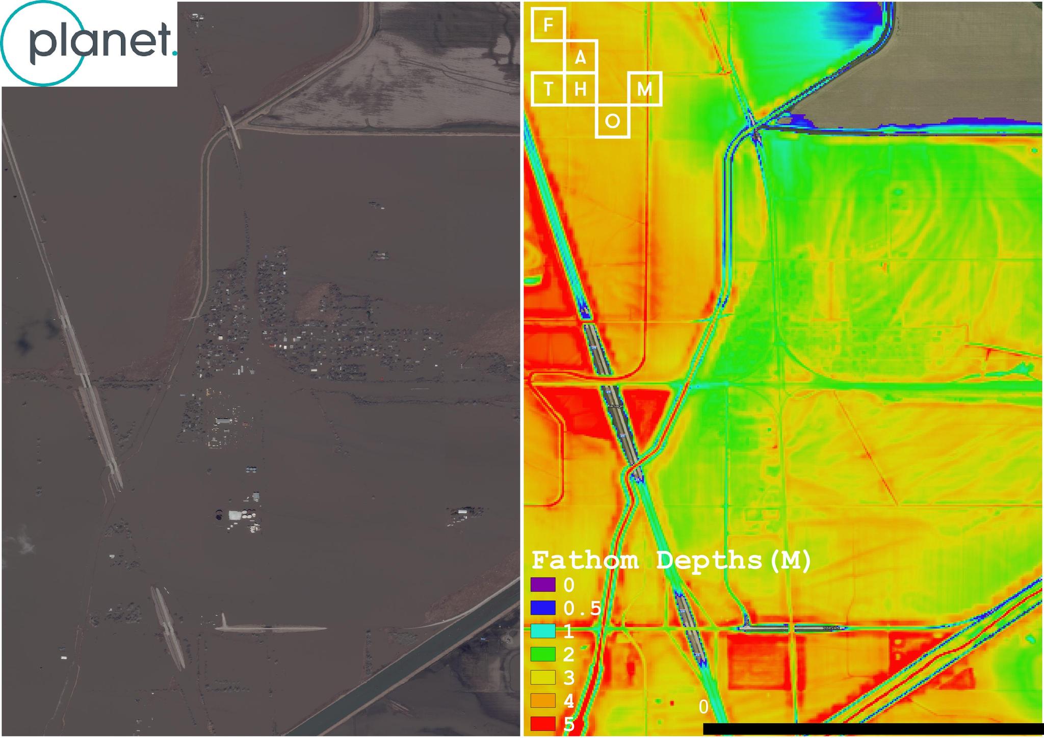
TechTechHow Fathom Leverages Frequent Satellite Imagery for Dynamic Flood MapsBrittany Zajic |May 22, 2019|4 min readRead more
NewsNewsIrma and Harvey Satellite Data Available for AccessBrittany Zajic |September 14, 2017|1 min readRead more