
In Conversation: Modernizing Agricultural Compliance with AI-Enabled Solutions
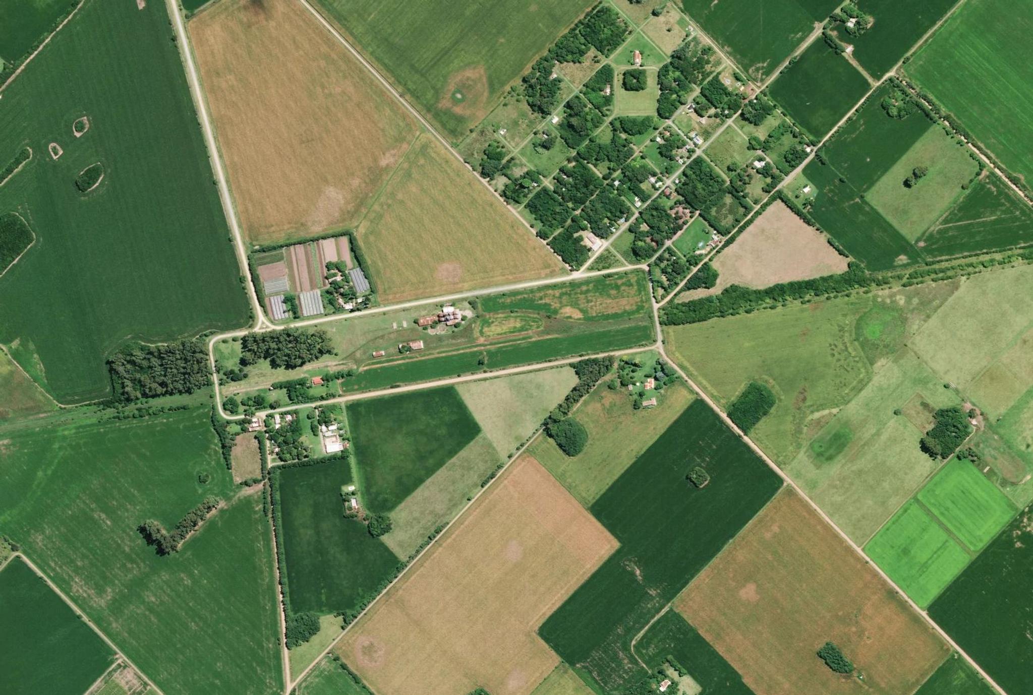
SkySat image of farmland in Chivilcoy, Buenos Aires, Argentina, captured February 9, 2022. © 2022 Planet Labs PBC. All Rights Reserved.
StoriesThis article is also available in the following languages: Spanish, Portuguese
An Interview with Dr. Ariel Zajdband, Product Manager at Planet
Governments play a vital role in stabilizing farm incomes, safeguarding food security, and reducing the environmental impact of agriculture. Yet many of the systems governments rely on to ensure compliance were built for another era. Paper forms, self-declarations, and spot checks can’t keep pace with today’s environmental volatility or the growing demand for transparency and timely insights.
A new model is emerging: one that is digital, automated, and near-real time. To explore what this means for governments, we spoke with Dr. Ariel Zajdband, Product Manager at Planet, whose work sits at the intersection of agronomy, remote sensing, and policy innovation.
Read on to learn how this approach is bringing new levels of efficiency and accuracy to agricultural compliance. And if you’re interested in how Planet AI-enabled solutions help governments monitor agricultural land at scale, download our new e-book, Improving Agricultural Compliance with Planet.
From Buenos Aires to Planet

“I’m originally from Argentina,” Ariel begins. “Agriculture is a huge part of the economy there. I grew up in Buenos Aires, not in a rural area, but I was fascinated by how agronomy blends biology, chemistry, physics, and economics. When I moved to the U.S., I found myself drawn to the intersection of technology and agriculture, especially remote sensing. It’s one of the most promising technologies being applied in the industry right now.”
Today, Ariel helps governments and commercial organisations around the world modernize how they monitor agricultural activity, verify compliance, and track policy effectiveness.
Why Traditional Compliance No Longer Works
Across the world, agricultural compliance still depends on self-reported data and annual spot checks. “Self-reporting relies on farmers’ willingness to share information,” Ariel explains. “It’s hard to process, slow, and expensive. Field visits provide only a snapshot in time yet farming is dynamic. Tillage, planting, harvest: these all happen within narrow windows. One visit is likely to miss what actually occurred.”
Beyond inefficiency, manual checks risk subjectivity. “I remember hearing about a farmer being marked ‘compliant’ for cover crops because the inspector saw weeds and mistook them for crops,” he smiles. “Those aren’t isolated stories. Objectivity matters, and satellites give us that.”
PlanetScope timelapse of chili harvest in Xinjiang, China, captured between August 21 and November 6, 2023.
Seeing the Whole Season
Near-daily satellite monitoring changes the equation. “Instead of one picture at one point in time, we now have the full movie of the growing season,” says Ariel.
The high revisit rate of Planet satellites enables agencies to detect short-term events, planting, mowing, harvesting, while building time-series analyses that reveal longer-term trends. “With more observations, we can reduce the likelihood of error and detect changes earlier” he adds. “That’s crucial for governments verifying compliance or responding quickly to risk.”
Public vs. Commercial Satellite Data
Public programs like Sentinel-2 have been transformative, but Ariel highlights where commercial data adds value. “PlanetScope® has two main advantages: frequency and resolution,” he says.
“In Europe for example, many farms are small. If your pixels are too big, data from neighboring fields mixes together, adding noise and reducing signal clarity. Higher-resolution imagery captures the real signal. And with more frequent observations, you can overcome cloud cover and have a higher chance of capturing short-lived events like grassland mowing that public satellites might miss.”
Those differences have real-world consequences. “Missed events aren’t just data gaps,” he notes. “They can lead to paying a non-compliant farmer or denying payment to one who’s eligible. That erodes trust.”
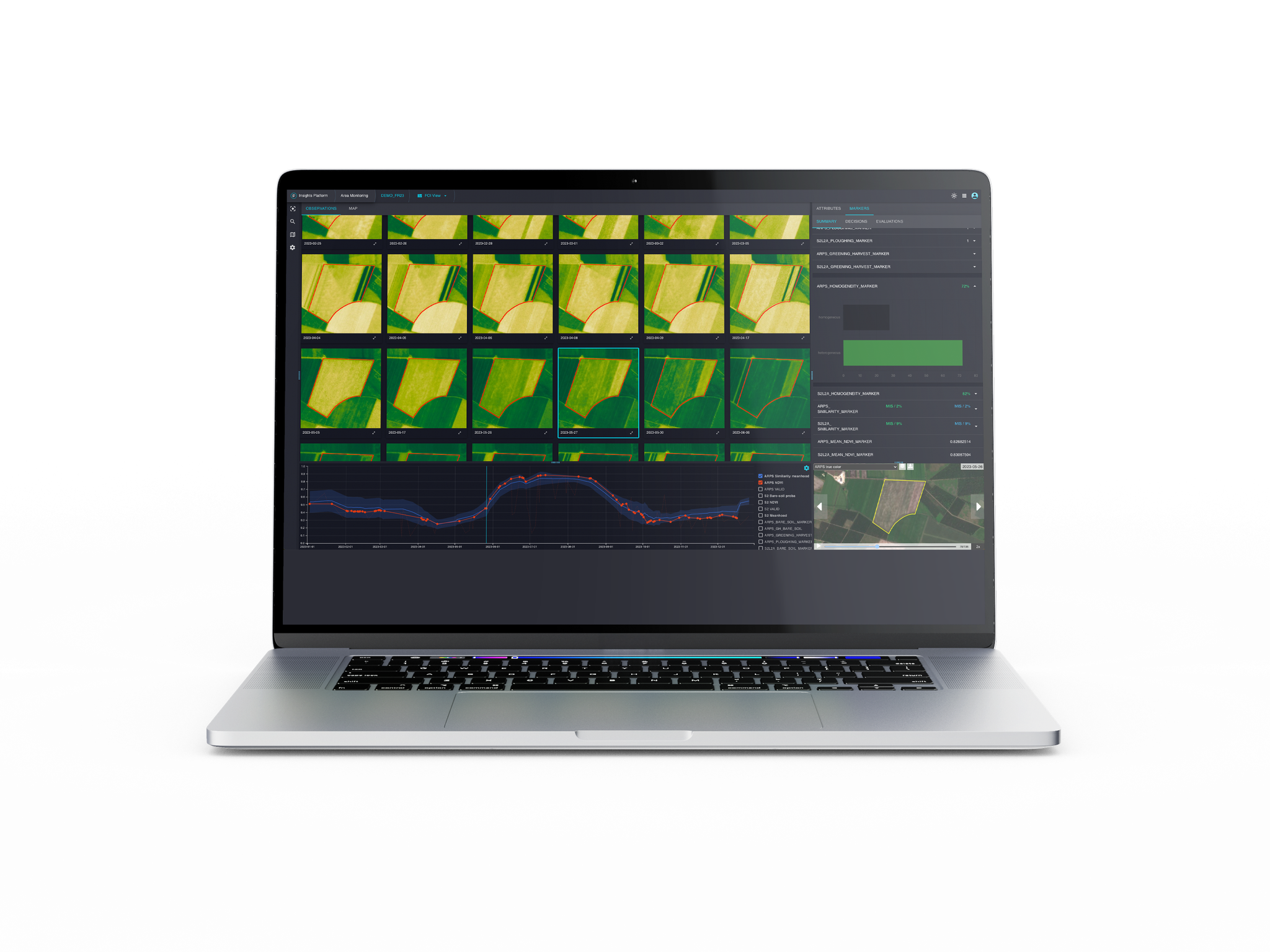
Area Monitoring Service from Planet is an AI-Enabled solution to help governments verify compliance at a national scale.
Turning Monitoring Into Trust
Trust between governments and producers is fundamental. “Farmers sometimes worry that satellite monitoring means surveillance,” Ariel acknowledges. “But when used well, it’s the opposite. It builds confidence.”
He explains that the benefits extend far beyond oversight: if you’re doing the right thing, the system recognizes it; automated monitoring accelerates payment verification; and the same data can help identify drought-hit or pest-affected farms so governments can offer targeted support. “Remote sensing isn’t about policing farmers,” Ariel adds. “It’s about collaboration and support.”
AI: Speeding Up the Path to Insight
Here at Planet we have been using machine learning for years to interpret our massive image archives, but advances in artificial intelligence are now taking this even further.
“AI lets us train models faster and adapt them to local conditions. Tillage looks different in Brazil than in France,” Ariel explains. “It helps detect anomalies across millions of parcels and summarize patterns for humans to review. It doesn’t replace expertise; it makes it faster and more consistent.”
That efficiency, he says, translates directly into impact: quicker analysis, faster decisions, and ultimately, better outcomes for farmers and policymakers alike.
Designing the Next Generation of Compliance
If Ariel were advising a new administration on agricultural reform, he’d start with policy design. “Right now, many programs use satellite data to replace field visits, but they’re still built on the same checklist mindset,” he says.
“The next step is to move from binary decisions, pay or no pay, to outcome-based programs. Instead of verifying that a farmer simply planted a cover crop, what if we measured the benefits of that crop: carbon sequestration, nitrogen retention, soil health? Subsidies could be tied to impact, not just action.”
Such a shift would align incentives for both farmers and governments. “If you generate more positive outcomes for society,” Ariel says, “you should be rewarded for that.”
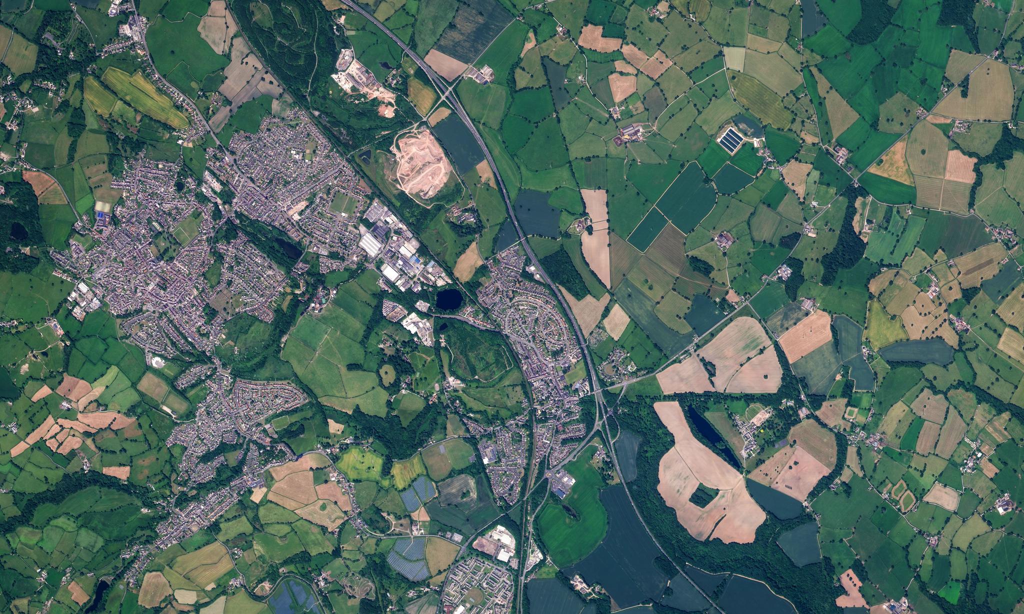
SkySat image of farmland in Wrexham, Wales, captured June 17, 2022.
Looking Ahead
After five years at Planet, Ariel is energised by what’s next. “We’re moving from delivering raw data to delivering solutions,” he says. “We can build applications governments can use directly, no remote-sensing expertise required, like our Area Monitoring Service, already adopted by national governments to monitor agricultural compliance at country-wide scale.”
He’s equally excited about the new Planet hyperspectral mission, Tanager™. “With over 400 spectral bands, we can detect things like nutrient levels and nitrogen stress,” he says. “The challenge is simplifying that complexity, giving users the insight they need without overwhelming them with data.”
This conversation supports the release of the new Planet e-book, Improving Agricultural Compliance with Planet, exploring how near-daily satellite data is transforming the way governments monitor, verify, and support sustainable farming.
Ready to Get Started
Connect with a member of our Sales team. We'll help you find the right products and pricing for your needs.