Mapping Water Scarcity with MetaMeta
)
In the attic of MetaMeta’s Netherlands office, the ceiling presses down on Frank van Steenbergen’s tall frame. “I wish I’d started MetaMeta ten years earlier,” he says, letting a broad smile settle onto his face. Frank, who bounces between Addis Ababa, Pakistan, Nairobi and the Netherlands on a monthly basis, almost never stops smiling. The boundless energy from his team of water resource experts at his NGO, MetaMeta Research, is infectious.
Taye is a Ph.D. resource manager working on a project called “Roads for Water”, designed to harvest rainfall in arid Ethiopia. Abdullah is a Yemeni Master’s student, scouring the water table in villages along the Red Sea, where rivers stopped flowing 30 years ago. Marta is experimenting with salt-tolerant potatoes in Pakistan.
As a Program Manager for Planet’s Impact initiatives, I traveled to the Netherlands to work with Frank and his team—to explore ways in which Planet Labs data can be integrated into MetaMeta’s projects. Over two days, we toured the world using Planet’s satellite data, with Taye from MetaMeta in the driver’s seat. Each scene told a story.
With Taye in command of Planet’s Scenes Explorer, we travelled to northern Ethiopia to examine rural roads. I learned that satellite imagery reveals how roads can affect soil moisture. Where rainwater runs off the road’s surface, crops prosper. Across the road, they die. As part of the Global Resilience Partnership (supported by the Rockefeller Foundation, USAID, and Sida) MetaMeta is exploring the potential for roads to be better planned to capture critical water resources. In East Africa, rainfall is typically scarce and sudden. Roads cover enough land—even in rural areas—to redirect a significant portion of rainfall into retention ponds and storage systems. Such installations would enable more efficient water usage.
The last stop on our tour was Alamata in the Tigray region. Here, the effects of poverty, food insecurity and environmental stressors are plainly visible in Planet data:
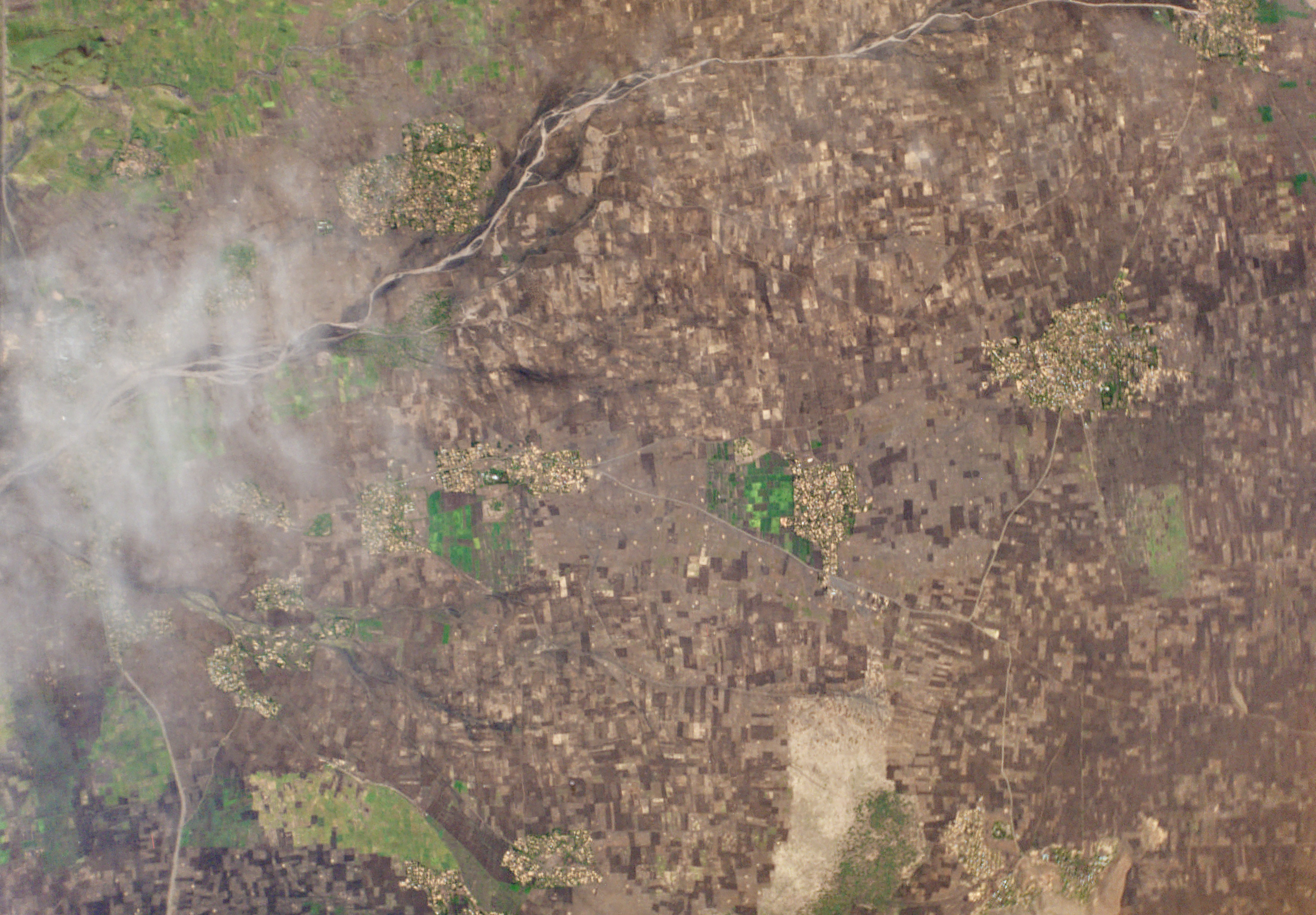
A Dove captured water scarcity outside Alamata, Ethiopia. Irrigated fields prosper, others falter.
In this landscape of barley, sorghum and millet, crops thrive where irrigation flows. The scattered green fields are a geospatial signifier of wealth in the region. Those that can afford it, irrigate. Those that cannot dry up.
I chatted with Taye about Planet Labs and his work at MetaMeta:
Taye explains:
I’m visiting the site almost every day, for any kind of change. I have a sense of the dynamism; the rate of change is just enormous…. In Ethiopia we need this kind of data. There are wide areas of application to use this data. Ethiopia has become a very dynamic nation. Change is taking place every day. There is all kinds of development in every corner of the nation: megaprojects in the lowlands; there are road constructions and demolitions. So, its a day-to-day change that couldn’t be addressed with a conventional satellite image. With a 16 day revisit time, you miss a lot; we miss a lot. Changes are happening everyday, so monitoring changes every day…this is no longer a luxury for us. It is a requirement.
In the coming months, Planet will work with MetaMeta Research to enhance the use of roads for water retention in Ethiopia, hunt for long dead Yemeni rivers, and assess the vitality of salt-tolerant Potatoes in Pakistan. Watch this space for updates.
To learn more about our humanitarian partnerships, visit our Impact page.