
Planet’s Newest Planetary Variable, Automated Field Boundaries
From food security to supply chain traceability to commodities trading, agricultural field boundaries serve as the foundational framework for a wide range of analyses. That’s why we are excited to introduce Field Boundaries, our newest Planetary Variable.
Field Boundaries provide a fundamental data layer for agriculture solutions, including regional crop monitoring and yield estimation over broad areas. This data can serve customers across a diverse range of sectors including civil government, commercial agriculture, finance, and consumer packaged goods. Available globally, Field Boundaries along with other Planet data offer a scalable solution and a simplified experience when using earth observation data to monitor large areas.
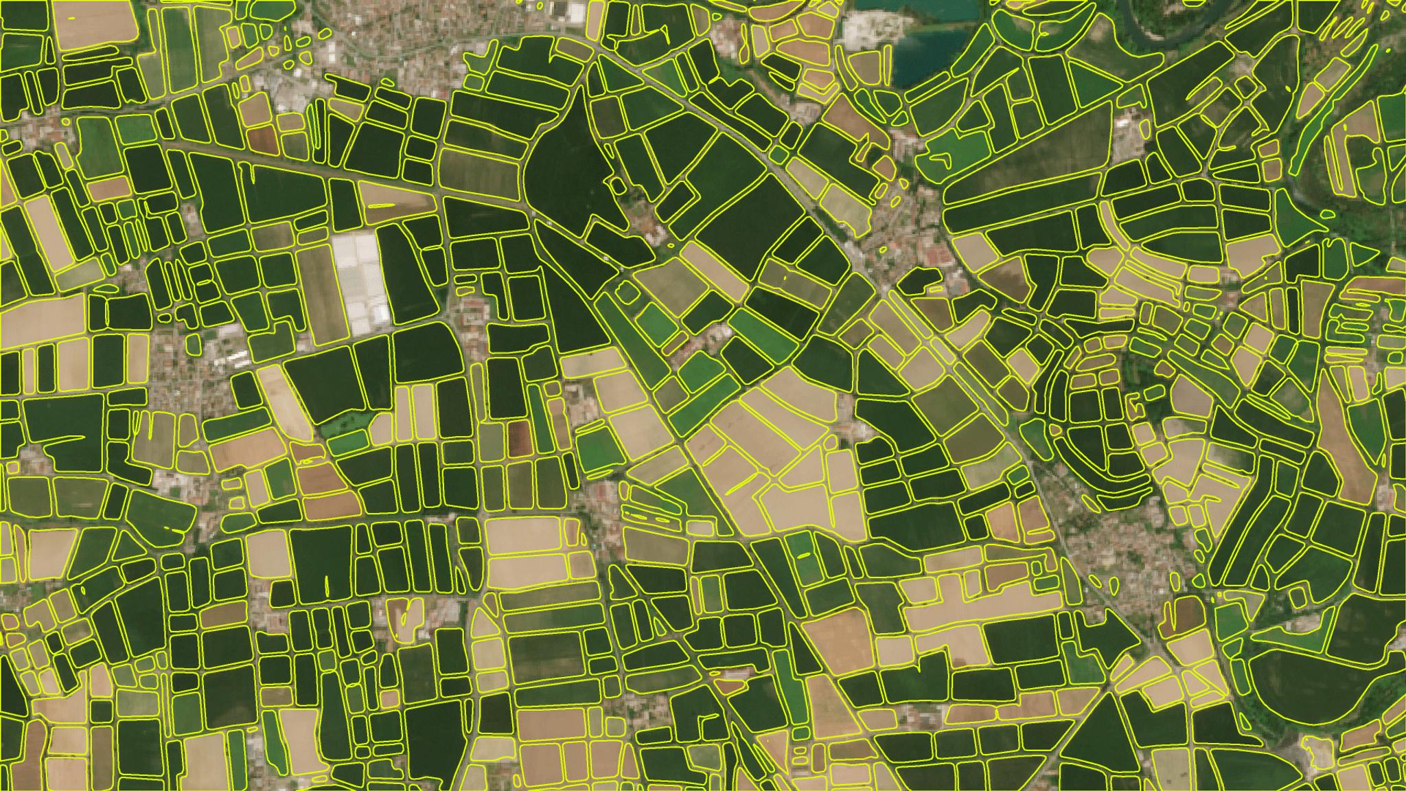
So how does this work? An agricultural field is a spatially homogeneous land unit utilized for agricultural purposes, where a single crop is grown. Our proprietary algorithm leverages the similarity of spatial, spectral, and temporal properties of pixels belonging to the same field. Using a deep neural network based on the U-Net architecture, we are able to trace the parcel’s extent and boundary from a time series of images. This can be used to generate current field boundaries or historical boundaries back to 2018.
The result is a set of closed vector polygons marking the extent of each agricultural field. Each polygon also includes important metadata improving understanding and confidence in the output. Metadata includes a polygon ID, area of the polygon in hectares, metrics describing the shape of each polygon to relate information about the performance of the algorithm, and a quality assessment.
To many of the world’s largest agribusinesses and government agencies, Planet is a strategic partner in digital agriculture and broad area monitoring. We are now able to provide important foundational data layers like Field Boundaries alongside our full product suite, including daily PlanetScope data, high-resolution SkySat data, and other Planetary Variables such as Soil Water Content, Crop Biomass, and Land Surface Temperature. Providing seamless access to the full breadth of Planet products helps to simplify technical integration and procurement, accelerate our customer’s time to value, and enable more scalable workflows for broad area management.
Field Boundaries is the first Planetary Variable developed by team members in Slovenia who joined the Planet team through our acquisition of Sinergise. Watch our 20 minute Field Boundaries webinar, and get started with Field Boundaries today.
Ready to Get Started
Connect with a member of our Sales team. We'll help you find the right products and pricing for your needs.