
Revolutionizing Wetland Mapping and Monitoring With Skytec's Ranger Platform
Timely and accurate data is essential for making informed decisions with regards to land and resource management. Government agencies and land managers need effective tools to assess and monitor landscapes efficiently—without the constraints of outdated, labor-intensive processes. Enter Skytec Ranger, a cutting-edge geospatial artificial intelligence (AI) application that leverages Planet high-temporal satellite imagery to map and monitor land changes efficiently.
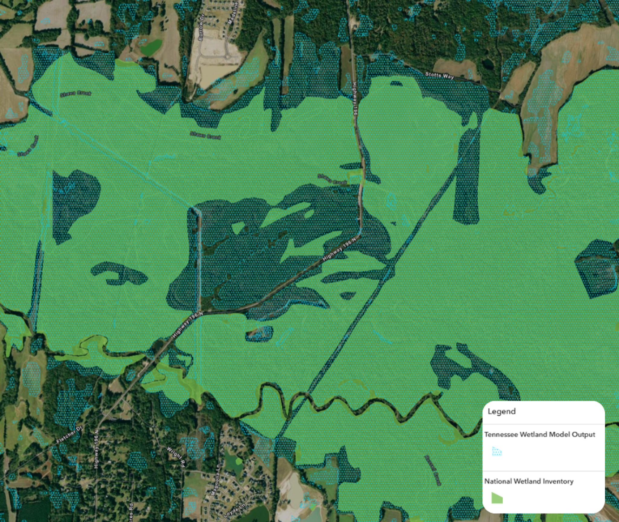
A Breakthrough in Wetland Mapping
Skytec, a long-time Planet partner, is a geospatial analytics company specializing in AI-powered mapping and monitoring solutions. They have been working with the state of Tennessee to revolutionize how wetlands are identified and assessed. Wetland mapping has traditionally been a slow and resource-intensive process, often taking multiple years to complete. Analysts had to rely on manual digitization techniques, identifying wetland areas by visually inspecting satellite images.
Now, with Skytec’s Ranger platform, wetland mapping can be completed in a fraction of the time. By applying advanced AI and deep learning models, Skytec automates feature identification, producing detailed wetland maps in a matter of weeks rather than years. “The traditional approach of mapping wetlands takes anywhere from two to three years,” explained Andy Carroll, CTO and co-founder of Skytec. “With AI, we can now replicate these processes in days or even hours, injecting dynamic data from the landscape into our decision-making process.” This efficiency is a game-changer for state agencies, enabling them to integrate near-real-time data into their regulatory and planning processes.
Beyond Mapping: The Power of Monitoring
Mapping wetlands is only the first step. What sets Ranger apart is its ability to continuously monitor landscapes over time. Using Planet high-resolution, high-cadence satellite imagery, Ranger provides agencies with up-to-date insights into how wetlands are changing, identifying areas of degradation or opportunities for restoration. “Now the agency has a tool not only to help them protect the existing intact wetlands,” Carroll noted, “but now they have a roadmap of where the degraded wetlands are. What can we restore for flood control? What can we restore for biodiversity values?”
This capability allows officials to:
- Proactively manage flood risks by identifying degraded wetlands that can be restored for improved water retention.
- Enhance land-use planning with data-driven insights into wetland health and transformation.
- Streamline regulatory processes with detailed, up-to-date information, reducing the burden on fieldwork and manual assessments.
A Scalable Model
Tennessee’s success with Ranger provides a model that other states can follow. The technology’s scalability, powered by Planet satellite data, means that wetland mapping and monitoring can be replicated in other regions. With minimal investment in additional staff or technical expertise, state and local agencies can deploy Ranger to gain actionable insights about their landscapes, making smarter decisions faster.
By combining Skytec’s AI-driven analytics with Planet satellite data, together we are empowering decision-makers with the tools they need to efficiently manage land and water resources. The success in Tennessee demonstrates how geospatial intelligence can enhance regulatory processes, improve land management, and pave the way for smarter, data-driven governance across the country.
To showcase the power of this partnership, Planet invited Skytec to participate in the Planet AI Symposium event in January 2025. We brought together industry experts, Planet leaders, and partners to explore the possibilities of artificial intelligence and Earth observation.
Watch the video of Skytec’s CTO, Andrew Carroll to learn more:
Ready to Get Started
Connect with a member of our Sales team. We'll help you find the right products and pricing for your needs.