SAINS to Map Southeast Asia With Planet Labs Data
)
As I’ve browsed the Planet Labs imagery pipeline over the last year, many of the most striking images I’ve found were of Southeast Asia. It’s truly awe-inspiring to get a glimpse of the region’s natural beauty— and its dynamic urban growth— from Low Earth Orbit. Here at Planet Labs, I lead our international sales efforts, and today, I’m very excited to announce that we’ve entered into an agreement with Sarawak Information Systems (SAINS), an early customer in Southeast Asia.
SAINS, one of Malaysia’s largest Information Communications Technology (ICT) companies, recognizes the immediate value of timely geospatial imagery. Dato Teo Tien Hiong, CEO of SAINS, states: “With over two decades of experience as a major Geomatics and Remote Sensing industry player in the region, we recognise, and are extremely excited about, the business potential of the strategic partnership between SAINS and Planet Labs. I see the strategic relationship as a game-changing opportunity for both Planet Labs and SAINS in providing timely satellite imagery as well as value adding geospatial services and solutions competitively to a wide range of industries in the region.”
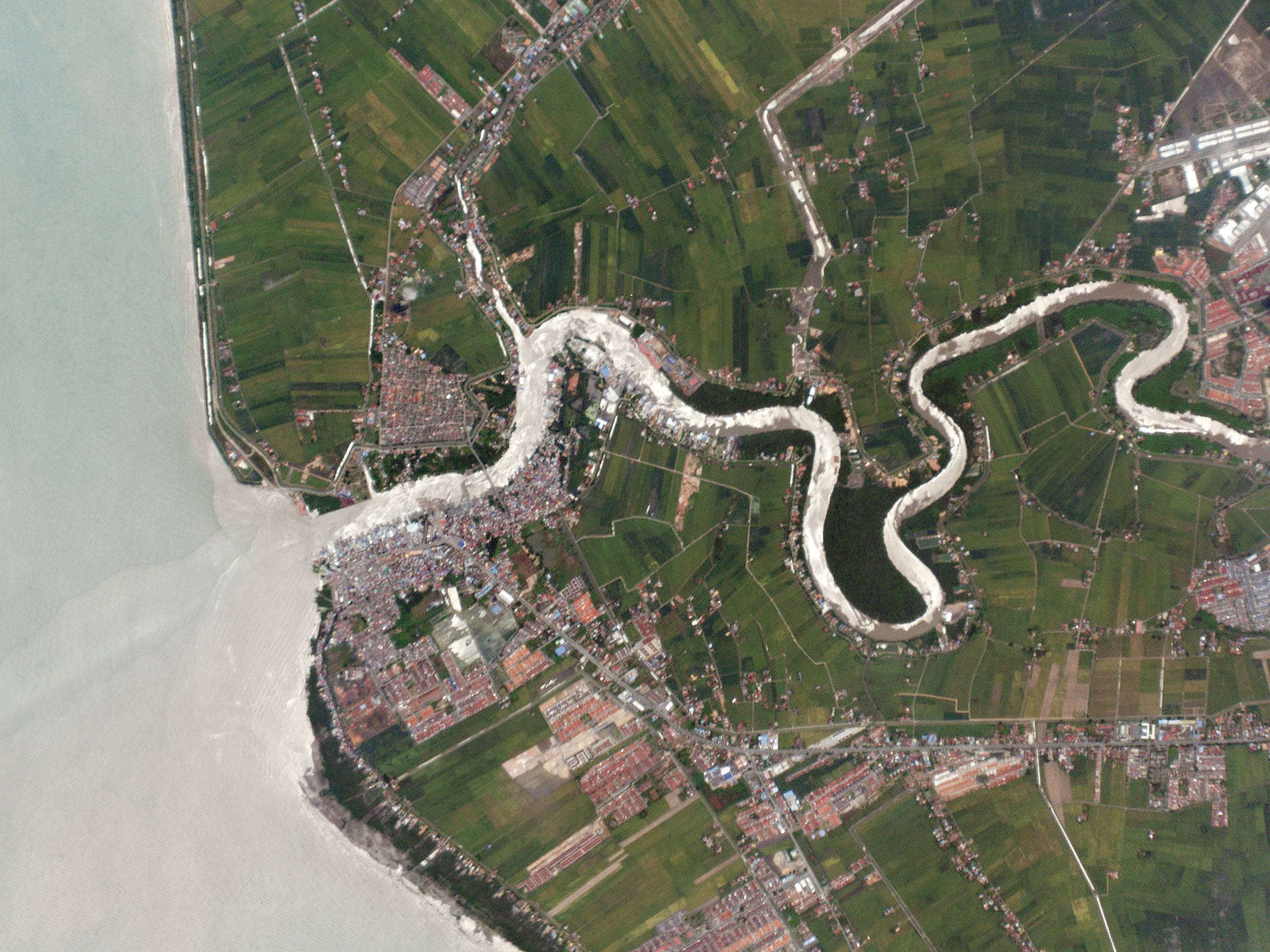
Agricultural fields line the sediment-rich mouth of Malaysia’s Sungai Kedah River
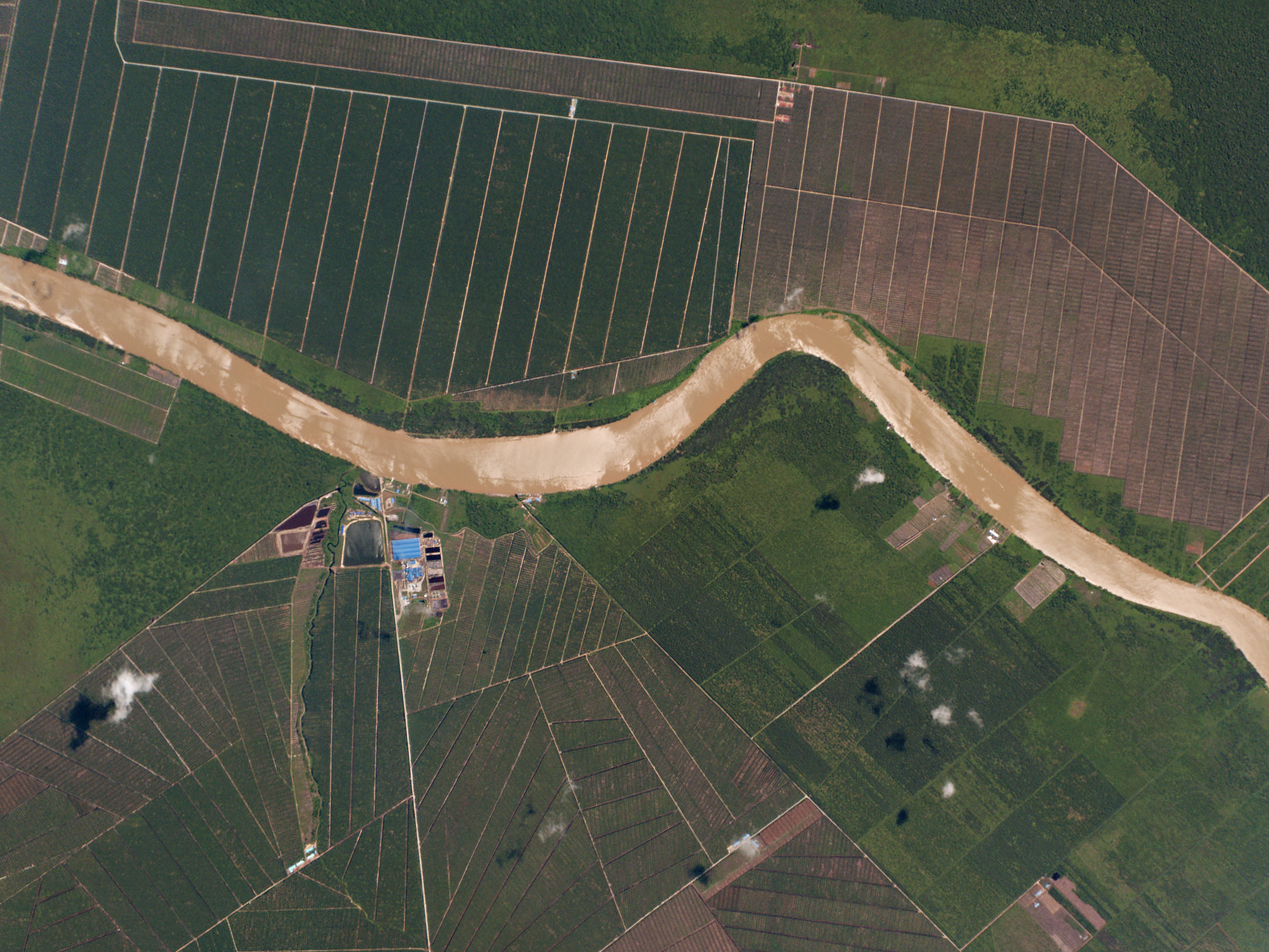
A plantation rests on the banks of the Baram River in the Malaysian state of Sarawak, East Malaysia
The team at SAINS are experts in GIS solutions, software solutions, enterprise network infrastructure, and security solutions. SAINS will integrate our timely imagery data of Malaysia, Indonesia, Singapore, Brunei, and the Philippines into a wealth of existing products and services. I’m personally thrilled to see our beautiful imagery in the hands of SAINS’ knowledgeable network of civic and corporate customers.
For more information about Planet, visit our Solutions page.