
Planet Solutions
Planet provides high cadence, global coverage and efficient delivery with an open, accessible platform
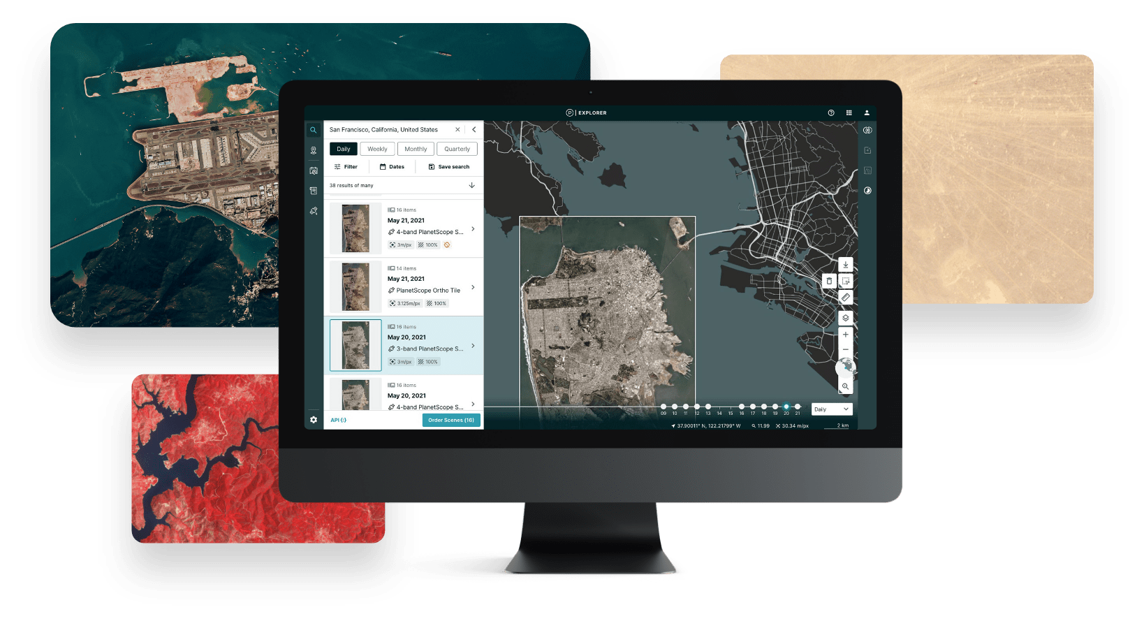
GLOBAL, DAILY, EARTH DATA
See change and make better decisions
On average, Planet has 1,700 images of every place on Earth. This unprecedented dataset can be fed into a variety of workflows to enable an ecosystem of apps and services.
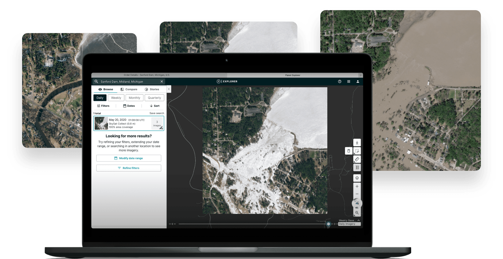
PLANET MONITORING
Real-time satellite monitoring
Observe areas of geographic interest, discover patterns, track infrastructure, and identify changes as they happen. From space, Planet Monitoring equips you with ground-truth data to make timely, informed decisions.


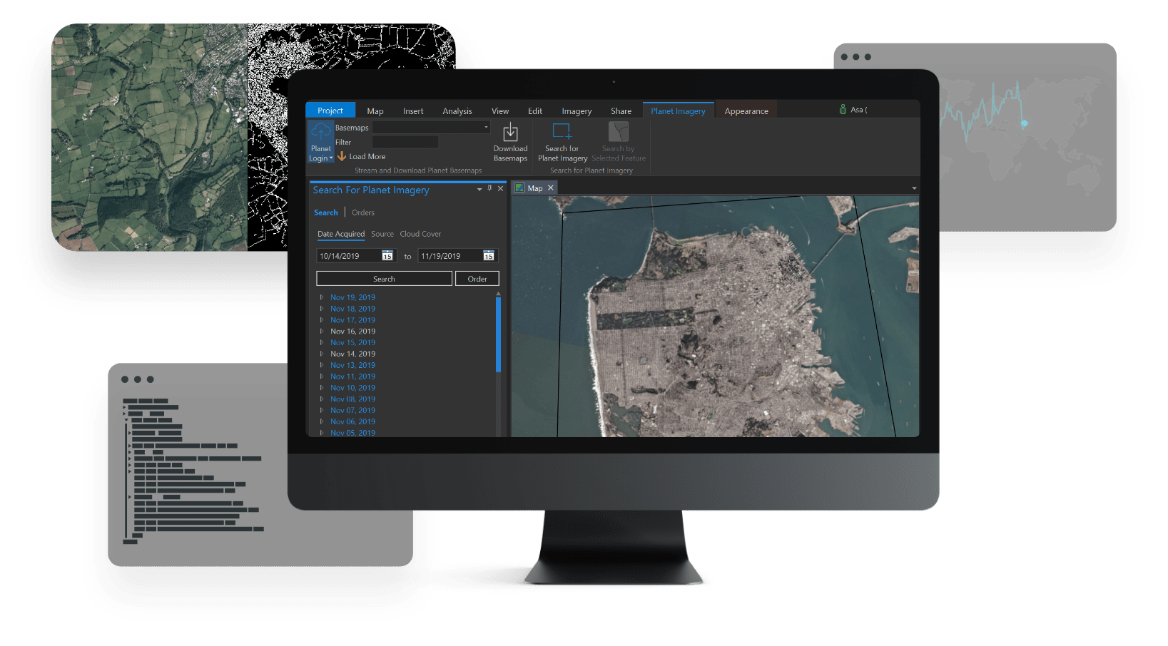
PLANET BASEMAPS
Comprehensive, high-frequency mosaics for analysis
Planet Basemaps provide insights over broad areas by leveraging cutting-edge software and daily satellite imagery to create visually consistent and scientifically accurate mosaics.
PLANET TASKING
50 cm resolution imagery with Planet Tasking
With ~20 SkySats in orbit, Planet offers the most frequent, intraday revisit capability of any commercial provider, capturing actionable insights between 5-7 times per day for real-time decision making.


PLANET PLATFORM
An accessible, scalable, and API-first satellite imagery platform
The entirely automated, cloud-based imagery and analytics platform provides access to our comprehensive, daily dataset and directly integrates with leading geospatial platforms.
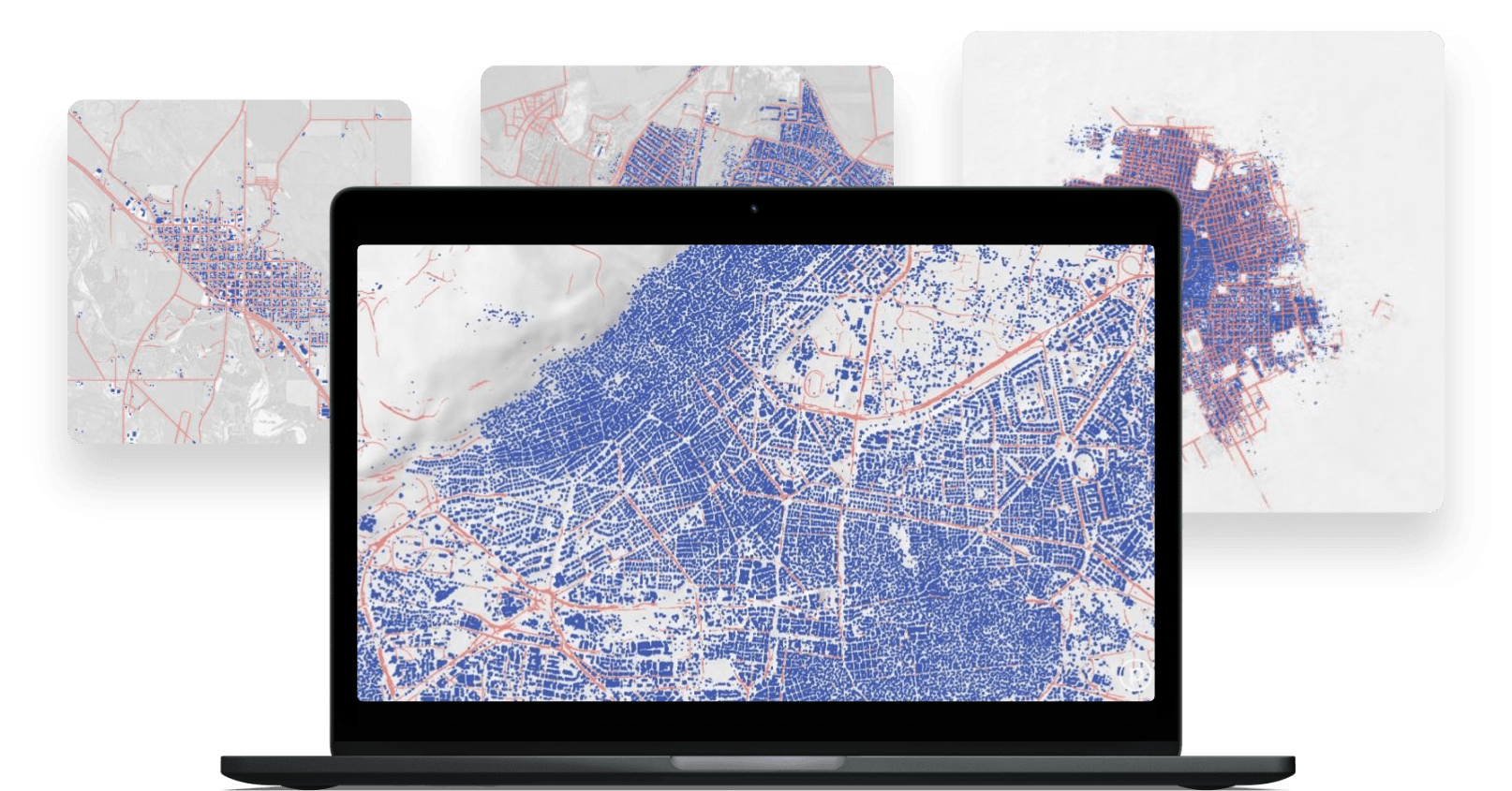
PLANET ANALYTIC FEEDS
Automated, cloud-based analytic feeds
Powered by deep learning and computer vision, daily imagery is transformed into analytic feeds that detect and classify objects, identify geographic features, and monitor change over time. Data is delivered from your area of interest in GeoJSON and GeoTIFF format.


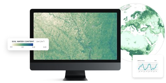
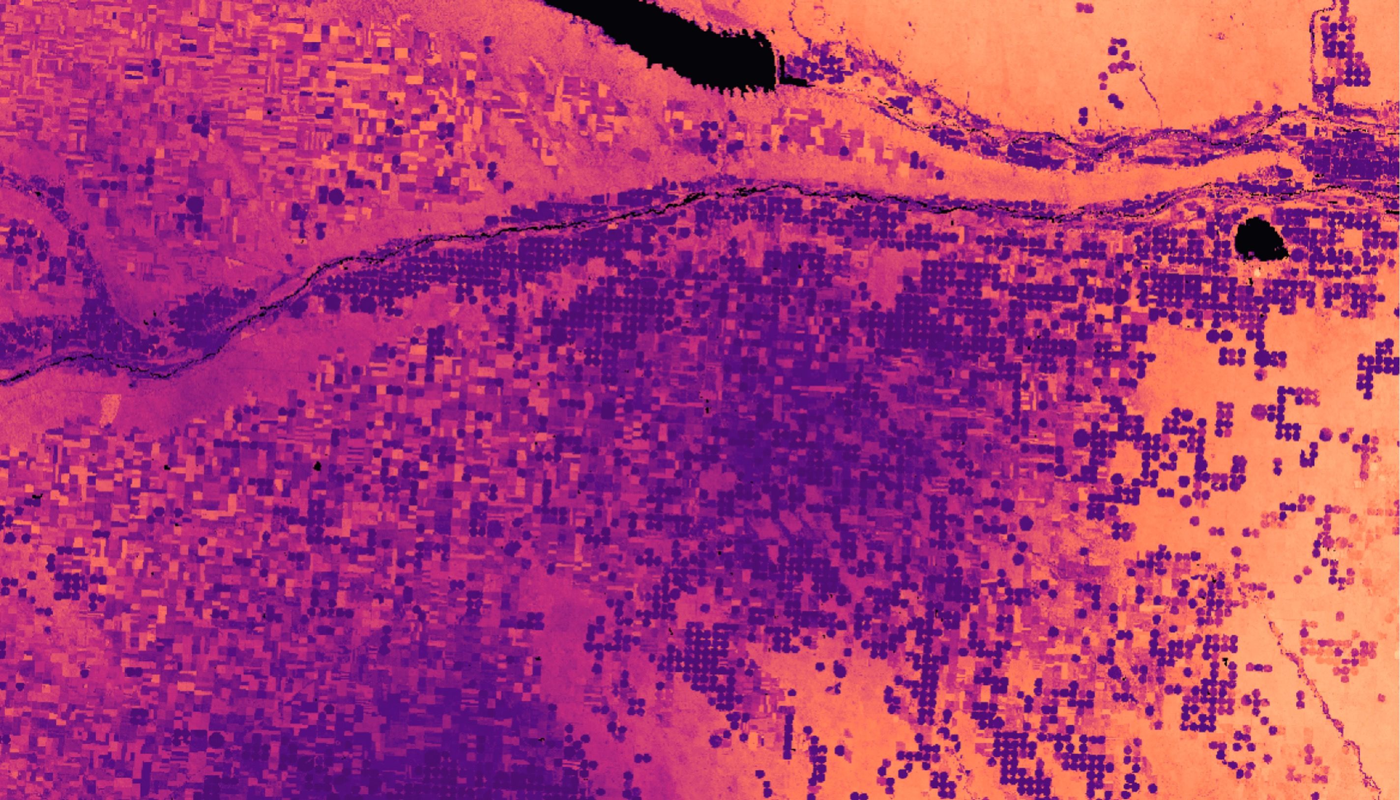
PLANETARY VARIABLES
Analysis-ready data powered by remote sensing for water, temperature, carbon, and vegetation
Data sources from across the electromagnetic spectrum, including optical, radar, passive microwave, and lidar sensors, reveal different aspects about Earth’s physical properties. By fusing these distinct sources together, Planetary Variables unlock actionable insights.


Water
Daily observations of Soil Water Content across the globe at 100 meter and 1 km resolution.

Crop Health
Easy-to-implement, cloud-free Crop Biomass data delivered daily at 10 meter resolution.


Temperature
Accurate, continuous insight into Land Surface Temperature at 100 meter and 1 km resolution.

Forest Carbon
Quantifying aboveground Forest Carbon at less than 5 meter resolution.

Forest Structure
Monitor changes in woody vegetation canopy height and canopy cover at less than 5 meter resolution.
GET IN TOUCH
Interested in learning more? Reach out to your account executive or contact our team below.
© 2024 Planet Labs PBC. All rights reserved.
| Privacy Policy | California Privacy Notice |California Do Not Sell
Your Privacy Choices | Cookie Notice | Terms of Use
