Topics
News
Stories
Tech
Publications
All Articles
View All Posts
All
News
Stories
Tech
Tech
Planet Enables Self-Service Purchasing for Small Customers on Planet Insights Platform
Grega Milcinski
|
May 8, 2025
|
7 min read
Read more
Stories
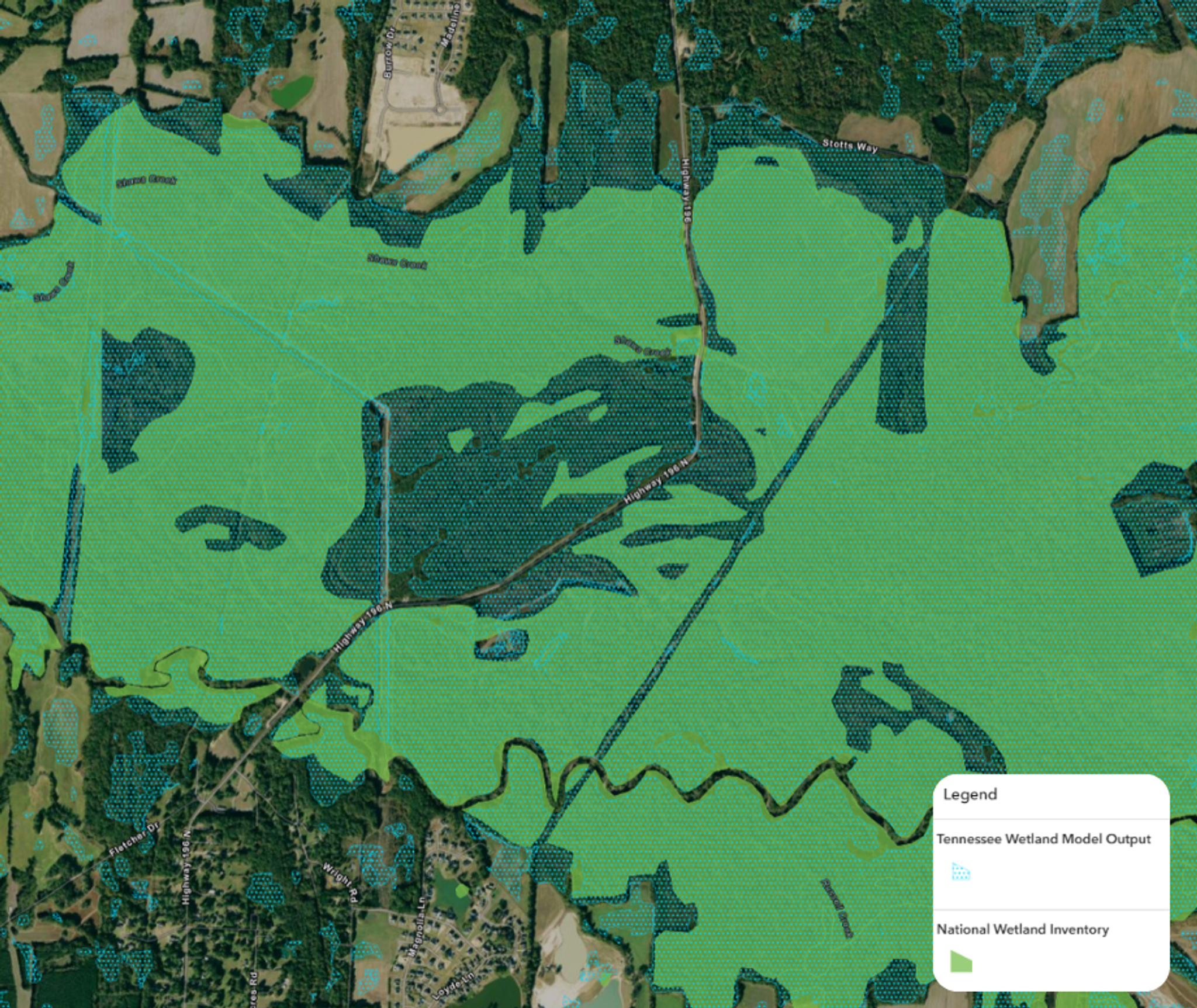
Revolutionizing Wetland Mapping and Monitoring With Skytec's Ranger Platform
Ariana Sexton
|
May 1, 2025
|
3 min read
Read more
Stories
EO-Powered Energy and Infrastructure Intelligence for Earth Day 2025
Janeth Fule
|
April 22, 2025
|
4 min read
Read more
Stories
Earth-i Unlocks Market Insights With Planet Data and AI
Ariana Sexton
|
April 17, 2025
|
3 min read
Read more
Stories
How Colombia and Brazil Tackle Crime in Vast Protected Areas
Planet Labs PBC
|
April 8, 2025
|
4 min read
Read more
Tech
Sharper. Faster. More Responsive Than Ever: Next Generation High-Resolution Pelican Imagery
Planet Labs PBC
|
March 27, 2025
|
6 min read
Read more
Stories
Forests, Food, and Frequent Satellite Data for International Day of Forests 2025
Janeth Fule
|
March 21, 2025
|
3 min read
Read more
News
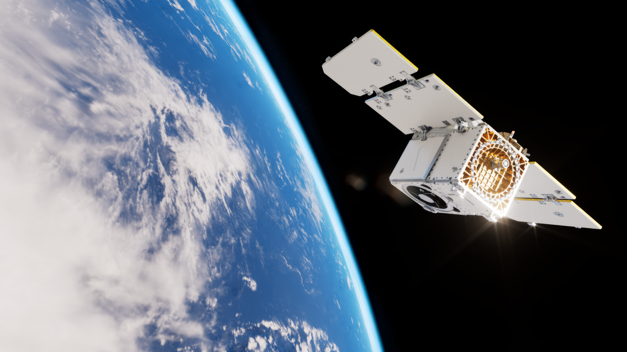
First Light Imagery From Pelican-2 Released
Planet
|
March 20, 2025
|
5 min read
Read more
News
Global Renewables Watch - a Living Atlas of the World’s Renewable Energy - is Now Live to the Public
Planet Labs PBC
|
March 20, 2025
|
3 min read
Read more
Tech
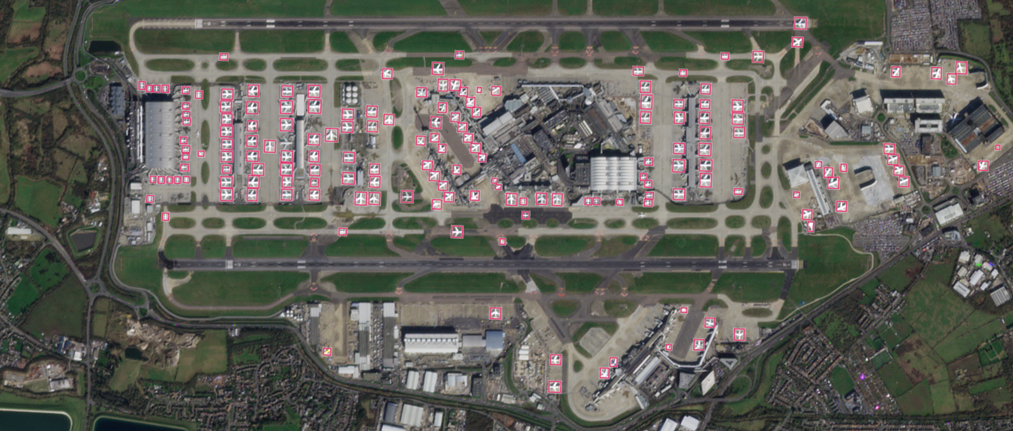
Aircraft Detection at Planetary Scale
Adam Van Etten
|
March 19, 2025
|
5 min read
Read more
Tech
Revolutionizing Agriculture Insurance With Satellite Data: Watch the Webinar On Demand
Mariah Hauck
|
March 19, 2025
|
3 min read
Read more
News
SynMax Intelligence Enhances Maritime Domain Awareness with Daily Satellite Imagery, Expert Analysis, and Advanced AI Models
Ariana Sexton
|
March 12, 2025
|
3 min read
Read more
View More Posts