How Governments Can Reduce Wildfire Risk Before Ignition

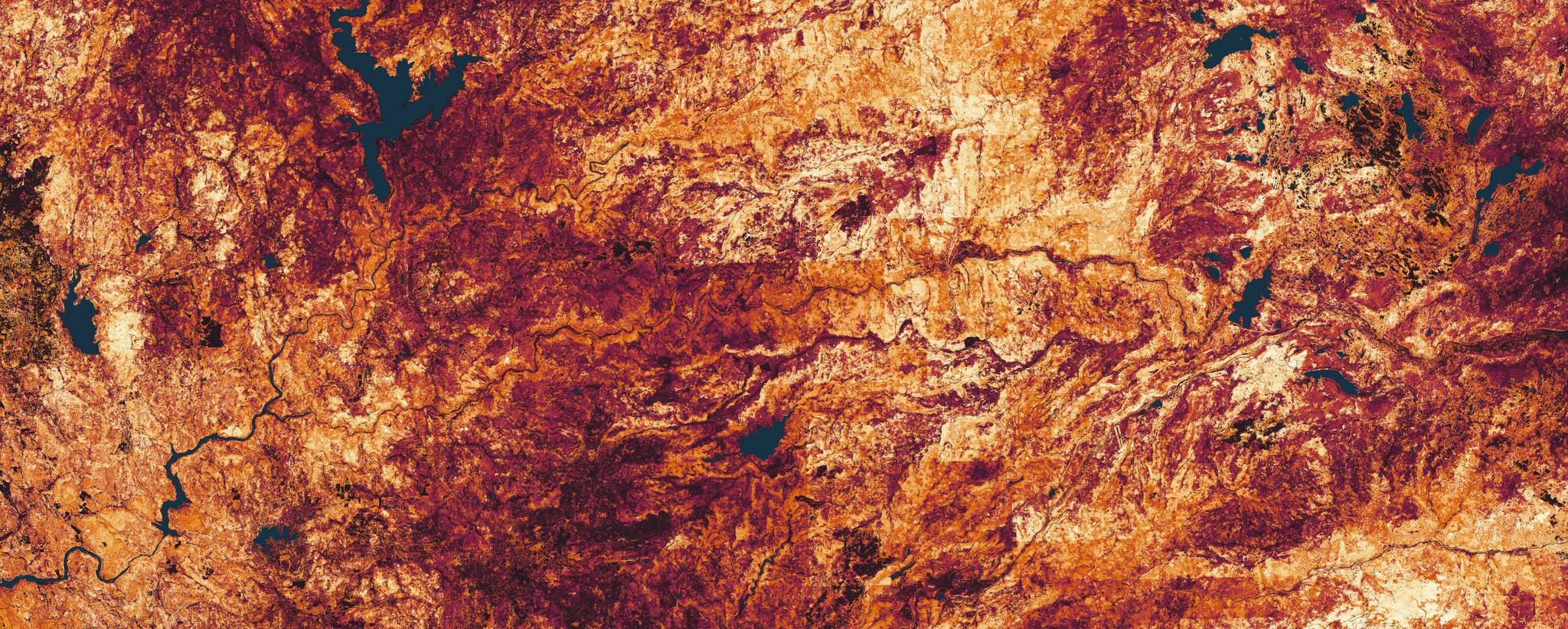
Planet wildfire hazard data over Northern California. Brighter yellow areas have a higher level of hazard. Water data mask source: USGS.
TechWildfire preparedness is often measured by response capacity. But the conditions that drive extreme fires are visible long before the first spark.
Governments invest heavily in wildfire response, from crews and aircraft to incident command structures and community alerting capabilities. This is understandable, as media, public scrutiny, and budgets often concentrate on response. But as wildfire seasons become longer and more destructive, a difficult question is emerging: is better response enough?
Wildfire risk does not begin at ignition. It builds over time through vegetation growth, fuel accumulation, drought stress, seasonal drying, and expanding development in the wildland-urban interface. By the time a fire is detected, many of the conditions that determine its severity are already in place.
The opportunity for governments is to shift more attention to earlier in the wildfire cycle, to managing the conditions that make extreme fires more likely. Satellite-derived data and high-resolution risk models can provide the visibility agencies need to enhance preparedness strategies and reduce wildfire risk.
The Visibility Gap in Wildfire Risk Reduction
Most agencies already recognize the importance of mitigation. Fuels management, defensible space programs, prescribed burns, vegetation thinning, utility corridor management, and community preparedness all help reduce wildfire risk.
The challenge is not intent. It is visibility.
Mitigation programs are often difficult to monitor at scale. Field inspections and aerial LiDAR surveys are essential, but they are expensive, time-consuming, and hard to repeat across vast and varied landscapes. Public datasets provide important baselines, but they often lack the updates and resolution needed to capture rapid vegetation change or localized fuel buildup. This creates a gap between wildfire policy and the reality on the ground.
California’s defensible space regulations are a useful example. Public Resources Code 4291 requires property owners in relevant fire-prone areas to maintain defensible space around structures. But monitoring compliance across hundreds of thousands of parcels is a major operational challenge. The issue is not whether mitigation rules exist, but whether agencies can see, at scale, where those rules and strategies are being followed, maintained, or falling short.
Without frequent visibility, mitigation can become fragmented. Agencies may know where risk exists in theory, but not where conditions are changing fastest, where treatments are needed most, or whether completed work is reducing risk over time.
Enhance Visibility Into Vegetation Change
Wildfire risk is dynamic; vegetation grows, dries, recovers, and regrows. Conditions can change quickly during drought, after storms, or following earlier fuel treatments. That means agencies need more than a static map of risk. They need the ability to monitor change.
Planet helps agencies do this by transforming near-daily satellite imagery into analysis-ready data that reveal changing vegetation conditions on the ground.
By applying AI to high-resolution satellite imagery, Planet can help agencies achieve detailed vegetation assessments across broad areas, without the cost and complexity of repeated airborne surveys. These layers are designed to help agencies move beyond simply seeing the landscape, to understanding how fuel conditions are changing over time — from broad patterns of vegetation growth and drying to fine-scale risks around individual trees, structures and infrastructure.
This includes the ability to assess vegetation cover, monitor green-up and dry-down patterns, evaluate fuel characteristics such as tree height and density, and track live fuel moisture across broad areas. Together, these insights can help agencies understand where vegetation is increasing, where fuels are drying, and where changing ground conditions may contribute to elevated wildfire risk.
Take the 2024 Park Fire in California. Using Planet AI-derived insights, it is possible to examine how vegetation conditions changed in the area before ignition. This kind of visibility can help agencies examine how risk factors were changing before the event and identify similar patterns across other priority areas.
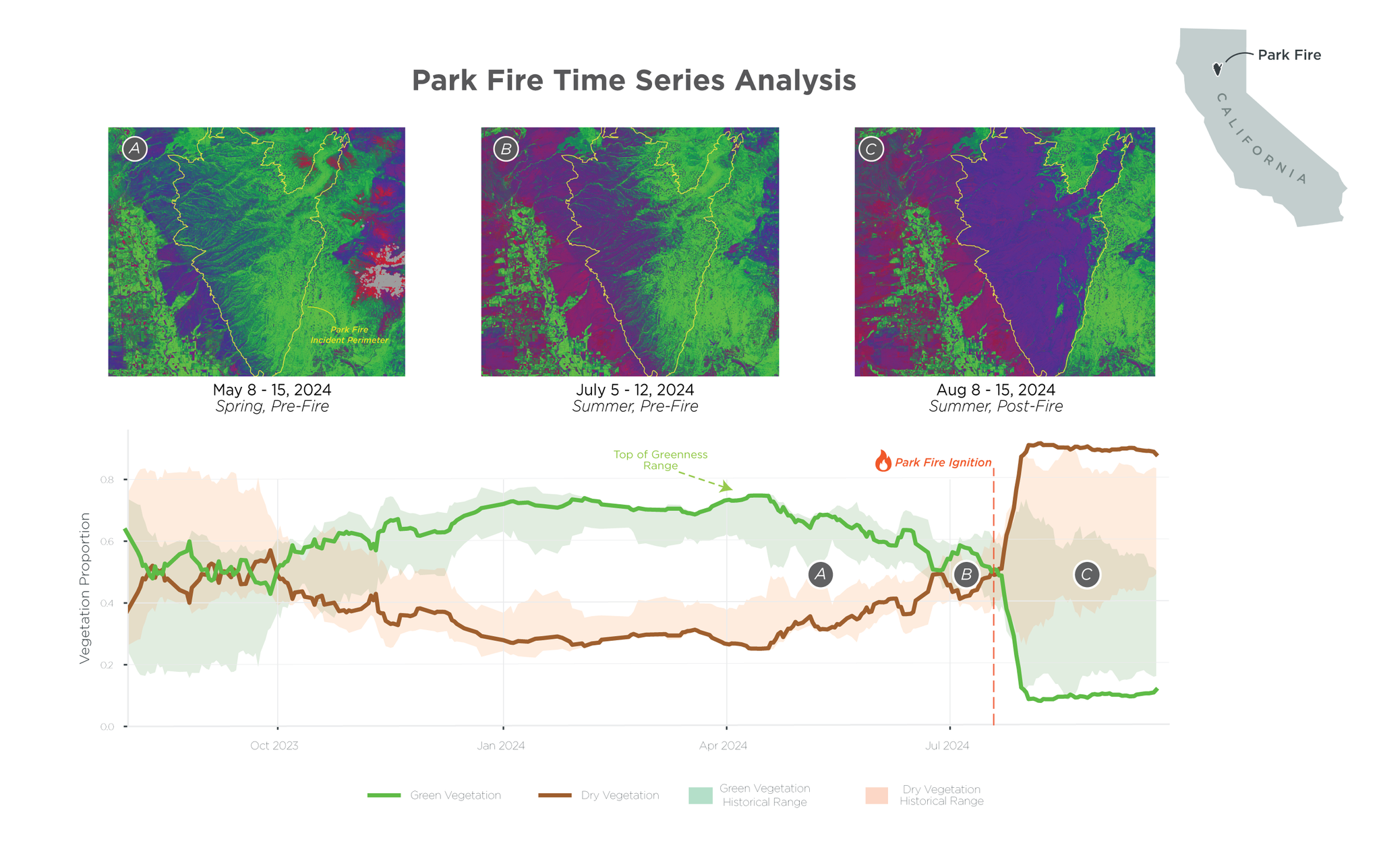
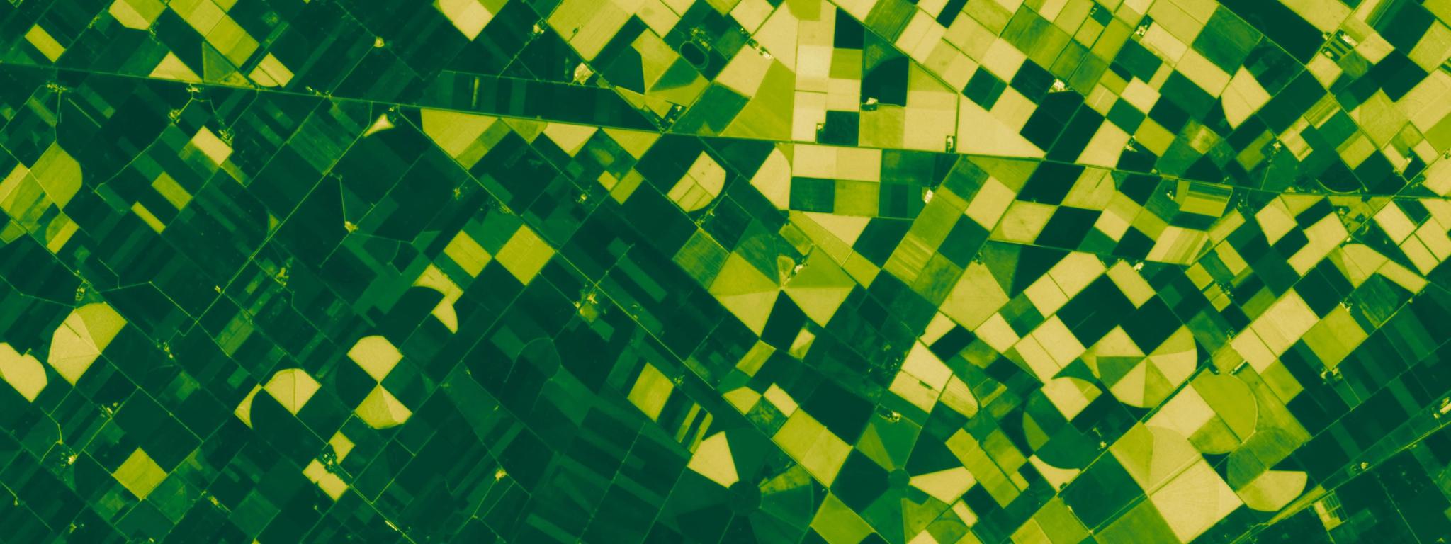
Planet 3 m vegetation cover data showing level of green and dry vegetation in the 12 months prior to ignition.
The same capability can also support compliance with wildfire mitigation policies and risk-reduction strategies. For example, agencies and infrastructure operators need to understand where vegetation may be encroaching into clearance zones, where defensible space requirements may not be met, or where planned fuel treatments have not yet been completed. Frequent monitoring can help teams identify potential gaps earlier and prioritise field verification where it is most needed.
Move From Static Models to Dynamic Intelligence
Risk models are essential to wildfire planning. They help agencies understand hazards, prioritise investments, and communicate risk to stakeholders. But models are only as useful as the data behind them.
Many public wildfire datasets, such as LANDFIRE in the United States, are invaluable. However, they are limited by update frequency, spatial resolution, or the difficulty of capturing fine-scale changes near homes, roads, utility corridors, and other infrastructure. In the wildland-urban interface, small changes can matter. Vegetation between structures, regrowth after treatment, or encroachment near powerlines can all influence ignition risk and fire behaviour.

Comparison of periodically updated, 30 m LANDFIRE vegetation fuels with quarterly-updated, 3 m Planet vegetation fuels for wildfire assessment and modeling. (Structures data source: Overture Maps Foundation, overturemaps.org.)
Instead of being bound to the limits of public datasets, agencies can use frequent satellite data to keep models and mitigation plans aligned with what is happening on the ground. This does not replace existing models or field expertise. It strengthens them by adding a more current, observable layer of evidence. For example, utilities and public agencies can use Planet AI-powered solutions to identify where vegetation may pose grow-in or fall-in risks near communities and critical infrastructure.
This same principle applies to statewide hazard assessment. The California Forest Observatory offers another example of how satellite-based monitoring can improve wildfire hazard assessment. By combining information on forest structure, canopy cover, surface fuels, weather, topography, and infrastructure, it provides a more detailed view of wildfire risk across the state. When higher-resolution Planet Mosaics are used, assessments can be produced with 10x greater spatial detail, supporting more targeted fuel treatment, preparedness, and restoration planning.
Reducing Risk Before Response Begins
Investing in wildfire response will always be essential. But response capability should not be the only measure of wildfire readiness. The bigger opportunity lies earlier in the cycle: seeing risk as it builds, acting before ignition, and verifying whether mitigation efforts are changing outcomes on the ground.
For agencies looking to strengthen wildfire preparedness, a useful starting point is to re-examine recent fire seasons and compare what was visible in the landscape before ignition with what existing monitoring systems and risk models were able to surface at the time. Planet’s wildfire experts can help you assess recent events, compare satellite-derived insights with existing risk models, and identify opportunities to improve pre-fire risk reduction strategies.
Talk to a Planet expert, today.