

How Is Satellite Imagery Used for Decision-Making Across Industries?

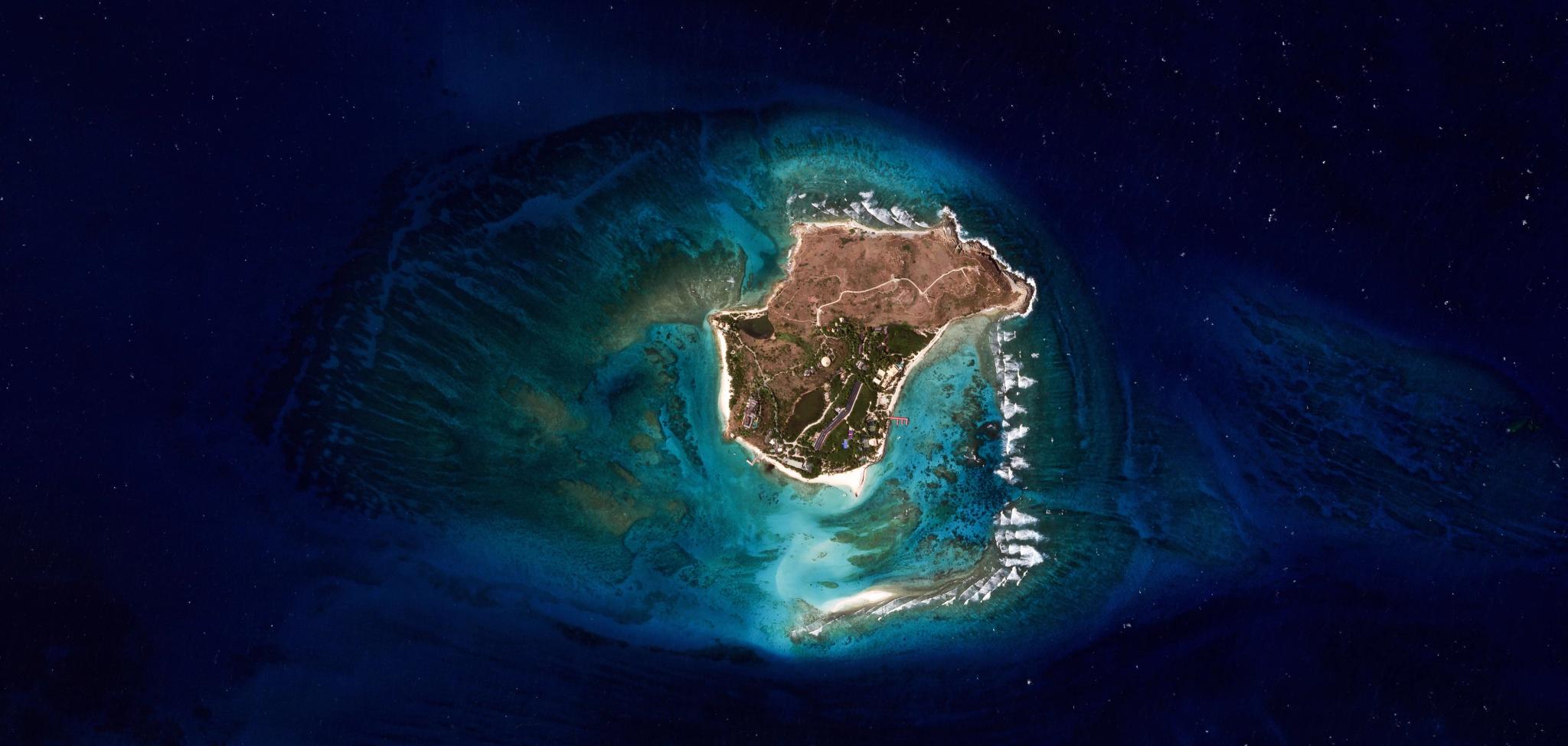
SkySat image of Necker Island in the British Virgin Islands, captured June 14, 2026. © 2026 Planet Labs PBC. All Rights Reserved.
EducationThroughout history, humans have used a view from above to inform decisions made below. From the earliest cartographers scaling peaks to map the unknown, to the birth of aerial photography in World War I, humans have always known that distance can create clarity. Today, that perspective has shifted from the skies to the stars. Satellite imagery has become a critical tool for detecting, understanding, and responding to change across the Earth’s surface.
And what makes satellite imagery valuable isn't just the view, it’s the frequency. With fleets of satellites capturing images on a near-daily basis, decision-makers are no longer operating on outdated assumptions. They have access to a continual, living record of global activity to help quantify change, validate threats, or minimize risk. Let’s look at some examples of how satellite imagery can be used to make data-driven decisions in different industries and government agencies.
How Commercial Industries Use Satellite Imagery
While the universal benefit of satellite imagery is to monitor and understand change across time, each industry applies these insights to different use cases — here are a few.
Agriculture
Commercial agriculture companies (from growers and ag retailers to seed companies, commodity traders, and CPGs) use satellite imagery to de-risk operations, optimize input costs, and build supply chain transparency.
| Precision agriculture |
|
| Crop health monitoring |
|
Insurance
Insurance companies use Earth observation insights to improve underwriting and streamline loss adjustment.
| Drought and disaster monitoring |
|
| Disaster response optimization |
|
Energy and Infrastructure
Analysts use satellite data to oversee assets and monitor their competition.
| Utility wildfire hazard management |
|
| Asset monitoring |
|
How Governments Use Satellite Imagery
Governments face a range of complex pressures, many of which are accelerated by environmental change and economic uncertainty. Planet satellite imagery helps them observe, quantify, and analyze changes on the ground over vast areas, bringing leaders a multidimensional view of change as it’s happening.
Civil Government Agencies
Earth Observation data is playing a more central role across government operations and decision-making.
| Disaster preparedness and recovery |
|
| Permitting and enforcement |
|
Defense and Intelligence
Commanders, operational planners, and intelligence professionals rely on global imaging for near-real-time unclassified insights.
| Situational awareness |
|
| Infrastructure and asset monitoring |
|
With satellite imagery, industry and government leaders are able to see the big picture, take a closer look when needed, and advance their strategic priorities.
A comparison of these two satellite images reveals structural upgrades, including new construction, freight activity, and expanding waste deposits, at North Korea’s Pyongsan uranium plant. The image on the left was captured on January 21, 2026 and the one on the right is four months later, on April 7, 2026. Profiled in the Daily NK (https://www.dailynk.com/english/north-korea-pyongsan-uranium-refinery-satellite-imagery-2026/).
Learn More
Planet owns and operates the largest fleet of commercial Earth imaging satellites in history. To learn more about how Planet satellite imagery supports data-driven decisions, read the questions and answers below, or visit the Planet website.
Questions You Might Have
What you are able to see in satellite imagery depends on many factors, including the spatial resolution and the spectral bands (or data layers) recorded by the sensor. These technical capabilities are unique to each constellation, which makes some satellites better at capturing certain conditions or objects than others.
When just considering spatial resolution:
Low-resolution satellites can often see a large swath of the Earth, monitoring global trends like weather.
Medium-resolution satellites can detect a wide range of change, from agricultural activity like plowing or harvesting to progress in infrastructure construction.
High-resolution satellites can take a closer look to detect smaller things like aircraft or vessels.
And by combining satellite imagery with other Earth observation data it’s possible to measure conditions on the Earth’s surface, like soil moisture, surface temperature, biomass, canopy height, and carbon.
Key Takeaway: Depending on the spatial resolution, satellite imagery can be used to analyze patterns across broad areas or identify objects as small as aircraft in a more refined area of interest.
Satellite data tracks physical changes that serve as indicators for broader economic health and market shifts. For example, analysts can monitor the activity levels at major shipping ports to estimate trade volume. Or the expansion of industrial sites provide clues about production capacity before official reports are published.
These visual cues allow investors to build models based on observed behavior rather than lagging indicators. This objective oversight provides a clear picture of how markets are functioning in near-real time.
Key Takeaway: Physical indicators like port activity and industrial expansion serve as real-time proxies for economic growth and market performance.
Businesses and government agencies use satellite imagery to gain situational awareness and validate reports from the field. For example, a local government might use high-frequency imagery to monitor urban sprawl or check the progress of public works projects without sending crews to every site, including difficult to reach or remote locations.
Private companies use the same data to assess risk for insurance purposes or to plan the placement of new facilities based on land use patterns. This constant stream of visual information helps officials respond to events with greater speed and precision. It creates a reliable record of change that supports long-term planning and accountability.
Key Takeaway: Organizations use satellite data to validate ground reports and monitor projects to improve the speed and precision of their planning.
In the logistics sector, satellite imagery helps managers track the movement of goods and the condition of critical transport links. Companies monitor port congestion and vessel traffic to optimize supply chain routes and avoid costly delays.
For infrastructure, utilities use periodic imagery to inspect thousands of miles of power lines and pipelines for encroaching vegetation or ground subsidence. This remote inspection capability reduces the need for expensive helicopter flyovers or manual ground patrols in difficult terrain. In addition, oil and gas companies monitor global operations using satellite imagery to detect methane leaks. Continuous monitoring helps maintain the integrity of vital networks and prevents small issues from becoming major failures.
Key Takeaway: Remote monitoring of transport links and utility lines helps logistics companies optimize routes and maintain infrastructure integrity at a lower cost.
Earth observation provides a transparent view of global events that is essential for maintaining security and understanding geopolitical shifts. Government agencies use satellite images to monitor border regions and verify compliance with environmental or peace treaties. By providing an unedited view of the ground, satellite technology helps prevent misinformation from shaping public perception of critical events. This transparency supports more stable international relations by providing all parties with the same set of facts.
Key Takeaway: Satellite imagery promotes global transparency and security by providing unedited evidence of events in restricted or remote regions.

Ready to Get Started
Connect with a member of our Sales team. We'll help you find the right products and pricing for your needs.