Putting Tanager to the Test With Independent USGS Evaluation of On-Orbit Performance

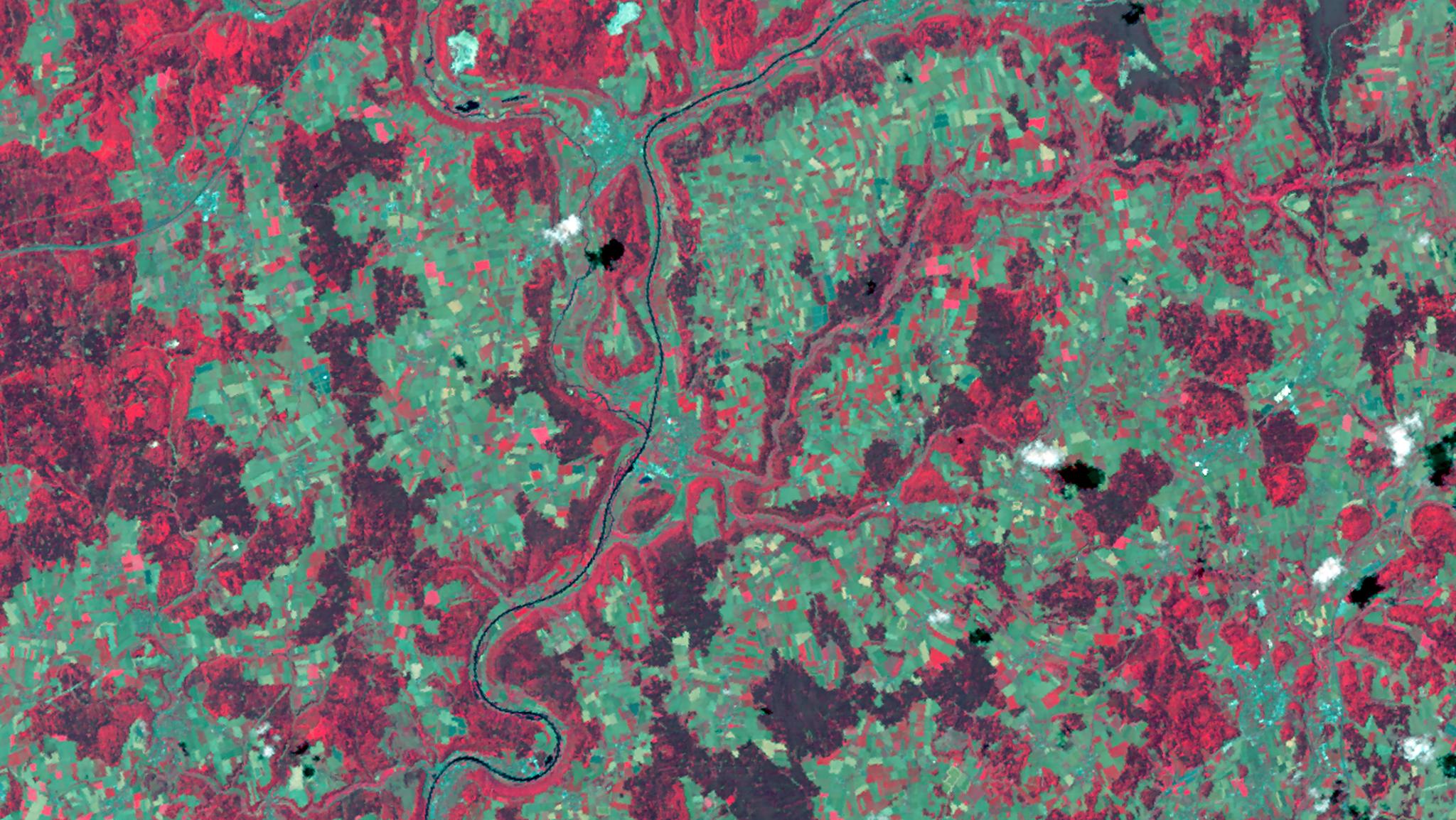
Tanager image of the Franconian Jura mountains in Germany, captured July 11, 2026. The color-infrared (CIR) composite highlights healthy vegetation in red. © 2026 Planet Labs PBC. All Rights Reserved.
NewsPublic satellite missions like Landsat, jointly managed by NASA and the USGS, set the standard for data quality in Earth observation. This is in part because the USGS evaluates all satellite sensor performance with independent procedures, so the research community gets an unbiased read on what a satellite can actually deliver.
The USGS recently put Tanager-1, Planet’s hyperspectral satellite, through this evaluation, comparing it against Landsat and instrumented ground calibration sites, and published the results in full. This is timely, as Tanager-2 has shipped to the launch site, and will expand one proven satellite to a constellation. But more satellites only matter if the data holds up.
Every Material Leaves a Fingerprint
Hyperspectral imaging identifies what's on the ground by reading the fingerprint that every material leaves across the electromagnetic spectrum — the mineral in an outcrop, the plant species in a field, the gas in a plume. Five characteristics must be right for that to work. Here's what the USGS found for each.
The Bands Align to Within a Tenth of a Pixel
Band-to-band registration is the degree to which pixels from different wavelength (bands) line up over the same part of the ground. If they drift apart, the spectrum for a given pixel becomes a blend of several places at once, and no longer matches reality.
The USGS found the bands aligned to within about a tenth of a pixel, which means every wavelength samples the same spot on the ground.
Tanager Scenes Stack Cleanly on Landsat
Image-to-image registration is how well one image lines up with others of the same place, either from Tanager on a different date, or different satellite entirely. Strong image-to-image registration allows analysts to compare the same field, glacier, or facility over time and between sensors.
Compared against Landsat, Tanager's pixels landed less than half a pixel apart, roughly 6 to 12 meters — close enough to overlay the two and compare pixel for pixel without significant realignment.
Radiometry Tracks Known Standards Closely
Radiometric accuracy refers to whether the brightness values Tanager reports are correct in absolute terms, not just consistent with themselves. This is important because it means the data can be used to quantify gasses in the atmosphere or measure the reflectance of the surface accurately. All the incredible downstream applications of hyperspectral data rely on the integrity of these values.
When compared to ground stations and Landsat, Tanager's brightness measurements tracked both closely. A perfect match would be a slope of 1 and 0 offset; the USGS found slopes of 0.830 to 1.066, with almost no offset at zero reflectance. This means images taken from different dates can be directly compared and combined with archival data.
Spectral Channels are Accurate to Under a Nanometer
Spectral calibration ensures that a sensor measures the specific range of wavelengths (or channel) that it is designed to capture. Accuracy is critical because the features that identify a material are very specific. For example, Neodymium, a rare earth mineral used to build electric motors, hard disks, and medical scanners, absorbs in a tight band near 740 nm. Algorithms can detect potential deposits of this mineral by looking for these absorption features. And if the channel drifts, a real signal will be missed.
Measured against a known oxygen absorption feature, the channels were off by less than a nanometer, on bands roughly 5 nm wide, so these narrow features stay where the algorithms expect them.
Small Features Stay Distinct
Spatial sharpness governs whether small features stay separate or blur into their surroundings. In practice, this determines whether an analyst can isolate a well pad from the site around it, or trace a plume back toward its source.
Using bridges and other structures with clear, linear edges, the USGS measured Tanager's sharpness to be 1.3 to 1.75 pixels, characterizing how narrowly it can focus a point of light. The system was sharpest when imaging in the shortwave-infrared wavelengths.
Why the Numbers Hold Up
The strong results reported in the USGS characterization closely mirror Planet's own validation (available to Planet customers through Planet Support). That performance traces back to how and why Tanager was built.
Tanager was born out of the Carbon Mapper Coalition, a public-private partnership led by the nonprofit Carbon Mapper with Planet, the Jet Propulsion Laboratory (JPL), research universities, and philanthropic funders, formed to find and track methane and CO₂ super-emitters globally.
That ambition demanded an exceptional instrument, and JPL has a long track record of cutting-edge design demonstrated through their airborne and space-based programs, such as the AVIRIS series, and EMIT aboard the International Space Station. Tanager's imaging spectrometer is their direct descendant, and the inheritance runs past the hardware. The Planet radiance pipeline is adapted from open-source EMIT code, with algorithm documents published and co-authored with JPL. Our calibration procedures follow methods refined there over 30 years.
It is all of this heritage coming together that makes the data usable, and ensures the methods are open and tested — both critical for research.
Public-Mission Standards, in a Scaled Commercial Mission
Carbon Mapper's global efforts to mitigate methane and CO₂ require a satellite constellation founded in rigorous and proven science, with the scale and speed of an operational program. The Tanager program brings this together, with an instrument lineage built on best-in-class science, on a growing constellation with at least three more satellites built and launched on an accelerated timeline by Planet.
And because the Tanager design has been characterized by USGS and the evaluation is independent and public, you don’t have to take our word for it: here’s the full report.
Want to explore the data now? Access our Open Data Catalog, licensed under CC-BY 4.0.
Interested in using Tanager data? If you’re a federally funded researcher interested in accessing Tanager through NASA’s Commercial Satellite Data Acquisition program (CSDA), email the program team directly at csda-support@nasa.gov to inquire about access.
For U.S. government employees, you may have access via the NRO’s Strategic Commercial Enhancements program. Please reach out to defense@federal.planet.com.
And for all other inquiries, including those working on an independent project or direct commercial partnership, please contact the Planet team.