
Planet Purpose Award Submissions Spark Innovation Ahead of Bali OTR
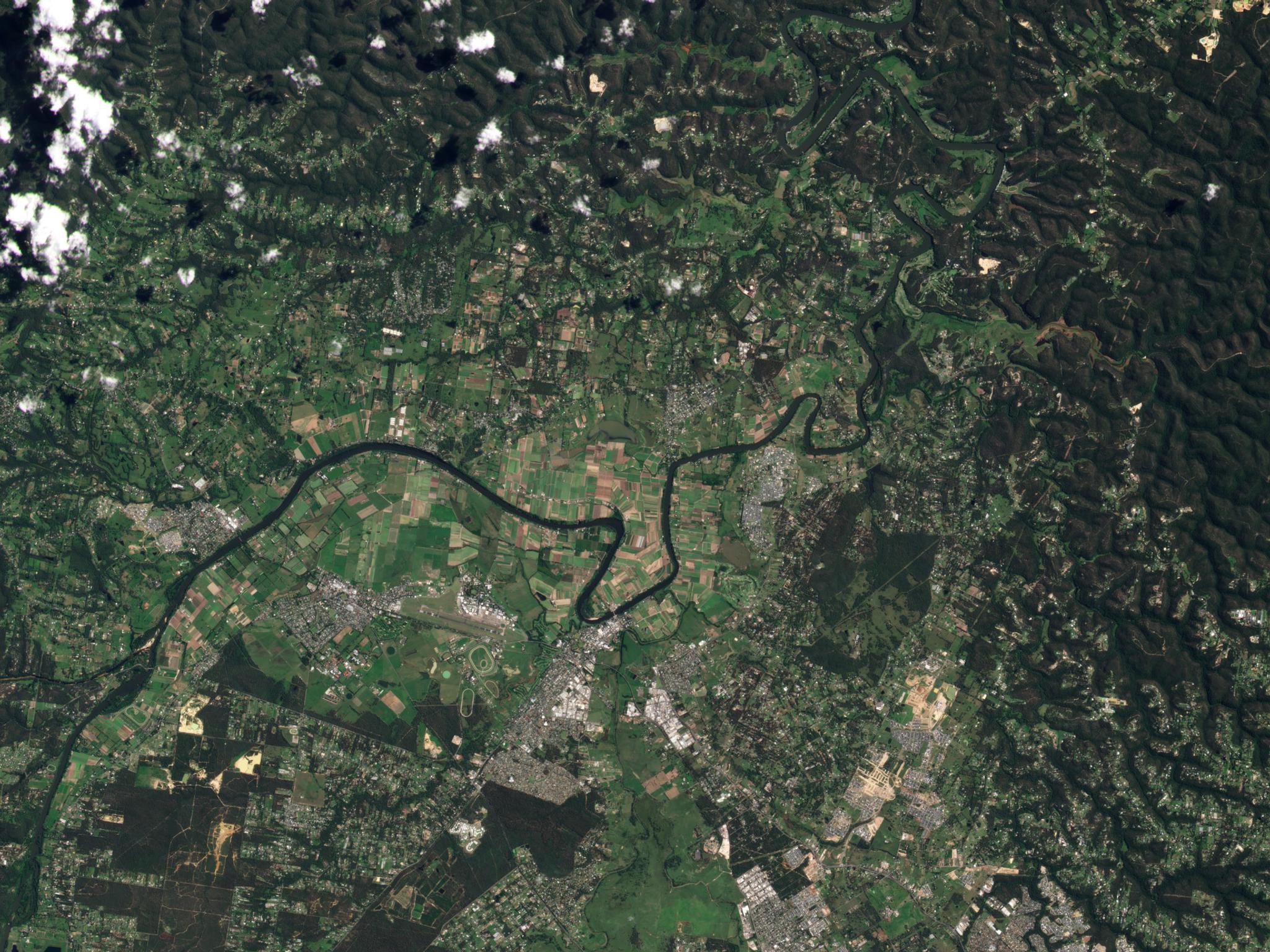
PlanetScope image showing flooding of the Hawkesbury River in Windsor, Australia captured March 3, 2023. © 2023 Planet Labs PBC. All Rights Reserved.
StoriesThe energy is building here at Planet as we gear up for our On the Road event in Bali, Indonesia on September 9, 2025! We're just weeks away from bringing together the key players in geospatial data, and we're thrilled to showcase the incredible innovation happening across the Asia-Pacific Japan (APJ) region.
Witness the Impact: Spotlight on the Business Impact Award Submissions
Submissions continue to roll in for the Planet Purpose Award: Business Impact. These entries highlight the results our partners and customers achieve with Planet data, driving significant business value through Planet's products—whether it's boosting revenue, streamlining operations, entering new markets, or realizing substantial cost savings.
Here's a glimpse at some of the solutions from our community:
- Creattura is Revolutionizing Sustainable Rice Farming: Rice fields, a daily staple for half the world's population, are a prominent source of human-caused methane emissions, a key component of agricultural greenhouse gases. Creattura is tackling this critical environmental challenge head-on. They're working with rice farmers to adopt modified irrigation techniques that cut methane emissions by as much as 50%. Using PlanetScope's daily, 3-meter resolution data, Creattura monitors irrigation activities across over 15,000 hectares in the Philippines, Thailand, and Japan. This allows farmers to receive financial incentives from carbon credits, generating over $1.8 million in direct farmer incentives and community benefits. Their use of Planet data not only delivers significant environmental impact but also creates substantial economic opportunities.
- NGIS is Empowering NSW Government with Comprehensive Imagery: NGIS has supported the New South Wales’ Department of Climate Change, Energy, Environment and Water (DCCEEW) with the establishment of the NSW Imagery Hub. This hub provides whole-of-government access to high-resolution Planet imagery, training, and support, enhancing critical decision-making across the state. From emergency management and bushfire recovery to monitoring illegal cropping and protecting fish habitats, NSW government agencies are leveraging PlanetScope and SkySat data. This program has proven incredibly valuable, with over 82% of survey respondents recommending Planet imagery to a colleague, and a 1,749% increase in streaming usage across NSW Government in just five months. This partnership highlights the power of accessible, high-quality satellite data in building social, environmental, and economic resilience.
- SI Analytics is Unlocking New Value with Super-Resolution: SI Analytics is pushing the boundaries of what's possible with satellite imagery through their SuperX solution. By integrating advanced deep learning-based super-resolution and denoising AI models with Planet imagery, SuperX can upscale low-resolution images by a factor of two or even four. This means PlanetScope imagery can be enhanced to Spot6-level resolution, opening up new high-value markets like defense, insurance, infrastructure, and precision agriculture. SuperX not only delivers a 20% reduction in image acquisition costs compared to traditional high-resolution alternatives but also improves object detection and change monitoring performance by 30-40%. This enhances the utility and cost-effectiveness of satellite data.
These examples are just a sneak peek into the impact you'll discover at Bali OTR. Our APJ community is at the forefront of leveraging Planet data for tangible business results and a better planet.
Haven't registered for the Bali On the Road event yet? Don't miss out on this chance to learn, connect, and witness these incredible success stories firsthand!
We can't wait to see you there!
Ready to Get Started
Connect with a member of our Sales team. We'll help you find the right products and pricing for your needs.