NewsNewsMonitoring Natural Disasters in the PhilippinesShelby Siegel |May 6, 2021|3 min readRead more
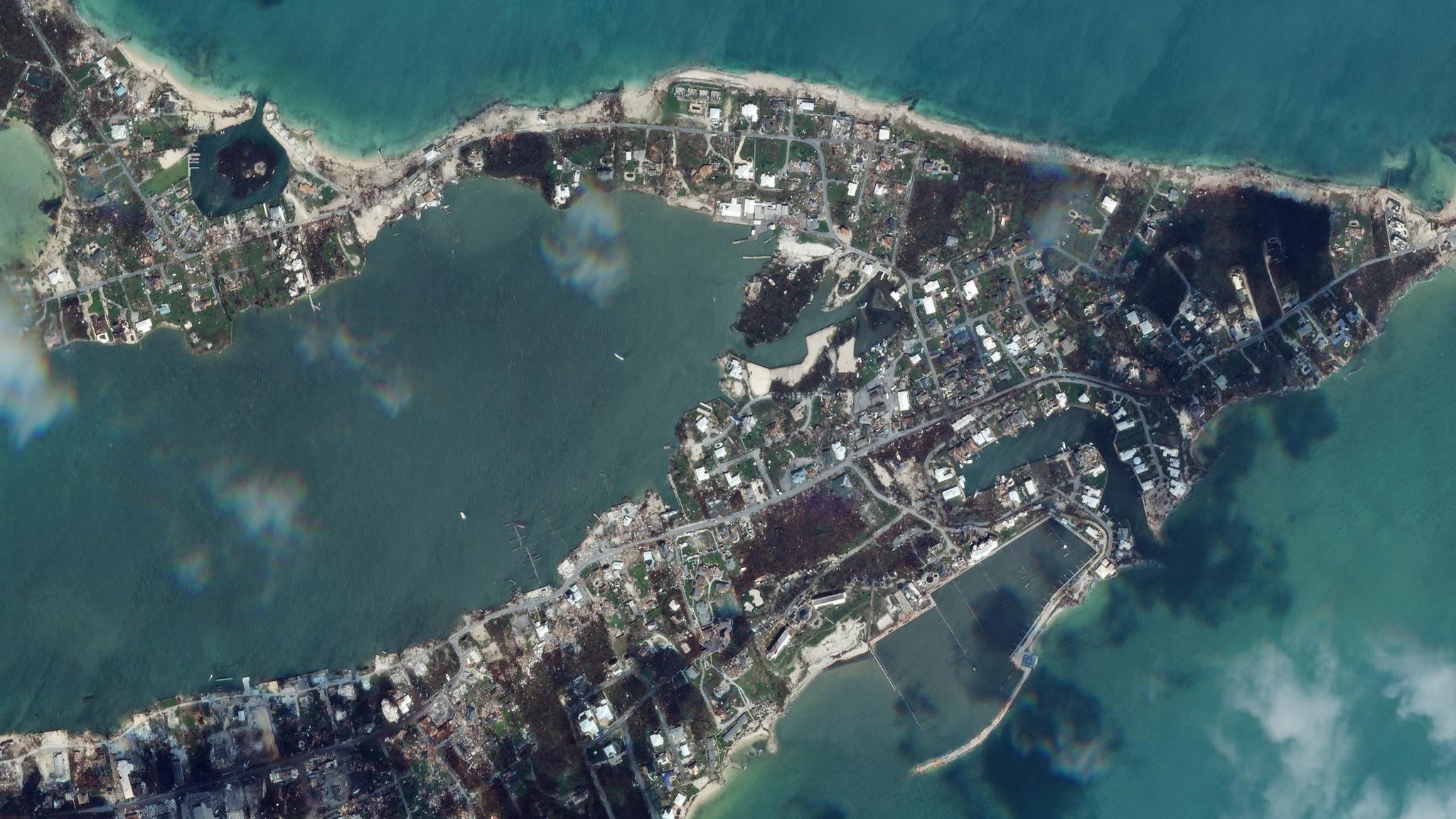
NewsNewsThe Atlantic braces for another busy hurricane seasonSarah Preston |May 24, 2021|3 min readRead more
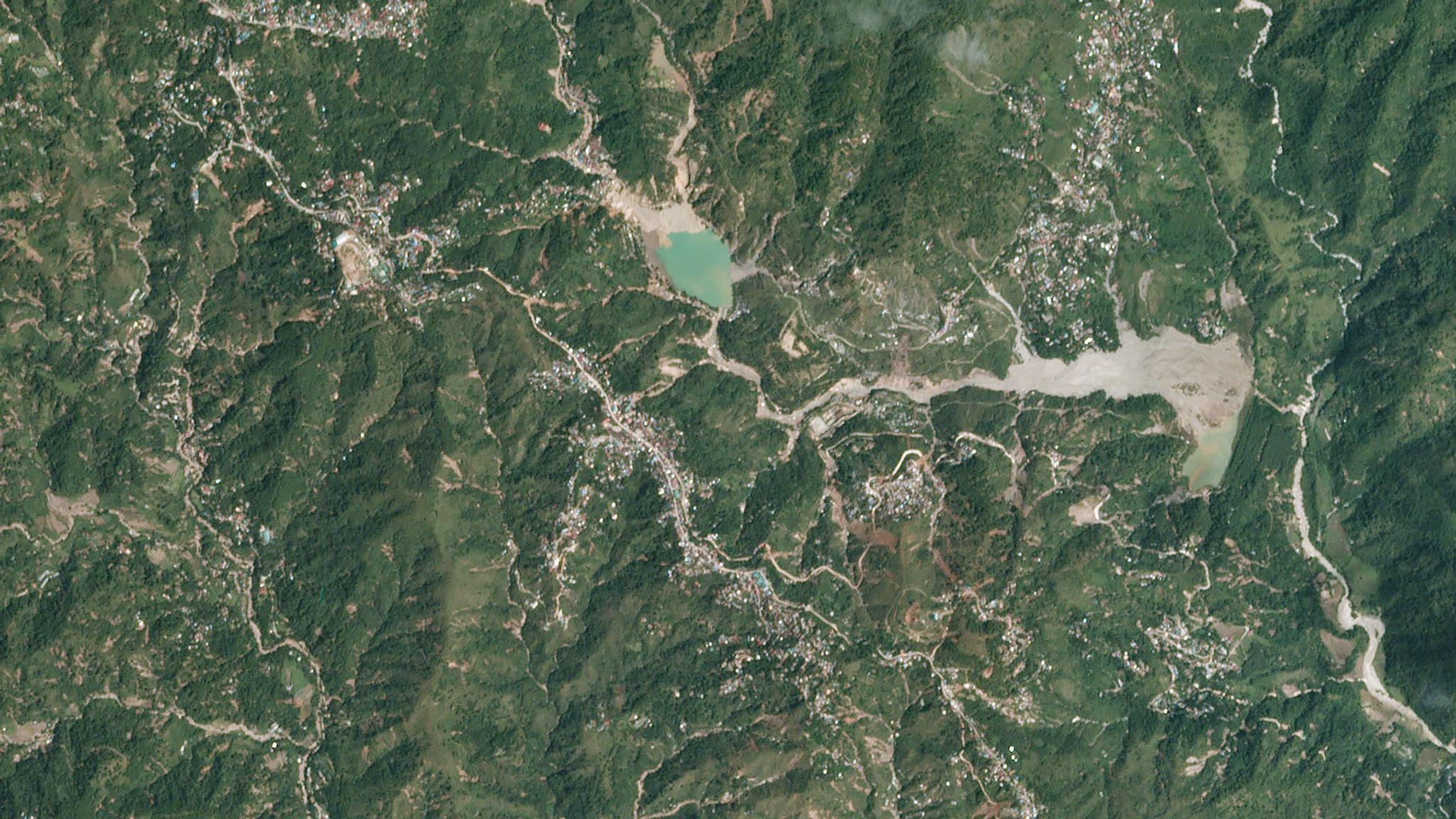
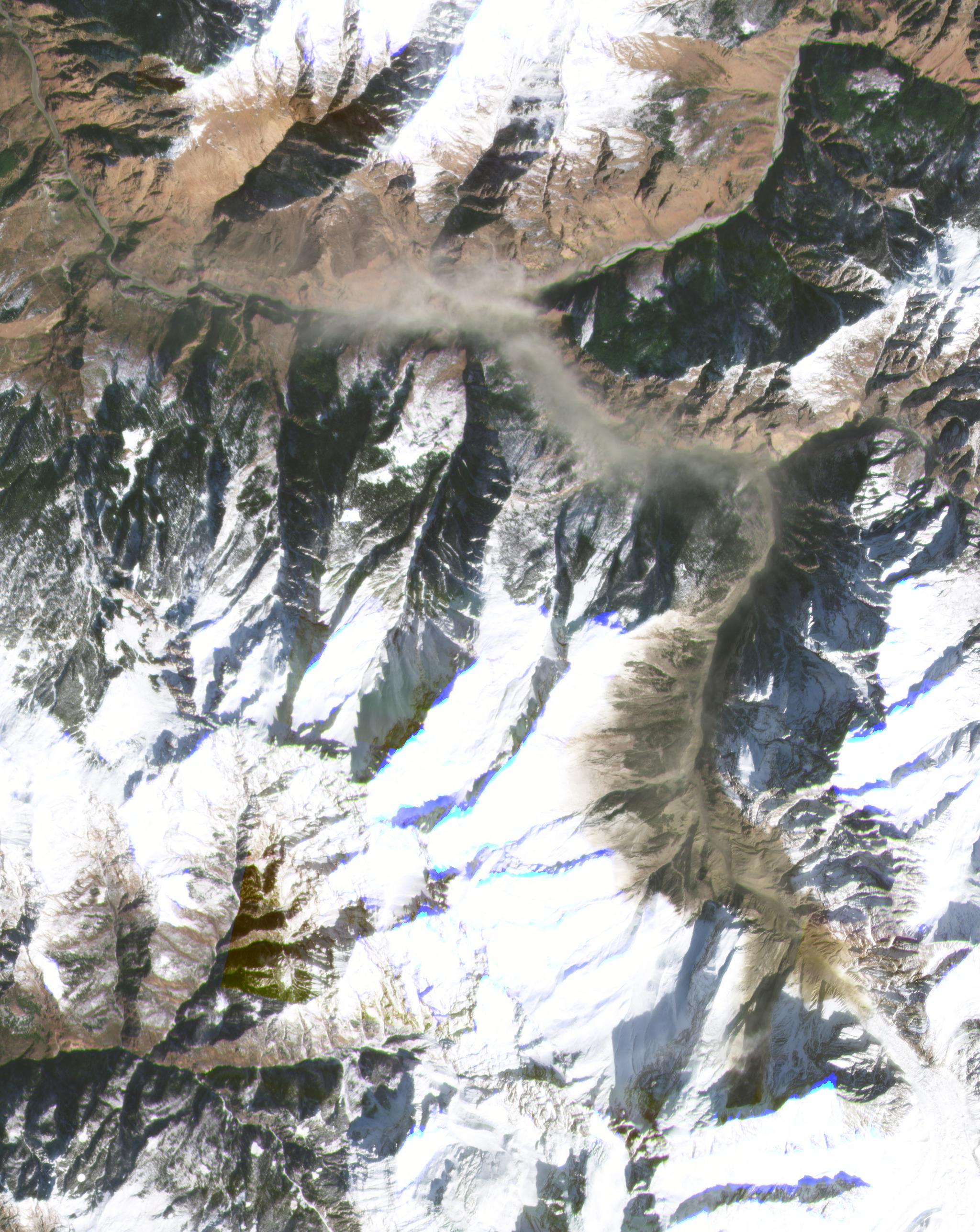
StoriesStoriesRapid Response Research: The Chamoli LandslideTanya Harrison |June 14, 2021|4 min readRead more