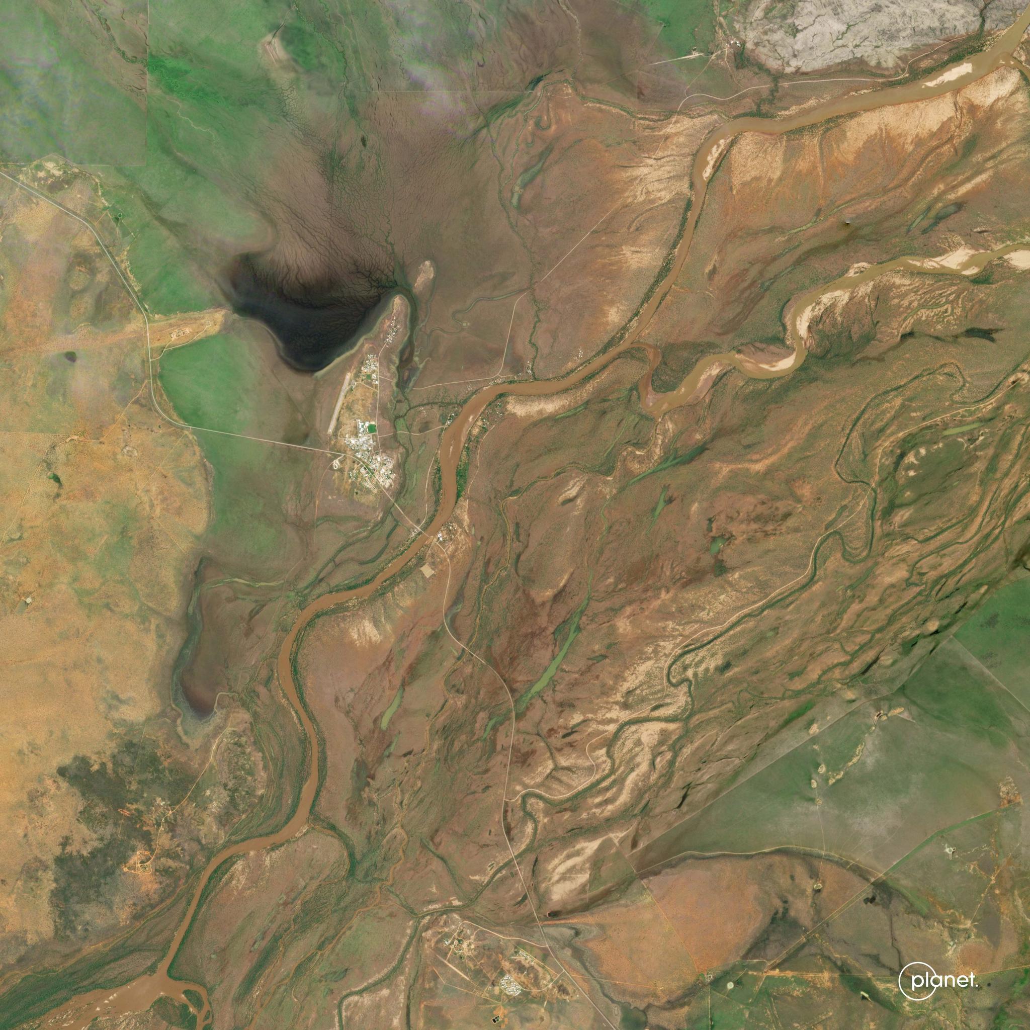
Boulder, July 13, 2016

flooding Blog Posts

Slingshot Aerospace Maps Flooded Areas following Hurricane Harvey

Stories

When Hurricane Harvey made landfall in Houston earlier this month, Slingshot Aerospace, a Planet Application Developer Program partner, leapt into action. Working with Team Rubicon and the BAE Systems Geospatial eXploitation Products™ (GXP®), Slingshot was able to use its flood detection algorithms on up-to-date satellite imagery to determine the extent of the […]

Protecting Queensland’s Natural Resources with Satellite Imagery

Stories

Queensland is home to nearly 5 million citizens and some of the earth’s most delicate ecosystems. At 1.8 million square kilometers, the region contains rare earth resources, unique biodiversity and sensitive coastlines neighboring the Great Barrier Reef. Protecting this vast natural landscape is the challenge of Queensland’s Department of Natural Resources and […]