Tracking the Ocean’s Great Forest: How Hakai Institute's Kelp Explorer Is Helping British Columbia Secure Its Coastal Heritage
This article was written in collaboration with the Hakai Institute.
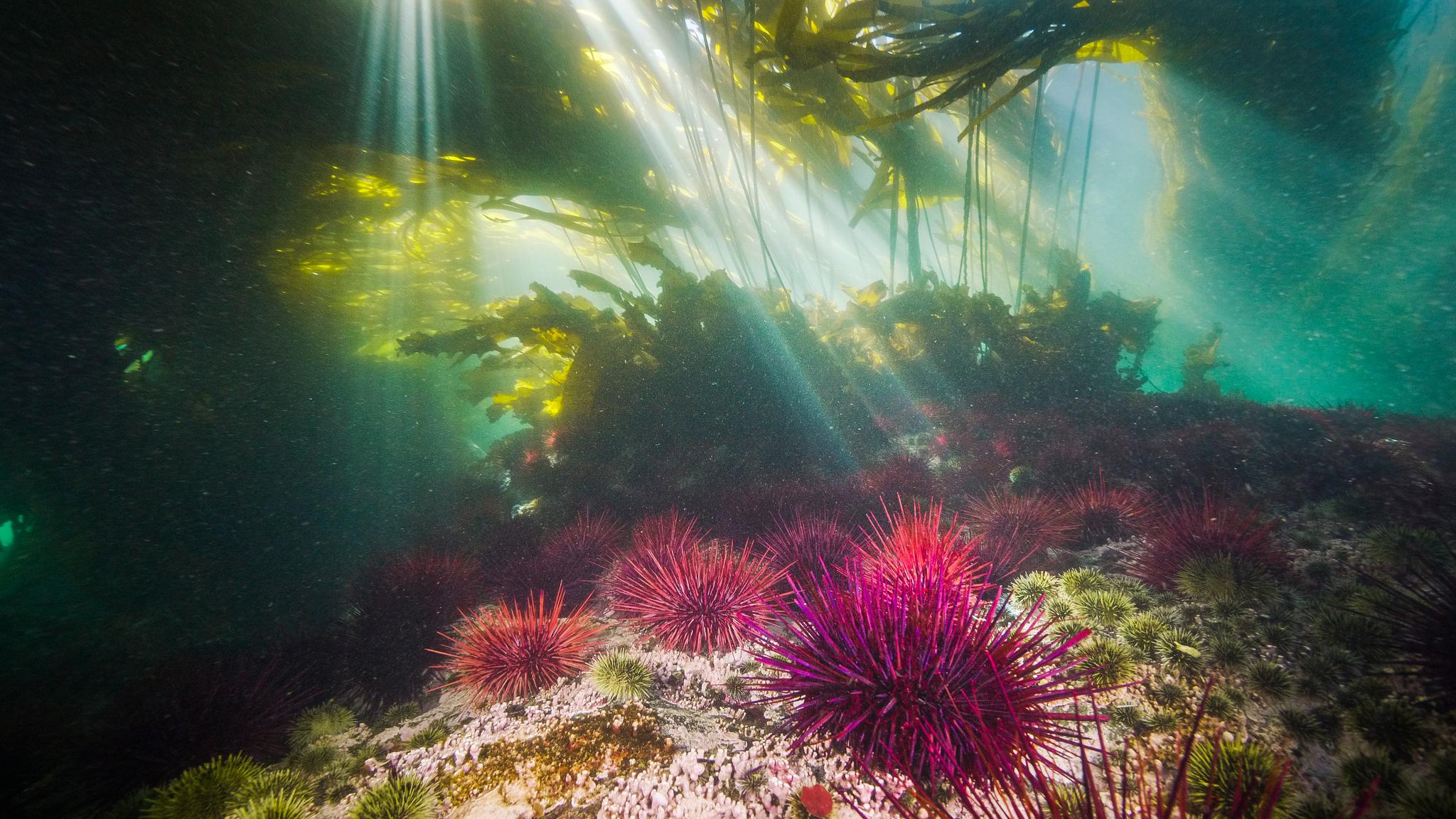
At low tide on the west coast of Vancouver Island, bull kelp blades float on the ocean surface in a buoyant, sun-catching canopy. They sway in the Pacific swell in a kaleidoscope of golds, blues, and browns. For the people who look after Pacific Rim National Park Reserve, these kelp forests are more than beautiful scenery; they are nurseries for fish, food for sea otters, a buffer against storm surge, and one of the best barometers of nearshore ocean health. But despite the crucial and interconnected role they play in the ecosystem, they can be a challenge to measure and manage.
“For Parks Canada and the First Nations and local communities we work with, kelp is a key ecosystem in nearshore marine waters that supports biodiversity. Our job is to measure and monitor the health of these systems, and to understand if they’re improving, stable, or declining, and what that means for the park reserves,” says Pacific Rim National Park Reserve ecologist Jennifer Yakimishyn. “Because we can’t be underwater or everywhere at once, we’re looking for innovative methodologies to reflect those ecosystems by tracking kelp canopies.”
The Hakai Institute is harnessing Planet imagery to help Yakimishyn, and many others across British Columbia, solve this problem. They developed Kelp Explorer, an online platform designed to help communities and organizations better understand and steward these rich kelp forests.
A Forest That Doesn't Stand Still
For a seaweed that creates large canopies, kelp can be surprisingly hard to keep track of. Bull kelp is an annual macroalgae, so a kelp forest can grow, shrink, and move from one year to the next – even under healthy conditions. Tides hide and reveal the canopy several times a day. And in British Columbia, the coast is long, convoluted, and often under cloud, inhibiting a full accounting at scale.
Seventeen First Nations communities and the B.C. government know first-hand how much work it takes to comprehensively inventory. When they began building a regional kelp monitoring program under the Marine Plan Partnership for the North Pacific Coast, a group of Coastal Guardian Watchmen went out by boat to record kelp along roughly 800 linear kilometres of coastline, logging what they saw over the course of a summer.
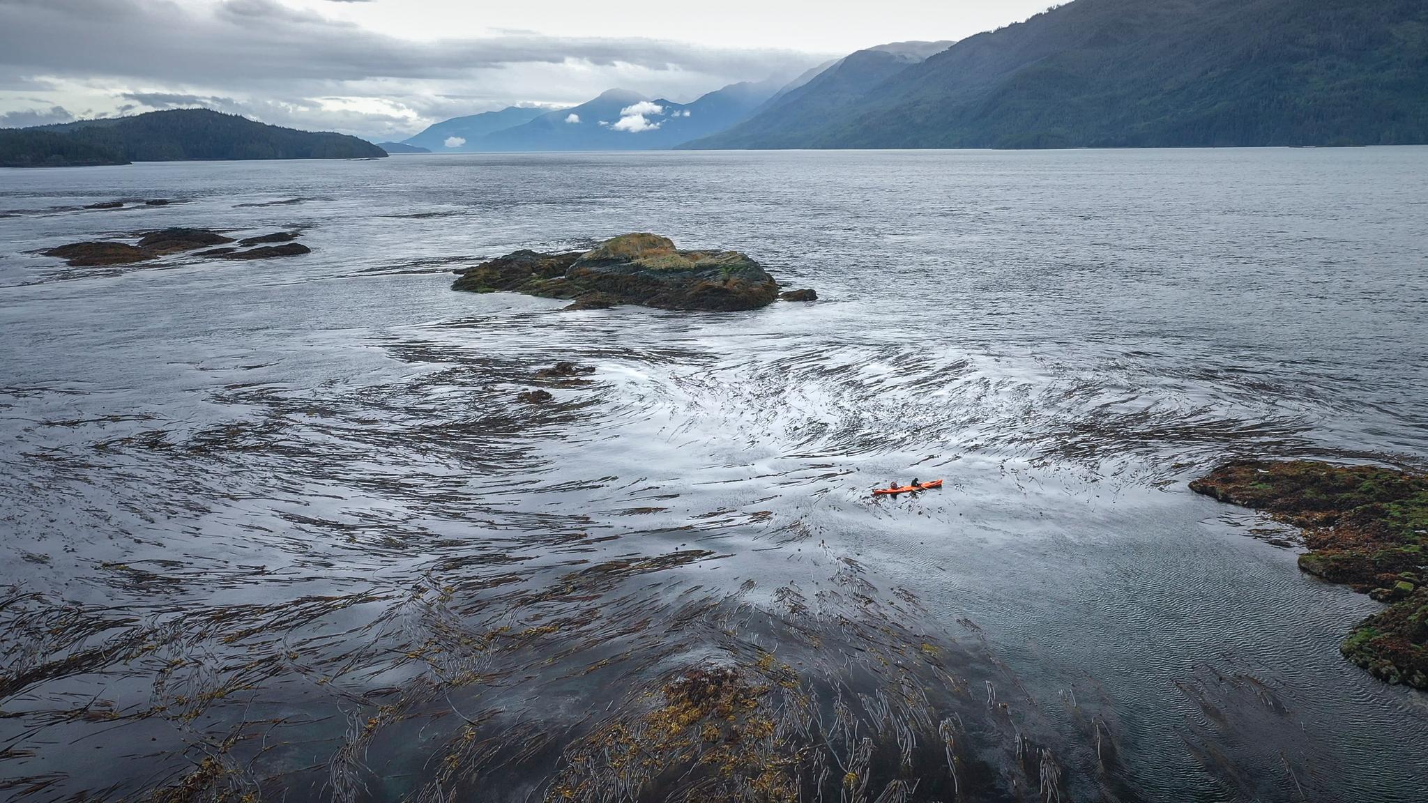
Mamalilakulla Guardian Watchmen surveying Kelp by Kayak for a MaPP survey. Credit: Grant Callegari, Hakai Institute.
But the tides, capacity and shifting kelp have made it nearly impossible to repeat extensive, comprehensive boat-based surveys in a consistent way.
"It's very challenging to cover all that water and census hundreds of kilometers of coastline often enough to track kelp forests at those scales; we need other methods to help inform monitoring, research and management," says Luba Reshitnyk, who leads marine habitat mapping at Hakai Institute.
Marine protected areas across B.C. face this same problem. Gwaii Haanas, Pacific Rim, and Gulf Islands park reserves all have to report regularly on ecological indicators. While drone-based kelp forests surveys occur at local sites, data, methods and capacity are missing to map kelp forests across the whole managed region. Similarly, First Nations know how much kelp matters to their territories and heritage – as habitat that supports biodiversity, as a harvested and culturally important resource, and as an indicator of ecosystem health — and are looking for tools and resources to address the challenge of mapping and understanding kelp forests at large, regional scales.
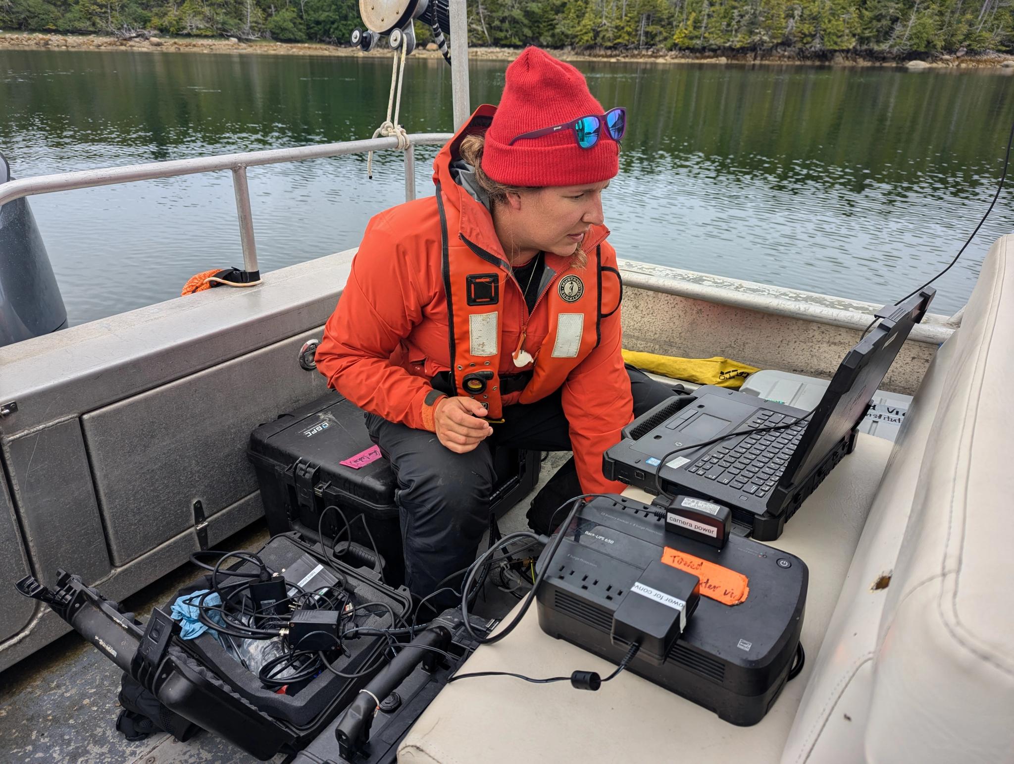
Credit: Keith Holmes, Hakai Institute.
Filling a Crucial Gap
The Hakai Institute, part of the Tula Foundation, studies the B.C. coast, from its icefields to the deep ocean. Its geospatial team maps nearshore habitats using drones, aerial photography, lidar, and satellites, and creates specialized tools to help stakeholders address regional challenges and opportunities. In 2020, Hakai noted an important gap that deserved renewed attention: No one had surveyed where kelp grows along the B.C. coast, and how those forests are changing, since the mid-2000s. And no one had ever done it for the entire coast.
The team pulled together every dataset it could find or create. Building on drone-based, long-term monitoring site data which began in 2015, they embarked on regional scale species mapping using a fixed wing aircraft. For the deeper story, they used Landsat imagery to build a time series of the region with colleagues at the Woods Hole Oceanographic Institution and the University of Massachusetts Dartmouth. The analysis looks back decades, tracking change in expanse and location. It can identify outlier years, relating these shifts to marine heatwaves and other possible catalysts.
The team then used Planet imagery to provide a sharper lens. At about three-meter resolution, PlanetScope® picks up the small kelp beds that hug the shoreline, which other satellite sensors miss. It can give a fuller picture of the kelp forests that are there, and where changes affect local stakeholders. Machine learning models and pipelines built by Software Developer Taylor Denouden at Hakai classify Planet imagery at a scale beyond the scope of manual interpretation – visualizing this higher-resolution information across the region.
Loading Video...
Visualization of kelp forests across the region, derived from PlanetScope data, analyzed by Hakai Institute and powering Kelp Explorer.
From Pixels to Insight
The result is Kelp Explorer, a free online tool designed to answer the big questions planners and communities have about kelp forests.
The design was shaped by many conversations with First Nations stewards and marine planners. "Remote sensing is pixels, and it's tricky to interpret," says Will McInnes, Geospatial Team Lead at Hakai. "If you look at one pixel over time, it's not that meaningful. We've sent people raw pixel data in the past, and they say, 'Okay, thanks. But what do I do with this?'"
Kelp Explorer groups pixels into hexagons with clear trend charts, providing real insight – so a park ecologist, a guardian, or a provincial planner can look at their own area and see how kelp is doing. McInnes explains, “Kelp Explorer gives a fuller picture, and helps interpret the changes we’re experiencing, so that it can help people on the coast make informed decisions."
With satellite imagery, Hakai is able to build a more complete understanding of kelp forests. Reshitnyk compares it to a pantry: every group already holds some of the ingredients it needs for a decision. "Kelp Explorer can be one of the key things they bring into their decision-making process."
The province now uses this understanding of kelp coverage and abundance to plan kelp harvests. First Nations can now look back through time and see how kelp has fared in their territories.
Setting the Table
"Kelp Explorer is setting the table for folks working in kelp forest ecosystems," Reshitnyk says. "It provides a foundation, so that you can ask, ‘what else do I need to bring to answer my specific question?’ instead of ‘how do I get started?’"
It is already informing timing, location, and resources for field work. Rather than surveying everything, teams can use Kelp Explorer to determine which areas require in-person observation or drone surveys.
One of Hakai's First Nation partners is planning to use it to inform their kelp restoration program. The visualizations help them identify candidate sites where kelp forests have been present in the past, but no longer exist. It fits into their planning processes, by providing highly visual and historical data that inform community consultation and complement oral histories for holistic decision making.
Loading Video...
Kelp forests shifting within the Byers, Conroy, Harvey, Sinnet Islands Ecological Reserve. Data from Hakai Institute; visualization by Planet.
A Living Tool for Many Generations
Version one of Kelp Explorer is live, with Landsat coverage across the coast and Planet data at finer scales. Hakai treats the tool as a living program: they are working with parks, First Nations, and planners to decide which datasets to incorporate next, and gathering feedback on how future versions can best support kelp restoration, management, and reporting across the region.
For Pacific Rim, that could mean finally reporting on kelp forests consistently over time across the entire park: where they are now, how this year compares with the decades before, and where to send crews next summer.
“Kelp Explorer is helping inform management actions by providing a broader picture of the whole region and the park reserves system, helping prioritize what needs restoration and conservation, and improving the health of these systems as a whole,” notes Park Reserve Ecological Yakimishyn.
“Kelp Explorer is helping inform management actions by providing a broader picture of the whole region, including the park reserve, helping prioritize what needs restoration and conservation, and thereby improving the health of these systems as a whole,” notes Pacific Rim National Park Reserve ecologist Jennifer Yakimishyn.
We invite you to explore the Hakai Institute’s platform at Kelp Explorer, and to learn about our nonprofit program and commitment to sustainability and impact at Planet.