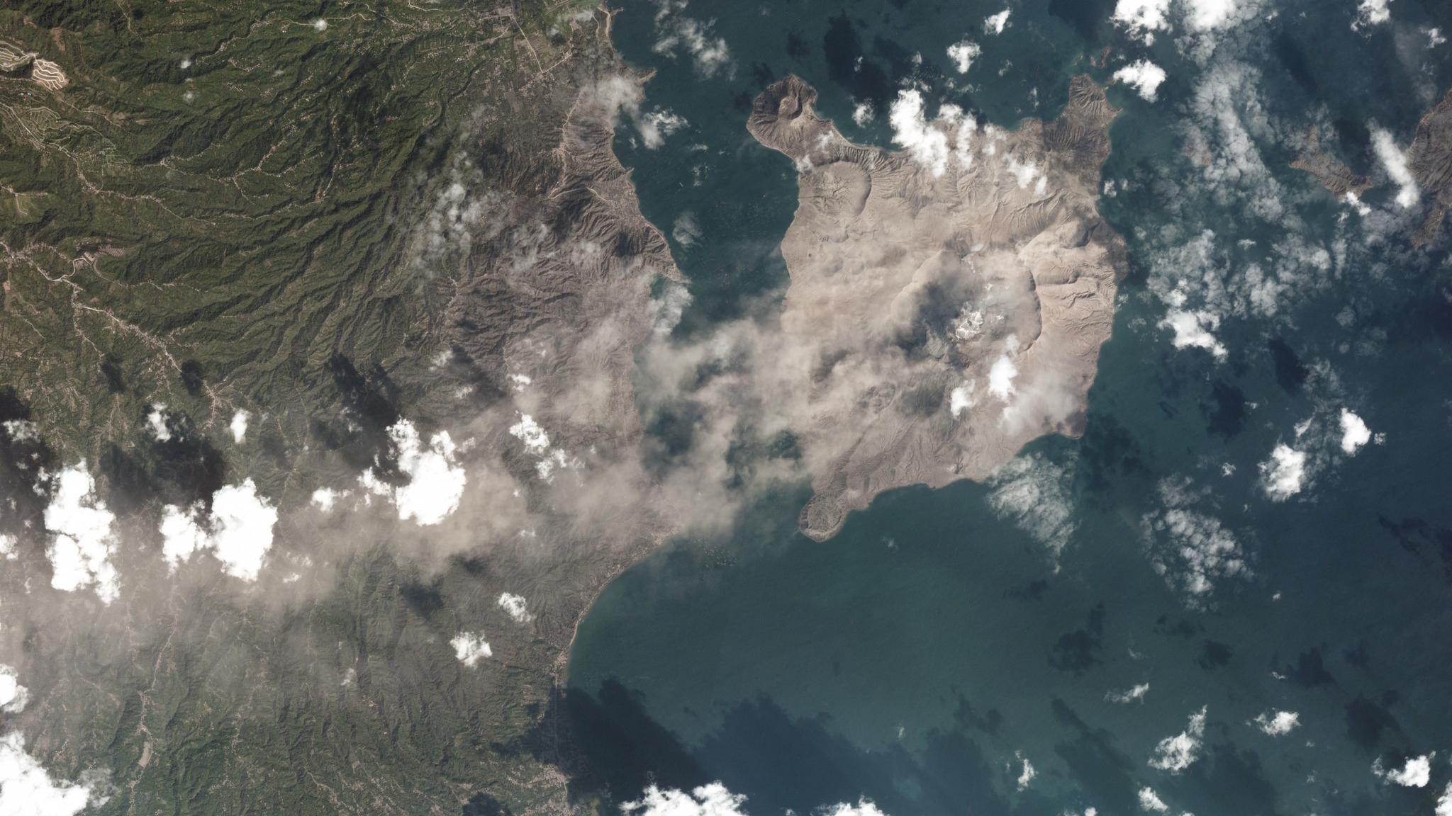
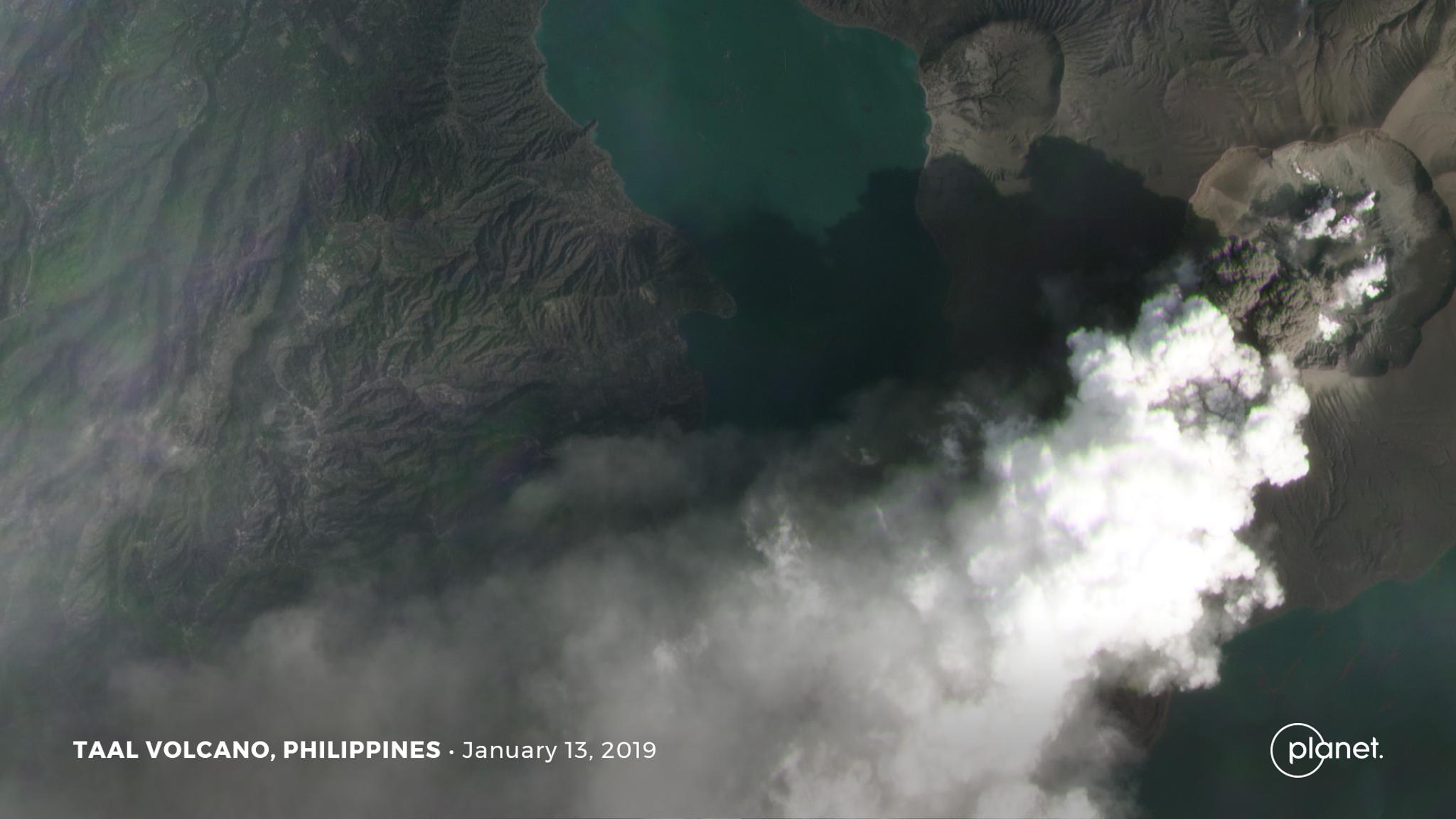
Planet imagery provides a unique view of the Taal volcano’s recent explosive events. © 2020, Planet Labs Inc. All Rights Reserved.
AUTHOR PROFILE Krissy Eliot
Krissy is Planet's wordsmith. She loves writing about rocket science and innovative technologies, among other Earth-shaking topics.

Wuhan Reacts to Coronavirus, the Taal Volcano Erupts and More

News

Journalists continue to utilize satellite data to inform the public about pressing issues. Here are some examples of how satellite imagery has been used to help monitor important global events.
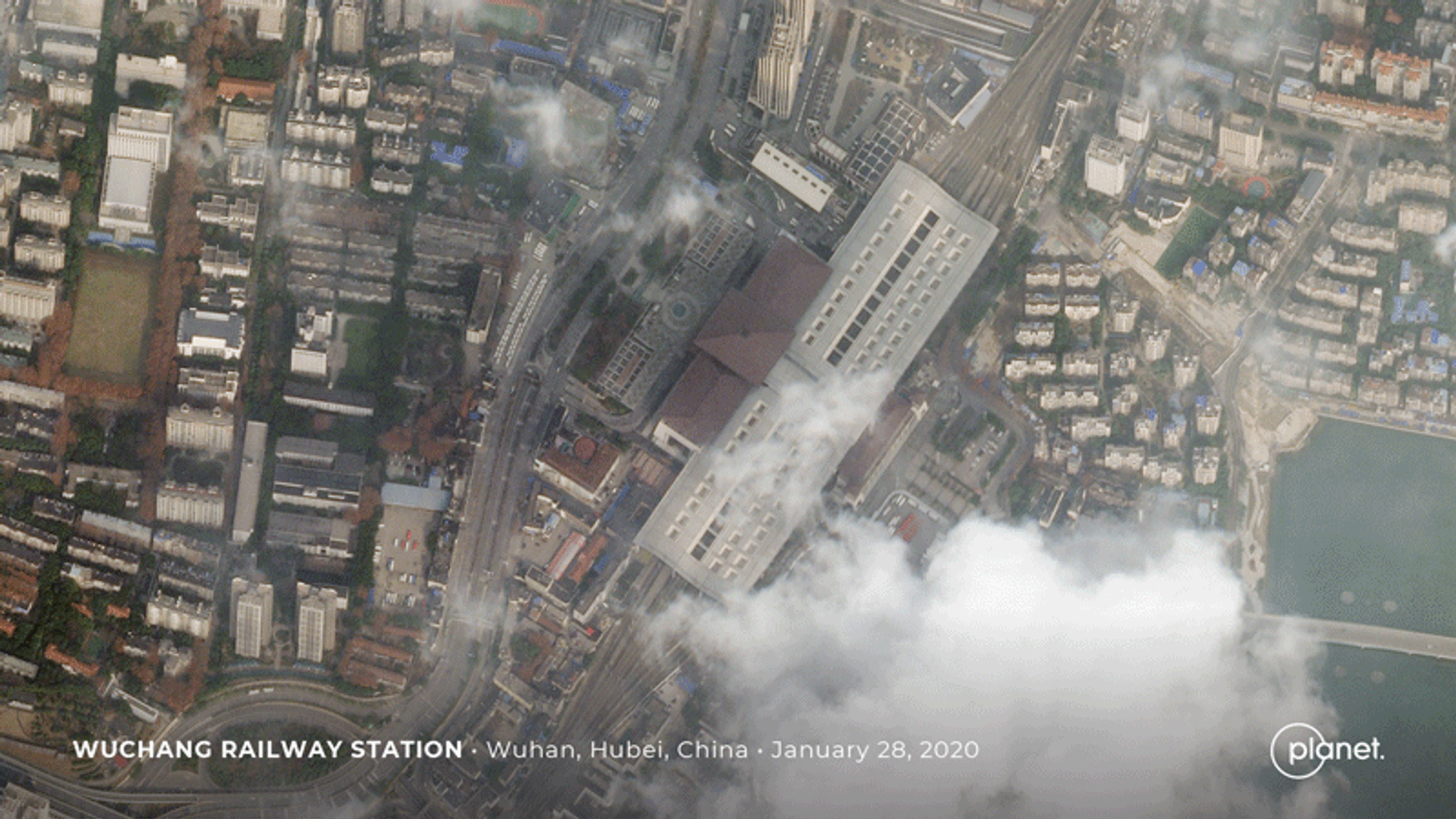
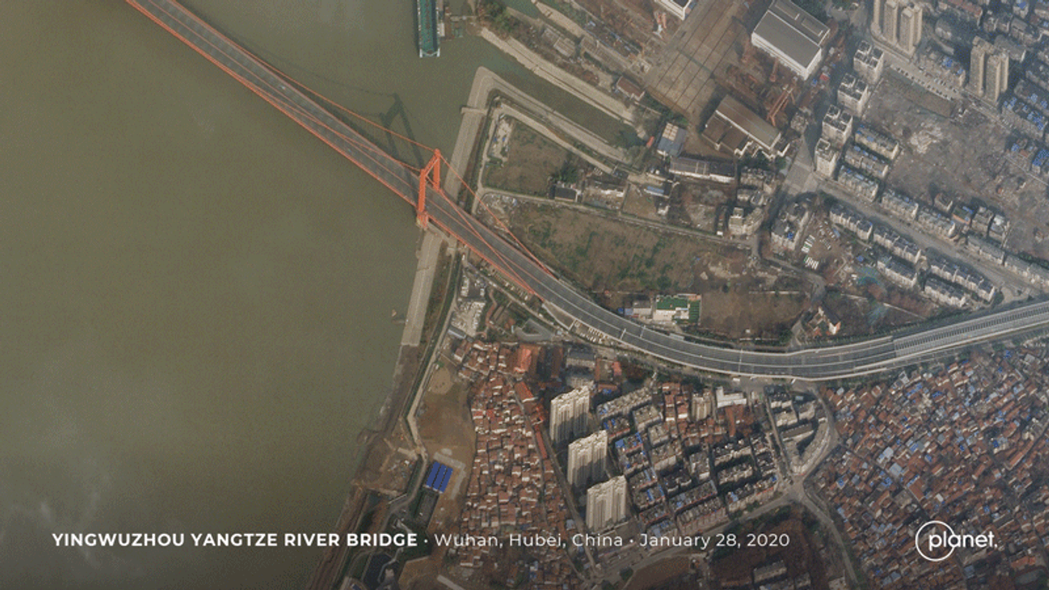
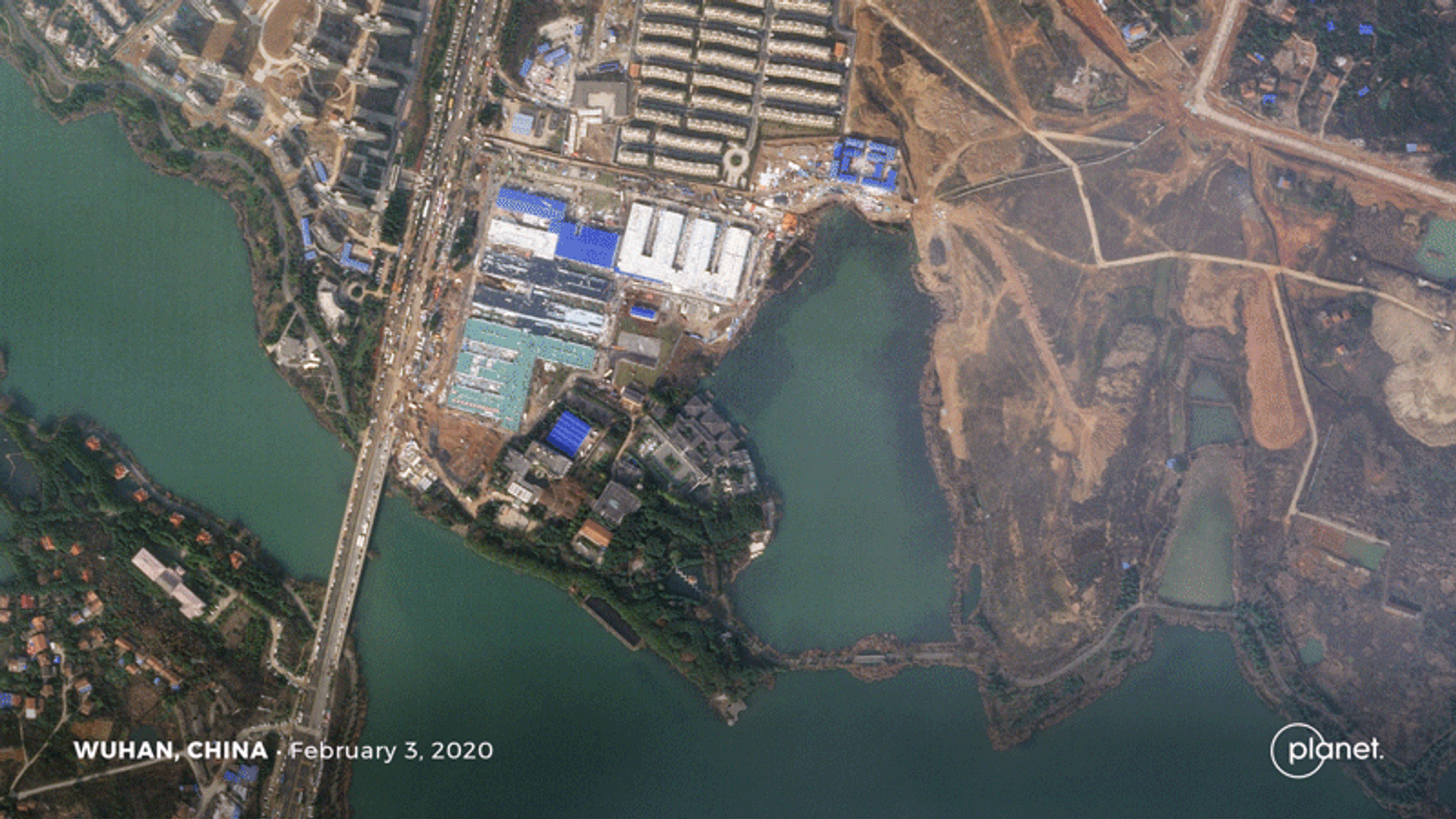
The Phases of Wuhan

Reuters utilized satellite data to track the effects that the coronavirus outbreak has had on Wuhan, the capital of Central China’s Hubei province. Quarantine efforts have essentially brought the city of 11 million to a halt as people stay inside their homes to help protect themselves from illness. Below are a series of Planet images documenting the changes in Wuhan as they’ve unfolded.

Planet SkySats captured the desolate streets and railways of Wuhan, China as businesses temporarily suspended operations in an attempt to limit the spread of the deadly coronavirus. © 2020, Planet Labs Inc. All Rights Reserved.

Planet SkySats captured the desolate streets and railways of Wuhan, China as businesses temporarily suspended operations in an attempt to limit the spread of the deadly coronavirus. © 2020, Planet Labs Inc. All Rights Reserved.


Planet imagery shows a usually-crowded bridge over the key Yangtze waterway on January 12 and a completely deserted roadway on January 28 following the coronavirus outbreak. © 2020, Planet Labs Inc. All Rights Reserved.

Planet imagery shows a usually-crowded bridge over the key Yangtze waterway on January 12 and a completely deserted roadway on January 28 following the coronavirus outbreak. © 2020, Planet Labs Inc. All Rights Reserved.


Before and after high-resolution SkySat imagery reveals one of the new hospitals in Wuhan, China. It was built in a matter of days to help combat the fast-spreading virus. © 2020, Planet Labs Inc. All Rights Reserved.

Before and after high-resolution SkySat imagery reveals one of the new hospitals in Wuhan, China. It was built in a matter of days to help combat the fast-spreading virus. © 2020, Planet Labs Inc. All Rights Reserved.

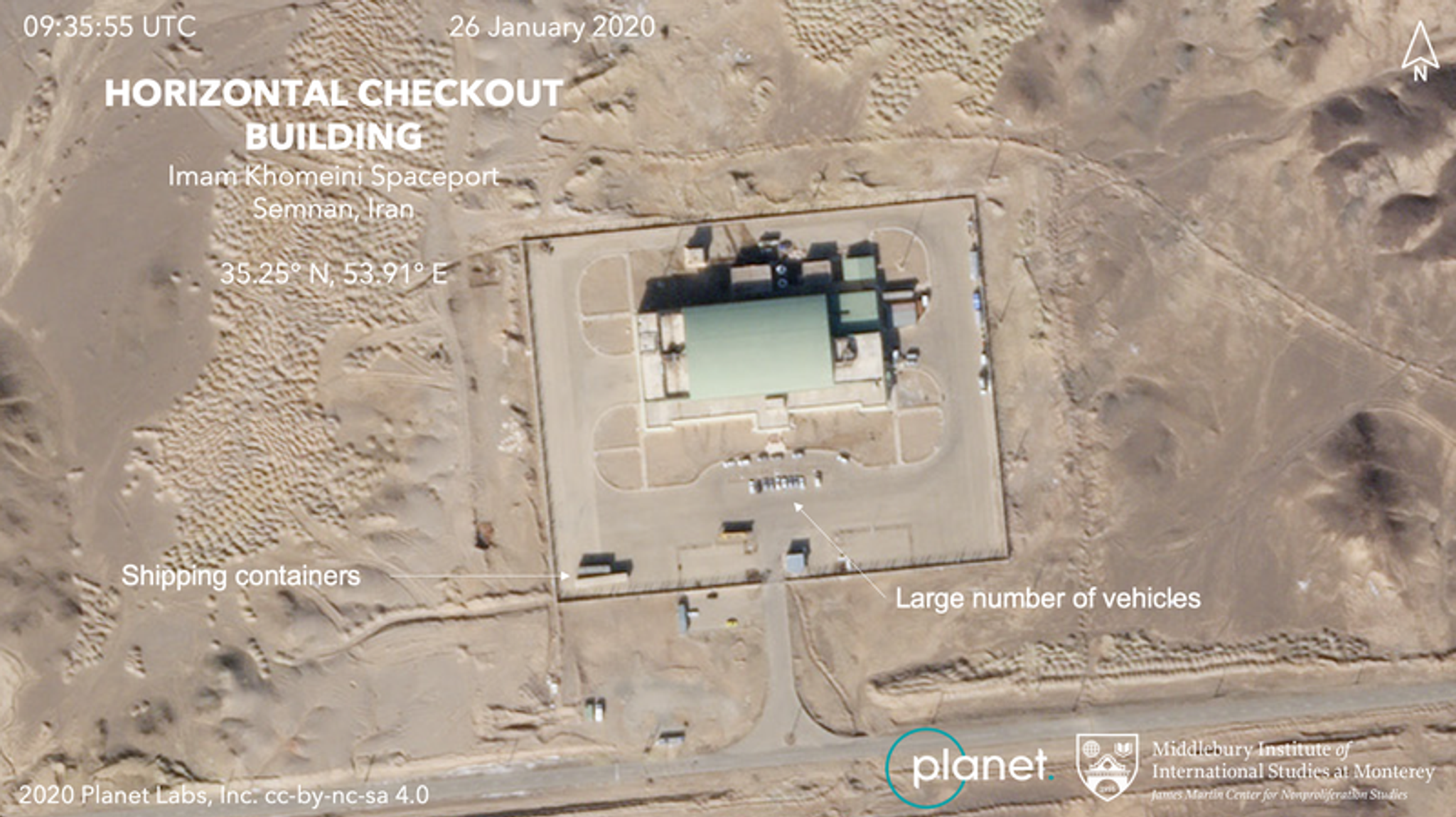
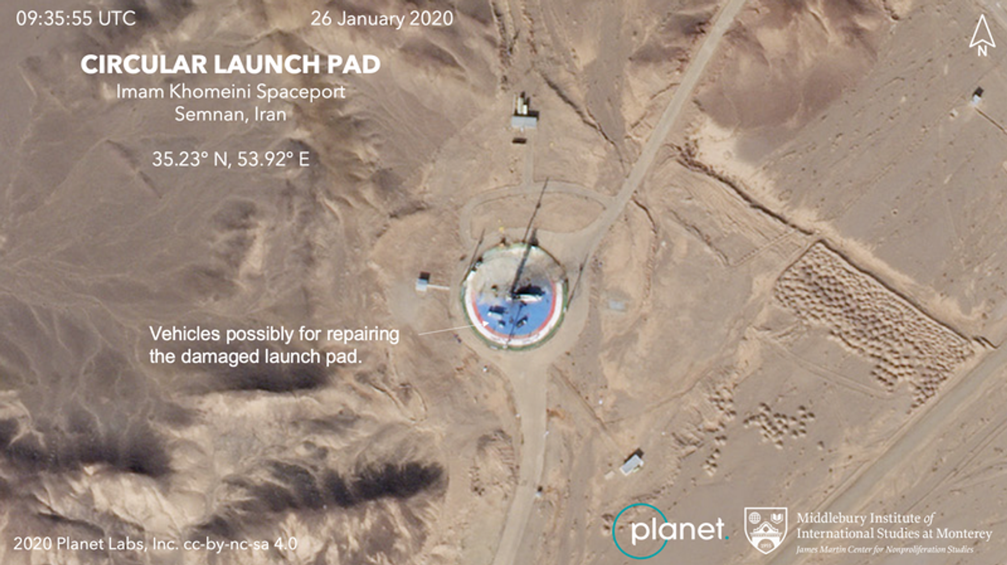
Iran’s Possible Satellite Launch Prep

Planet’s satellites captured imagery suggesting that Iran is preparing for another space launch—a conclusion drawn by arms control expert Jeffrey Lewis, professor at the Middlebury Institute of International Studies at Monterey.

“It looks pretty clearly to us like Iran is going to try and put a satellite into space,” Lewis told NPR.

Planet imagery reveals cars near the assembly building where Iran's rockets are constructed. Analysis provided by the Middlebury Institute of International Studies at Monterey. © 2020, Planet Labs Inc. All Rights Reserved.

Planet imagery reveals cars near the assembly building where Iran’s rockets are constructed. Analysis provided by the Middlebury Institute of International Studies at Monterey. © 2020, Planet Labs Inc. All Rights Reserved.

Earlier launch attempts in January and February of last year were unsuccessful, and in August of 2019 a rocket exploded at this location.

While some have shared their concerns about Iran possibly using the launch to communicate a political message, Lewis says he doesn’t believe that is necessarily true.

“These programs have existed for a long time,” Lewis told NPR. “And we have seen Iran do a number of launches in the past.”

Planet imagery of the Imam Khomeini Space Center in northern Iran shows vehicles on a circular launch pad. Analysis provided by the Middlebury Institute of International Studies at Monterey. © 2020, Planet Labs Inc. All Rights Reserved.

Planet imagery of the Imam Khomeini Space Center in northern Iran shows vehicles on a circular launch pad. Analysis provided by the Middlebury Institute of International Studies at Monterey. © 2020, Planet Labs Inc. All Rights Reserved.

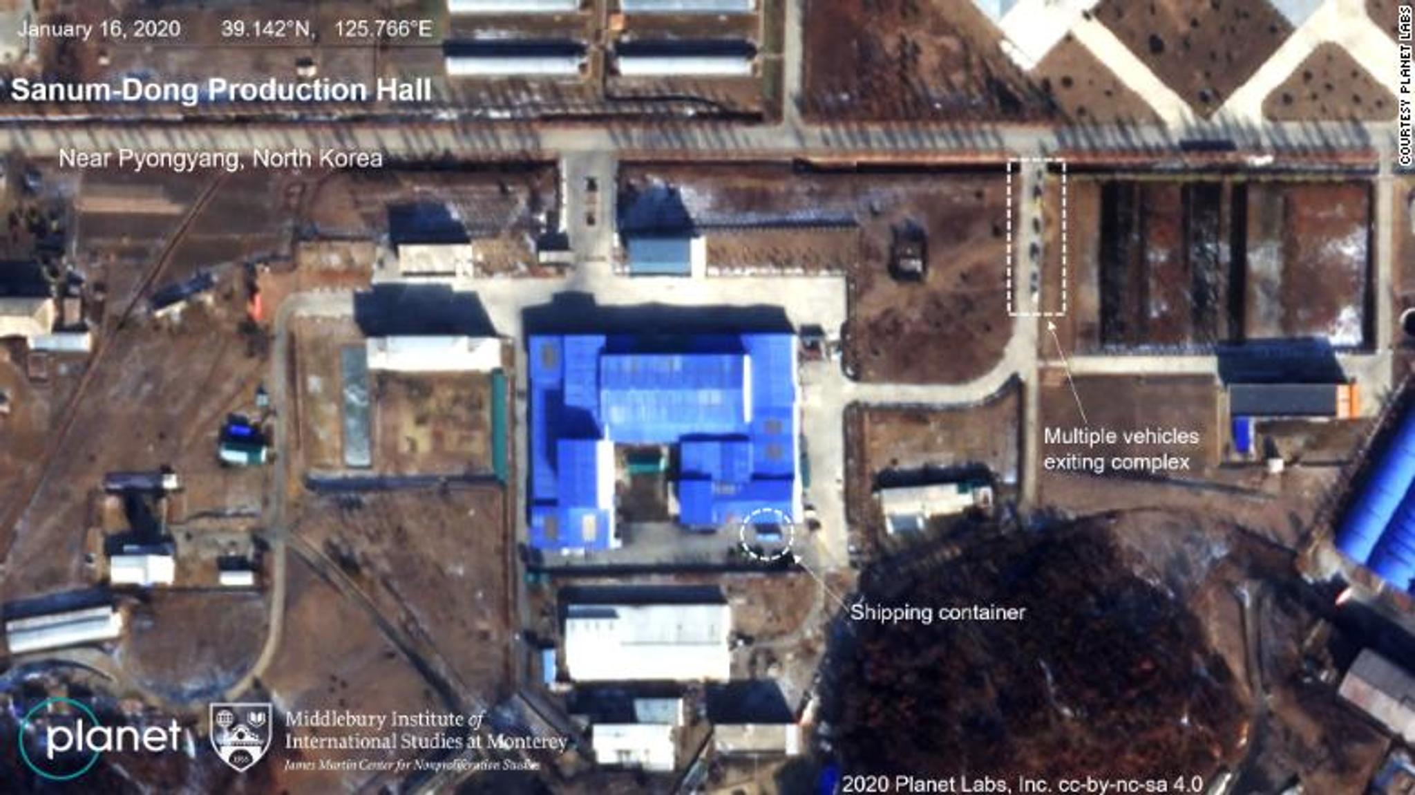
North Korean Missile Observations

Planet imagery analyzed by experts at Middlebury Institute shows recent vehicle activity at a North Korean missile site. Defense officials say that North Korea could be preparing for a missile or missile engine test.

The “activities are consistent with what we’ve seen prior to other missile tests,” one senior U.S. official told CNN. While there’s no indication of an imminent test launch, they would not rule out the possibility, officials add.

Planet’s satellite imagery shows the Sanum-Dong Production Hall, with analysis provided by the Middlebury Institute of International Studies at Monterey (MIIS).

Planet’s satellite imagery shows the Sanum-Dong Production Hall, with analysis provided by the Middlebury Institute of International Studies at Monterey. © 2020, Planet Labs Inc. All Rights Reserved.

Planet imagery also shows a large blue shipping container at Sanum-dong missile research center near Pyongyang. What’s in the container currently remains a mystery, but the container seems to have been moved at varying intervals in January. The container can be seen in images captured on January 9 and 10 but isn’t visible in images taken four days later. The container shows up again in images captured on January 16, but disappears again on January 19.

The Eruption of Taal

The Taal volcano in the Philippines experienced a series of eruptions recently, launching debris and ash more than 30,000 feet into the air. Planet captured imagery of the event, providing visual coverage to Axios and the Washington Post.

Planet imagery shows ash plumes shooting almost a half mile upward as the Taal volcano erupts. © 2020, Planet Labs Inc. All Rights Reserved.

Planet imagery shows ash plumes shooting almost a half mile upward as the Taal volcano erupts. © 2020, Planet Labs Inc. All Rights Reserved.

According to the Philippine Institute of Volcanology and Seismology (PHIVOLCS), 595 volcanic quakes occurred over the course of five days, resulting in the draining of nearby lake. The drainage is most likely due to “fissures that have opened up that are permitting the water to drain out,” a geophysicist told the Washington Post.

Journalists! Planet imagery can be useful for reporters who are investigating important issues. You can sign up for a Planet Explorer account—free for the first two weeks—to unlock the potential for visual and compelling stories.