
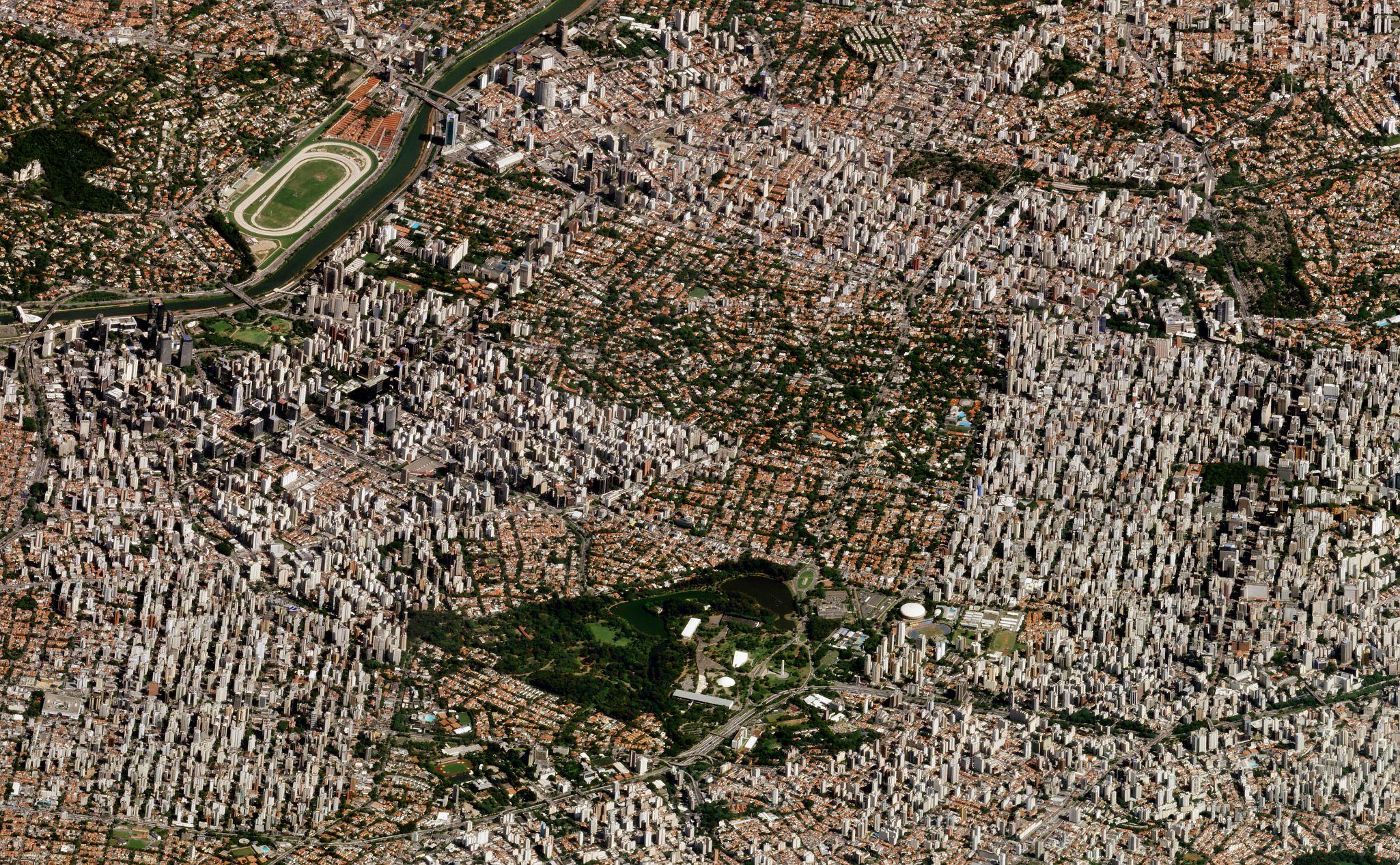
Monitoring Infrastructure and Urban Planning
Planet Solutions for Disaster Management
IDENTIFY RISK WITH FREQUENT, HIGH-RESOLUTION IMAGERY
Supercharge readiness and resilience initiatives by utilizing GIS in urban planning
Build disaster-resilient infrastructure and improve community preparedness with near-daily satellite monitoring and an archive of high-resolution Earth data dating from 2009.
Learn how San Diego Gas & Electric uses Planet data to reduce the risk of wildfires.
DYNAMIC HISTORICAL BASELINE
Identify new and emerging hazards over large areas
Model historical trends, establish a baseline of behavior, and identify irregular events faster with the Planet living archive of high-resolution data.

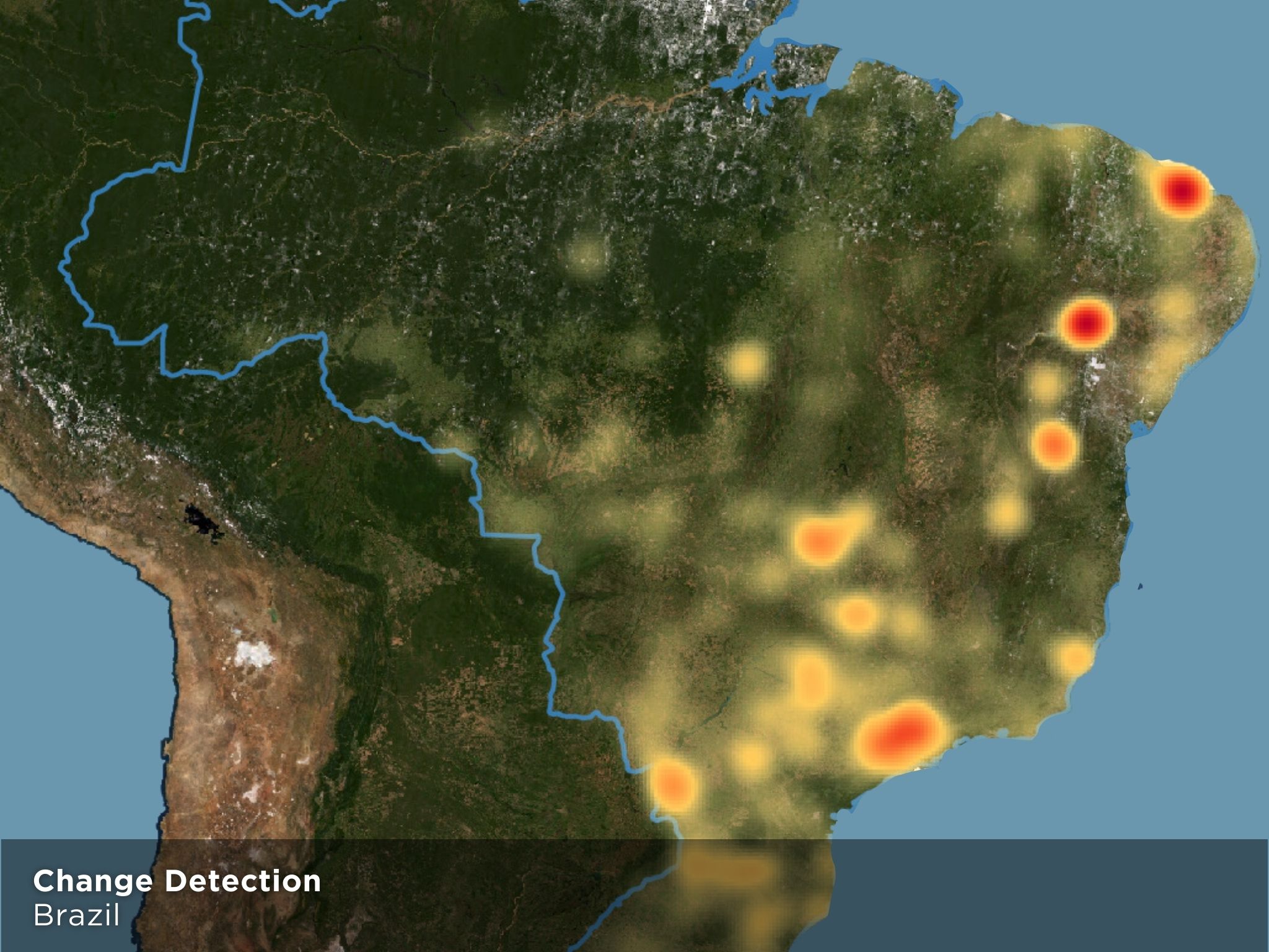
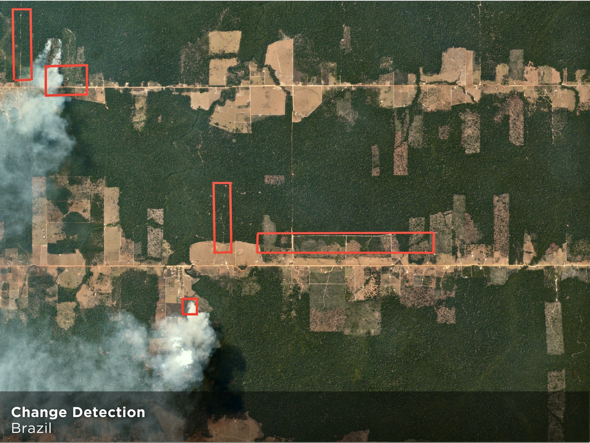
AUTOMATED CHANGE DETECTION
Detect unpermitted roads and buildings
Identify potentially hazardous construction activity at scale with alerts that signal where change has occurred across long periods of time.
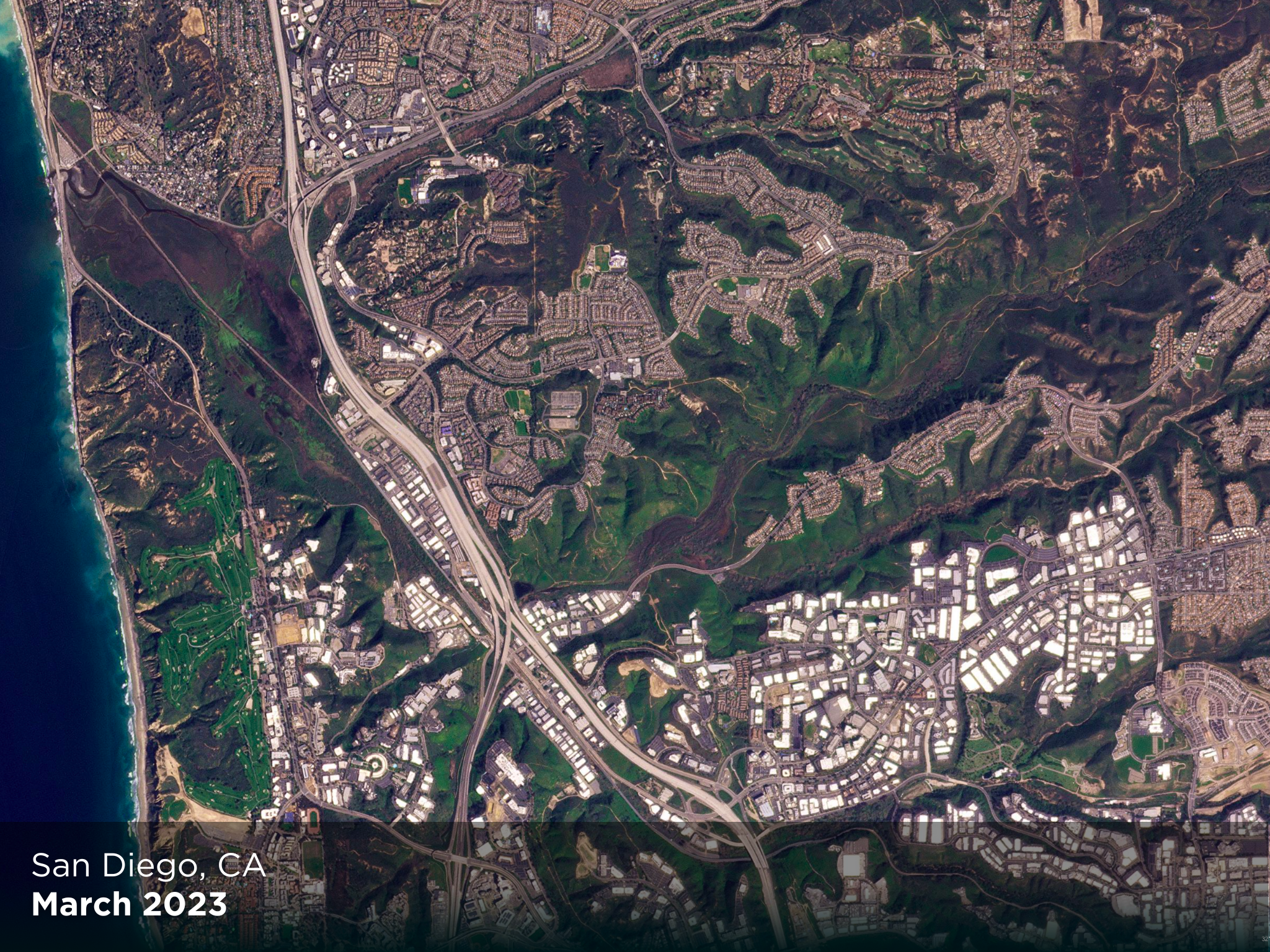
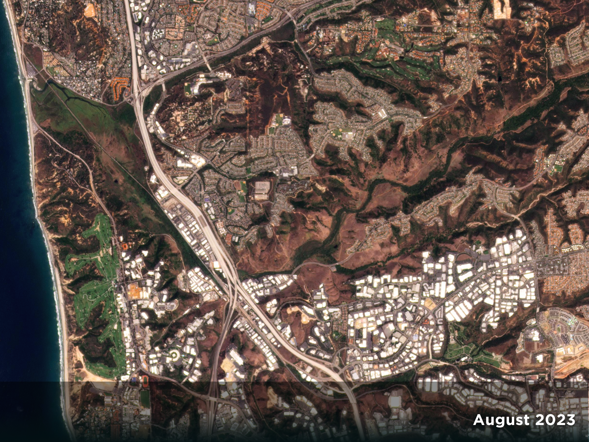
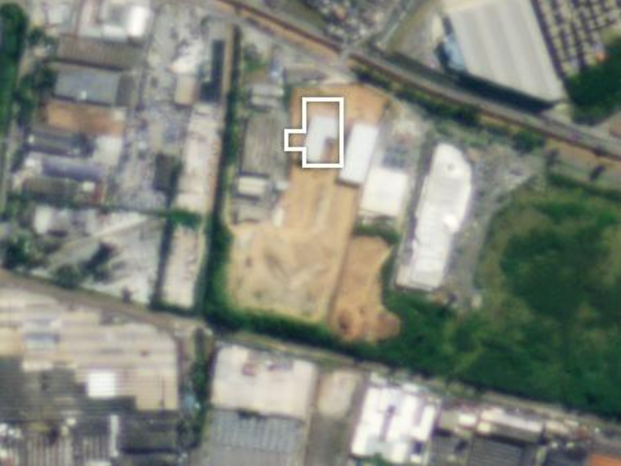
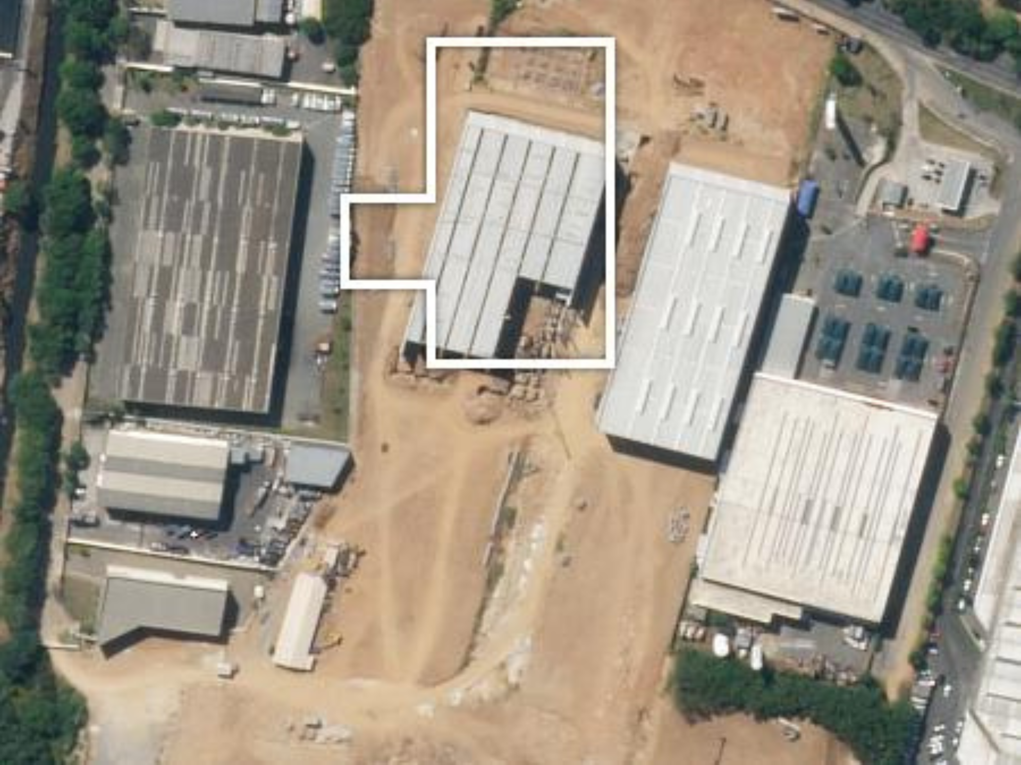
HIGH-RESOLUTION TASKING
Monitor rebuilding progress
Survey the progress of recovery efforts and prioritize community needs with highly accurate, high-frequency satellite imagery.


Get in Touch
Interested in learning more? Reach out to your account executive or contact our team.
© 2024 Planet Labs PBC. All rights reserved.
| Privacy Policy | California Privacy Notice |California Do Not Sell
Your Privacy Choices | Cookie Notice | Terms of Use | Sitemap
