
Global Disaster Coverage
News outlets rely on Planet imagery to document and understand the impact of natural disasters across the world.
Featured in top news outlets
News
Read the Latest News Stories With Planet Imagery
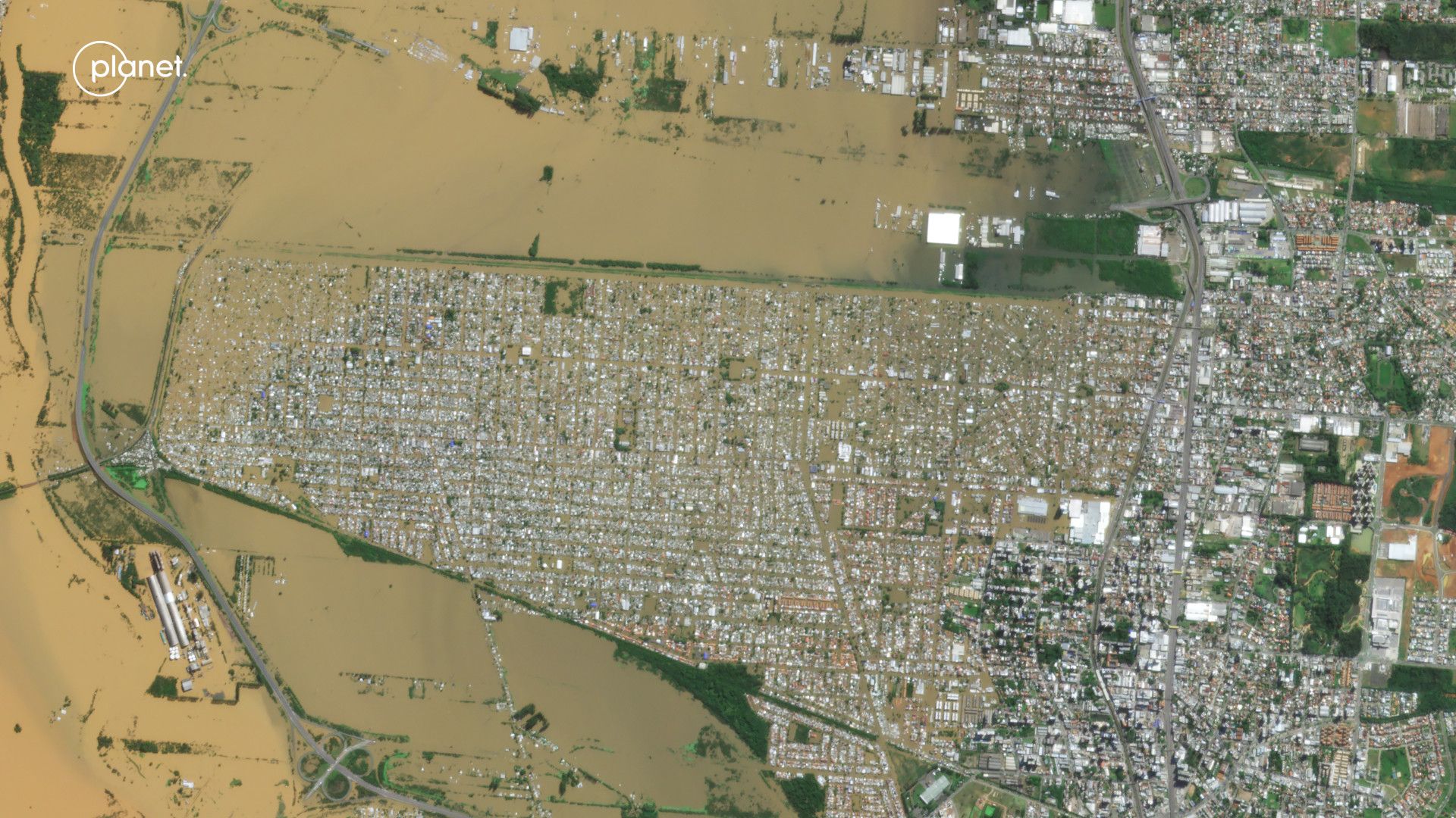
May 9, 2024
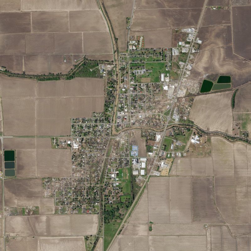
See Before and After Municipalities in Rio Grande do Sul After Being Inundated by Floods
Aerial images show how the climate disaster changed the landscape in several locations in southern Brazil.
Diario do Nordeste
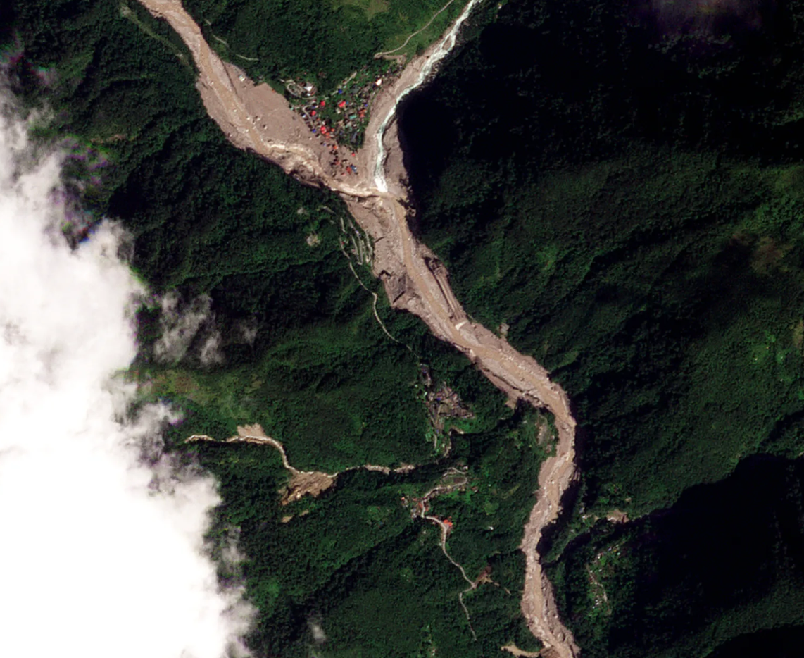
December 11, 2023
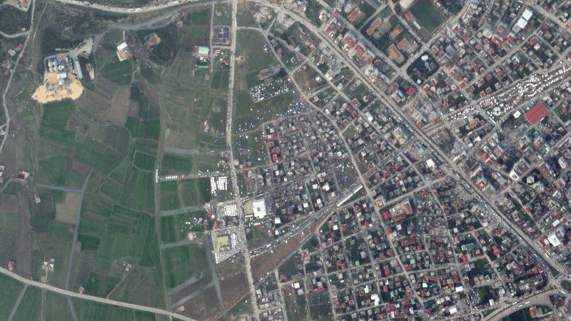
Sikkim: Satellite Images Show Devastating Himalayan Floods
Satellite images show the extent of the damage caused by deadly flash floods that hit a village in India's north-eastern state of Sikkim in October.

October 17, 2023
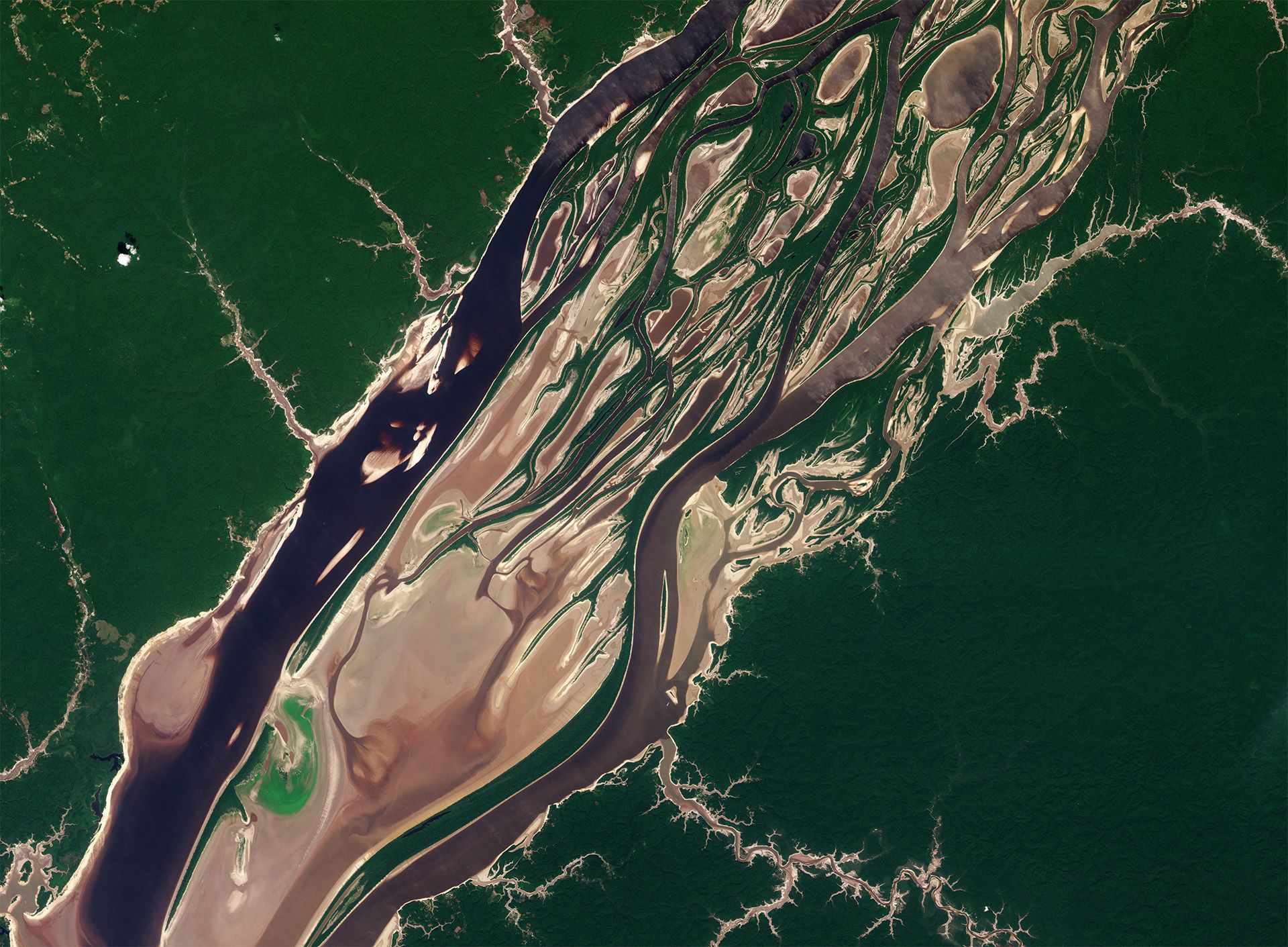
A Severe Drought Pushes an Imperiled Amazon to the Brink
Planet satellite images of the same section of the Rio Negro in Brazil, on September 13 and October 8, demonstrate the severity of current drought conditions.

October 7, 2023
Ukraine Dam: Rebuilding Shattered Lives After Ukraine’s Dam Collapse
Planet images before and after the Kakhova dam collapse capture the extent of the flood.
September 14, 2023
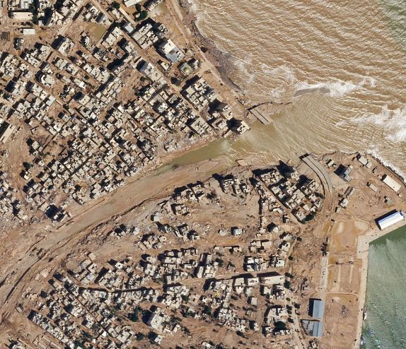
Mapping Where Floods Have Devastated a Libyan Port City
Extensive flooding damage through Derna, Lybia is capture in Planet satellite images.
September 14, 2023
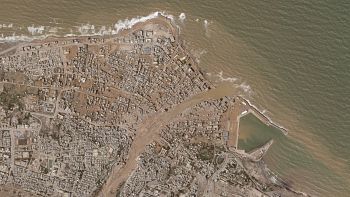
Before and After Satellite Images Show Scale of Libya Flood Destruction
Planet satellite images taken before and after flooding in northeastern Libya show the scale of the deadly destruction caused by Mediterranean Storm Daniel.

September 12, 2023
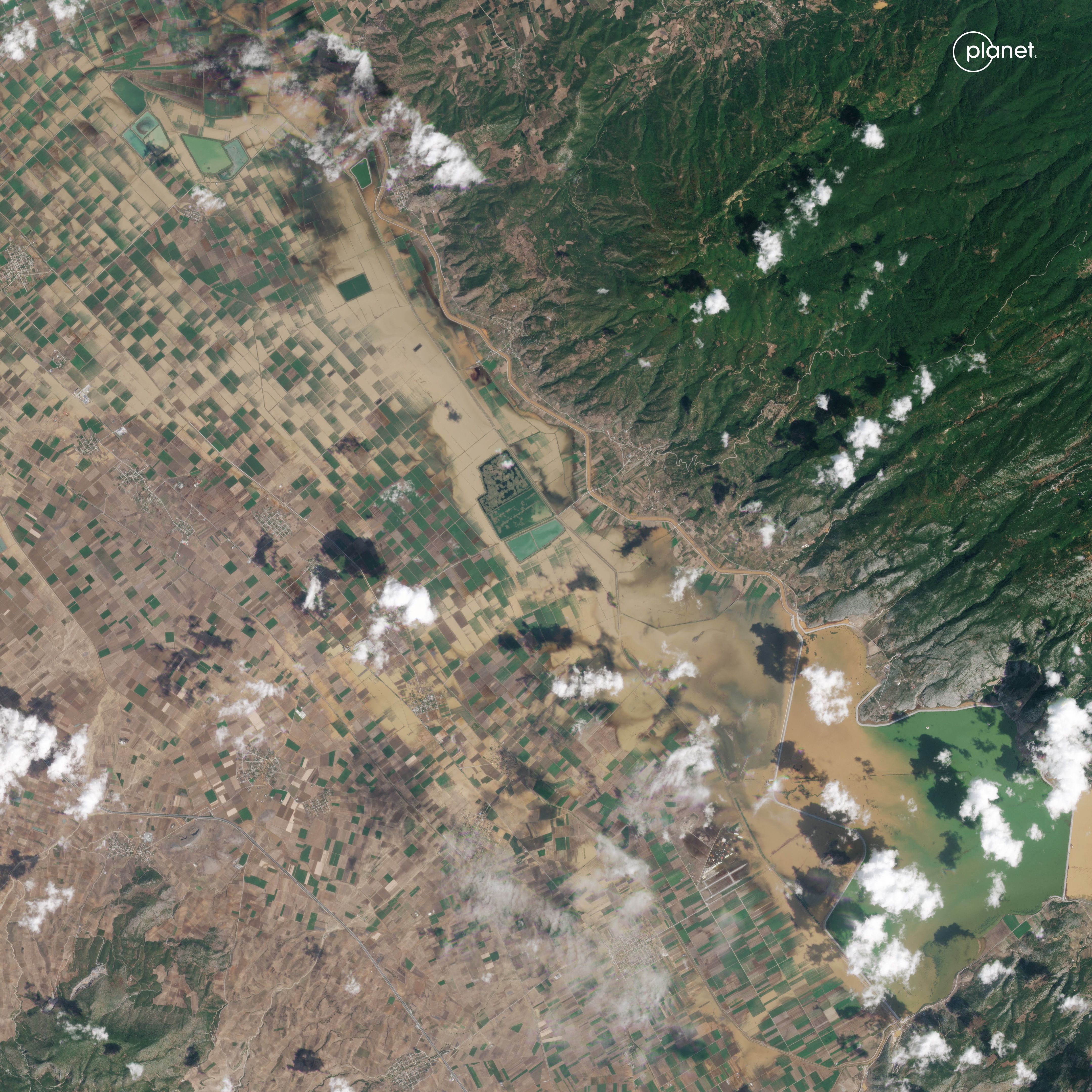
European Union to Rush More Than $2 Billion to Disaster-Hit Greece, Using Untapped fFunds
Extensive flooding in areas near the city of Larissa in central Greece is captured in Planet satellite images.
AP News
September 2, 2023
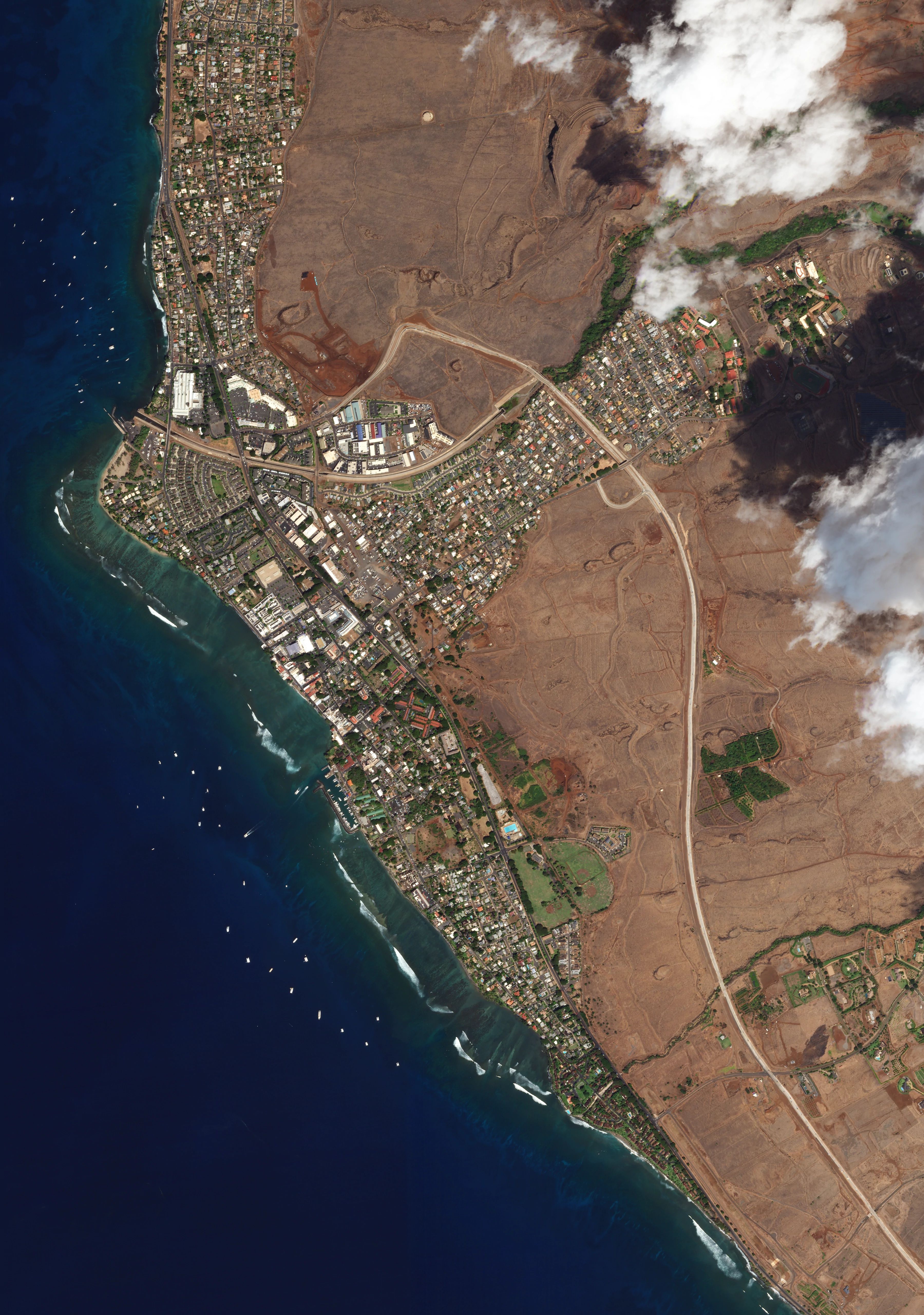
Maui's Neglected Grasslands Caused Lahaina Fire to Grow With Deadly Speed
This visual analysis uses Planet imagery to document how dense and unmanaged grasses on the hills above Lahaina contributed to one of the deadliest fires in U.S. history.

August 22, 2023
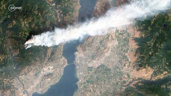
Satellite Image Shows How B.C. Wildfire Was Primed to Grow
The beginning of the devastating McDougall Creek wildfire is captured in Planet satellite images. The fire burned into West Kelowna in British Columbia, prompting evacuations.
North Shore News
August 17, 2023
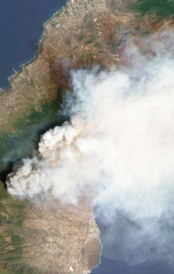
Thousands Evacuated as 'Out of Control' Wildfire Burns on Spain's Tenerife Island
A combination of Planet satellite images shows the Spanish Canary island of Tenerife before and during an out-of-control wildfire that burned thousands of acres.
ABC News (Australia)

August 12, 2023
Mapping the Damage From the Maui Wildfires
Planet satellite images were used in an analysis that identified approximately 1,900 structures that appear visibly damaged or destroyed by wildfires in Lahaina's historic downtown.

June 28, 2023
Canadian Wildfire Smoke Dims the Vision of Earth-Observing Satellites
The smoky haze from over 400 wildfires burning in Canada is apparent in imagery from numerous Earth-observing satellites, including Planet.
Space
April 26, 2023
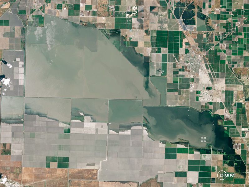
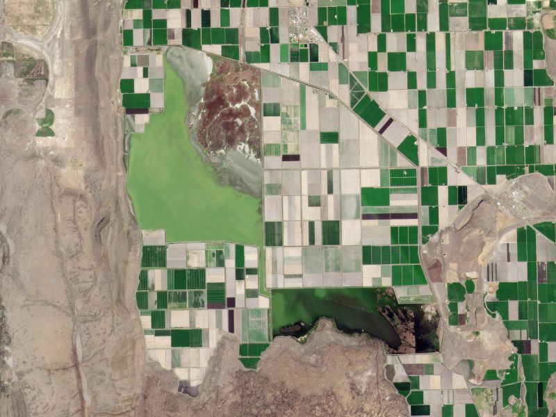
California's Reappearing Phantom Lake Could Remain for Two Years in the Central Valley
Images taken over the several weeks by Planet satellites document the resurrection of Tulare Lake in California's Central Valley and the flooding that could remain for years across previously arid farmland.

April 20, 2023
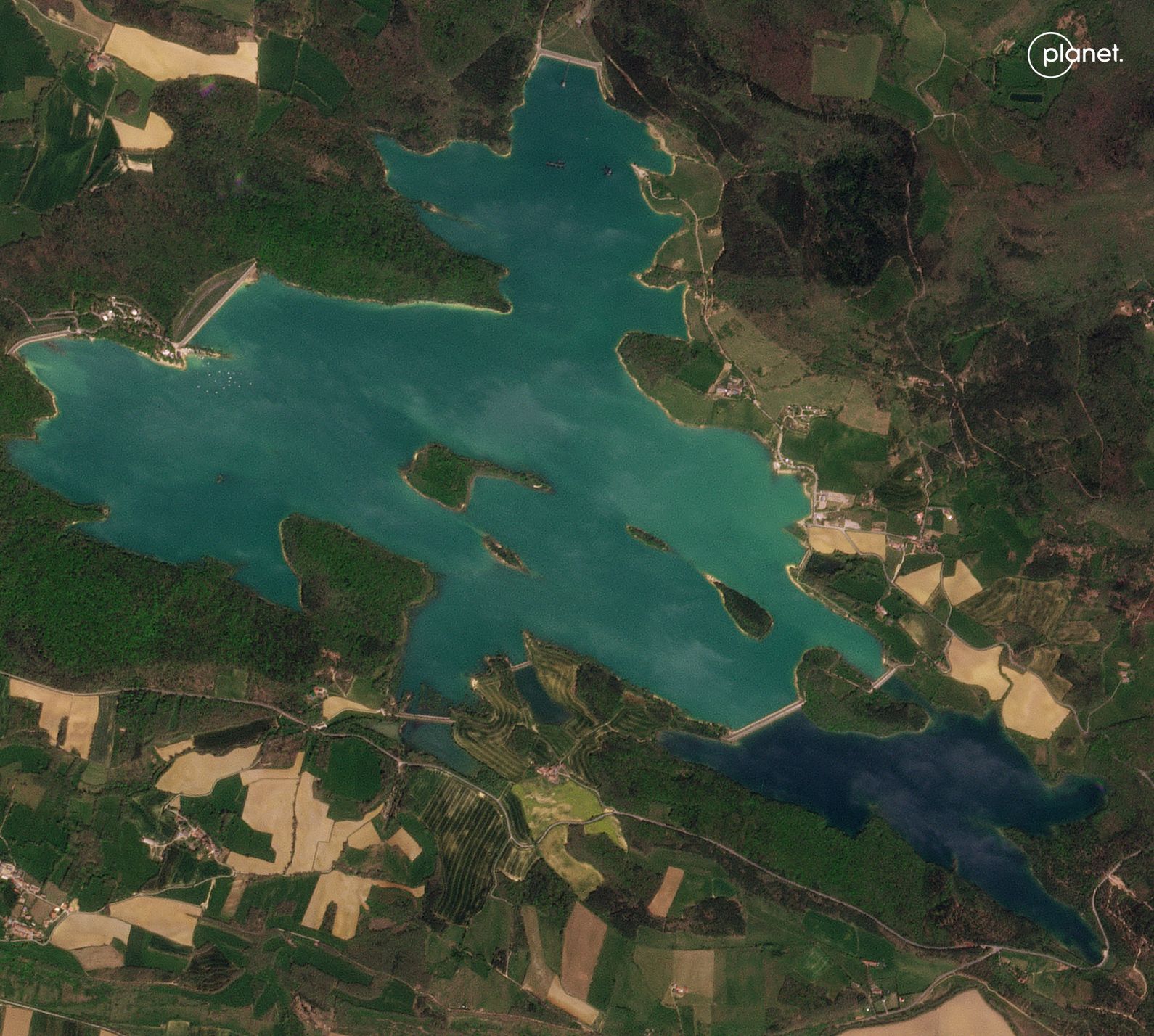
Satellite Images Highlight Extreme Drought in Europe
Planet satellite images taken over the course of several years show just how much lakes in Spain and France have shrunk, pushing local authorities to act.
ABC News
March 26, 2023
Satellite Images Show Destruction From Tornadoes in Rolling Fork, Miss.
The devastation caused by tornadoes across Mississippi and Alabama is captured in Planet satellite images taken before and after the storms.
February 8, 2023
Satellite Images From Turkey, Syria Capture Earthquake Devastation
Planet satellite images of Turkey and Syria before and after massive earthquakes shook the region illuminate the extent of the destruction.
October 5, 2022
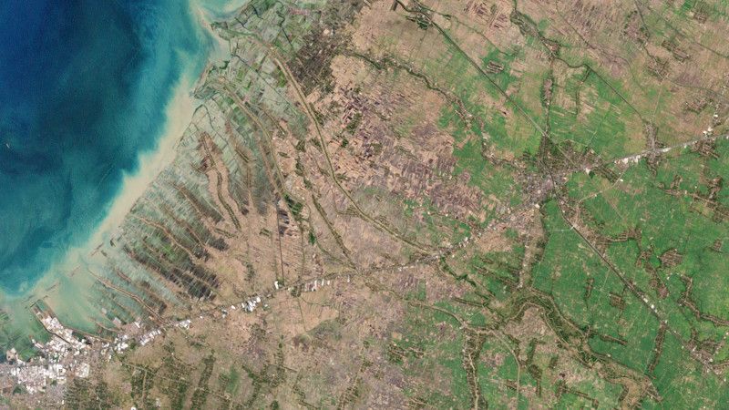
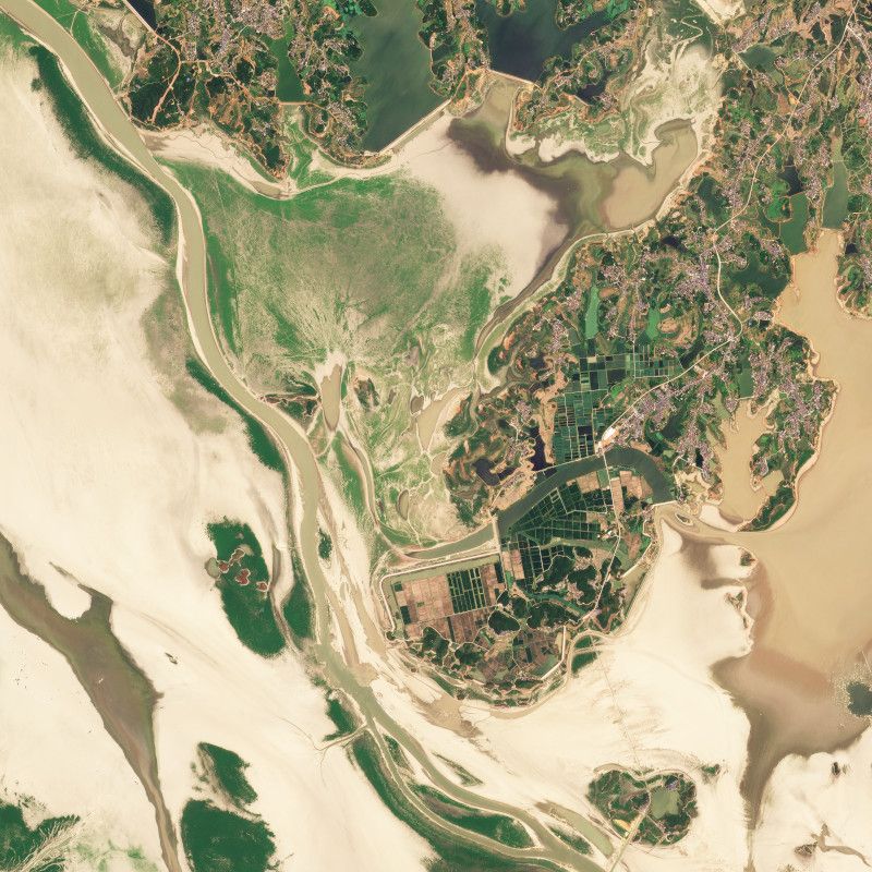
Climate Migration: Floods Displace Villagers in Indonesia
Planet satellite images from 2002 and 2022 show the change in geography in Central Java, Indonesia, where rising seas and stronger tides are submerging entire villages.
Associated Press
October 1, 2022
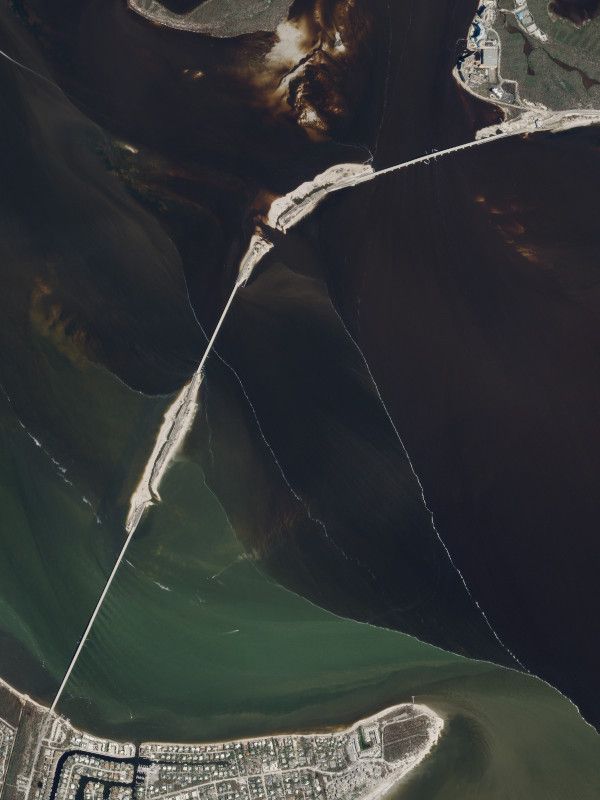
Weakened Storm Ian Sweeps North While Death Toll Mounts in Florida
Planet satelline imagery shows the partial collapse of Sanibel Causeway in Florida after Hurricane Ian swept across the state.

September 21, 2022
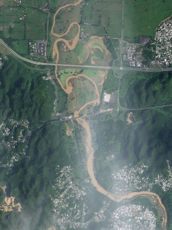
Hurricane Fiona's Destruction of Puerto Rico, in Maps and Photos
Planet imagery helped document flooding caused by Hurricane Fiona across Puerto Rico, including along the La Plata river.
September 8, 2022
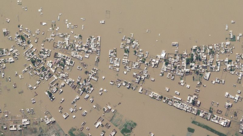
Before and After: the Huge Floods in Pakistan Seen From Space
An analysis of Planet satellite data shows that nearly 10% of the country's surface area has been flooded since the start of the monsoon in Pakistan.
Le Monde (FR)
August 24, 2022
What China's Worst Drought on Record Looks Like
Planet satellite images from 2021 and 2002 show the dramatic impact of the drought on Poyang Lake, China's largest freshwater lake, which shrunk by about 75%.
June 16, 2022
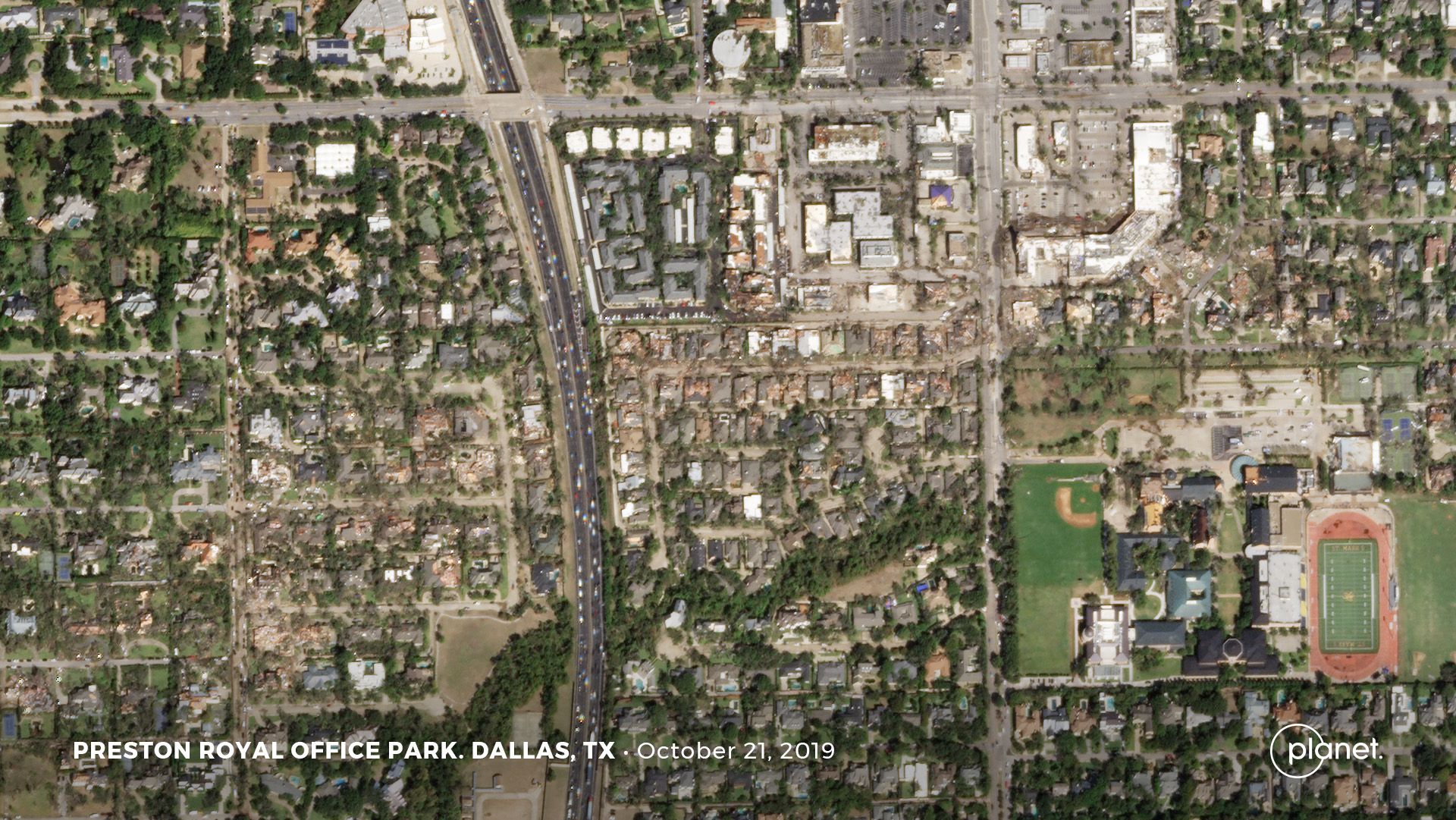
Dallas Tornado: Satellite Photos Reveal Twister's Path From Above
Before and after satellite images from Planet show the path of damage across northwest Dallas and surrounding areas.
June 16, 2022
These Maps Illustrate the Seriousness of the Western Drought
Planet satellite images taken 2021 and 2022 of Tule Lake in northern California show that over the year, much of the lake dried out.
© 2025 Planet Labs PBC. All rights reserved.
| Privacy Policy | California Privacy Notice |California Do Not Sell
Your Privacy Choices | Cookie Notice | Terms of Use | Sitemap
