Monitoring Dynamic Land and Coastal Change
Planet Solutions for Disaster Management
TRACK CHANGE ACROSS BROAD LANDSCAPES
Reduce the loss of life and property, and minimize the cost of disaster recovery
See new trends and focus attention where it’s needed most with near-daily spatiotemporal data, a living archive, and automated change detection.
DYNAMIC ARCHIVAL DATA AND AI-POWERED INSIGHTS
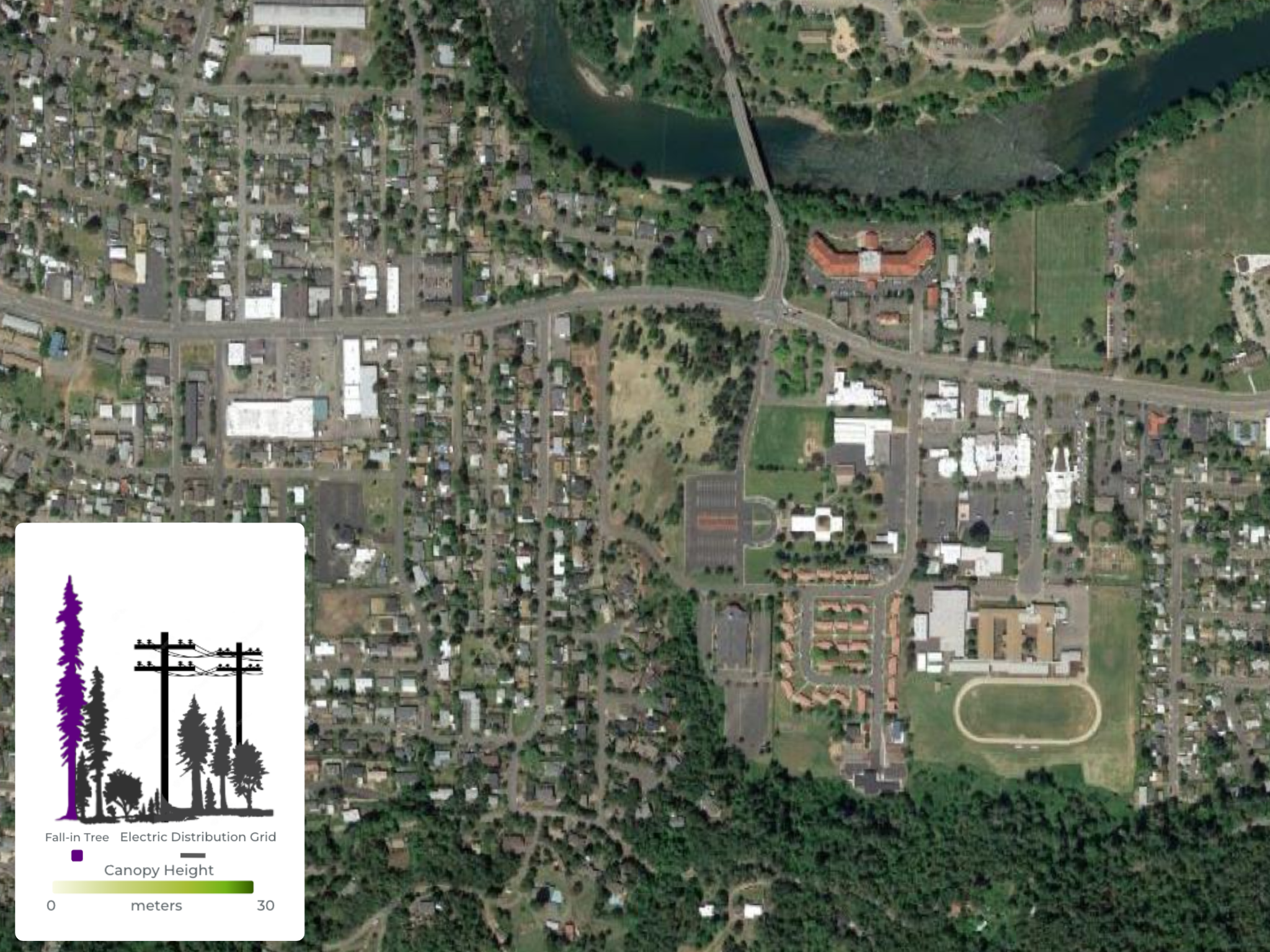
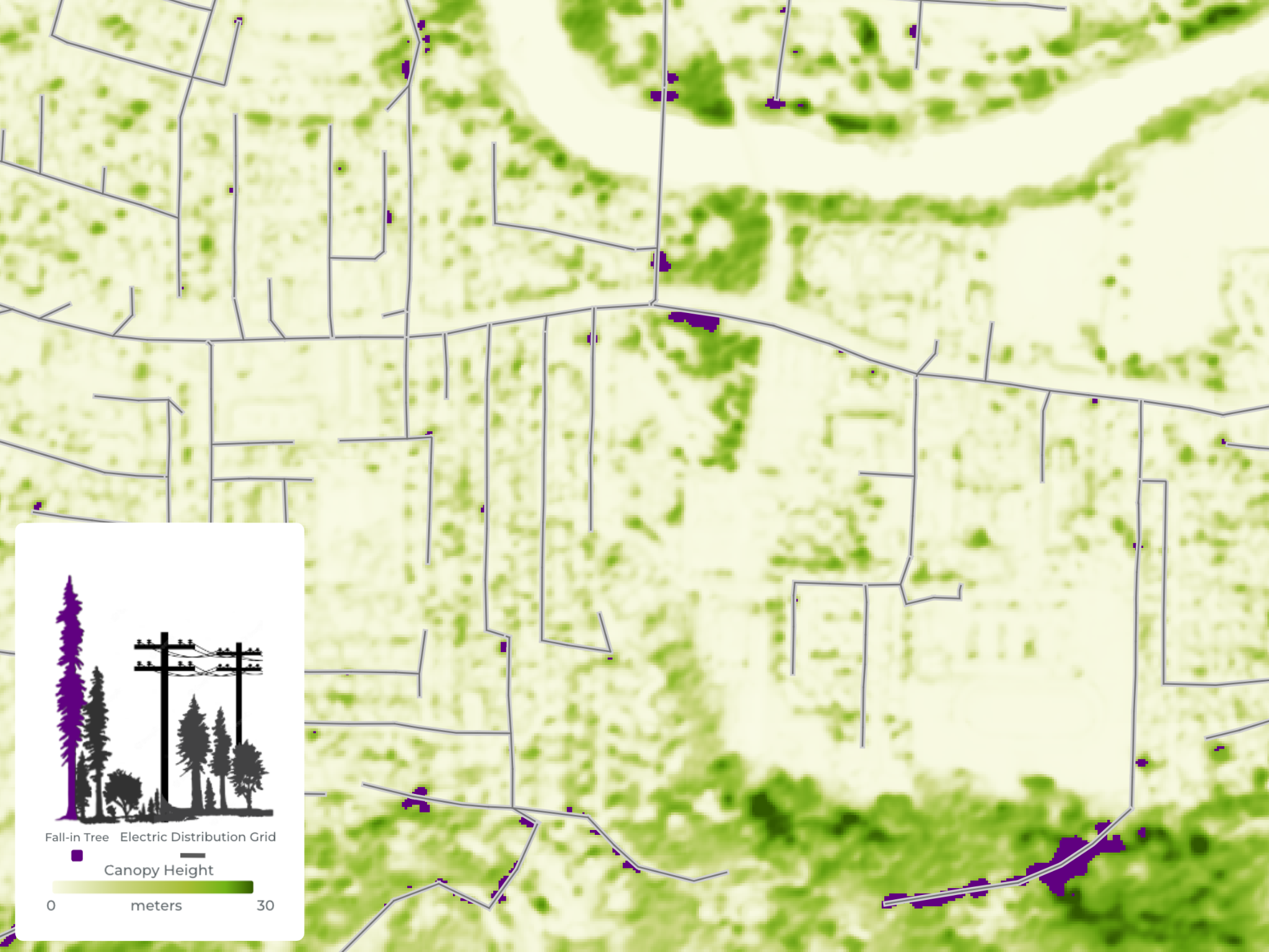
Monitor tree fall-in risk over utility lines
Proactively monitor changes in vegetation to mitigate wildfires and power outages with scalable insights on tree strike, canopy cover, and species identification.
Empirical Measurements
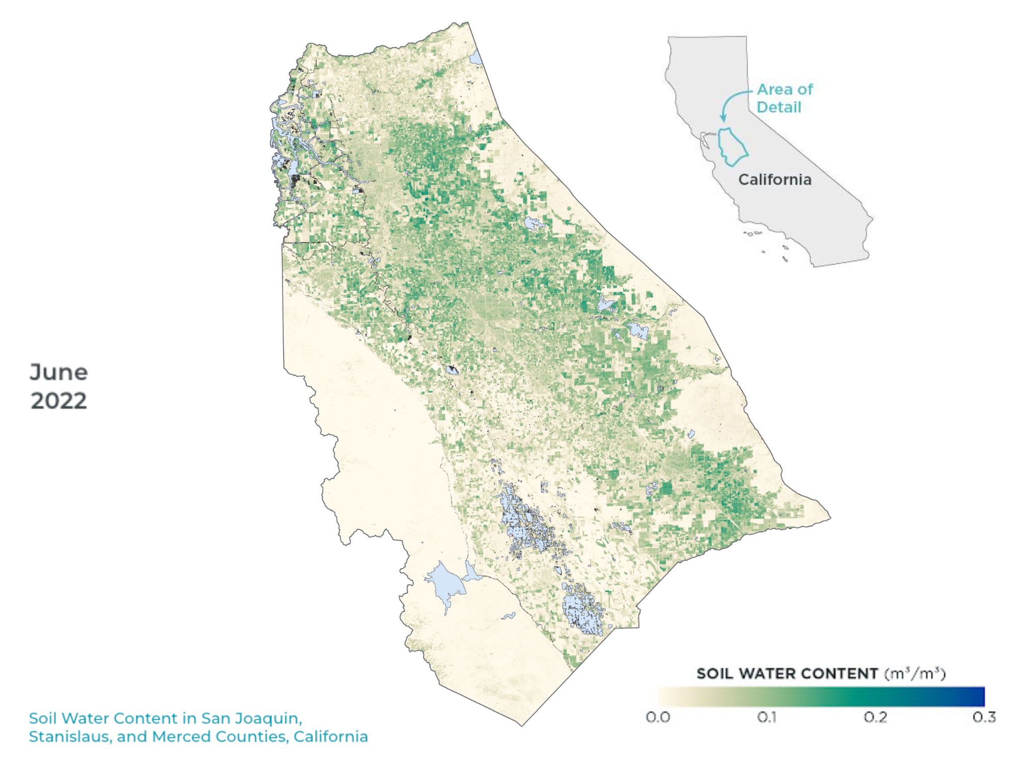
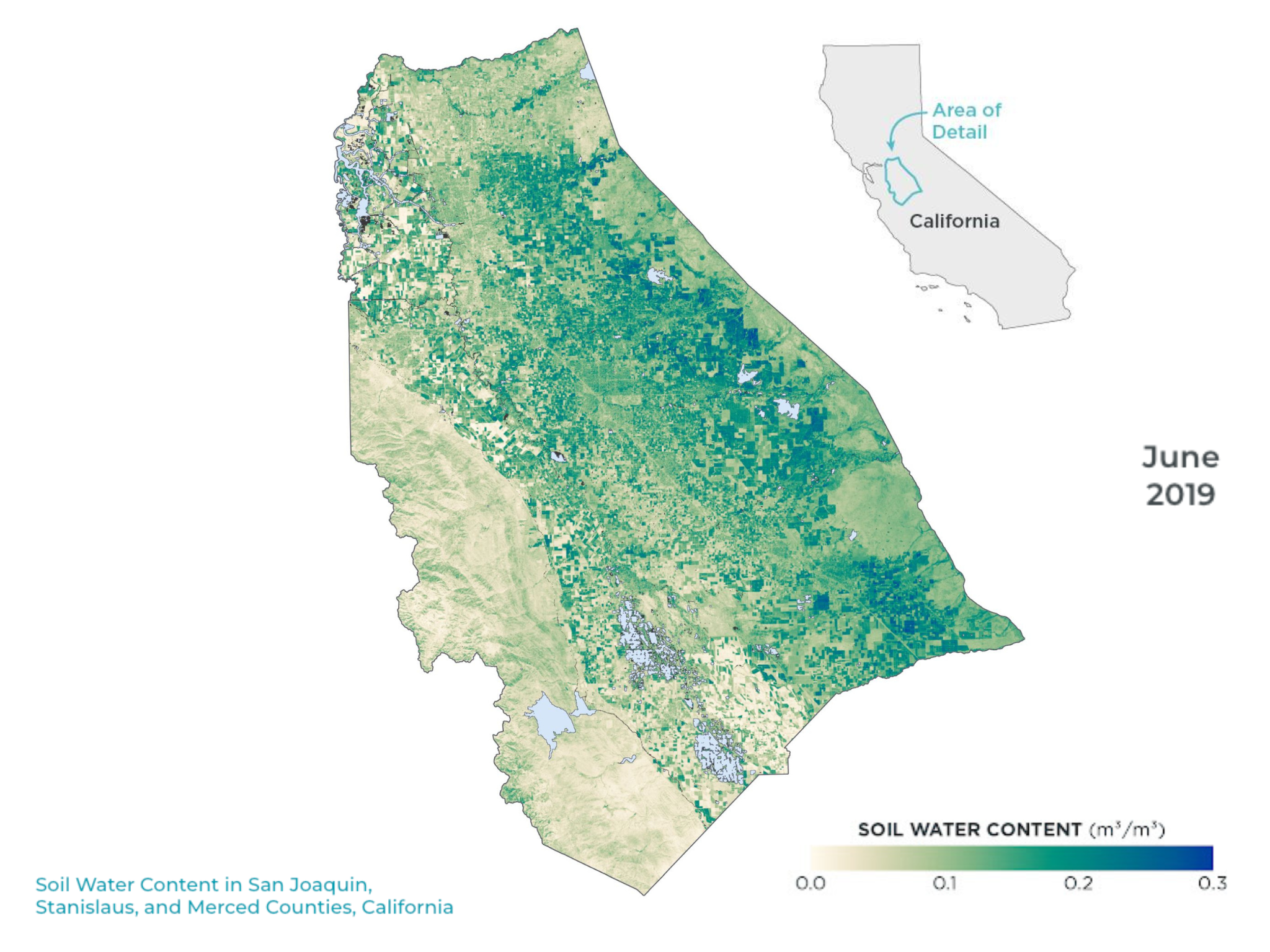
Track crop health and soil water content
Planet Soil Water Content and Biomass Proxy variables provide physical measurements of crop and vegetation health, unhindered by clouds.
DYNAMIC HISTORICAL BASELINE
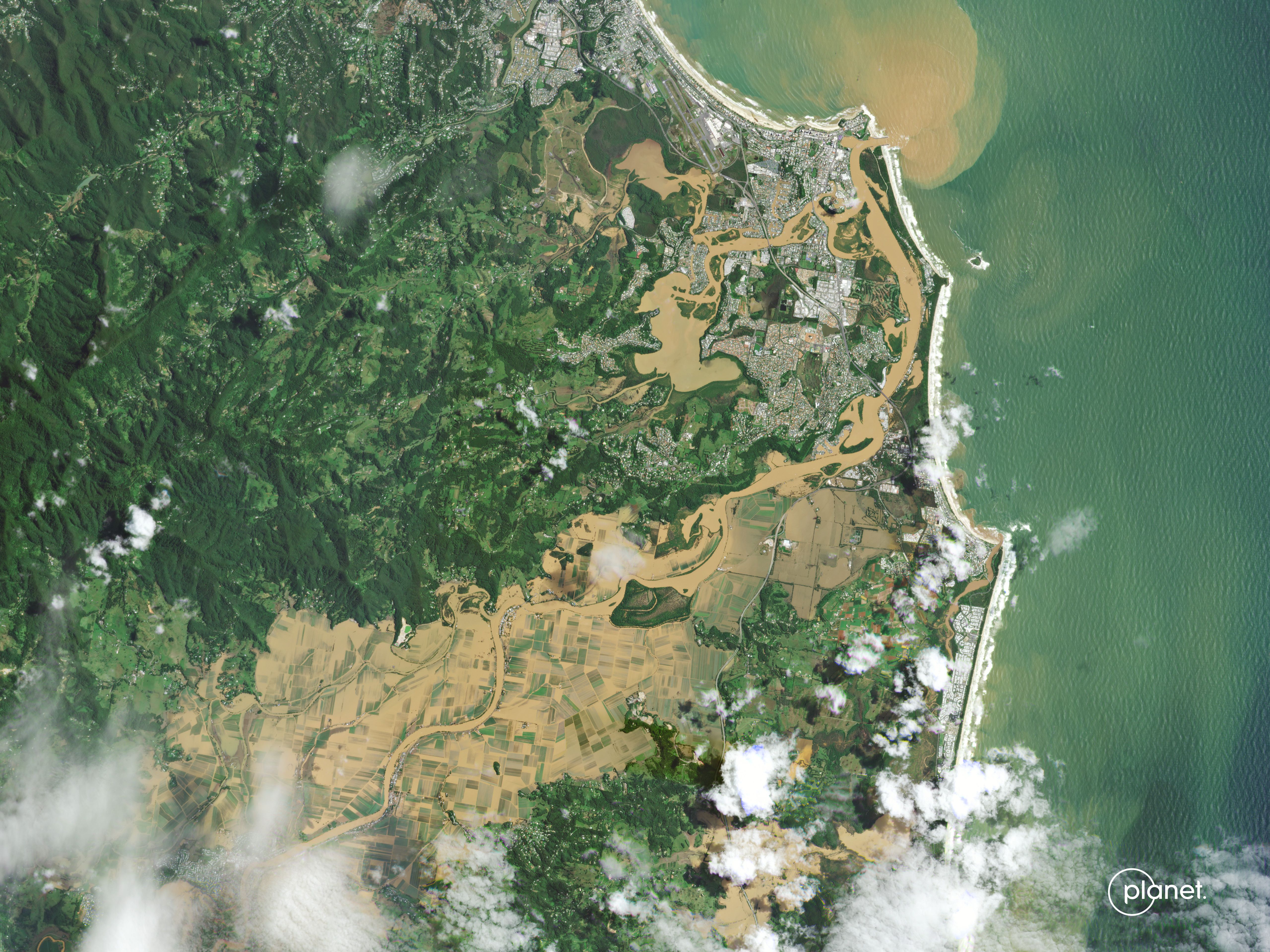
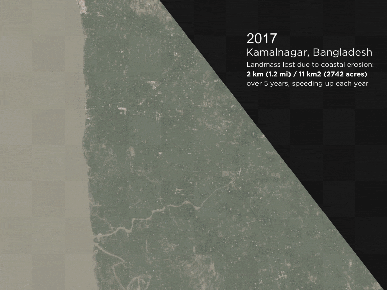
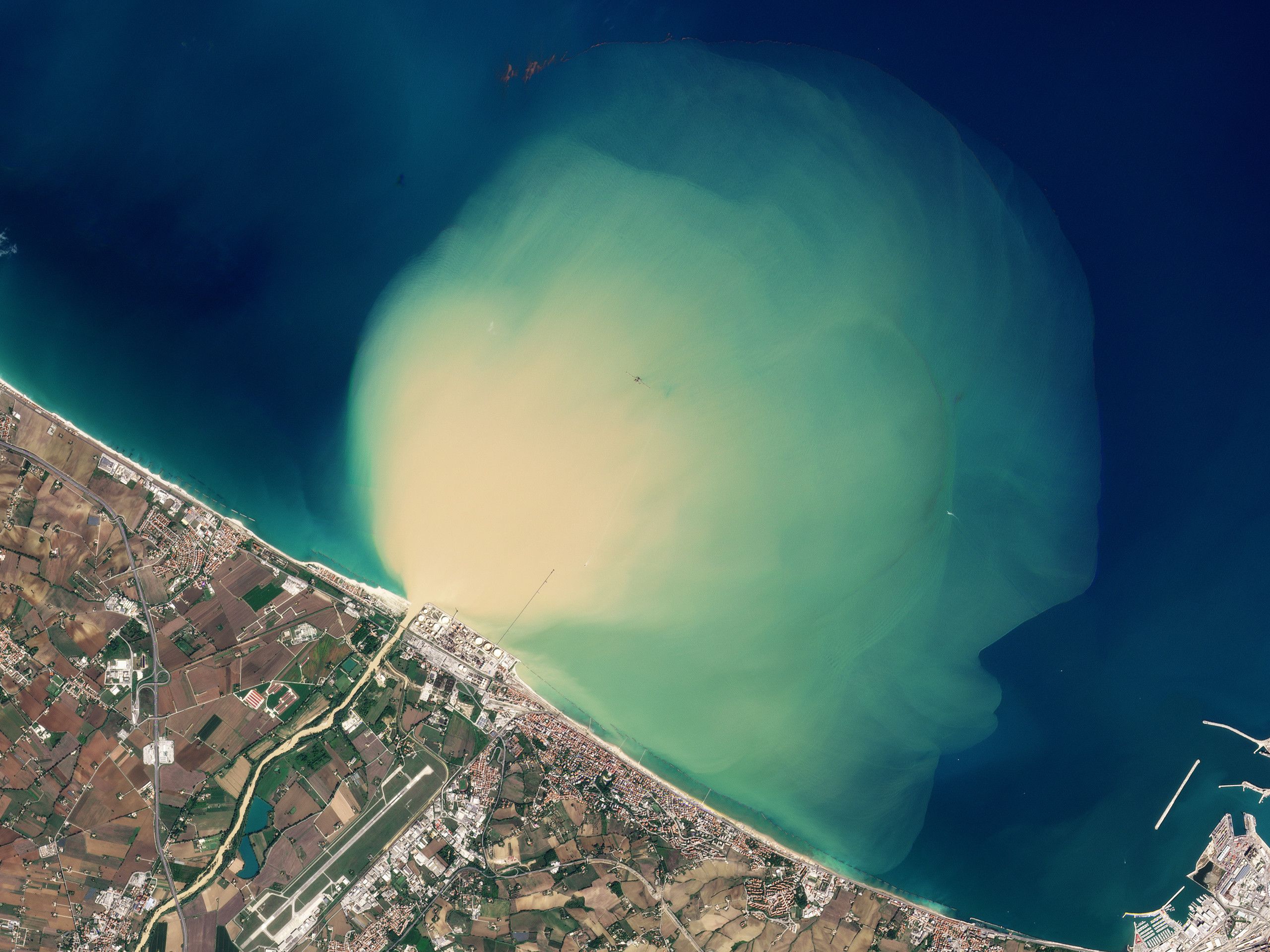
Monitor evolving risks to coastlines
Intervene on climate change-related impacts, environmental accidents, and debris with a living baseline of data, which expands daily.
EARTH INDICATORS
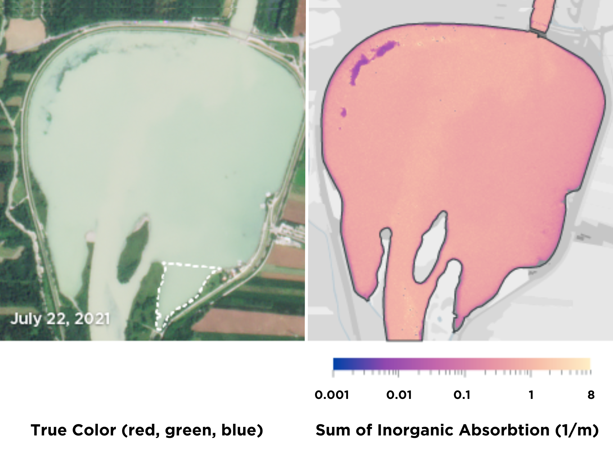
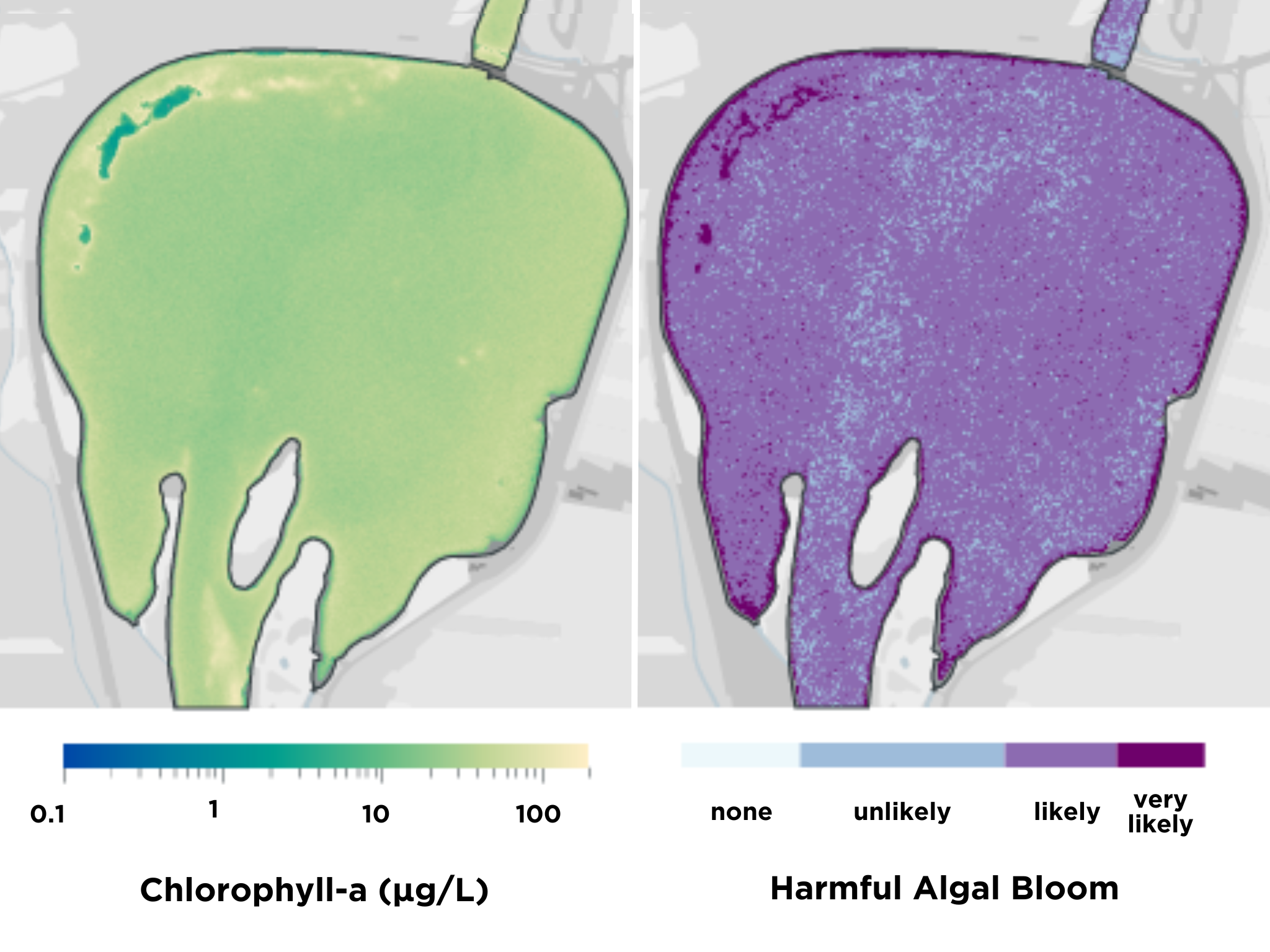
Monitor water quality, sedimentation, and algal blooms
Use water health indices to protect communities and natural ecosystems from acute and long-term water issues resulting from weather events, toxins, and invasive species.
Working with Planet, NOAA gets a more complete and frequent stream of information about the status of our oceanic and coastal world.
Jerome Fisher
Physical Scientist, National Oceanic and Atmospheric Administration (NOAA)
Learn how Planet solutions have helped a range of disaster preparedness and recovery efforts
Driving Digital Transformation in Wildfire Fuels Management With Satellite Data
Learn how Earth observation data can help governments scale monitoring efforts and accelerate decision-making to minimize wildfire risk.
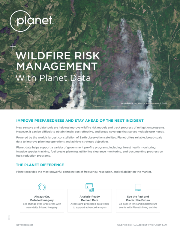
Wildfire Risk Management With Planet Data
Planet data helps support a variety of government pre-fire programs, including forest health monitoring, invasive species tracking, fuel breaks planning, utility line clearance monitoring, and documenting progress on fuels reduction programs.
Wildfire Permit Boundary Mapping
Paulina Zubatov, Account Executive at Planet, describes how Planet imagery can be used to guide wildfire recovery efforts.
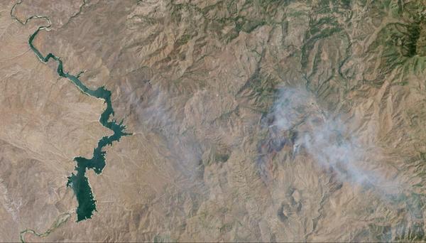
Flash Drought Hotspots: Southwestern United States
The Planet Soil Water Content (SWC) dataset captures the conditions that signal drought using granular, real-time measurements. A team at Planet developed a methodology to identify “hotspots” - including in the Southwest United States.
Rescue Efforts in Morocco after 6.8 Earthquake
The small mountain town of Amizmiz suffered destruction due to a massive 6.8 magnitude earthquake. Near the epicentre, survivors here are sleeping in temporary camps set-up by the government.
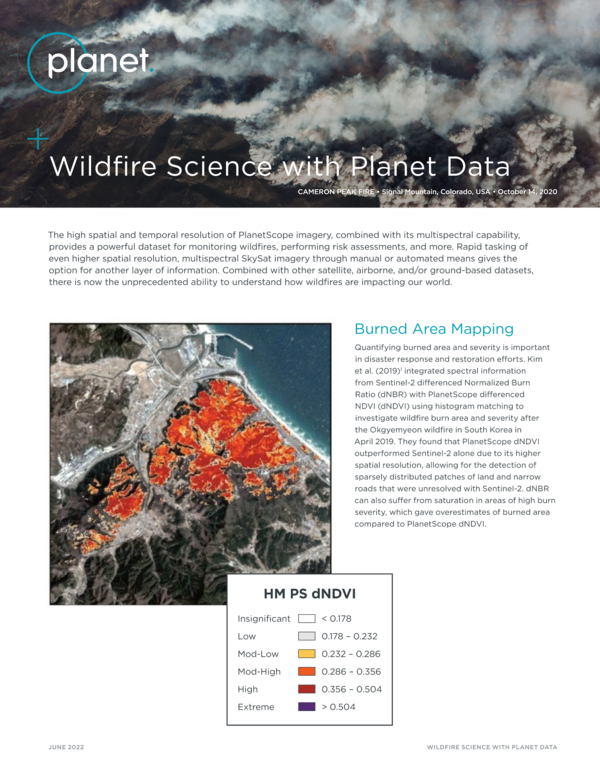
Wildfire Science with Planet Data
The high spatial and temporal resolution of PlanetScope imagery, combined with its multispectral capability, provides a powerful dataset for monitoring wildfires, performing risk assessments, and more.
Drying Up in a Flash: What Satellite Data Can Tell Us About Flash Drought Risks and the Regions We Should be Watching
Drought is a dynamic phenomenon, and Planet Soil Water Content, one of our Planetary Variables datasets, captures a snapshot of conditions that signal drought using granular, real-time measurements.
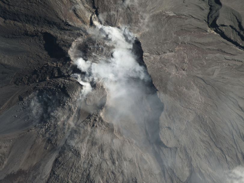
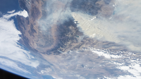
Mount Merapi Fumes
This image captures Merapi mid-eruption, with gas and ash rising from its summit as boulders tumble from the face of a slow-moving lava flow. Planet data can both help monitor the volcano’s behavior and enable research that could mitigate hazards from volcanoes near urban areas.
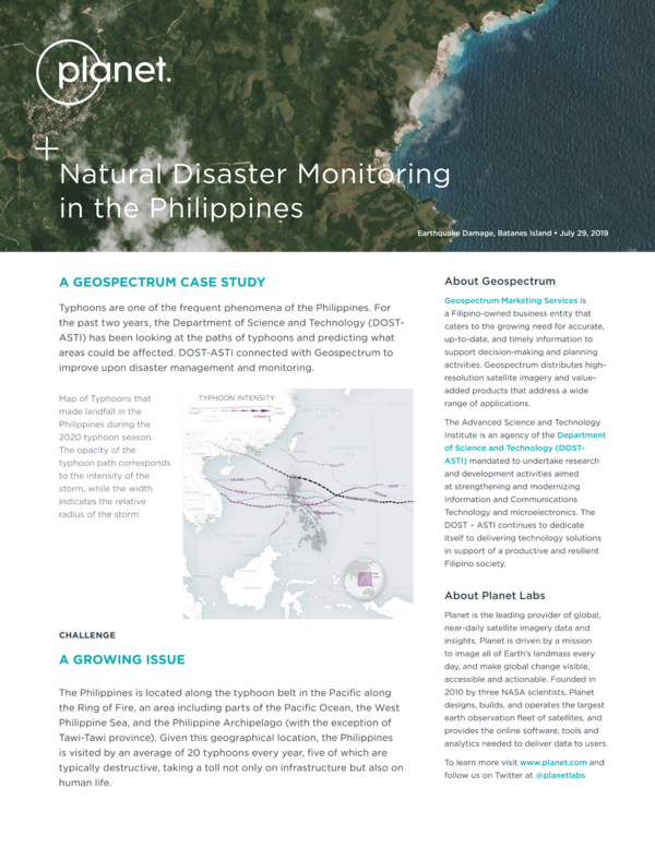
Natural Disaster Monitoring in the Philippines
The Phillipeans has a long history of natural disasters - from tsunamis and landslides to earthquakes. Planet imagery allows their Department of Science and Technology (DOST-ASTI) to better prepare for and respond to these events.
Planet's Response to Earthquakes in Turkey and Syria
Planet worked with Microsoft AI for Good Lab and other partners to produce a building damage assessment to assist in the response efforts from the Turkish government.
Using Planetary Forensics to Visualize Historic Drought in the Horn of Africa
Planet data provides insights into the ebb and flow of water in the Horn of Africa to help gauge the severity of drought and get ahead of widespread famine.
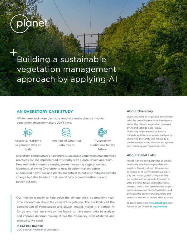
Building a Sustainable Vegetation Management Approach by Applying AI
Overstory demonstrates how more sustainable vegetation management practices can be implemented efficiently with a data-driven approach.
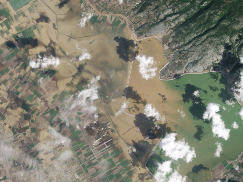
Flooding in Greece
Following weeks of heat waves and fires, torrential rains unleashed widespread flooding in Central Greece in early September 2023. This pair of before and after images shows the extent of flooding near Lake Karla.
Satellites Enable Disaster Management For Unprecedented Australian Floods
Our partner NGIS was able to leverage Planet data to respond to “once in a century flooding” which stranded communities and forced mass evacuations.
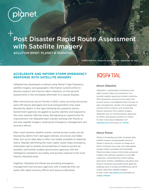
Post Disaster Rapid Route Assessment With Satellite Imagery
IQSpatial has developed a method using Planet’s high-frequency satellite imagery and geographic information systems (GIS) to directly support and improve labor-intensive, on-the-ground assessments in the immediate aftermath of a natural disaster.
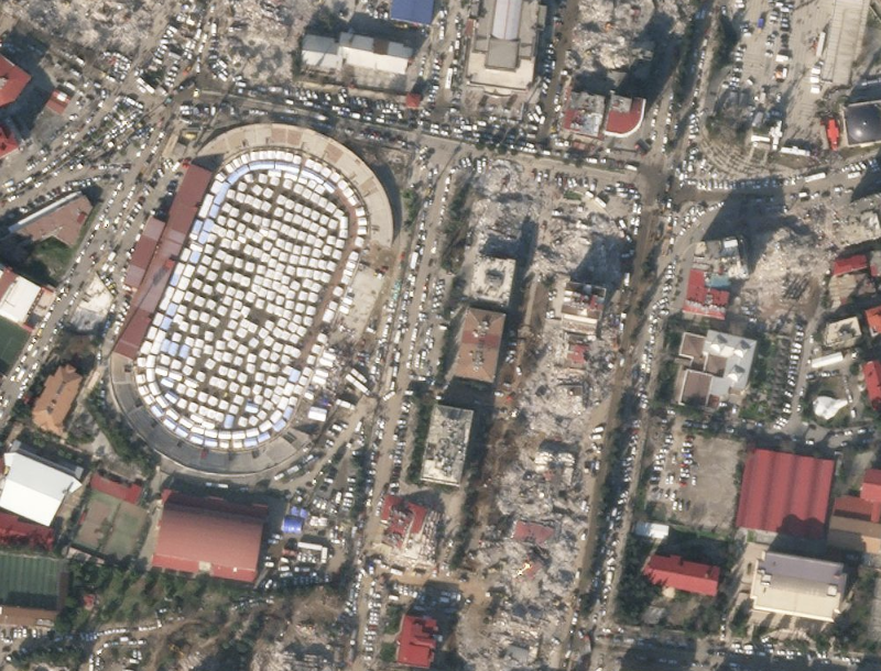
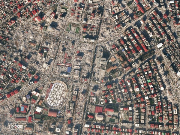
Earthquake Damage
These two images compare the center of Kahramanmaraş, Turkey, before the earthquake on April 3, 2021 and after. Rubble from destroyed buildings is clearly visible, as are tents covering the 12 Şubat Stadium field.
Linking Ground and Space Systems to Autonomously Assess Wildfires
The Moore Foundation, Moraga-Orinda Fire District, UC Berkeley and Planet collaborate to deliver timely, accurate satellite imagery that supports remote detection and assessment of wildfires.
How Planet Satellites Help Manage Fire Risk in a Parched Landscape
To help mitigate the threat of wildfire, western authorities are turning to new technologies, including high-frequency and high-resolution data from Planet satellites.
Planet Monitoring for Disaster Response
Planet imagery gives government, commercial, and non-profit organizations insights that help them maximize preparedness, mitigate risk, and accelerate recovery efforts.
Get in Touch
Interested in learning more? Reach out to your account executive or contact our team.
© 2025 Planet Labs PBC. All rights reserved.
| Privacy Policy | California Privacy Notice |California Do Not Sell
Your Privacy Choices | Cookie Notice | Terms of Use | Sitemap
