
Announcing Planet’s Developer Center
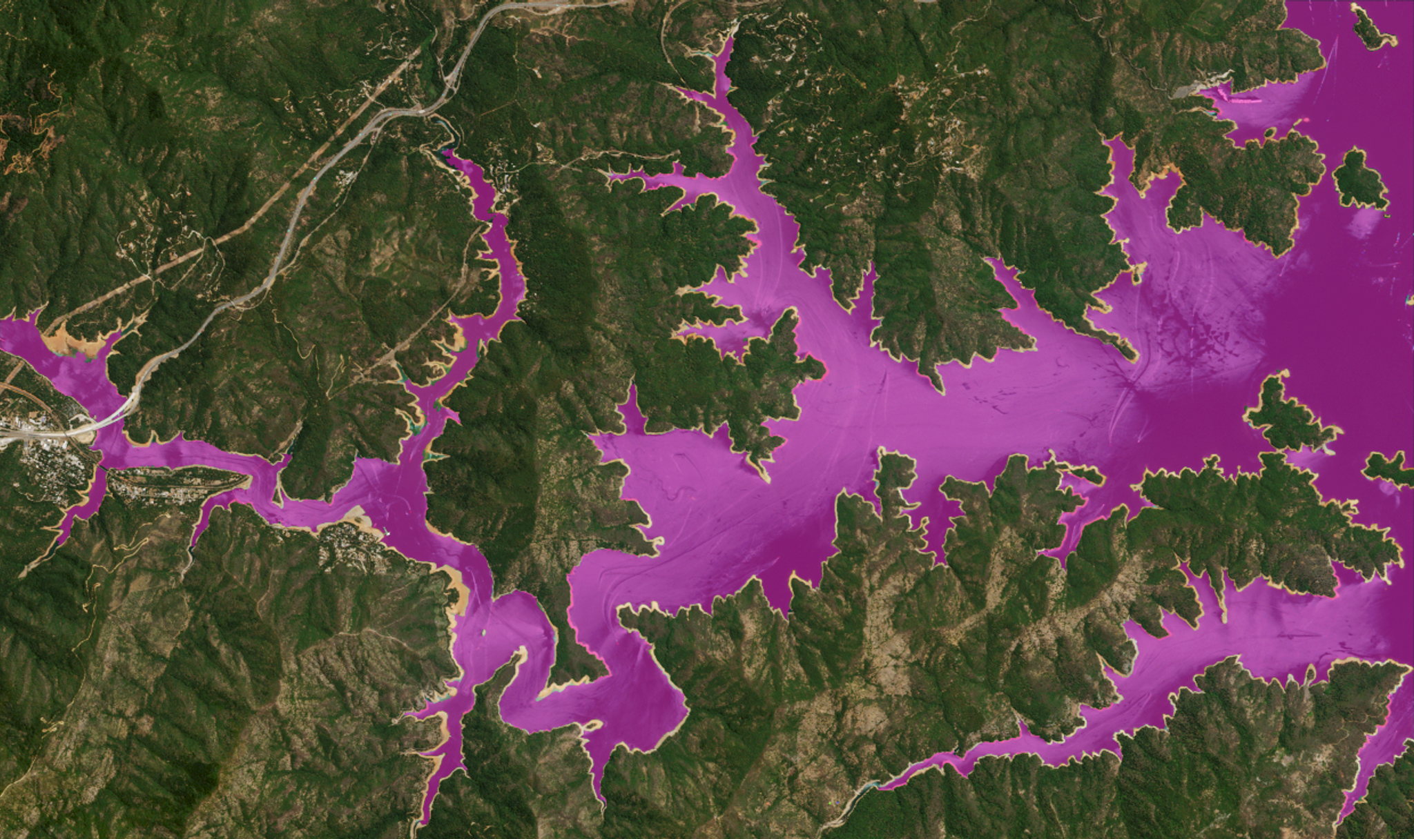
Identifying watershed areas to calculate water level change on RapidEye image of California reservoir © 2016, Planet Labs Inc. All Rights Reserved.
TechToday we’re excited to launch Planet’s Developer Center, a hub where technologists can learn how to use satellite imagery and analytic tools to uncover new insights about our changing planet.
Whether you’re a developer, an imagery analyst, a researcher, a customer, a partner, or just a curious person interested in a dynamic view of Earth from space, our Developer Center has the resources you need to get started. Here’s what you’ll find:
- Tutorials, guides, and reference material: API reference documentation, task-oriented guides, and overviews of key concepts and techniques. Tutorials include how to calculate changes in water level, an introduction to slippy maps, and how to create an area of interest.
- Open data, tools, and notebooks: Information about open data, open source tools, and Jupyter notebooks.
- Support and community: Get help from our technical support team, engage directly with Planet developers, and connect with other users.
- Planet Changelog: A monthly list of all public-facing changes and additions to the Planet Platform.
We will frequently publish new content at the Developer Center, as part of Planet’s ongoing effort to inspire, support, teach, and connect. We’re excited to see what our community will create and inspire in the new Developer Center – you can get up and running here.
Ready to Get Started
Connect with a member of our Sales team. We'll help you find the right products and pricing for your needs.